Elevation: 6,472 ft
Prominence: 332
This peak is not in the book. Margo wrote the original post. Livingston Douglas added a new route and photos which are set out below. Click on the photos to see a larger image.
Peak 6472 is located south of the city of Pocatello and approximately a mile (at most) from Slate Mountain. The peak lies in the Bannock Range. Like a number of Bannock Range peaks, there are several routes that can be taken to the top. Our route approached the summit from the north and was 4.8 miles round trip. If that is not enough climbing/hiking for you, connect this peak with its neighbor Slate Mountain or with Peak 7060 which is just a little farther south along the Bannock Highway. USGS Clifton Creek
North Approach, Class 2
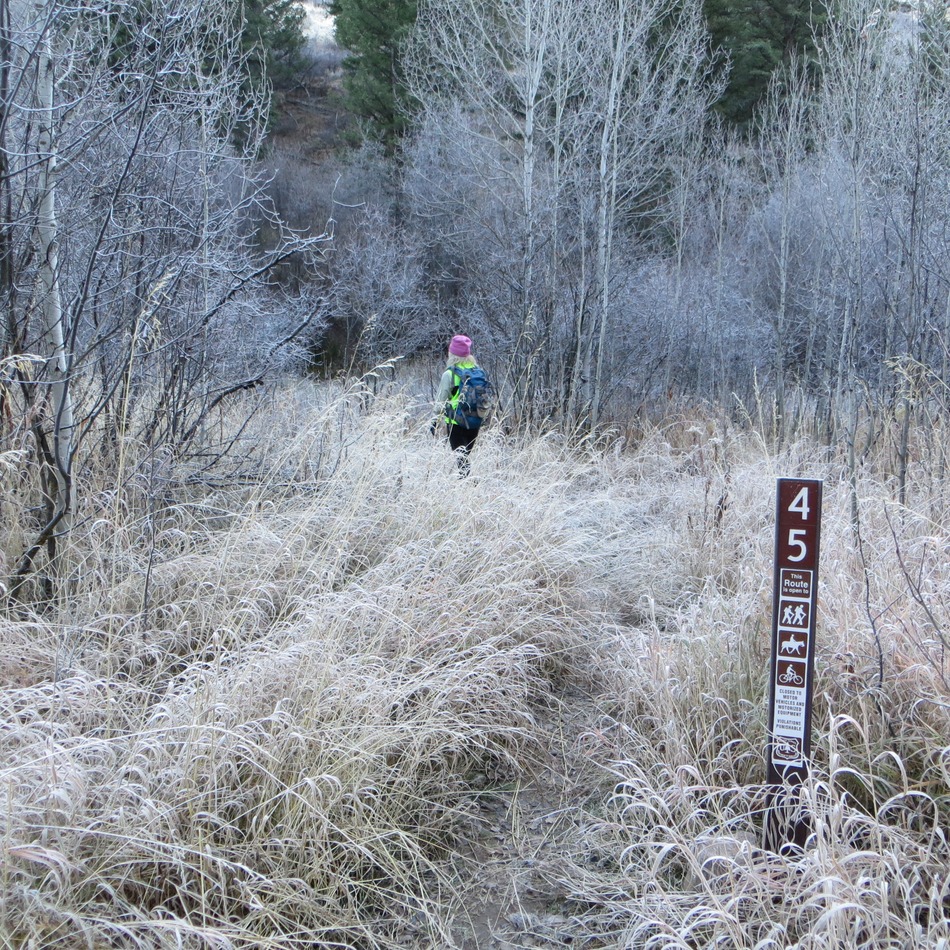
The junction of West Fork Mink Creek and FST-045. Steve Mandella Photo
From Pocatello, take the Bannock Highway south to the West Fork Mink Creek parking lot/West Fork Mink Creek trailhead. Begin your hike on this well-marked, popular trail.
Continue heading along this trail as it travels to the northwest until you reach a junction with FST-045 and take this trail. Ascend FST-045 until you reach a saddle or go off-trail early, as we did, and aim for the summit ridge.
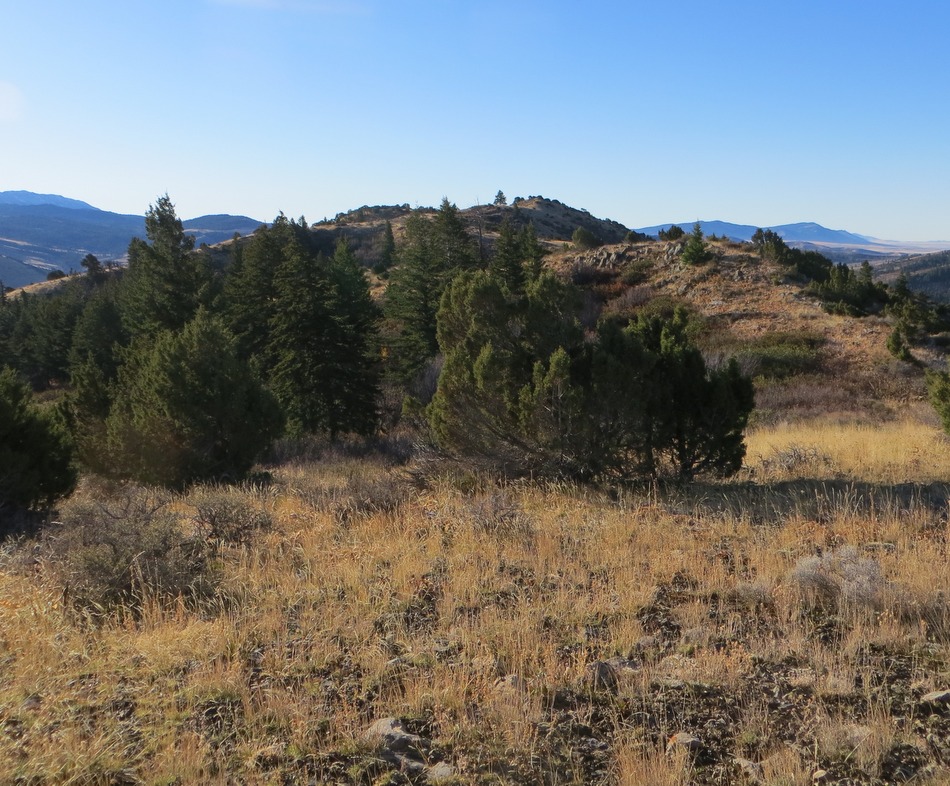
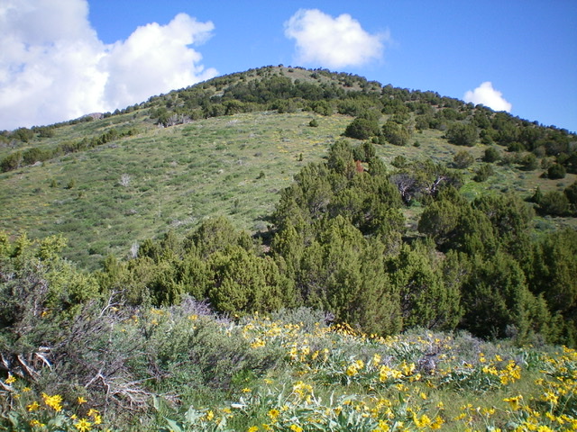
The ridgeline of Peak 6472. Steve Mandella Photo
If you are lucky, you may see a moose or two on your way to the summit. The West Fork Mink Creek and Gibson Jack areas are excellent habitat for moose, deer and elk. We saw moose and a large group of mule deer does and a buck on the flank of Slate Mountain.
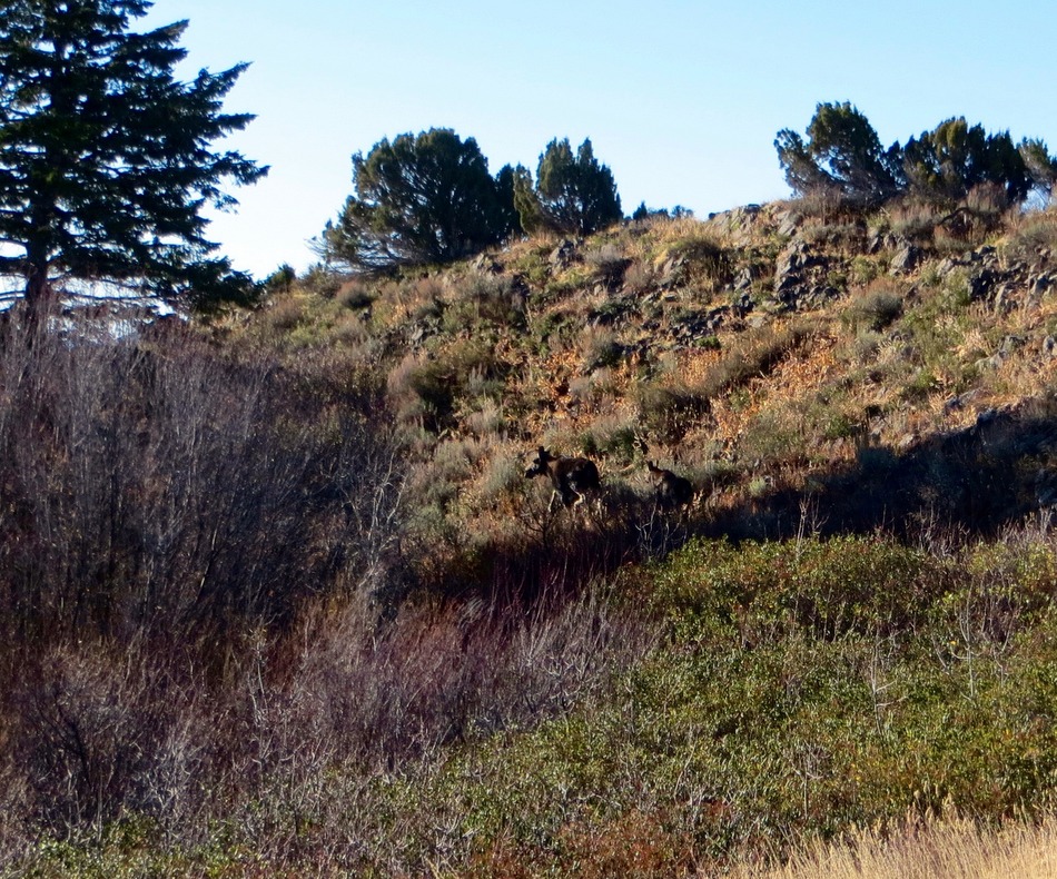
Cow moose and calf near the summit of Peak 6472. Steve Mandella Photo
Hike along the gentle ridge until you reach the summit cairn and enjoy views of peaks in the Bannock and Portneuf Ranges.
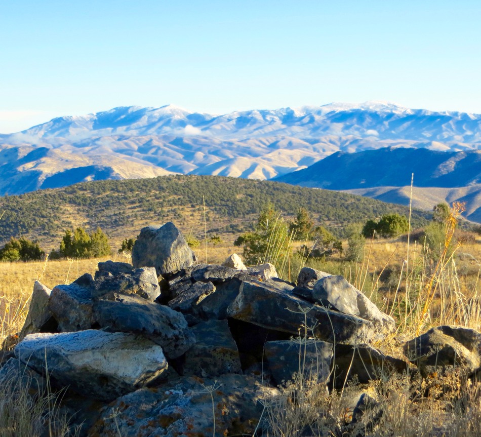
The summit of Peak 6472. Steve Mandella Photo
As the GPS track shows, we took the south ridge all the way back down. This required us to pass through a thick riparian area on a steep, loose-ish slope and then find a way to cross West Fork Mink Creek. A better option might have been to hike off the ridge to the east, before reaching the riparian area, and descend to the highway. Either way, it is a short hike back to the parking lot from either location.
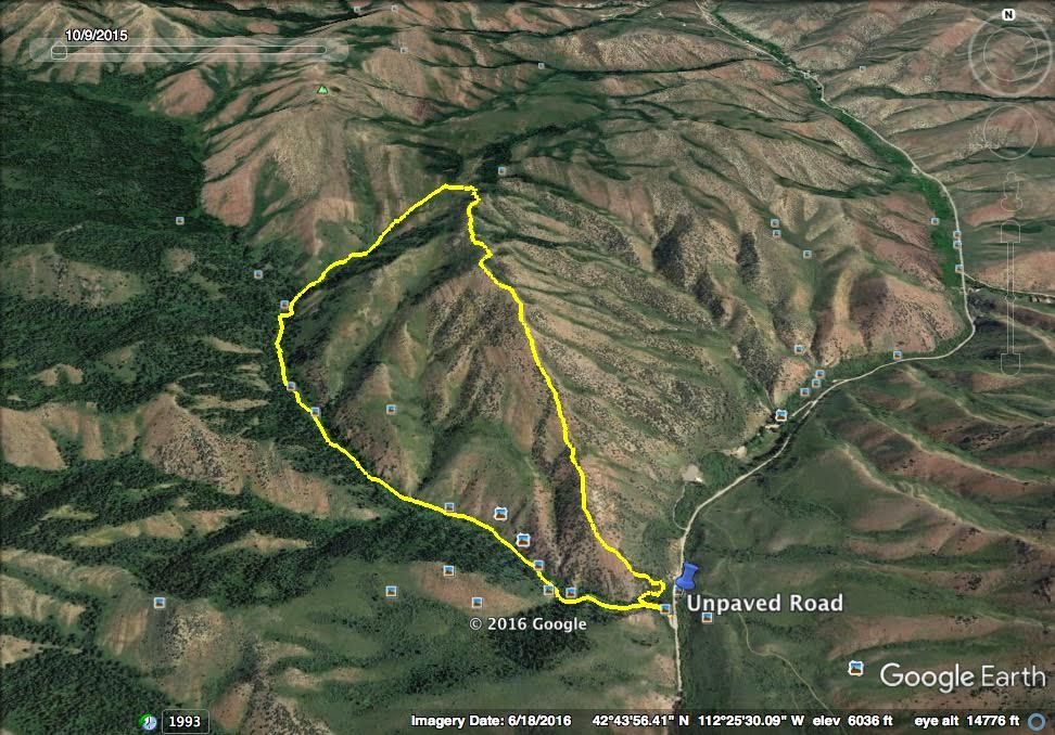
Peak 6472. Steve Mandella GPS track
South Ridge by Livingston Douglas
Access
From the junction of Portneuf Road and the Bannock Highway, drive south on the Bannock Highway for 6.4 miles to the trailhead parking area for the West Fork Mink Creek Trail on the right/west side of the highway. Park here (5,200 feet).
South Ridge, Class 2
The Climb
From the West Fork Mink Creek trailhead parking area, walk 0.1 mile north on the Bannock Highway to reach the base of the south ridge, just north of the West Fork Mink Creek and just north of the [signed] Valvehouse Trail/FST-058 on the right/east side of the highway. The south ridge is easy to find but is a bit ill-defined initially. From the Bannock Highway, bushwhack northwest to reach the ridge proper. The terrain here is a mix of junipers and field grass/scrub. Overall, the terrain is not too bad because it is not too thick or tall and has gaps in the scrub.
Follow the magnificent, open ridge on easy scrub to the summit. The summit is on a narrow ridge crest that is clogged with junipers. The summit has a decent cairn which I built up a bit. It offers a splendid view of nearby Slate Mountain. Be careful on the descent to avoid getting lured off the south ridge by the numerous east and southeast shoulders.
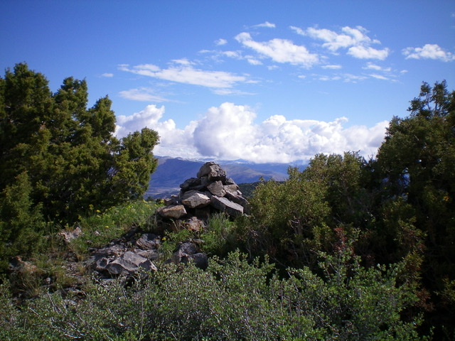
The summit cairn atop Peak 6472 with junipers surrounding it on the narrow ridge crest. Livingston Douglas Photo
Slate Mountain as viewed from the summit of Peak 6472. Livingston Douglas Photo
Looking up the beautiful south ridge of Peak 6472. Livingston Douglas Photo
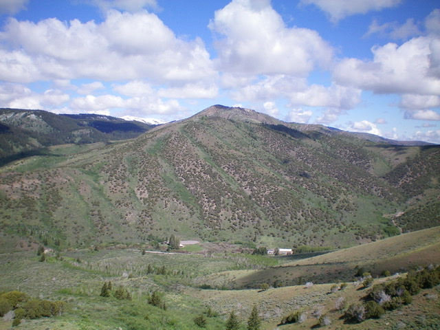
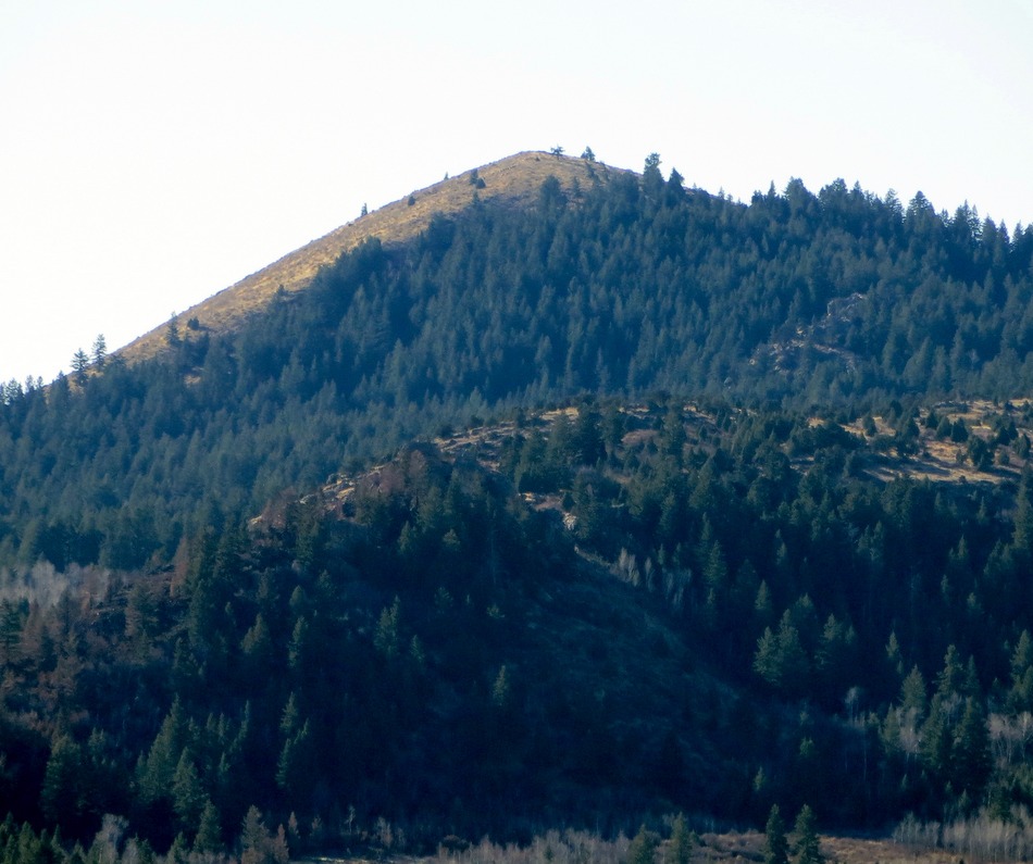
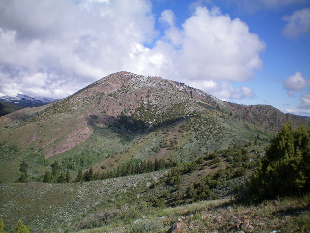
Peak 6472 as viewed from the southeast. Its magnificent south ridge goes diagonally from the lower left to the center of the photo, which is the summit. Livingston Douglas Photo
Additional Resources
Regions: Bannock Range->SOUTHERN IDAHO
Mountain Range: Bannock Range
Longitude: -112.42739 Latitude: 42.73759