Elevation: 10,660 ft
Prominence: 560
This peak is not in the book. Updated July 2020
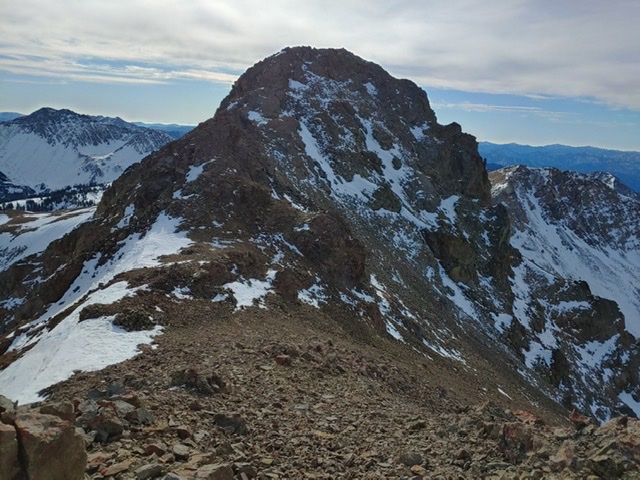
Trial End Peak is located north of Hemingway Peak and above the scenic Trail Creek drainage. USGS Meridian Peak
Trail End Peak. Brett Sergenian Photo
Access
Park Creek Road, FS-140 and the Trail Creek Loop Trail, FST-126 [(B)(1)(a) Page 242]. The Trail Creek Loop Trail, FST-126 has not been maintained in many years. Furthermore, trail is not in the location shown on the FS topographic map. See the map below. The tread is easy to follow until roughly 9,000 feet. After that point, there are cairns marking the route until treeline. Expert route finding skills are recommended. Roughly one hundred yards from the trailhead, the trail crosses Trail Creek and then forks. Take the right fork.
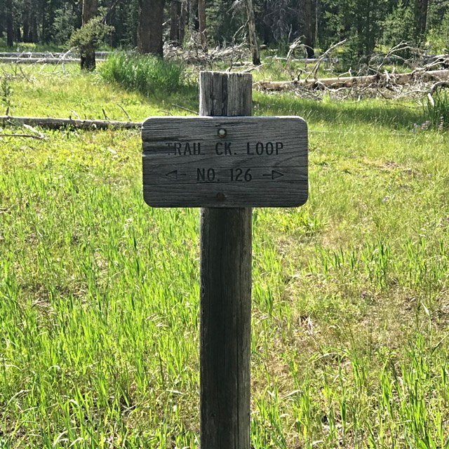
This sign is located a hundred yards from the trailhead. Go left.
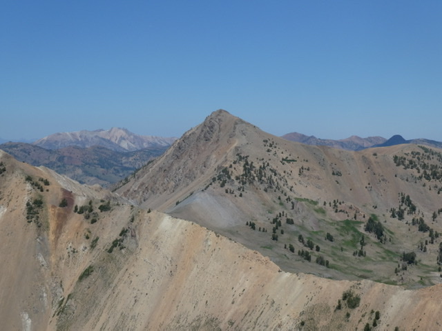
Northeast/North Ridge, Class 3
From the Trail Creek Trail, climb to the ridgeline northeast of the summit. Climb the Northeast Ridge until it joins the North Ridge. Follow the North Ridge to the summit. Use the link below to read Brett Sergenian’s trip report.
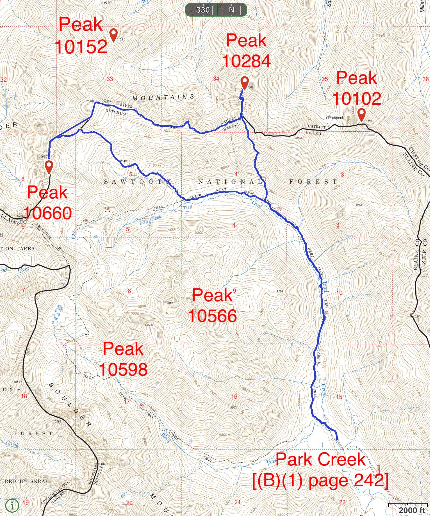
This map shows Brett Sergenian’s GPS track for Trail End Peak and Ursa Peak. His route covers 12.3 miles with 3,200 feet of elevation gain.
Trail End Peak viewed from Hemingway Peak.
Additional Resources
Regions: Boulder Mountains->EASTERN IDAHO
Mountain Range: Boulder Mountains
Longitude: -114.35241 Latitude: 43.8812