This mountainous area is not in the book.
The Bear Lake Plateau is in extreme southeast Idaho. It is bordered by Pegram Road and US-30 to the north, Boundary Ridge to the east (near the ID/WY state line), North Eden Canyon to its south (near the ID/UT state line), and Bear Lake to its west. While not officially designated as a “mountain range”, this area is mountainous and does have peaks worth visiting. To explore all Bear Lake Plateau peaks found on this website use this link: Bear River Plateau Peaks
Rick Baugher has noted that “the extreme southeast corner of the Gem State feels like Idaho in name only as its terrain is different than the surrounding country. The Bear Lake Plateau rises east of the magical mountain lake. The high point is Pine Spring Ridge (7,878 feet elevation; 1,128 feet of prominence). Upon reaching the desolate heights of the plateau, the hub-bub of the lake is far behind. Here one is easily reminded of the windswept high plains of Wyoming.”
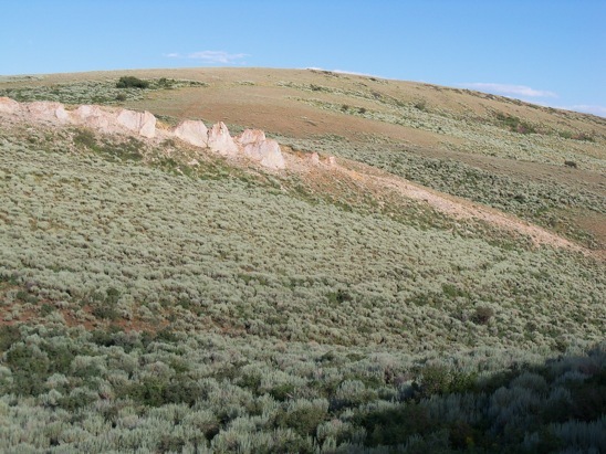
Peak 7091 as viewed from the north. Livingston Douglas Photo
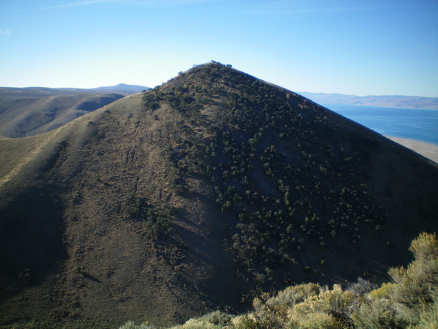
Livingston Douglas points out the scenic nature of this area writing “Pine Spring Ridge and the high ridgeline south of it (which includes Peak 7202 and Peak 7091) offer spectacular views of Bear Lake to the west. Far better views than from the west side of Bear Lake since the west side ridges are forested, not open like the east side ridges of the Bear Lake Plateau. My ridge traverse of the north ridge of Peak 7202 and its connecting ridge to Peak 7091 to its south will go down as one of my favorite Idaho ridge traverses. It was amazing and I highly recommend it.”
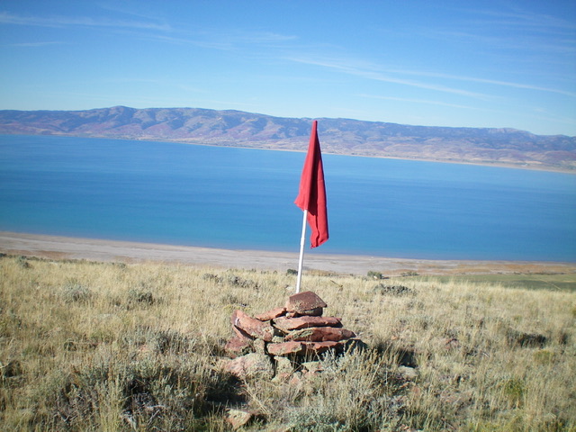
The large cairn and red flag at the north end of the high ridgeline of Peak 7202, with Bear Lake in background. This view is looking southwest across the lake. Livingston Douglas Photo
Livingston also notes “Regrettably, much of the Bear Lake Plateau is on private land and is not accessible to the public. In addition, most of the roads in the Bear Lake Plateau are rugged and may require the use of an ATV or MC. The smooth roads alongside Bear Lake are not representative of the steeper, narrower dirt roads higher up. Indian Creek Road is the only road that crosses the Bear Lake Plateau from Bear Lake eastward to Pegram Creek. And it becomes a steep, narrow 2-track high up and then descends steeply to Pegram Creek on the east side of the range.”
Livingston adds: “The Bear Lake Plateau is a bit of a misnomer. I found no plateau nor can identify one on the USGS topo map for this area. It’s more of a raised area east of Bear Lake with a mish-mash of named canyons, named hollows, named (and unnamed) ridges, and numerous hills. If you drive Indian Creek Road from Bear Lake up over the ridge crest then down steeply to Pegram Creek, you will be puzzled that, despite being in open terrain the entire way, there was no plateau up on top. I would call this area the ‘Bear Lake Hills’ to be more accurate with the actual topography. It’s somewhat akin to the Sheep Creek Hills just to the north.”
Montpelier, Idaho is the closest town of any size. US-30 is the main access road in the north and US-89 is the main access road to the west. Rick reports that “a good approach to the Bear Lake Plateau leaves US-89 just north of St. Charles, Idaho and crosses an extraordinarily scenic causeway around the north end of Bear Lake. On a sunny summer day, the azure waters and golden sands of North Beach State Park, Idaho fill up with Utah license plates.”
Regions: Bear Lake Plateau->SOUTHERN IDAHO
Mountain Range: Bear Lake Plateau