Elevation: 9,079 ft
Prominence: 1,299
Climbing and access information for this peak is on Page 368 of the book. I have updated the book entry with three routes, the North Ridge, the South Ridge by Livingston Douglas and the Southwest Spur by Rick Baugher. These updates replace the information found in the book. Updated July 2022
This impressive peak is the high point of Dry Ridge. It is located midway between Harrington Peak and Meade Peak. These three summits are the most important peaks in the the relatively overlooked Peale Mountains. Livingston Douglas’ entry set out below discusses the problems with existing maps of this area. USGS Harrington Peak
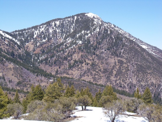
Hawks Peak viewed from the Hawks Roost. Snowdrift Mountain and Meade Peak in the distance on the left.
2018 Mapping Update by Livingston Douglas
Hawks Peak is a magnificent rocky summit with a stunning south ridge that splits Georgetown Canyon from Church Hollow. Unfortunately, the mapping misinformation about this peak is widespread and appalling, some of the worst that I have ever seen (Caribou-Targhee National Forest Map/Montpelier-Soda Springs Districts, 2011; USGS topo map). My update will clear up the extensive misinformation. The Motor Vehicle Use Map (MVUM) for the Montpelier Ranger District is much more accurate and recent (2018).
North Ridge, Class 2
Access
The North Ridge route is accessed from Summit View Campground. From Georgetown, Idaho and the LDS church. From the church drive east on the paved Narrowtown/Stringtown Road. Follow this road for 2.3 miles. Turn left on the Left Fork Georgetown Canyon Road. Follow this road for 5.5 miles to the CG entrance. There is no hiker parking in the CG. The hiking route leaves from the left hand loop in the CG as an ATV trail marked only with a post marked FST-211. Follow FST-211 a short distance to a marked junction with FST-260. Turn right and follow FST-260, another ATV trail, uphill a short distance to the start of FST-550, the Lateral Canyon Trail. As of 2022 the start of this trail is poorly marked. There is a post for FST-260 just past the point where FST-550 leaves FST-260. Look for the start of the trail just before the FST-260 marker. Once you are on FST-550 there is a good tread all the way to the top of Dry Ridge which is reached in just over a mile and roughly a thousand feet of elevation gain. See the map below.
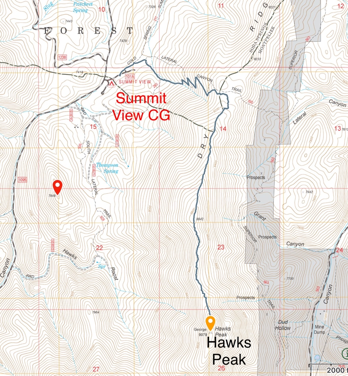
My GPS Track for the climb. Note that FST-550 is not located where it is shown on the current maps.
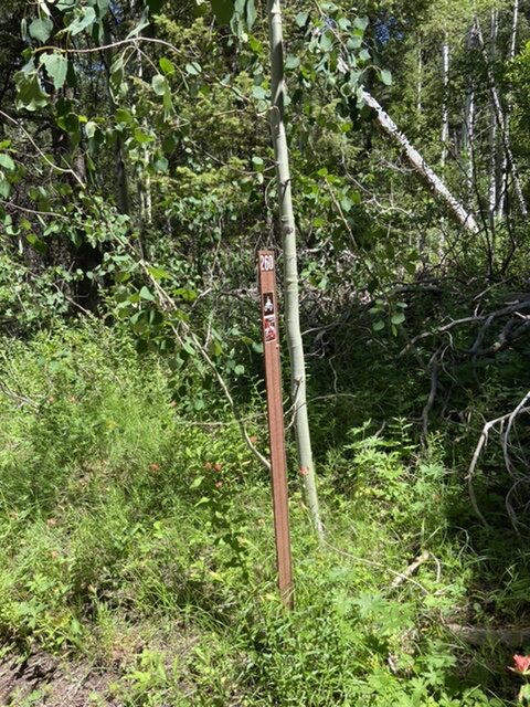
The marker located just south of the junction for FST-550.
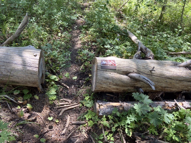
Soon after starting FST-550 you will encounter these signs.
The Climb
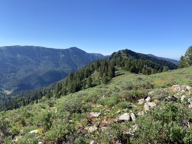
The North Ridge route begins at the point where FST-550 reaches the top of Dry Ridge. It is 2.5 miles to the summit. Follow the north ridge south to the summit crossing the 8,842 foot Hawks Roost along the way. The only thick forest is found in the first quarter mile. Most of the ridge’s eastern side is open, flower encrusted meadow. Game trails can be followed much of the way. The total round trip distance to the summit and back from the CG is 7.1 miles with 1,834 feet of elevation gain.
South Ridge/Church Hollow Route, Class 2+ by Livingston Douglas
Access
From the signed turnoff on US-30 in the center of the bustling metropolis of Georgetown, ID, turn east onto Georgetown Canyon Road (which is called Stringtown Road within the city limits). Drive up the road to a junction at 2.3 miles (LEFT is CR-1095/Left Hand Fork Road; STRAIGHT is Georgetown Canyon Road/FSR-102). Go straight; the road changes from paved to gravel here. At 3.5 miles, you enter the Caribou National Forest. At 5.2 miles, turn LEFT onto FSR-688/Church Hollow Road. Drive 0.2 miles to a parking area at the end of the road. This is the trailhead for FST-554 which connects Church Hollow Road to Hawks Roost Road/FSR-680 in the Left Hand Fork Canyon. The elevation at the trailhead is 6,590 feet.
The Climb
This route climbs Church Hollow to 7,600 feet and then requires a bushwhack up the southwest gully to reach the south ridge, and finally a short scramble up the south ridge to the summit.
FST-554/Church Hollow Trail is no longer maintained. It used to be an ATV trail that climbed to the head of Church Hollow and then descended the Hawks Roost drainage via FSR-680/Hawks Roost Road. FST-554 is no longer signed and the old ATV trail is no longer maintained. But it does still exist, at least partway up Church Hollow. This route starts at the end of FSR-688/Church Hollow Road, at the base of the old ATV trail (FST-554). The MVUM shows NO trail anymore. The NFS map shows a trail all the way up to the head of Church Hollow and a continuation down into the Hawks Roost drainage and the Hawks Roost Road/FSR-680. The truth lies somewhere in between. The USGS topo map is completely ridiculous, showing Hawks Roost Road mostly in areas that it has NEVER existed. Ignore it.
Hike up Church Hollow on the old ATV trail. This trail is good to about 7,000 feet, at which point it becomes very overgrown. The trail gradually degrades into a footpath and then completely disappears at about 7,600 feet. From this point, bushwhack northeast up a steep shoulder on the left/west side of an obvious gully. At about 8,100 feet, contour rightward across the dry gully and begin a steep climb northeast up onto the south ridge. The bushwhacking up from Church Hollow is on open terrain then a mix of pine trees and desert scrub then mostly open pine forest. The blowdown on the southwest side of the south ridge is a bit tedious to navigate through, despite the openness of the forest. Once on the open south ridge, it’s a Class 2 cruise up the open terrain (easy broken rock and scrub) to the top. You will find game trails to expedite your ascent of the south ridge. The summit of Hawks Peak is a rocky ridge point with outstanding views of the surrounding area. The summit includes a USGS BM on the highest boulder.
South Ridge/West Spur, Class 2+
Access
Same as for the south ridge/Church Hollow route
The Descent
From the summit of Hawks Peak, descend the south ridge about ¼ mile (and a 150-foot vertical drop). Leave the south ridge and descend right/west-southwest down the ill-defined west spur through thick forest and hidden cliff bands (Class 2+) to reach the small open area that is the connecting saddle between Hawks Peak and Peak 8786/Hawks Nest. This saddle is at an elevation of 8,100 feet. Navigating this route down the west face/spur is challenging. If you force yourself to descend west (not northwest or southwest), you will avoid the adjoining gullies which will take you in the wrong direction. If you get off course, simply contour back to where the slope is heading due west.
Southwest Spur by Rick Baugher
To climb this peak you could grunt up the steep, dry, limestone riddled south or east side out of the main Georgetown Canyon. Instead, on 5/29/01, I approached from Left-Hand Fork Georgetown Canyon and rode east up the Hawks Roost ATV trail. From 7,200 feet, an unmaintained forest trail reaches the 8,100-foot saddle southwest of the peak. Hike this southwest ridge cross-country to the summit. On top, the 1948 USGS benchmark tablet is stamped “George.” Fittingly, some hawks circled closely overhead.
Back down in the forest, I heard a nearby large animal. At first thought it was an elk, but the huge round size and thudding sound (gulp) indicated a bear, a big old boar. It wished to avoid me, for which I was glad. Made plenty of noise the rest of the way down. Rick’s trip report, which is linked below, contains additional photos.
View north to Hawks Peak (4/30/14). The southwest ridge is on the left skyline. Subsequent research has indicated this peak was used for triangulation by USGS topographical engineer George T. Hawkins in preparing the Montpelier 30-minute quad of 1909. I’d like to think the peak was named for the bird and the man. Rick Baugher Photo
Additional Resources
Regions: Peale Mountains->Pruess Range->SOUTHERN IDAHO
Mountain Range: Peale Mountains
Year Climbed: 2022
First Ascent Information:
- Other First Ascent: South Ridge/Church Hollow
- Year: 2018
- Season: Summer
- Party: Livingston Douglas
Longitude: -111.27979 Latitude: 42.52889