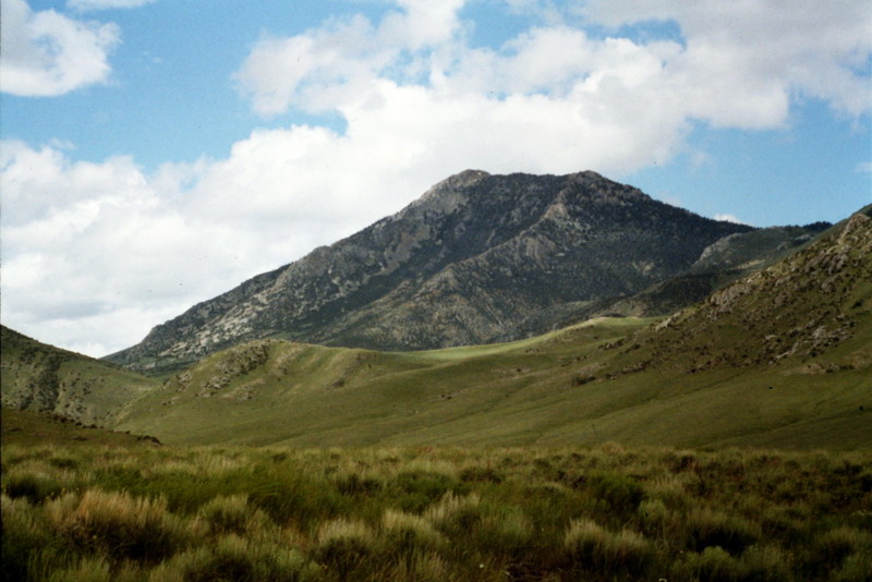
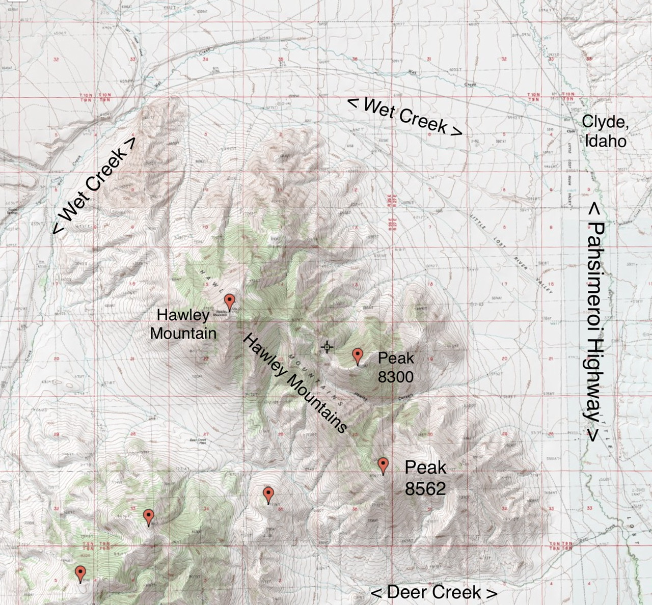
The Hawley Mountains are the southernmost of a ridge system that parallels the Lost River Range crest on its eastern side. The Donkey Hills and the Red Hills are the northern and central sections of this ridge system. The Hawley Mountains are roughly 10 miles long. The Little Lost River flows on the east side of this subrange. Wet Creek forms the northern boundary. Deer Creek flows on the south and west side.
The Hawley Mountains
Hawley Mountain, at 9,752 feet, is its highest point. In addition to Hawley Mountain two other points on this ridgeline have enough prominence to be classified as separate peaks, Peak 8,300 (shown on older maps as 8,229 feet) is roughly 1.5 miles southeast of Hawley Mountain and Peak 8562 sits at the far southern end of the range. The entire subrange is found on the Hawley Mountain USGS Quad.
Regions: EASTERN IDAHO->Hawley Mountains->Lost River Range
Mountain Range: Lost River Range