Elevation: 6,959 ft
Prominence: 409
This peak is not in the book. Updated November 2021
Indian Creek Butte is a two-humped summit that is located on the east side of Indian Creek in the southeast corner of the South Beaverheads. It is a relatively unimpressive, sagebrush-covered hill with no rock face or crater. But it does have, arguably, the largest summit cairn in the State of Idaho. A weak 2-track road leads to the summit from its east side and Indian Creek Butte Road. USGS Indian Creek
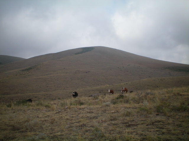
Indian Creek Butte as viewed from the east. This is cattle country. Livingston Douglas Photo
Access
From Exit 167/Dubois on I-15, drive west on ID-22 for 5.9 miles to a signed junction with Medicine Lodge Road. Turn right/north onto Medicine Lodge Road and reset your odometer. At 2.9 miles, the road bends left/west at a signed junction. At 4.1 miles, the road bends right/north at a signed junction. At 6.7 miles, the road bends left/west at a signed junction with Indian Creek Butte Road. Please note that this road is labeled “Cow Camp Road” on the USGS topo map and GOOGLE MAPS calls it “Doschades Cow Camp Road.”
Go straight/north onto Indian Creek Butte Road and reset your odometer. At 3.2 miles, reach a cattle fence crossing and “No Trespassing” signs on either side of the road. The BLM has an easement here, but stay on the road until past the north end of the private property. At about 4.3 miles, reach an unsigned junction. Bear right/northeast here. At 5.5 miles, reach an unsigned junction with a 2-track road that heads left/west. Park in a large pullout area at this junction (6,305 feet).
East Gully/South Ridge, Class 1
From the road junction, go west through a cattle gate and follow the 2-track road down 60 vertical feet to a dry gully then up over a minor shoulder and down another 35 vertical feet to another dry gully and an unsigned road junction with a north-south 2-track road. Up to this point, the 2-track road from Indian Creek Butte Road is NOT shown on the USGS topo map. However, from here to the summit, the 2-track ascent road IS shown on the USGS topo map as well as the north-south 2-track road that follows a dry gully.
Cross the north-south road and follow the weakening 2-track road west up a dry gully. The road is more of a cattle trail now and is quite overgrown. It has probably not been driven in years. The road/trail reaches a saddle at 6,150 feet. This saddle separates the [lower] south summit from the true/north summit. The road/trail bends right/north here and climbs the south ridge then heads east to get close to the summit. A final jog left/north puts you on top. The summit has a massive, well-constructed cairn–probably the largest summit cairn in the State of Idaho.
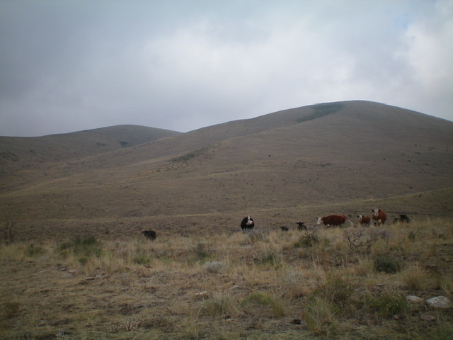
The dual summits of Indian Creek Butte. The ascent route follows an old 2-track up a gully between them (left side of photo) and then turns right to reach the right hump, which is the true summit. Livingston Douglas Photo
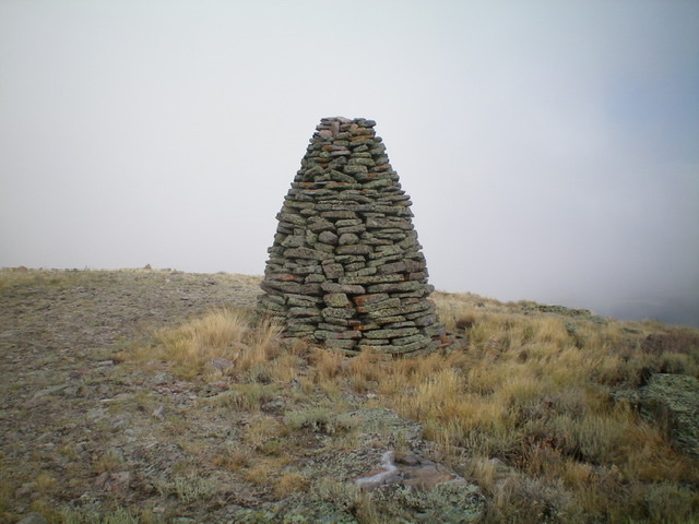
The tall summit cairn atop Indian Creek Butte, perhaps the biggest summit cairn in the State of Idaho. Livingston Douglas Photo
West Side Road Access
From the signed junction of Medicine Lodge Road and Indian Creek Butte Road, drive about a mile (or less) farther west/northwest on Medicine Lodge Road to a well-signed junction with “Indian Creek Road.” This is the “west side road.” It heads due north to the west side of Indian Creek Butte, which is clearly visible from here. In the event that Indian Creek Butte Road is closed to the public at some point in the future, Indian Creek Road is another option in an attempt to climb Indian Creek Butte.
Drive north on Indian Creek Road and ignore the “No Trespassing” signs that you encounter at a cattle guard about two miles up the road. The BLM has an easement on this road. The road follow the left/west side of Indian Creek and then climbs northwest up onto a bench that follows the West Fork of Indian Creek. Consult a USGS topo map and LOJ’s Land Management Map to decide where to park along the road and do a cross-country trek northeast from that bench, drop down to cross Indian Creek, and climb up onto the southwest face of Indian Creek Butte. Be very careful to observe the property lines here in order to remain on BLM land the entire way from Indian Creek Road to the summit.
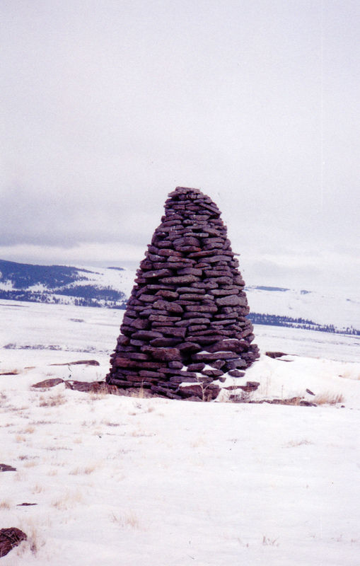
This 9 foot high signal is, perhaps, Idaho’s tallest standing cairn. Rick Baugher Photo
Additional Resources
Regions: Beaverhead Range->EASTERN IDAHO
Mountain Range: Beaverhead Range
Longitude: -112.39901 Latitude: 44.33501