Elevation: 5,074 ft
Prominence: 779
Livingston Douglas provides a complete update of the access and route information as well as additional photos for this desert butte. Updated January 2023
Kimama Butte is a former BLM fire lookout site. As best I can tell, it was manned during the summer from 1937 to 1975. The lookout was demolished in the early 2000s. A road leads to the summit of this butte, which is located roughly 15 miles northwest of Rupert, Idaho. USGS Kimama Butte

Kimama Butte
Livingston Douglas Updates
Access
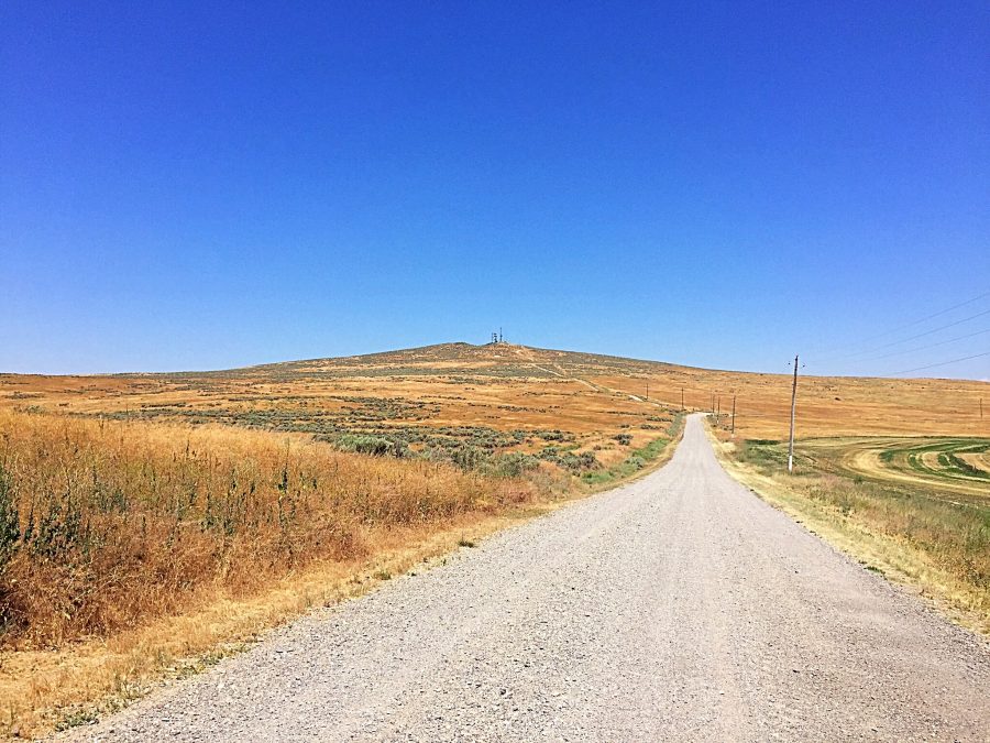
From ID-24 at a sharp left/west turn (just west of Minidoka), drive 15.1 miles west on ID-24 to a signed junction with [paved] 600W Road. Turn left/south onto 600W and drive 5.4 miles to a signed junction with 900N Road. Turn right/west onto 900N and drive 5.4 miles to a sharp left/south bend at a junction with signed 1150W (Kimama Lookout Road). Drive about 100 feet up 1150W, cross a cattle guard, and reach a parking area (4,580 feet). You can drive farther up this 2-track 4WD road but it gets steep and rocky near the summit. In retrospect, the better/easier drive to the summit is via a well-maintained service road that comes in from the north from [signed] 1100N along 600W.
South Face, Class 1
The Climb
From the parking area near the base of 1150W, hike north up the steep 2-track road to the antenna-clad summit of Kimama Butte. The high point is a cluster of volcanic boulders located in the middle of the summit plateau, between the antenna towers. The summit has two USGS benchmarks.
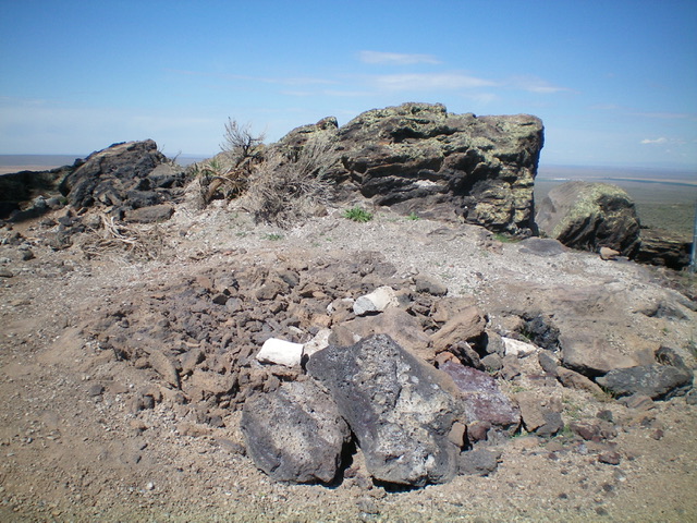
The summit boulders atop Kimama Butte. The antennas, thankfully, are just out of view. Livingston Douglas Photo
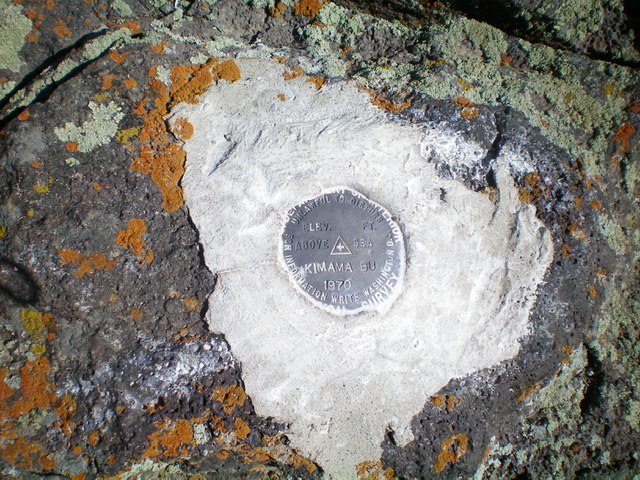
The USGS benchmark atop Kimama Butte. Livingston Douglas Photo
Additional Resources
Regions: SNAKE RIVER PLAIN
Mountain Range: Snake River Plain
Year Climbed: 2016, 2017
Longitude: -113.8969 Latitude: 42.76209