Elevation: 9,280 ft
Prominence: 50

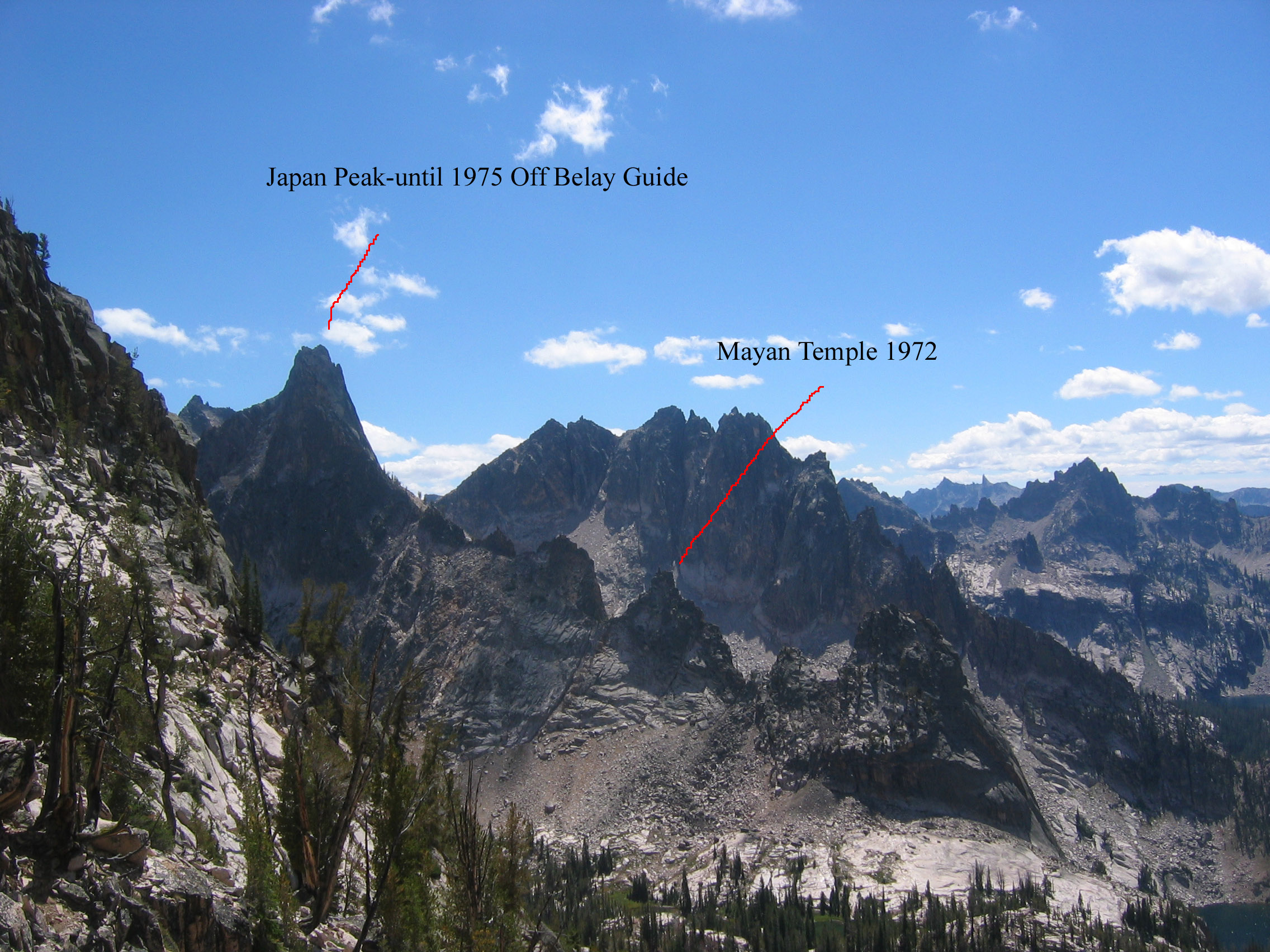
This formation is not in the book. The name Mayan Temple mistakenly shows up as Japan Peak in the book. Ray Brooks explained the source of the confusion which dates back to 1972. Ray reports : “ In September 1972, we did make a nice first ascent of a pinnacle on the ridgeline just northeast of Japan Peak. We named the pinnacle the Mayan Temple. When we ran into Sawtooth legend Louie Stur on our way out and told him what we had been up to, he misunderstood us and came to believe that Japan Peak was our Mayan Temple.” As things would happen, Off Belay Magazine used Louis Stur for a source for a 1975 article on the Sawtooth Range and the article misidentified Japan Peak as Mayan Temple. From that point on, both names have been used by climbers. Thanks to Ray, we know the location of the “real” Mayan Temple. Published December 2023
Mayan Temple is located on the ragged northwest ridge of Japan Peak between Blue Rock Dome and Rainy Day Pinnacle. USGS Warbonnet Peak
Looking south from Warbonnet into Bead Lakes basin. Ray Brooks Photo
Access
Access the formation from Warbonnet Lakes [(A)(6)(c.3) on Page 207].
East Face, Class 5.7
Ray Brooks described the climb as follows: “Harry and I climbed a nice route on one of the minor pinnacles on the west side of our valley. I mention it because we thought it was a “first ascent” and we named the pinnacle “Mayan Temple” since it looked like one. We scrambled some of its east face and then enjoyed three pleasant leads to a striking 15-foot high summit block.”
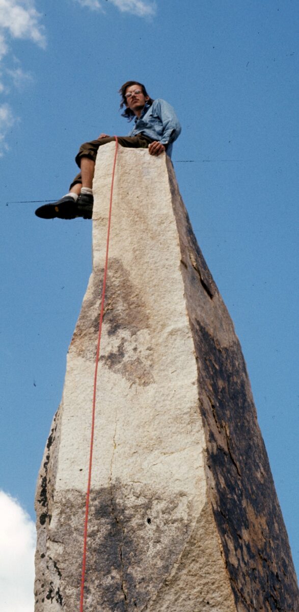
Ray on top of the Mayan Temple
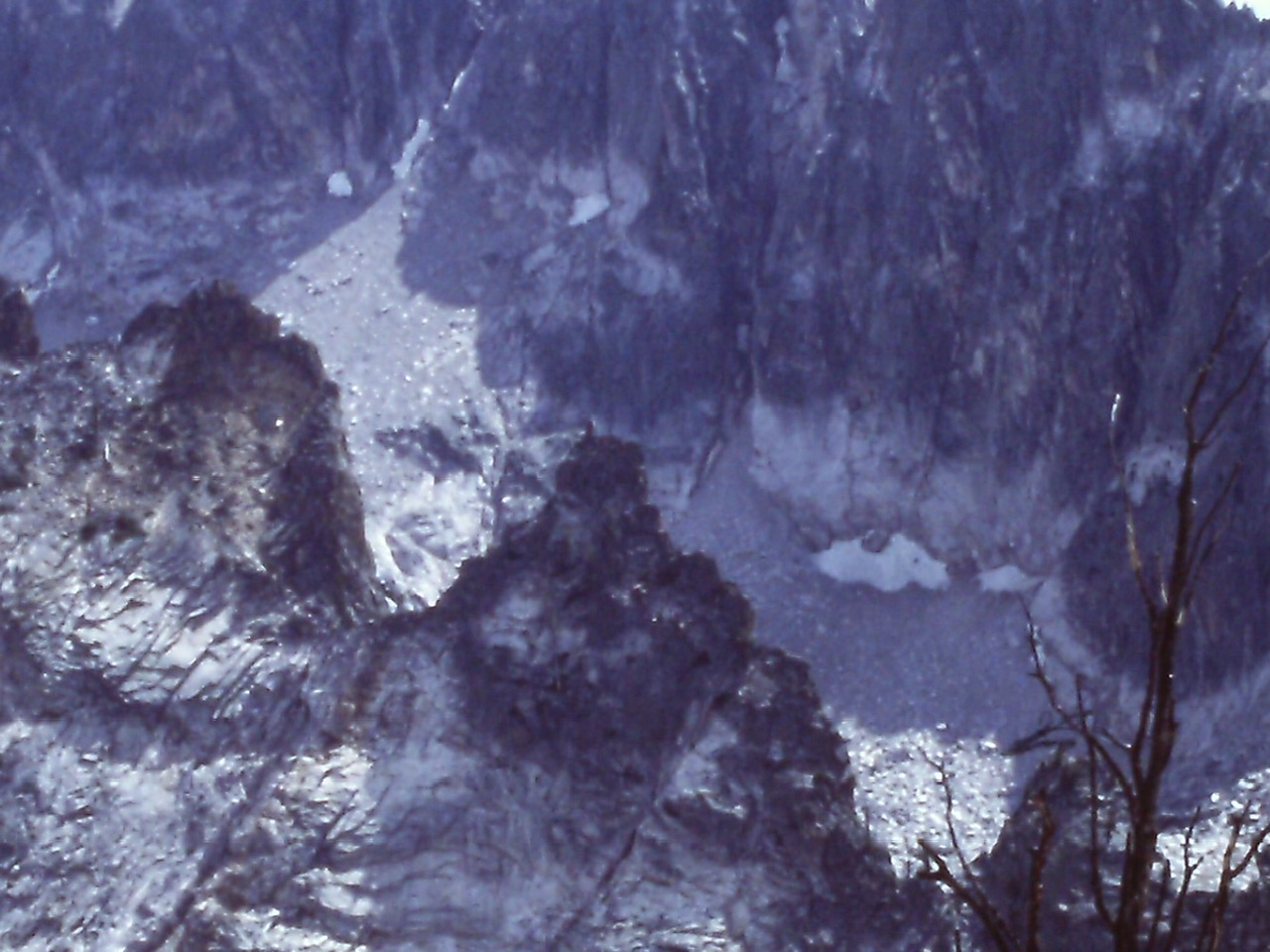
The Mayan Temple is dead center in this photo taken from Warbonnet Peak
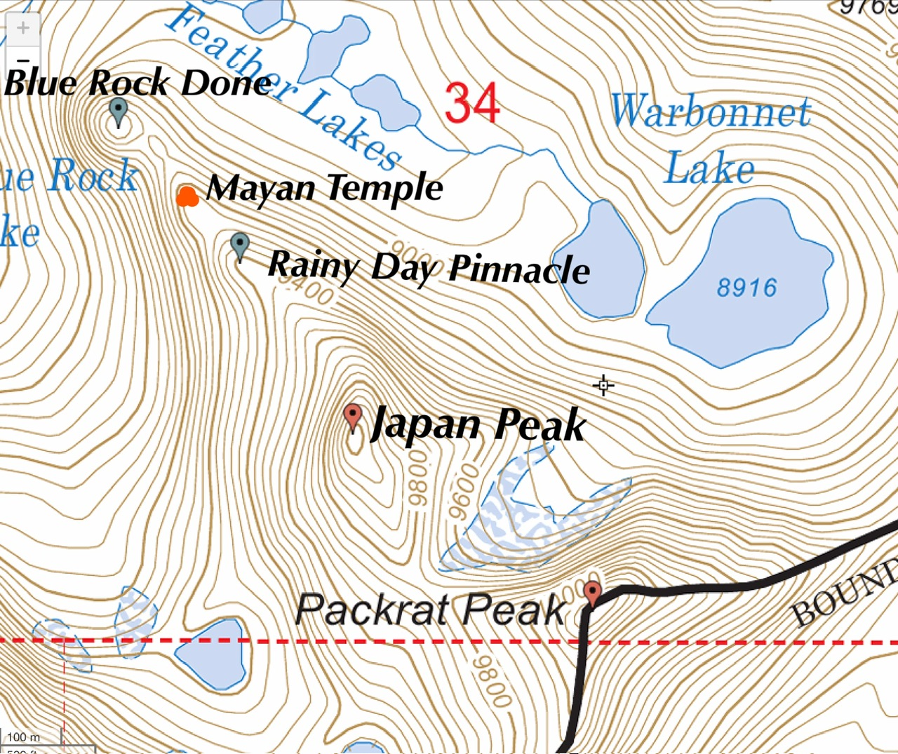
Mayan Temple sits between Blue Rock Done and Rainy Day Pinnacle
Additional Resources
Mountain Range: Sawtooth Range
First Ascent Information:
- First Ascent Year: 1972
- Season: Summer
- Route: East face to summit tower
- Party: Ray Brooks and Harry Bowron
Longitude: -115.05127 Latitude: 44.06449