Elevation: 5,912 ft
Prominence: 342
This peak is not in the book. Updated November 2023
North Laidlaw Butte is located about three miles southwest of the south end of the established Craters of the Moon National Monument. It is also about two miles northeast of Snowdrift Crater and about seven miles northeast of Laidlaw Park. Depending upon road conditions from Laidlaw Park, you may need an ATV or MC to reach Snowdrift Crater or Little Laidlaw Park. The hike from the trailhead at Craters of the Moon (4.8 miles one way) combined with the cross-country route to the summit (3 miles one way) demands a LONG mileage day of almost 16 miles round trip.
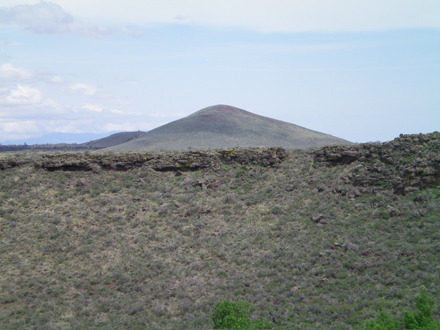
North Laidlaw Butte as viewed from the southwest. Livingston Douglas Photo
Approach from the North (Craters of the Moon National Monument)
From Craters of the Moon National Monument along US-20, hike east then south on the Wilderness Trail all the way to the end of the trail at 5,700 feet just before reaching The Sentinel. This trail hike covers about 4.8 miles one way.
Northeast Side/North Ridge, Class 2-3
From just north of The Sentinel, hike southwest across sagebrush and lava flows to reach the east side of the summit massif. Climb west up onto the north ridge and follow it south to the summit. Based on my visuals from the summit of The Sentinel, the terrain looks relatively easy without many sections of lava flows or rocky outcrops. But it requires three miles (each way) of cross-country travel and the USGS topo map shows numerous lava outcrops along the way, so be advised.
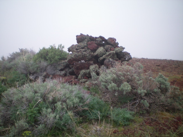
The large summit cairn atop North Laidlaw Butte. Livingston Douglas Photo
Approach from the South
From US-20 east of Carey, turn right/south onto [signed] North Laidlaw Road. This junction is 0.2 miles west of Fish Creek Road, which is well-signed. Drive south on North Laidlaw Road for 1.2 miles to an unsigned “T” junction. This is Laidlaw Park Road. It can also be approached directly from farther west on US-20 and the road quality should be fine. Turn left/southeast onto Laidlaw Park Road and drive 13.6 miles to reach a signed 4-way junction (5,078 feet on the USGS map).
From this junction, turn left/north and drive just over 0.1 miles to cross a cattle guard. Just past the cattle guard, the road forks. Ant Butte is to the left. Go right/northeast here to stay on the main road. Continue driving northeast then north on the road as it passes Big Blowout Butte (left) at 2.7 miles then heads north-northeast past Hollow Top (right) at 4.4 miles. The 2-track road never seems to end. It reaches a major right/east bend to head directly at [obvious] Snowdrift Crater. The road finally bends right-ish/southeast and gets very close to the southwest rim of the crater.
At 7.2 miles, reach a signed turnoff for a parking/camping area (signed for “Snowdrift Crater”) on the southwest rim of Snowdrift Crater. Park here (5,580 feet). This parking area is 4.1 miles from the pullout southward directly to Laidlaw Park Road but this road (the “east road”) is much more primitive than the road (the “west road”) that comes up from the southwest.
Southwest Face from Snowdrift Crater, Class 2
From the Snowdrift Crater parking area, follow a use trail eastward along the split-rail fence along the crater rim until the fence descends left/north into the crater. Leave the trail/fence and follow a cattle trail(s) near the crater rim through thick sagebrush to reach an old 2-track road (now mostly a cattle trail) on the east side of the crater, near the crater rim. Leave this 2-track road fairly soon to head directly at North Laidlaw Butte, which is readily visible from here. Bushwhack northeast through a mix of easy and thick sagebrush directly at the pyramidal summit in the distance. After a good ¾ mile, reach an extensive lava field after descending almost 100 feet.
Work through the tedious mix of lava boulders and sagebrush and then a final section of pure lava boulders, ridges, and narrow gullies to reach the base of the southwest face. Scramble northeast up the easy face on lava gravel/dirt and short sagebrush to reach the bare summit of North Laidlaw Butte. The summit has a large summit cairn. The lava “cracks” shown on the USGS topo map are probably just some of the deep gullies in the lava field, some of which must be downclimbed or skirted using narrow ridges of lava rock. This route covers 5.0 miles with 600 feet of elevation gain round trip.
South Side from Little Laidlaw Park, Class 2-3; NOT ACCESSIBLE
Little Laidlaw Park is not accessible due to private land. And the road shown on the USGS topo map coming up into Little Laidlaw Park from the south no longer exists.
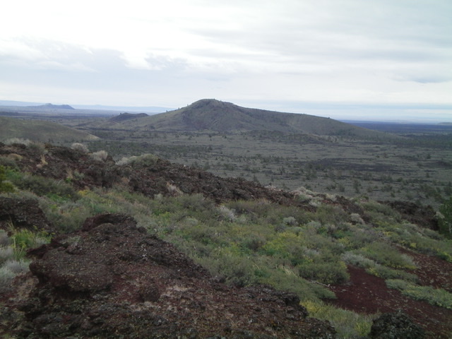
North Laidlaw Butte as viewed from The Sentinel to its northeast. Livingston Douglas Photo
Additional Resources