Elevation: 10,196 ft
Prominence: 1,013
Climbing and access information for this peak is on Pages 132-133 of the book. Updated by Livingston Douglas November 2021
North Twin Peak is one of only a handful of 10,000ers in the Eastern Salmon River Mountains. It towers over Spruce Gulch Lake and has a magnificent, steep gully that splits its south face. North Twin Peak is the fifth-highest peak in the massive Salmon River Mountains. USGS Twin Peaks
North Twin Peak. Dan Robbins Photo
Access
This is the first leg of a 2-peak adventure that includes North Twin Peak (10,196 feet) and South Twin Peak (10,340 feet). It is a loop route that covers 5.5 miles with 2,475 feet of elevation gain round trip.
From US-93 at the north end of Challis, turn left/west onto [signed] Clinic Avenue. Follow Clinic Avenue as it goes west briefly, then jogs north briefly, then heads west to a “T” junction with [unsigned] Challis Creek Road. This junction is 0.4 miles from US-93. Turn right/north onto Challis Creek Road and drive 9.7 miles to a signed junction. Go left for Mosquito Flat Reservoir (7 miles) and go straight/northwest for Bear Creek Road and Twin Peaks. Go straight here.
This road heads northwest briefly then turns sharply left/southwest to cross some private property and reach the Bear Creek drainage. The road bends right-ish/west to follow Bear Creek upstream. It is labeled as “Sleeping Deer Road.” From the signed junction on Challis Creek Road, drive 7.8 miles on Sleeping Deer Road/FSR-086 to the old Twin Peaks Guard Station. Park here (8,930 feet). The guard station is just below a “T” junction.
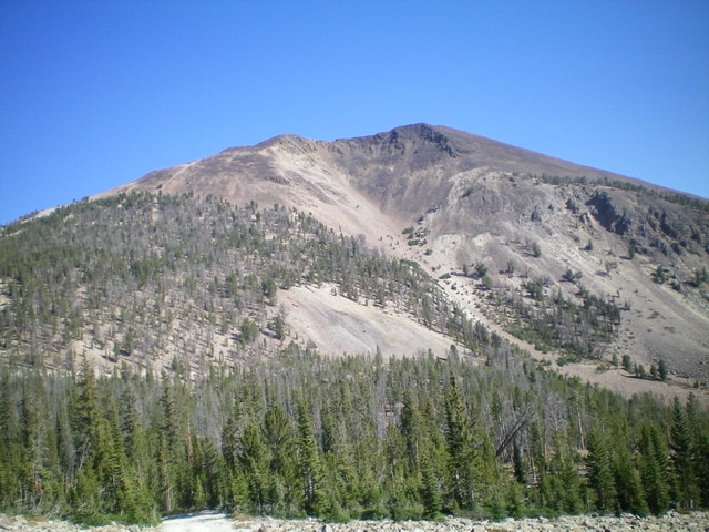
North Twin Peak as viewed from the summit of South Twin Peak. Livingston Douglas Photo
South Ridge, Class 2
The Climb
From the guard station, hike briefly up Sleeping Deer Road to a signed “T” junction. Go left here for the road up to the Twin Peaks Lookout (atop South Twin Peak) and right to continue up Sleeping Deer Road. Go right and follow Sleeping Deer Road up to the 9,183-foot saddle between North Twin Peak and South Twin Peak. Sleeping Deer Road is a rocky, steep, narrow road that can be driven with 4WD and good tires all the way to the saddle. This is a massive burn area, so take appropriate precautions.
From the 9,183-foot saddle, bushwhack north up through open pine forest with a loose gravel/sand base with some scree mixed in. Higher up, the trees become scattered and the terrain is mostly loose gravel. Skirt the right/south side of Point 9650 to reach a minor saddle. From the saddle, scramble up another steeper, looser section of open pine forest to reach the open, rocky terrain above. Work your way up talus slopes and over/around ridge outcrops to approach the northwest summit. Scramble up a steep-ish talus slope to reach the northwest summit hump.
Descend about 20 vertical feet to a minor saddle then scramble southeast up more talus to reach the well-cairned summit of North Twin Peak. The summit offers nice views of White Valley Mountain (9,981 feet) to the north and South Twin Peak (10,340 feet) to the south. Return to the 9,183-foot connecting saddle with South Twin Peak to complete the first leg of today’s 2-peak journey. South Twin Peak is up next.
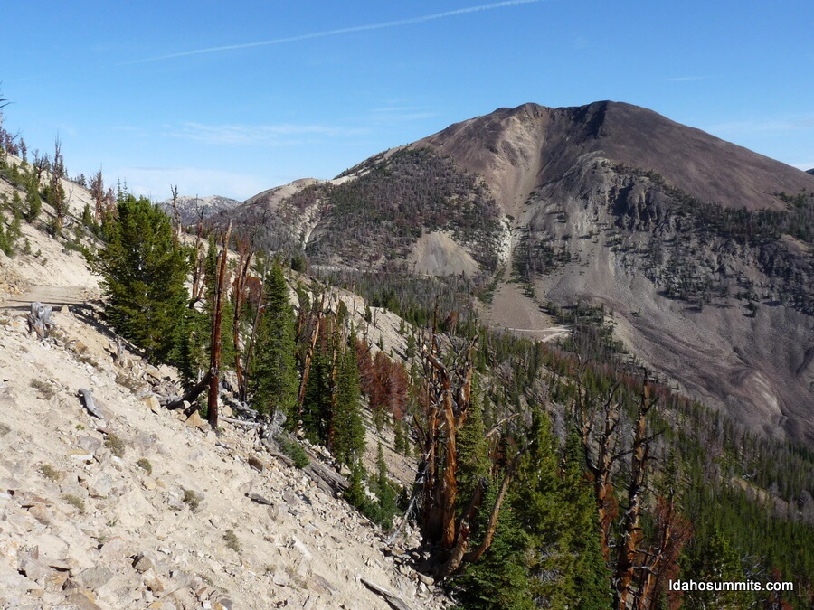
North Twin Peak and the massive gully that splits the south face. Livingston Douglas Photo
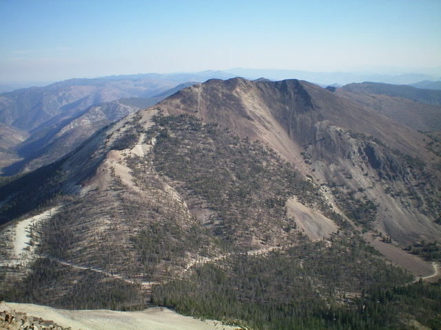
The South Ridge Route on North Twin Peak starts at the lower left of the photo (at the pass) and bends right as you climb. The summit hump is just right of center and just left of the south gully. Livingston Douglas Photo
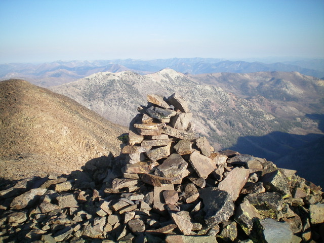
The impressive summit cairn atop North Twin Peak. Livingston Douglas Photo
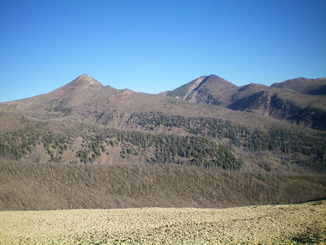
South Twin Peak (left) and North Twin Peak (right) as viewed from the southeast. Livingston Douglas Photo
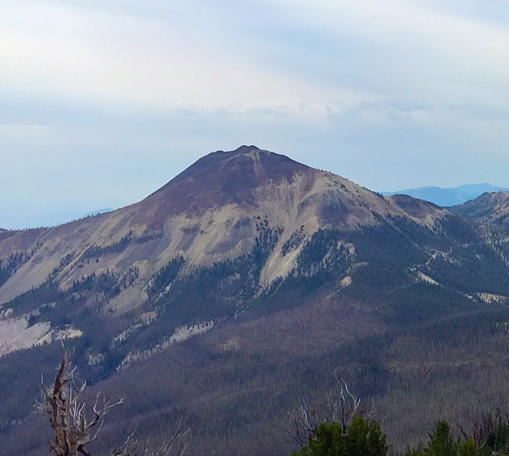
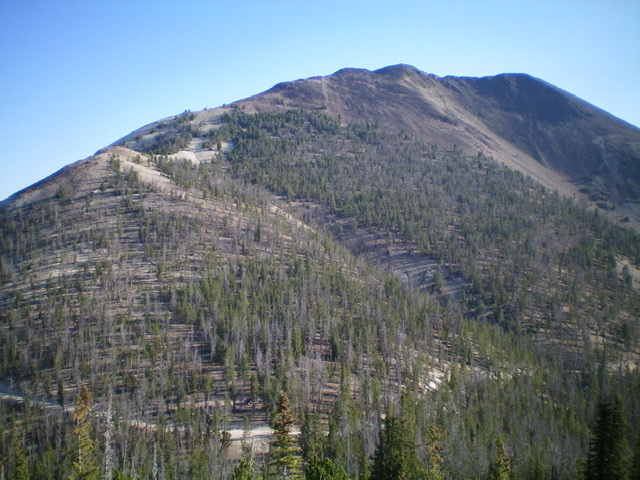
North Twin Peak as viewed from the west.
Additional Resources
Regions: Eastern Salmon River Mountains->Salmon River Mountains->Southeast Corner Peaks->WESTERN IDAHO
Mountain Range: Eastern Salmon River Mountains
Year Climbed: 1989
Longitude: -114.46549 Latitude: 44.60569