Elevation: 10,149 ft
Prominence: 809
This peak is not in the book.
East Burnt Peak sits east of the head of the East Fork of Burnt Creek. See map below, which shows this intermittent stream as East Fork Burnt Creek. This peak is connected to Apex Peak via a saddle at 9,360 feet. This grass- and talus-covered peak can be approached from almost any direction. USGS Massacre Mountain
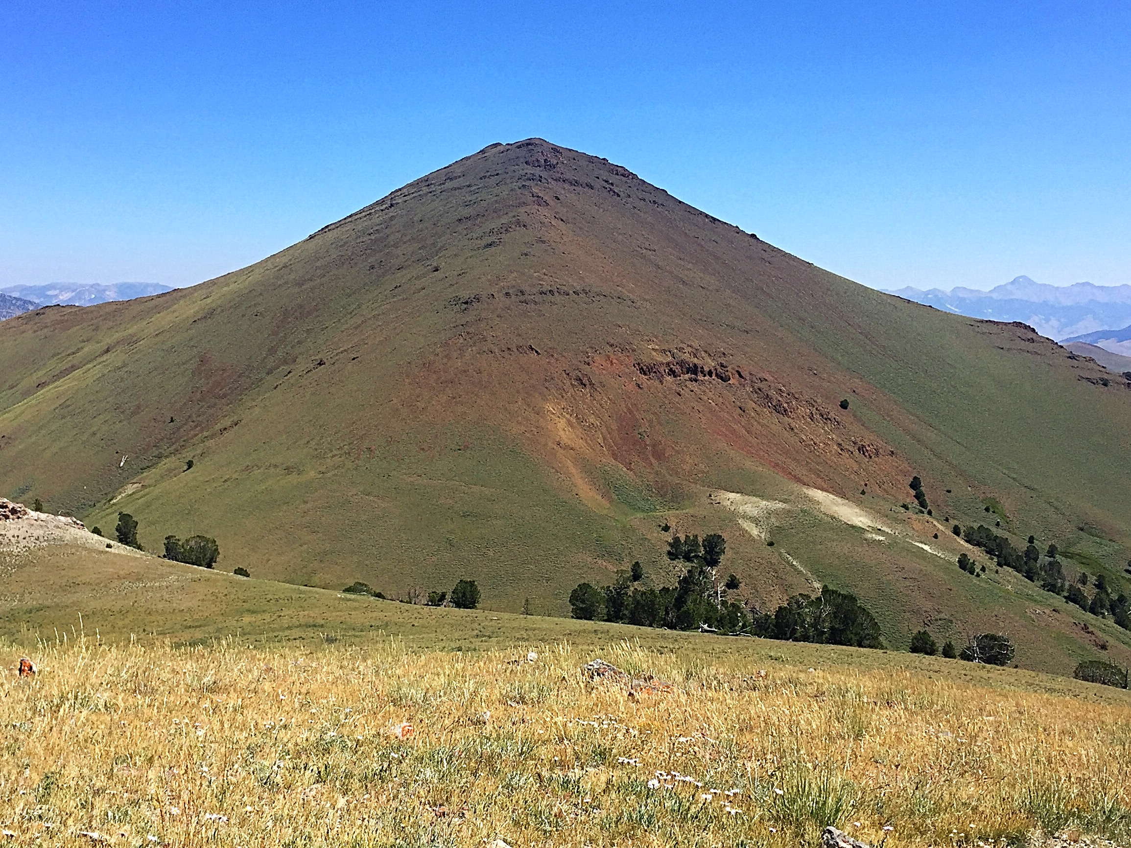
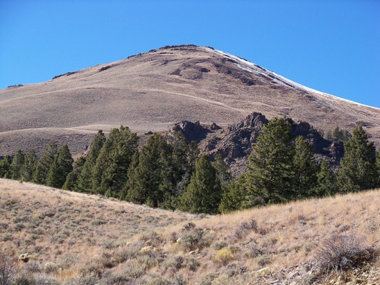
East Burnt Peak as viewed from the slopes of Apex Peak.
Access
Access the peak from the Burnt Creek Canyon Roads [(A)(6.2) on Page 290]. Follow the road into the drainage until the road drops down off a high point to East Fork Burnt Creek.
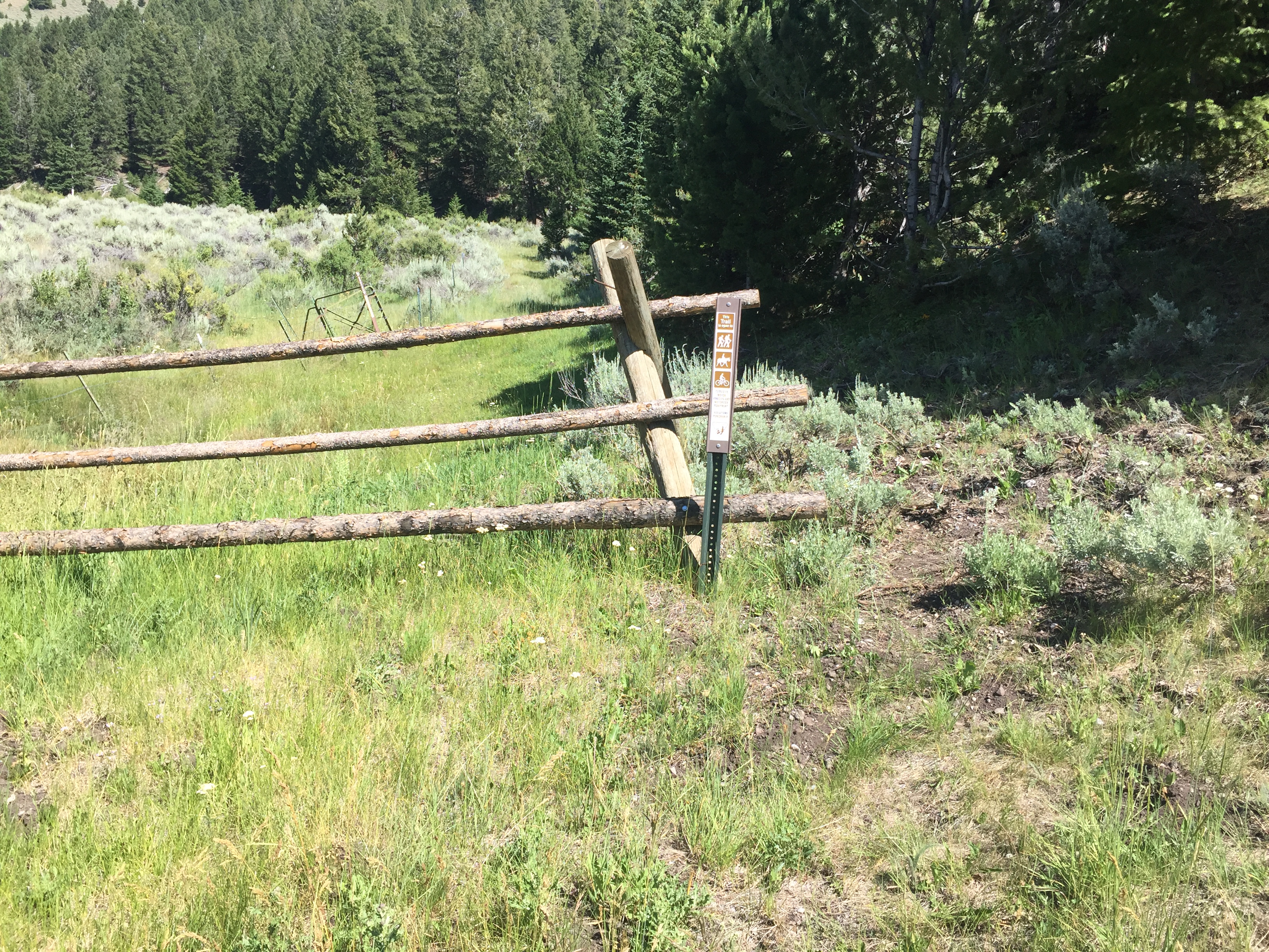
The trail starts behind this fence.
East Fork Burnt Creek Approach, Class 2
From the end of the road, walk past the fence and follow the trail along the East Fork Burnt Creek until you reach Burnt Creek Lake. This unofficial trail was in good shape in July 2017. The trail passes the lake on its East Side and disappears in the meadow at the South End of the lake. Continue up the drainage. You will find a good game trail most of the way to the saddle between Apex Peak and East Burnt Peak. Once you get above 8,600 feet, you can follow almost any line to the summit.
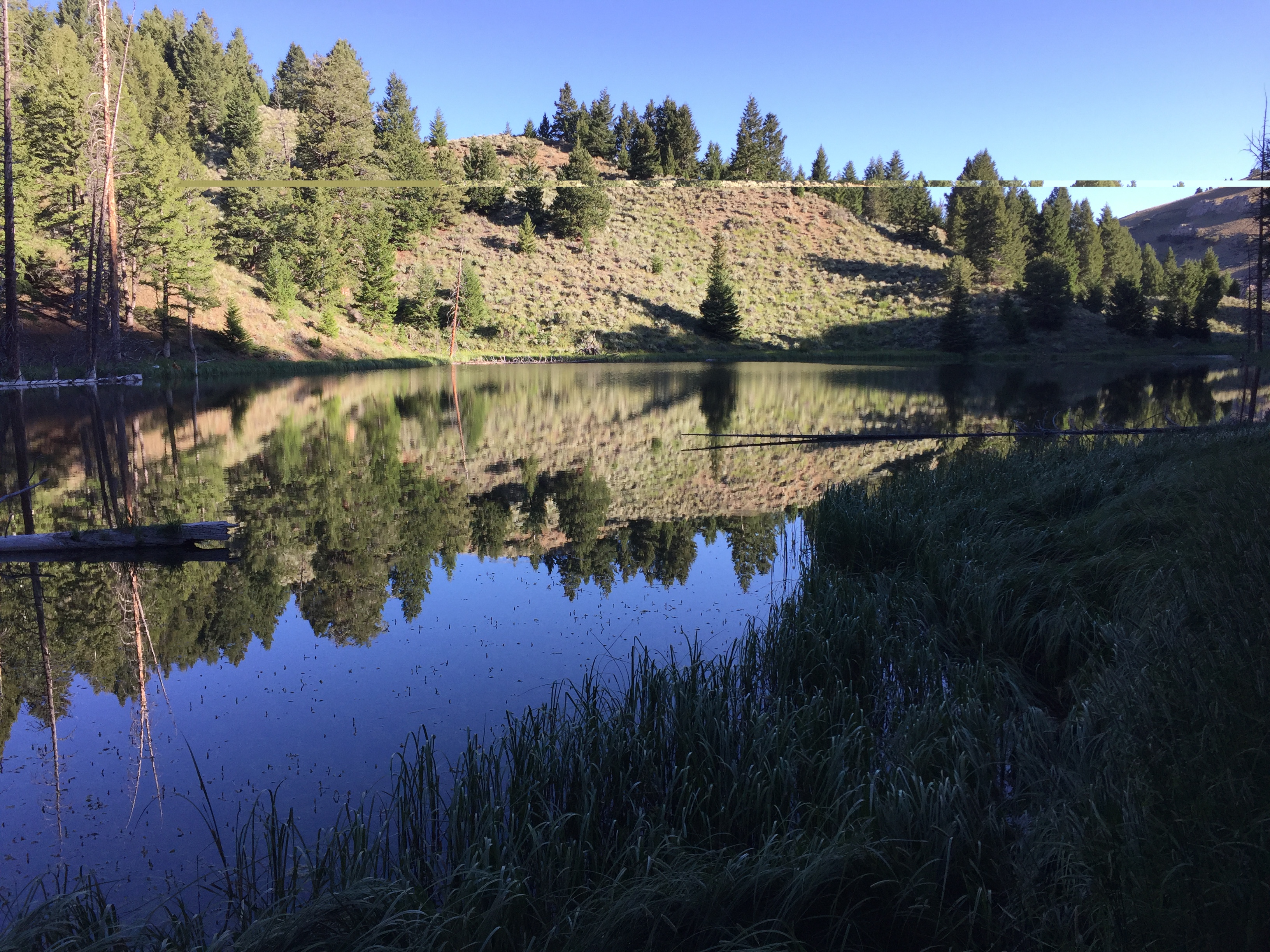
Burnt Creek Lake. The lake is picturesque, but the water is foul-looking.
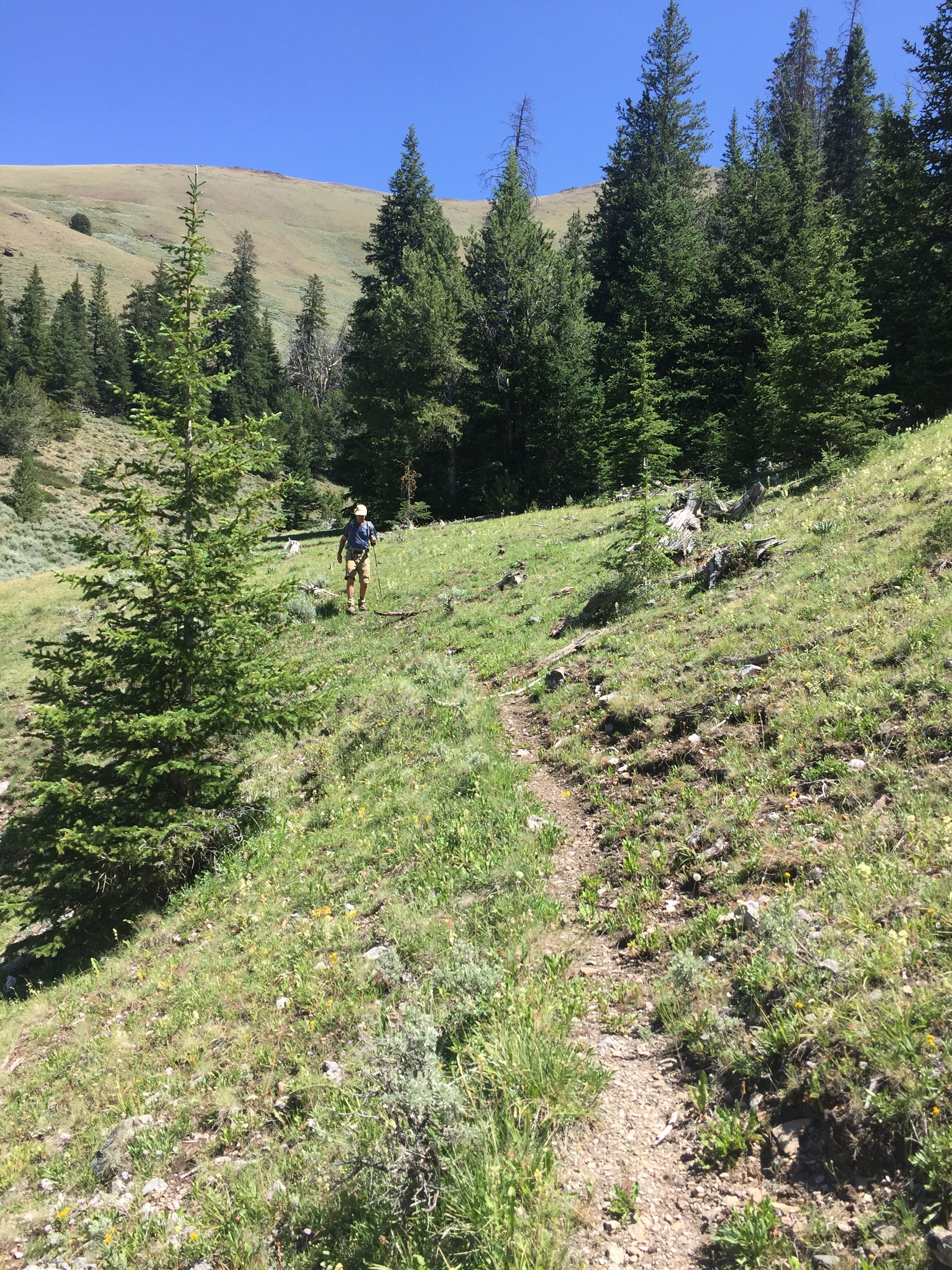
The game trail above the lake is well defined in places.
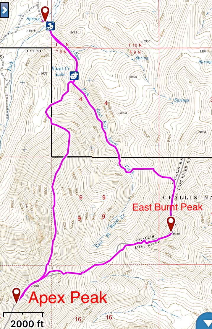
This is my GPS track for Apex Peak and East Burnt Peak. The route off Apex Peak is a Class 2 walk down steep, loose talus.
Additional Resources
Regions: EASTERN IDAHO->Lost River Range
Mountain Range: Lost River Range
Year Climbed: 2017
Longitude: -113.61029 Latitude: 44.12159