Elevation: 10,404 ft
Prominence: 904
Climbing and access information for this peak is on Page 325 of the book. Livingston Douglas provided detailed route information for climbing the peak from Montana. Rick Baugher’s trip report discusses the Idaho approach and the basis for the proposed name. Updated November 2020
Dianes Peak is another impressive Beaverhead Mountains peak that is overlooked by climbers because it does not have an official name. It sits on the Continental Divide above Willow Creek. USGS Eighteenmile Peak
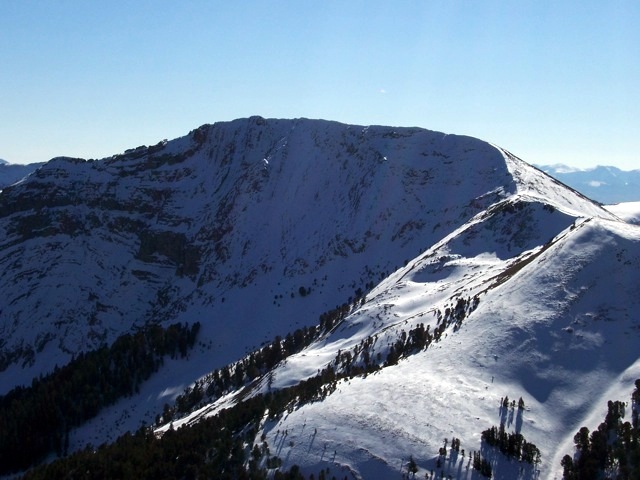
Dianes Peak as viewed from Tendolia Peak (10,201 feet) in Montana (11/6/07). Rick Baugher Photo
Montana Access
From Exit 23/Dell on I-15 in Montana, cross under I-15 to its west side. Turn left/southeast onto the frontage road and drive 1.6 miles to the [signed] junction with Big Sheep Creek Road. Turn right/southwest onto Big Sheep Creek Road and reset your odometer. At 16.7 miles, reach a road junction. Go left for Meadow Creek/Nicholia Creek. At 16.8 miles, reach another road junction. Go left onto Nicholia Creek Road/FSR-657. At 17.1 miles, reach a road junction. Go straight on Nicholia Creek Road. At 19.6 miles, turn left. At 23.3 miles, turn left. At 24.1 miles, reach the NF boundary and go left. At 24.4 miles, reach a signed road junction. Go right onto Nicholia Creek Road. At 26.8 miles, reach the end of the road and the Nicholia Creek/CDT trailhead. Park here (7,850 feet). The final 3.4 miles on Nicholia Creek Road is narrow, rocky, and rough. It includes mud holes and three drainage crossings.
North Ridge, Class 2
The Climb
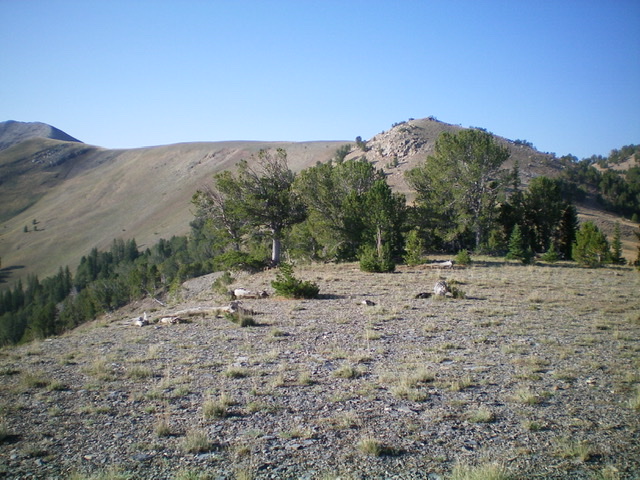
From the Nicholia Creek trailhead, hike west then southwest up through open sagebrush (not too bad) to eventually reach the pine forest just right/north of a prominent talus slope on the northeast face of the north ridge. Bushwhack southwest up through pine forest to reach the crest of the north ridge. This climb is very steep initially on a talus/scree base. The ridge is ill-defined and rounded initially but it quickly gains definition and is a steep but steady scramble. There are 2-3 minor rocky humps to go over or around. The boulders/talus in these sections is a bit tedious. Higher up, the terrain is a mix of tundra and scree/broken rock and goes quickly.
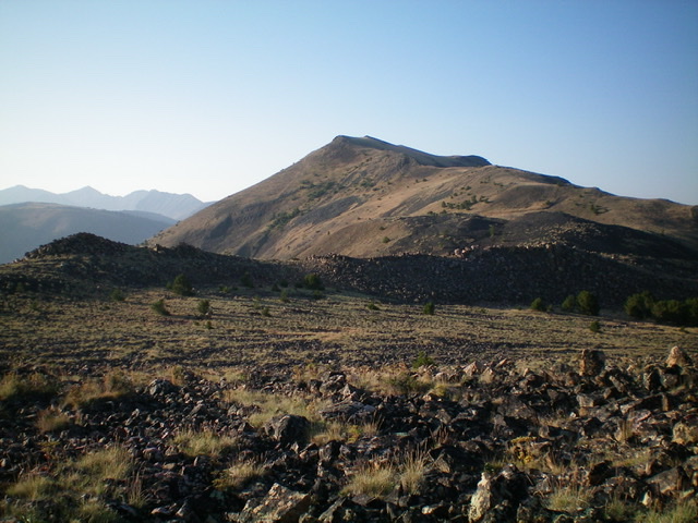
The first leg of the north ridge–getting up over Peak 10201/Tendolia Peak (MT) which is dead ahead. Livingston Douglas Photo
Reach the top of Peak 10201/Tendolia Peak from which you now have a splendid view of Dianes Peak and the work that lies ahead of you. Make a rocky, tedious descent southwest on boulders and talus to reach a gentle tundra saddle at 9,660 feet. From the saddle, climb south up a rocky, steep slope (with some goat trails and tundra to help) to reach a rocky ridge point. Drop south 30 vertical feet to another gentle saddle. The ridge bends left-ish/southeast here. Cross a wide, tilted section of tundra to reach the base of the narrow, rocky ridge section that leads to the summit ridge.
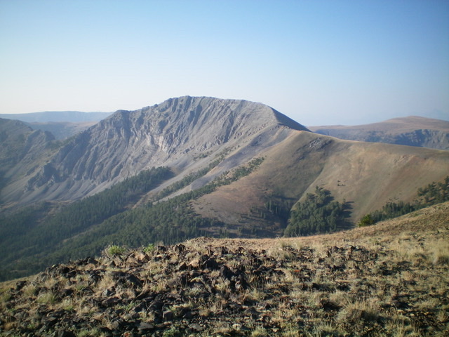
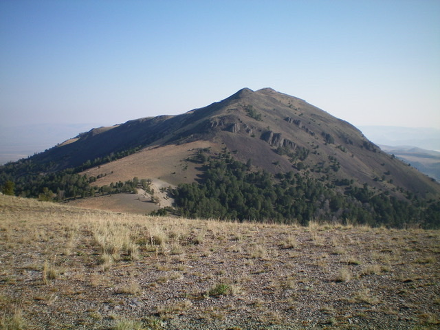
Dianes Peak as viewed from the top of Peak 10201 to its south. The summit is the small bump just left of center. The north ridge descends rightward from the rocky, flat summit ridge. Livingston Douglas Photo
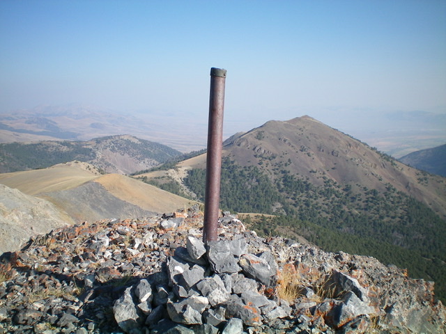
Climb south then southeast on the rocky ridge crest to reach the summit. The best footing is on the ridge crest. An on-and-off goat trail will help you make upward progress. The slope eases for the final section of ridge (the “summit ridge”) and, contrary to what it looks like from below, it is a steady uphill to the summit high point. It is not a choppy, tedious endeavor. The summit of Dianes Peak has an ID/MT boundary post in a cairn. The summit is on a narrow ridge crest and offers a magnificent view of the Nicholia Creek drainage. The ridgeline heading southeast from the summit is a wicked mess of crumbly towers, loose rock, and exposure and has probably never been climbed.
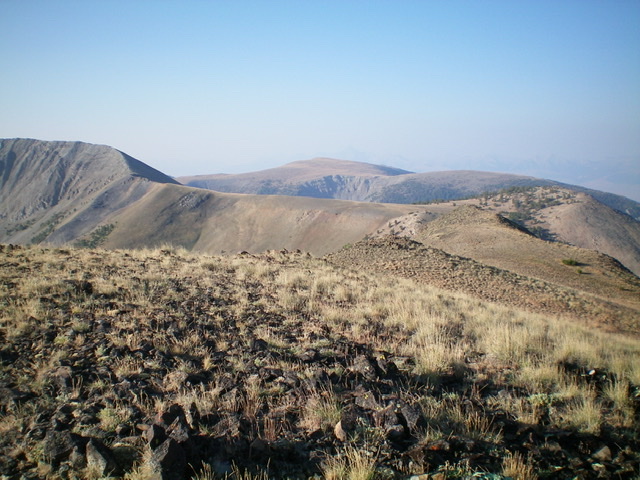
The mid-section of the north ridge, from Peak 10201 to the base of the steep, rocky finish. The ridge wiggles right/southwest then bends left/north then left/northeast again. This ridge section goes quickly. Livingston Douglas Photo
Moving up the north ridge. This is the view from a minor saddle at the base of a rocky hump. The tilted ridge section is next. Livingston Douglas Photo
Looking back at the ridge section that descends southwest from Peak 10201. Livingston Douglas Photo
Looking north at Peak 10201/Tendolia Peak (MT) from the summit of Dianes Peak. Peak 10201 is about 2/3 of the way up the north ridge of Dianes Peak. Livingston Douglas Photo
Northeast Shoulder, Class 2
The Descent
From the summit, descend the north ridge briefly to reach the top of the northeast shoulder at 10,020 feet. The northeast shoulder is visible and obvious. Descend northeast on the shoulder, initially on loose gravel (boot-ski it) to reach the waiting forest. Once in the forest, head east then northeast to remain on the shoulder. Follow a well-beaten elk trail all the way down to the toe of the shoulder. Exit the forest into an open field next to a stream (shown on the USGS topo map). Stay left/west of large grassy marshes and, as the drainage narrows and steepens, leave the drainage and follow a good elk trail on the left/west side of the drainage. This trail crosses a steep hillside and approaches the Nicholia Creek valley floor. Find a cattle trail to descend right/east through a patch of forest to reach the open valley floor and quickly find the CDT (look for a post with a CDT sign on it). Follow the CDT about 1.8 miles back to the Nicholia Creek trailhead.
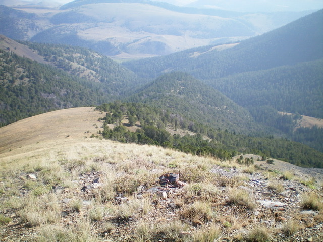
Looking down the magnificent northeast shoulder of Dianes Peak from its juncture with the north ridge. Livingston Douglas Photo
Idaho Access
Access this peak from Willow Creek Road [(B)(7.2) on Page 330 of the book]. Route information is found down the page.
Continental Divide Route, Class 2 by Rick Baugher
Met LaVar Newman, owner of Nicholia Ranch. Shared stories of the former town of Nicholia, ID, then rode up Willow Creek. Parked at 8,400 feet. Hiked north up a gulch, then northeast to the Continental Divide. Encountered mountain goats close up. Ascended a snow cap to the summit. Built a cairn and left a register. Suggested the peak name “Dianes Mountain”, which honors Diane M Palmer (November 12, 1946- June 14, 1947), who is buried at the Barzee Cemetery at Reno in the Birch Creek Valley.
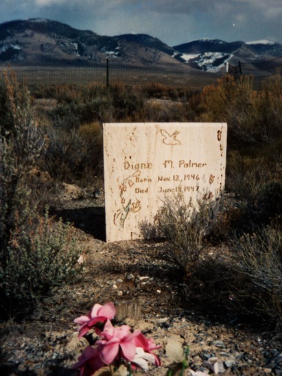
Ranch life in the Birch Creek Valley had its sad moments. The grave site of Diane M. Palmer at the base of the mountain named for her. Rest in peace, sweet child. Rick Baugher Photo
Just off the summit, I found a Montana Idaho Atlantic Pacific (MIAP) iron post
survey Mile Marker 572, placed by the Carpenter Stateline Survey in 1905.
Back in the valley, I met two Barzee kids at the old Reno Post Office site.
Additional Resources
Regions: Beaverhead Range->EASTERN IDAHO
Mountain Range: Beaverhead Range