Elevation: 10,681 ft
Prominence: 461
This peak is not in the book. Livingston Douglas added the southwest ridge route found below. Updated December 2019
Peak 10681 is located on the main Lemhi Range Crest between Midway Mountain to the south and The Clapper to the north. Foss Mountain is west of Peak 10681. I climbed the peak in 1981 via the connecting ridge from Foss Mountain. More recently, Larry Prescott climbed the peak on an epic 13-mile, 7,300-foot elevation gain, 6-peak day, which saw him traverse the peak from Midway Mountain to the south all the way to Foss Mountain. This route is detailed in his trip report: Lemhi Enchainment, Little Sister to Foss Mountain. USGS Bell Mountain
Access
Foss Mountain Road [(C)(8) on Page 318]
West Ridge, Class 2
The ridge from Foss Mountain to Peak 10681 involves some bushwhacking but is straightforward.
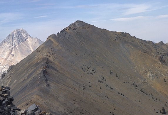
Peak 10681 as viewed from Midway Mountain. Larry Prescott Photo
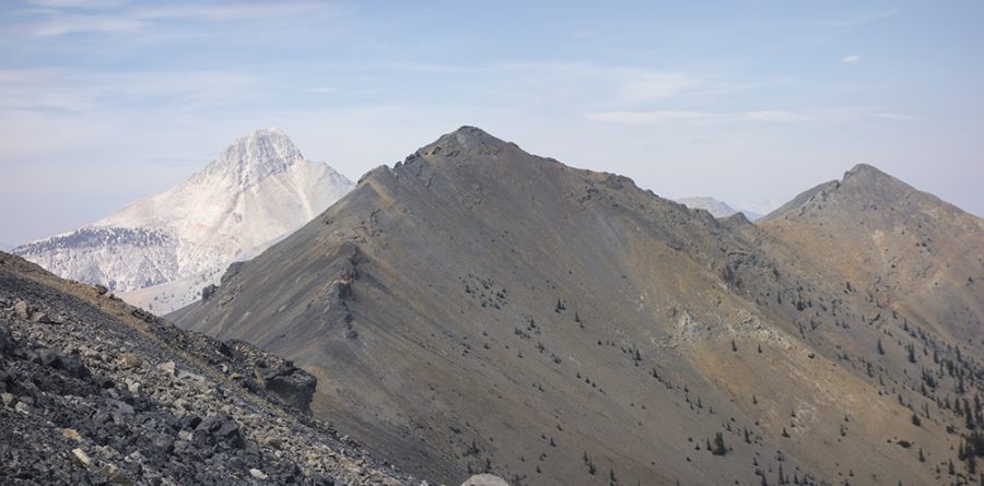
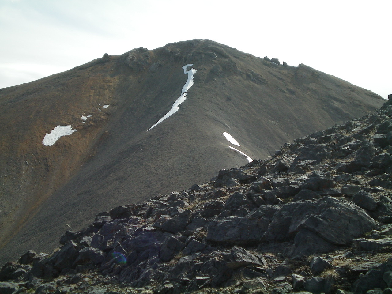
View of the southwest ridge of Peak 10681 from the summit of Peak 9634. The summit of Peak 10681 is right of center. The connecting ridge is forested initially and has two humps. Only the second one (bare) is part of the southwest ridge route. The first hump is part of the descent route off Peak 9634. The southwest ridge goes left-ish then goes right-ish then joins the west ridge of Peak 10681 and follows the skyline rightward to the summit. Livingston Douglas Photo
Southwest Ridge, Class 2 by Livingston Douglas
Access
The access road for Mud Spring/Cedar Run Creek is located on the Little Lost River Highway, exactly 0.3 miles north of the [signed] Pass Creek Road junction in Clyde and 28.0 miles north of Howe. Turn right/east onto the [unsigned] access road and reset your odometer. At 0.3 miles, turn right/south after crossing the Little Lost River on a bridge. Cross a cattle guard. At 1.0 miles, turn left/northeast at an unsigned road junction. This is Mud Spring Road. At 1.2 miles, go left at an unsigned junction. At 4.1 miles, reach the end of Mud Spring Road in a meadow/cow pasture. Park here (6,900 feet).
The Climb
From the 9,260-foot connecting saddle with Peak 9634, scramble north-northwest up a steep scrub/gravel slope to reach Point 9523. Continue along the ridge, heading north-northeast and descending 70 vertical feet to a minor saddle. From the saddle, climb north-northeast up a talus/scree slope with scattered pines to reach tree line. Continue up the ridge on loose scree and gravel to reach a juncture with the west ridge at about 10,200 feet.
Scramble east along the ridge, staying on the left/north side of the ridge crest to skirt some rocky outcrops. Drop 70 vertical feet to a final elongated saddle. Climb up loose scree/gravel (using some goat tracks when available) to reach the upper west ridge. This upper ridge section is a steep, nasty section of ridge outcrops, and sloped ledges/face rock with gravel/scree on them. Be very careful here. This area goes at Class 2+/3 due to the ledge climbing and very loose, steep rock. The slope eases as you near the summit. The summit itself is a gentle hump with ground boulders and a scree base. There is a decent cairn on top.
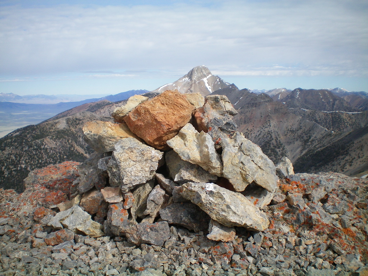
The summit cairn atop Peak 10681 with Bell Mountain in the distance. Livingston Douglas Photo
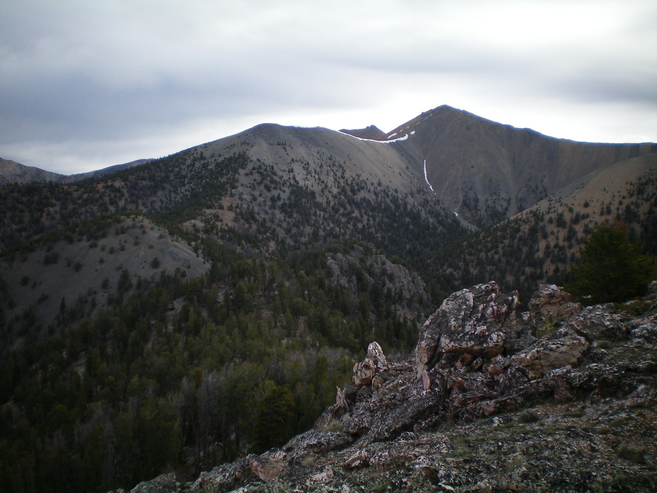
The rugged upper section of the west ridge of Peak 10681 as viewed from lower on the west ridge. That upper section goes at Class 2+/3, most assuredly NOT at Class 2. Livingston Douglas Photo
Additional Resources
Regions: EASTERN IDAHO->Lemhi Range
Mountain Range: Lemhi Range
Year Climbed: 1981
Longitude: -113.749 Latitude: 44.20419