Elevation: 10,684 ft
Prominence: 989
Climbing and access information for this peak is on Page 342 of the book. Please note that private property issues have impacted the access set forth in the book. Livingston Douglas provided updated access information which can be found on the Peak 10126/Clear Creek Peak page.
Rick Baugher suggests this name to commemorate H.B. Carpenter, GLO surveyor, who mile-marked this section of the Idaho/Montana border in 1904-1906. Use the link for Rick Baugher below to read more about Mr. Carpenter. Farther down the page, you will find Livingston Douglas’ Northwest Ridge/Northwest Face Route. USGS Morrison Lake
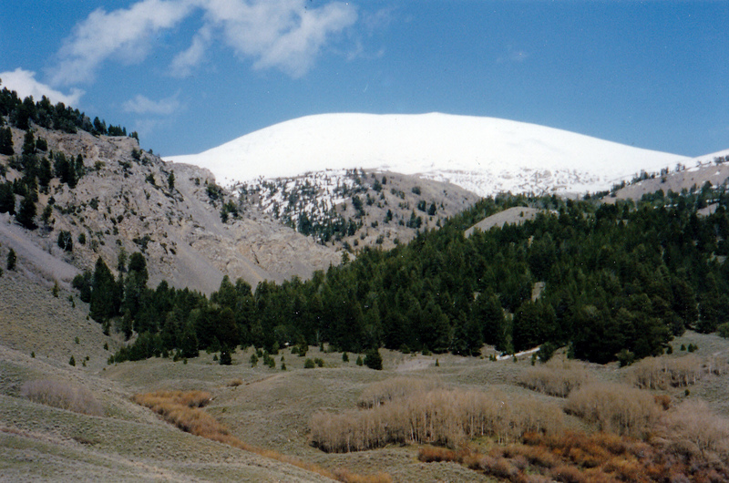
Mount Carpenter as viewed from Poison Creek. Rick Baugher Photo
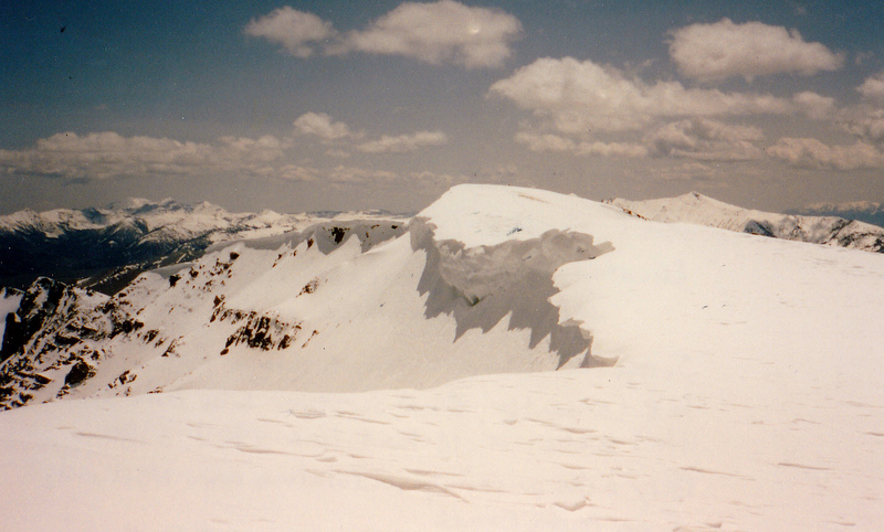
The summit of Mount Carpenter (6/1/96). Montana’s Lima Peaks are in the background. Rick Baugher Photo
Access
Clear Creek Road Approach: Please consult the newly-revised approach under the Peak 10126 (Clear Creek Peak) commentary.
Northwest Ridge/Northwest Face, Class 2 by Livingston Douglas
The Climb
Climb this route from Clear Creek Peak. Please consult the South Ridge Route (Class 2) for a description of the route to the summit of Clear Creek Peak. From the summit of Clear Creek Peak, descend ENE on easy scree then tundra to reach the Clear Creek Peak/Mount Carpenter saddle at 9,700 feet. From the saddle, scramble up easy tundra and scree to the gentle summit of Mount Carpenter. An ID/MT Boundary Post marks the high point.
North Ridge, Class 2 by Livingston Douglas
The Descent
I used this section of the ridge to traverse from Mount Carpenter to Gilcrest Peak. From the summit of Mount Carpenter, descend the ridge crest north then northeast down to Pass 9695. Skirt the west side of the ridge crest to avoid some minor rocky outcrops and minor cliff bands. This entire route follows the Continental Divide.
Additional Resources
Regions: Beaverhead Range->EASTERN IDAHO
Mountain Range: Beaverhead Range
Longitude: -113.04659 Latitude: 44.54549