Elevation: 10,878 ft
Prominence: 418
This peak is not in the book. Livingston Douglas climbed the northeast ridge in 2021 which was likely a first ascent. His route description is set out below. Updated November 2021
Peak 10878 sits on a connecting ridgeline due north of Doublespring Peak. I climbed the peak on my way to the summit of Doublespring Peak. USGS Borah Peak
Access
Horseheaven Pass Road [(C)(3) Page 293].
South Ridge, Class 2
We accessed the peak from the Horseheaven Pass Road via Cayuse Canyon. Then we drove up the jeep track in Cayuse Canyon a short way and parked. We followed the canyon south and then took the right-hand fork to the base of the slope leading to the saddle between the two peaks. We climbed to the saddle and then to the summit via the peak’s south ridge after descending from Doublespring Peak.
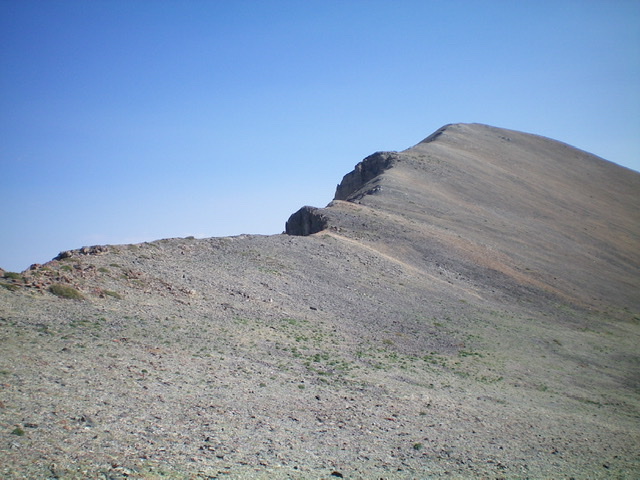
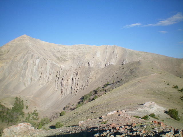
The gentle, Class 2 south ridge (left skyline) of Peak 10878. The summit is right of center. Livingston Douglas Photo
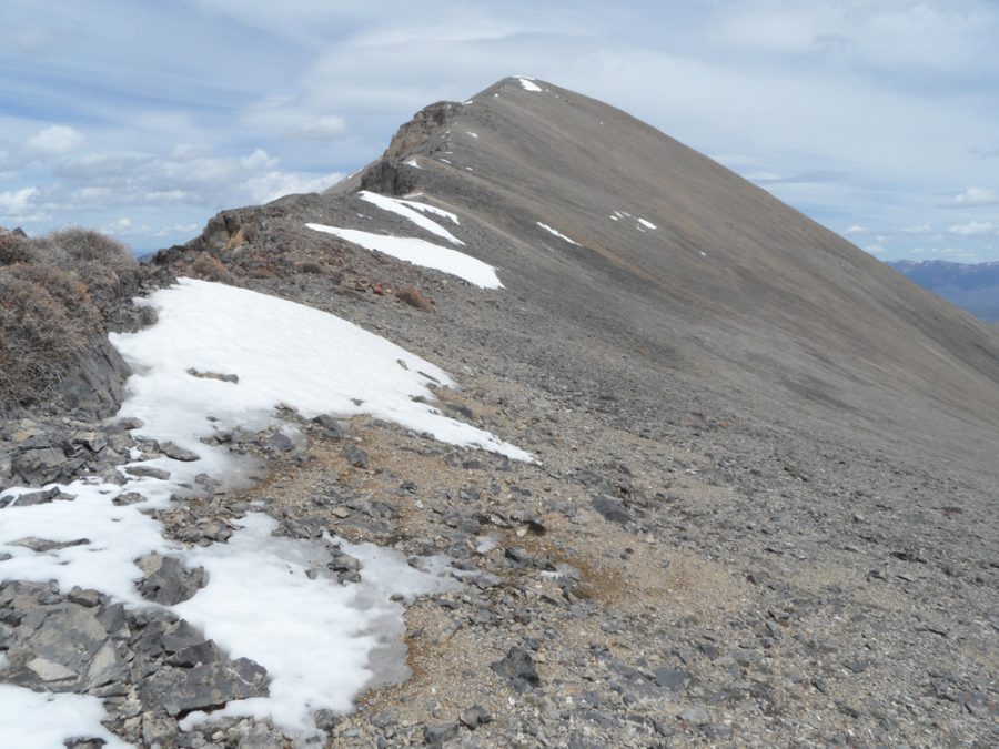
Peak 10878 as viewed from the saddle. John Platt Photo
Northeast Ridge by Livingston Douglas
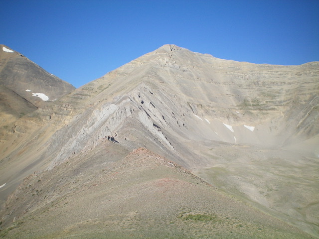
Peak 10878 (dead center) with Cayuse Canyon (left of center). Livingston Douglas Photo
Access
FSR-117/Horseheaven Pass Road [(C)(3) Page 293] is located along Doublespring Pass Road/FSR-116 exactly 3.8 miles south of Christian Gulch Road. Drive southeast up FSR-117 to Horseheaven Pass and park in a pullout at a road junction on the pass (7,935 feet).
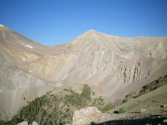
Peak 10878 (left of center) with its rugged northeast ridge (mid-ground) as viewed from Point 9638 on the northeast ridge. The ridge bends left soon and the easy terrain changes to a choppy, rocky mess. Livingston Douglas Photo
Northeast Ridge, Class 3+
The Climb
From Horseheaven Pass, hike (or drive) southwest about 0.3 miles on an old 2-track road to reach a cistern at the mouth of Cayuse Canyon. You cannot drive past this point. The remains of the old road (mostly a grassy clear cut now) continue up Cayuse Canyon. Continue up the old road to a flat area at 8,380 feet. Leave the road and scramble right/west up a scrub slope to reach the base of the [obvious] forested hillside that is the toe of the northeast ridge.
Bushwhack west up through the steep, but easy, pine forest (just south of Point 8576). Head straight uphill (not much brush or blowdown). The forest thins out then ends on an easy, open ridge of short scrub and broken scree. Scramble west up the ridge crest and cross over two ridge humps to reach Point 9798. At this point, the ridge bends left/southwest and heads directly at Peak 10878. Descend (slightly) on the ridge crest on easy scrub to a rocky, elongated saddle. Skirt the right/northwest side of a few rocky ridge points on a weak game trail. Return to the ridge crest and climb along (and up) a series of rocky ridge outcrops/towers (Class 3).
Stay close to the narrow ridge crest for the easiest going. The sides of the ridge are horribly crumbly and loose. Unfortunately, with only two ridge towers to go before reaching “smooth sailing” up to the summit, there is a 15-foot gap in the ridge that is impossible to downclimb. Backtrack 75 vertical feet to a gentle notch in the ridge and downclimb a steep, loose (but manageable) gully on the right/northwest side of the ridge. Reach the base of the aretes (near the valley floor) a whopping 320 vertical feet below the ridge notch. [In retrospect, I should have just dropped slightly off the ridge where it still had some veg/scrub and avoided all of the rocky ridge climbing that I had to retrace and skirt.]
After getting to the base of the aretes, contour southwest on talus/scree to reach a gully just past the ridge problems. Climb back up to the ridge crest on loose, steep scree (brutal, on all fours at times) in a gully, then on crumbly aretes, and on steep, loose talus/scree/gravel high up in the gully, then finally on an arete to regain the ridge crest (Class 3+). Much to my surprise (and disdain), the upper ridge is not “smooth sailing.” It is actually a climb up steep, loose scree up to a cliff band high up (Class 3+ to climb up over). Once above the cliff band, there is more loose, steep talus/scree (as if on a face) then a final scramble up less-steep, firmer ridge rock to reach the small summit. There is a small cairn on top.
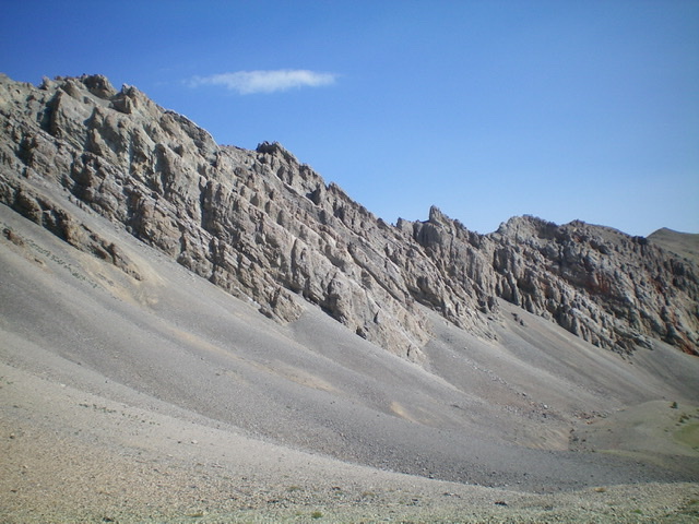
Looking up the northeast ridge from near Point 9798. Notice the cliff bands high up on the ridge. But the real difficulties are in between in the ridge towers/aretes. Livingston Douglas Photo
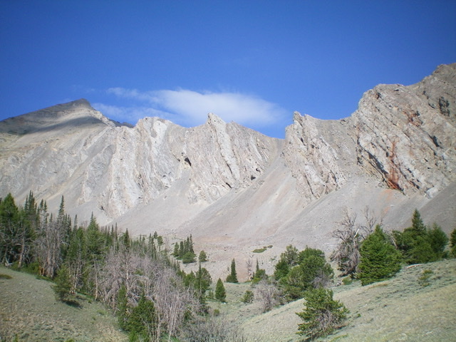
The lower section of the choppy northeast ridge as viewed from Cayuse Canyon. Livingston Douglas Photo
The mid and upper section of the rugged northeast ridge. The ridge proper becomes Class 5. Livingston Douglas Photo
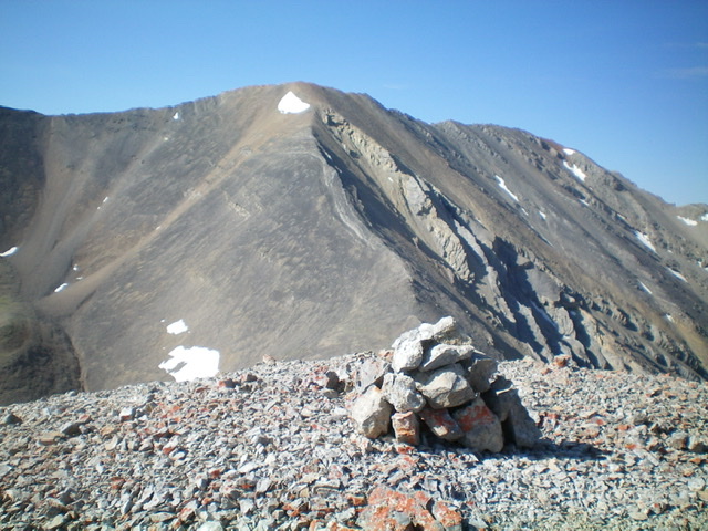
The summit cairn atop Peak 10878 with Peak 11611 in the background (dead center) to the south. Livingston Douglas Photo
South Ridge/Cayuse Canyon, Class 2
The Descent
From the summit, descend the easy scree and broken rock of the south ridge to reach a saddle. Leave the ridge and drop east into Cayuse Canyon. The initial descent is on steep, loose talus/scree and then easy broken rock on flatter terrain. Reach a meltwater stream (and small snowfields in the narrow canyon gap) with steep sides and loose rock of all sizes. Follow it down the canyon (the stream soon goes underground and never reappears) to reach more stable talus/scree slopes with a mix of veg farther down. Enter a pine forest lower down, which has a game trail through most of it. Finally, reach the remnants of the old road, which tops out in the forest in a small meadow. Follow the road back to your parked vehicle at Horseheaven Pass.
Additional Resources
Regions: EASTERN IDAHO->Lost River Range
Mountain Range: Lost River Range
Year Climbed: 2003
First Ascent Information:
- Other First Ascent: Northeast Ridge
- Year: 2021
- Season: Summer
- Party: Livingston Douglas
Longitude: -113.79919 Latitude: 44.21639