Elevation: 11,967 ft
Prominence: 627
Climbing and access information for this peak is on Pages 275-276 of the book.
Even though Peak 11967 falls just short of 12,000 feet, it is equal to any of the other 12ers. There are a lot of unclimbed routes on this giant. I suspect that, some day, it will attract climbers looking for hard, uncrowded lines. USGS Elkhorn Creek
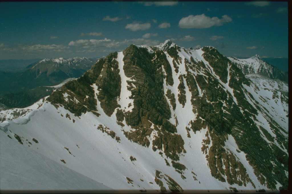
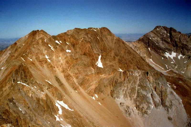
The summit of Peak 11967 as viewed from its [lower] South Summit.
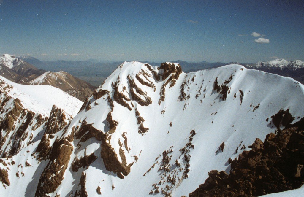
The equally-impressive South Summit of Peak 11967 as viewed from the [higher] North Summit.
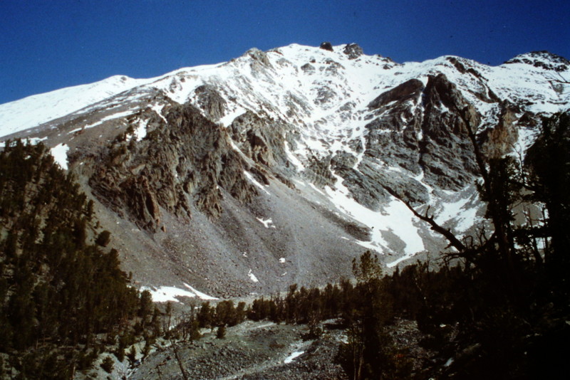
Peak 11967 as viewed from Sawmill Gulch.
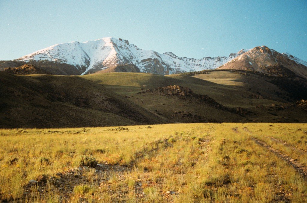
Peak 11967 and Mount Idaho as viewed from White Cap Mountain.
South Ridge, Class 3
The South Ridge Route described in the book is a classic Idaho route with hiking, route-finding, and steep climbing together on a big peak.
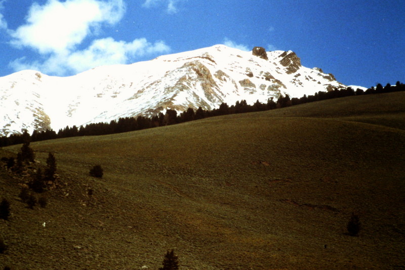
As you climb out of Sawmill Gulch and reach the ridge to the northeast, you get your first view of Peak 11967.
From the top of the ridge, you can see the South Ridge rising up toward the summit (from center left in this photo).
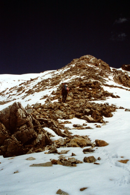
Crossing the intervening valley is not difficult. Once on the ridge, the route is obvious.
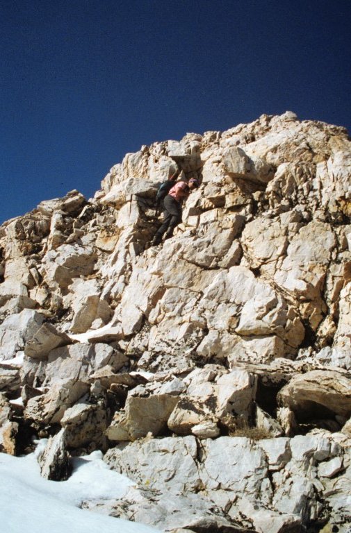
The ridge is blocked by a couple of Class 3 broken cliffs. Dana Hansen is climbing the first cliff.
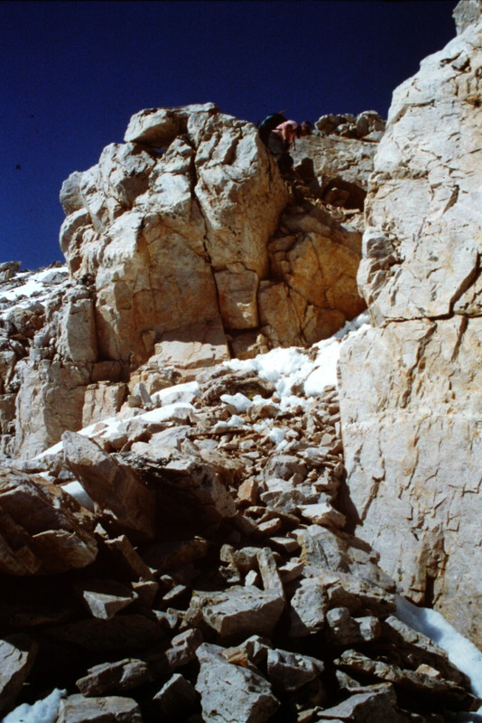
The second set of cliffs.
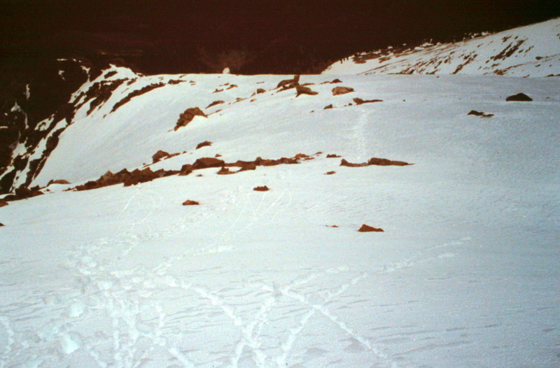
Above the cliffs, you find a broad slope leading to the summit ridge.
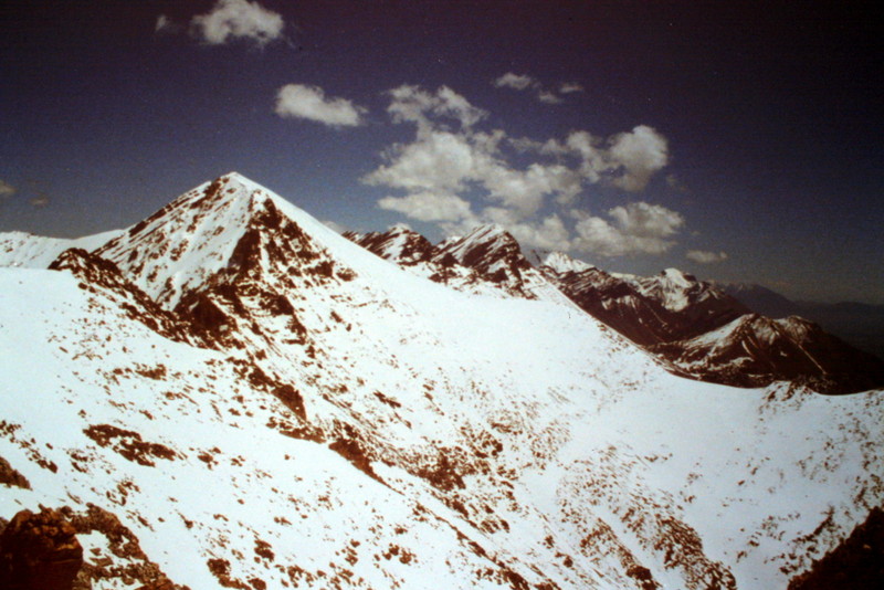
As you climb, you have a good view down the main ridge crest to White Cap Mountain and beyond.
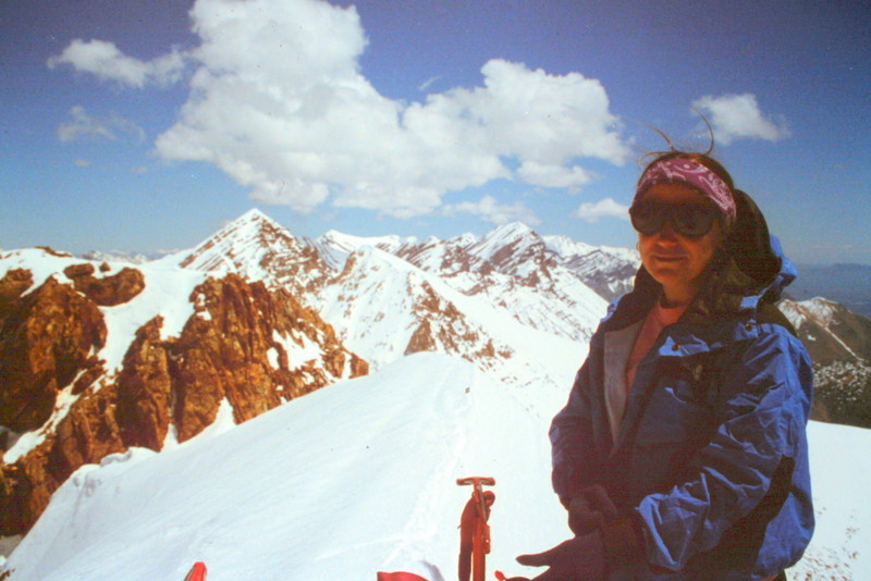
Dana Hansen on the summit of Peak 11967.
Additional Resources