Elevation: 4,008 ft
This peak is not in the book. Updated September 2019
Jackson School Butte is located northeast of Mountain Home, Idaho and south of US-20. This broad butte is approachable from any direction but private property and access issues allow two different ascent routes. First, from the north via US-20 and the access to John Hoffman Reservoir. Second, from the northeast via Northeast Teapot Road which runs along the peak’s East Side. Both of these access routes keep you on BLM-managed public land. USGS Teapot Dome
North Access/North Face Route
For the North Approach, take US-20 north and then east from I-15 (Exit 95) for approximately 4.8 miles to a gravel road that leads to John Hoffman Reservoir. US-20 can be very busy and turning off abruptly here may be difficult, so plan ahead. Follow this road through an open gate on BLM-managed public land. Orange markers along the fence (as of September 2019), which can be mistaken from the road as trespass markers, actually indicate a buried underground cable.
Follow the gravel road southeast, then south, passing by the junction to the reservoir, until you reach a gravel road heading east. Use this short road, which is likely used to release cattle, until it peters out. Park here. A high-clearance 4WD will easily get you to this point. From here, hike south aiming for higher ground. As you get closer, head toward the short rocky cliff walls that surround the summit. There are a number of spots to pass through these short cliffs. Once atop the cliffs, enjoy the views from the broad flat summit. The North Approach (contributed by Steve and Margo Mandella) is approximately 2 miles round trip with 382 feet of elevation gain.
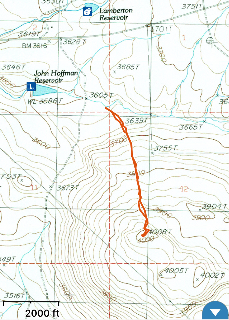
The North Face Route for Jackson School Butte. Steve and Margo Mandella’s GPS track
Northeast Access/Northeast Face Route
For the northeast approach, take US-20 north and then east from I-15 (Exit 95) for 7.2 miles to reach [signed] Northeast Teapot Road. Turn right and follow Northeast Teapot Road south. When there are no longer fences on either side of the road, you have reached public land. Park anywhere from this point on and hike across the flats to the butte. My route, shown below, covers 3.8 miles with 400 feet of elevation gain. We had to crawl under one range fence along the way. Whichever way you climb the butte, take a moment to stop at the interpretive monument off US-20 where the Jackson School used to stand and read about its history.
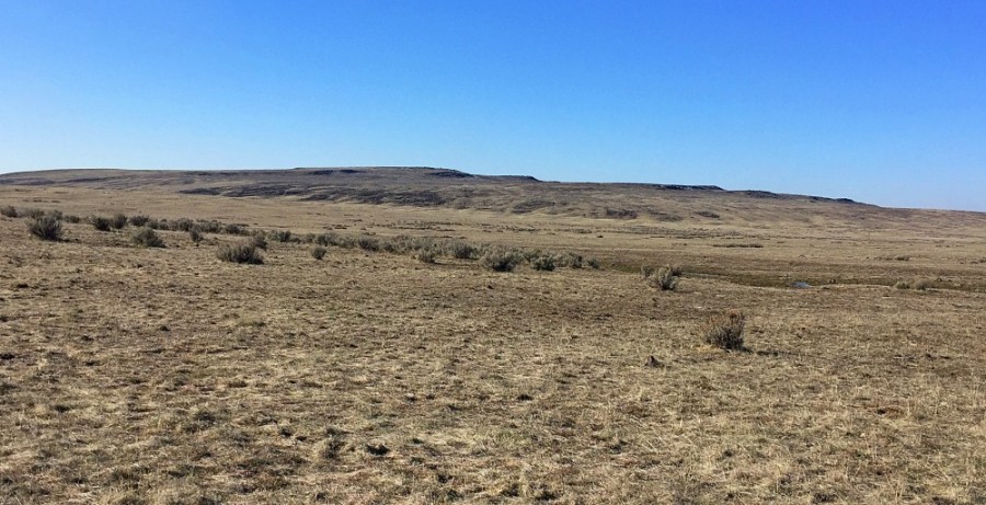
Jackson School Butte as viewed from Teapot Dome.
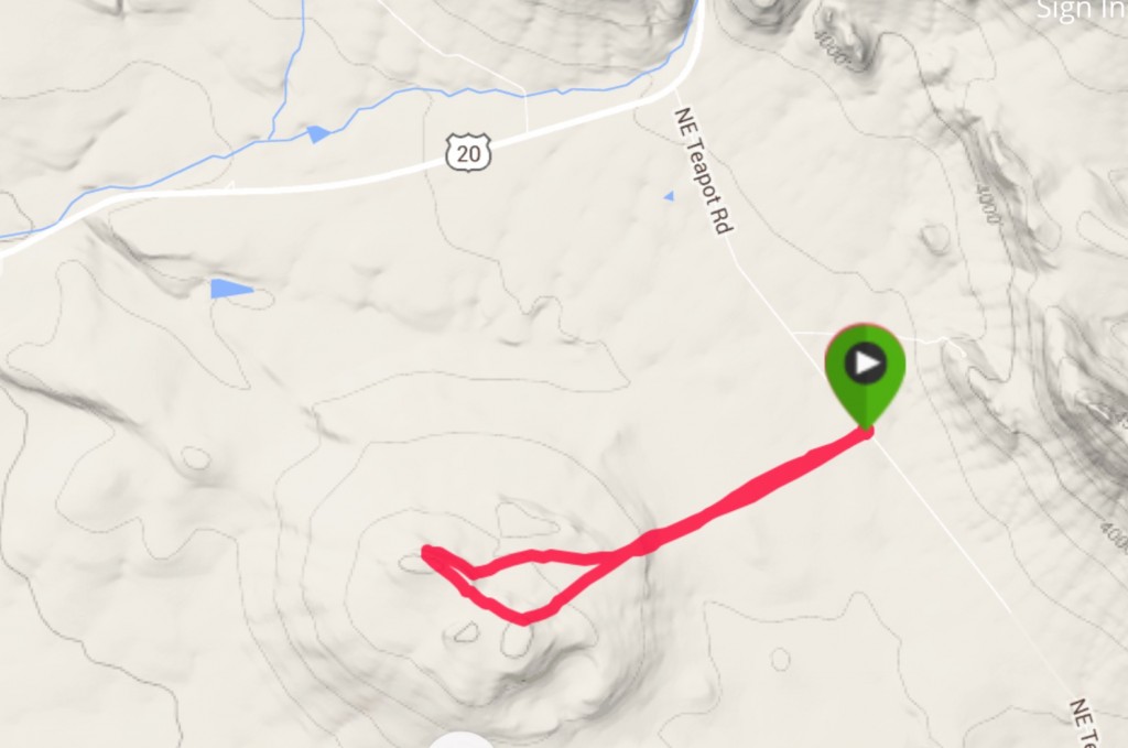
My GPS track.
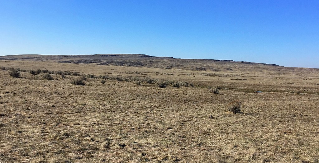
Jackson School Butte viewed from the northeast along Northeast Teapot Road where Dan Robbins and I started our hike.
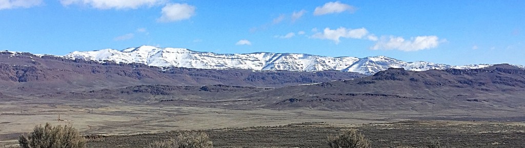
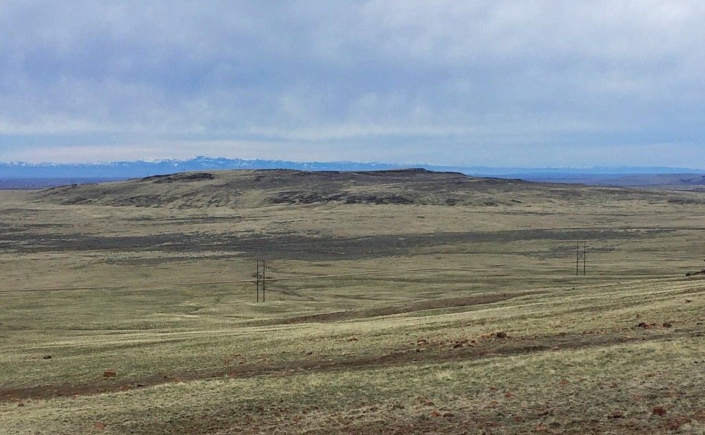
Bennett Mountain as viewed from the summit of Jackson School Butte.
Make a Day of It
While you’re in the area, combine a climb of Jackson School Butte with nearby Teapot Dome and Peak 5268!
Additional Resources
Regions: SNAKE RIVER PLAIN
Mountain Range: Snake River Plain
Year Climbed: 2016
Longitude: -115.57429 Latitude: 43.17219