Elevation: 6,321 ft
Prominence: 541
This peak is not in the book. Updated June 2018
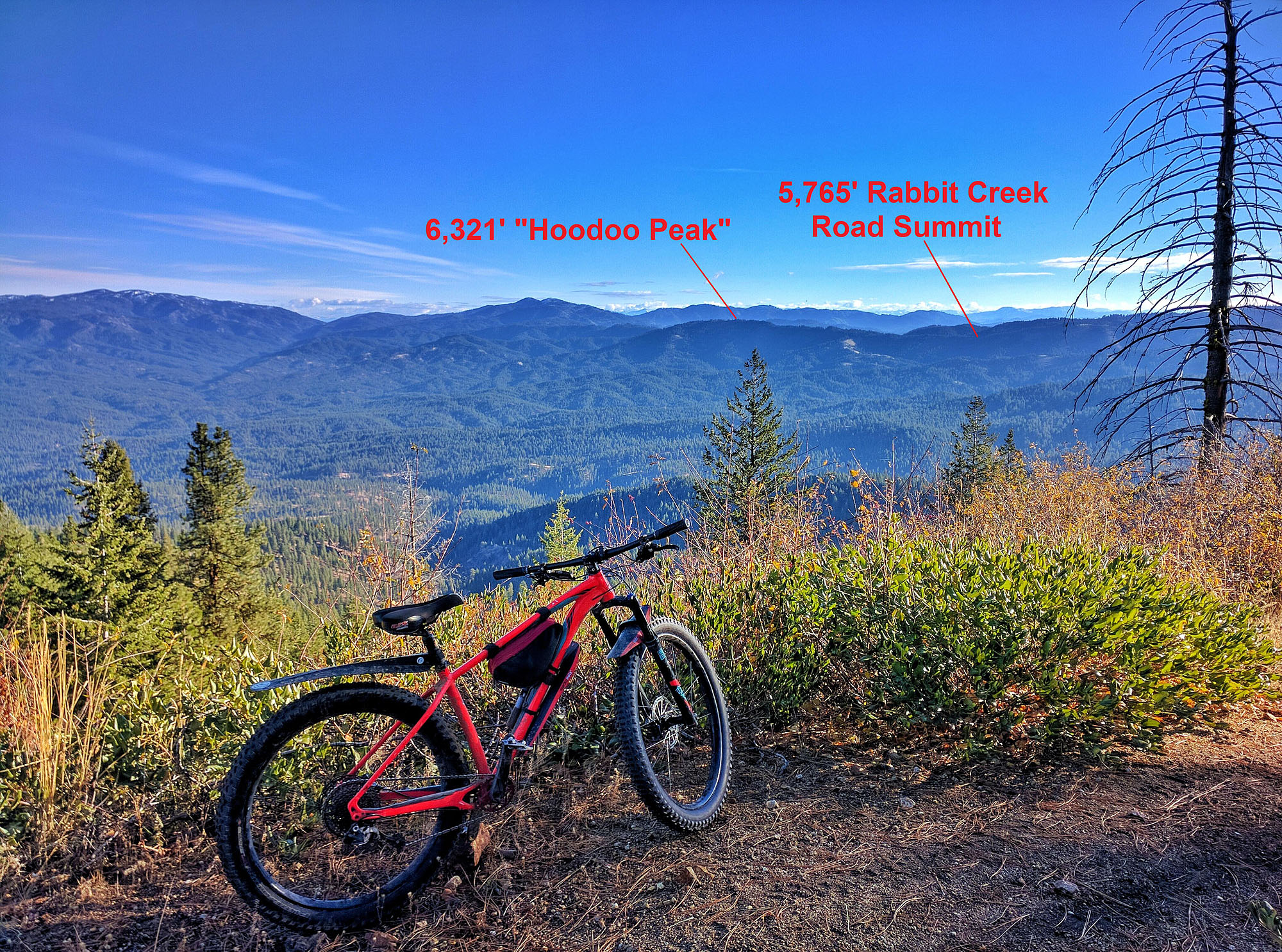
Hoodoo Peak is located roughly 5 miles east of Idaho City and south of Rabbit Creek Summit. To reach the peak, follow ID-21 east from Idaho City to [signed] Granite Creek Road/FS-327. This road is a well-maintained route that climbs up Granite Creek to Rabbit Creek Summit at 5,765 feet in roughly 7 miles. Park here. USGS Rabbit Creek Summit
Hoodoo Peak as viewed from Thorn Peak. Erik Pohlmann Photo. Erik Pohlmann Photo
South Ridge, Class 1
Follow FST-598/Jack Rabbit Motorcycle Trail to the north for approximately 2 miles to the summit. You will encounter one trail intersection along the way, which is not shown on maps (a trail re-route). Simply stay high and follow the obvious ridge to the summit.
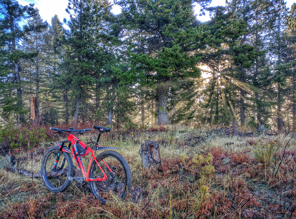
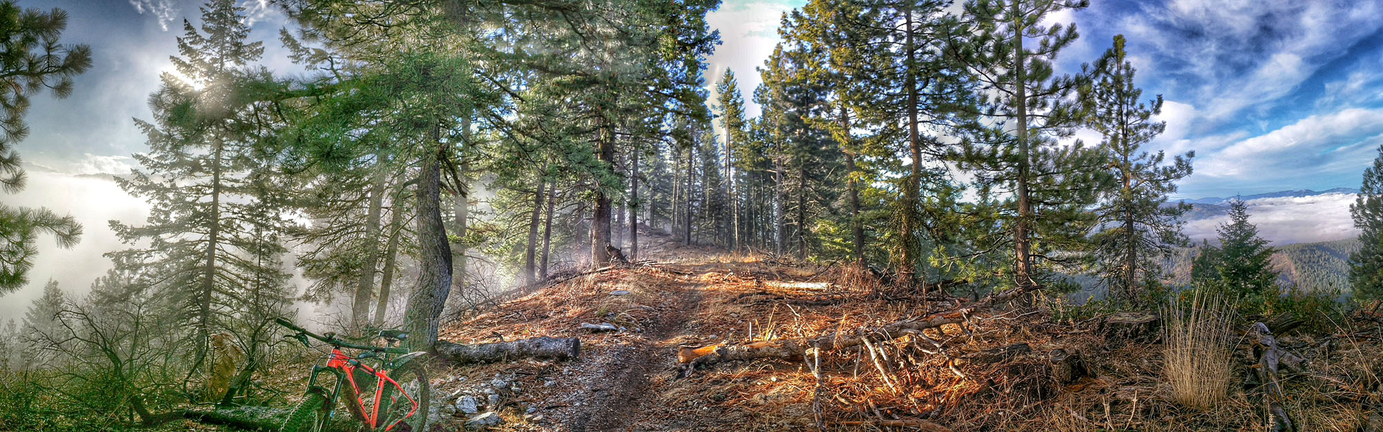
The hike follows a somewhat mellow and forested ridge to the summit. At some points, you just feel as if you’re walking in a forest. But when the trees open up periodically, the views of the vast Boise Basin to the west and North/Middle Fork Boise River drainage to the east are fantastic. The forest opens up even more at the summit, leading to even bigger views including the Northern Trinity Mountains [Sunset Mountain (7,869 feet) and Pilot Peak (8,128 feet)]. Note that the summit is just a bump on the ridge, which doesn’t really result in a “big peak” sensation but the ridge is still relatively prominent.
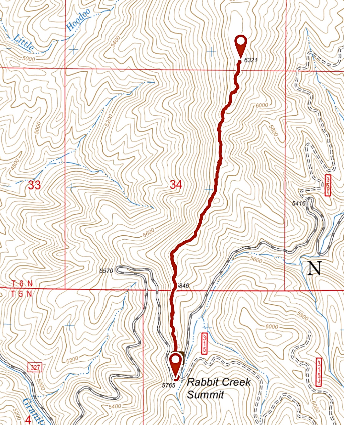
I followed Erik’s route in 2018. Trip stats: 3.24 miles with 470 feet of elevation gain.
The South Ridge. Erik Pohlmann Photo
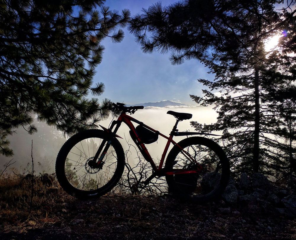
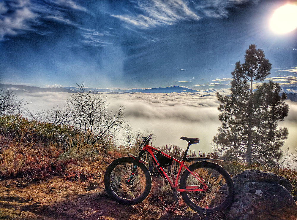
Above an inversion on the South Ridge of Hoodoo Peak. Erik Pohlmann Photo
The forest is open with views. Erik Pohlmann Photo
On the summit looking toward Steel Mountain. Erik Pohlmann Photo
For those interested, the trail is in good shape and is quite navigable on a mountain bike. However, it does require a few short hike-a-bikes before reaching the summit. Connecting this route with Hoodoo Trail/FST-592 makes for a great backcountry mountain bike loop.
Additional Resources
Regions: Boise Mountains->WESTERN IDAHO
Mountain Range: Boise Mountains
Year Climbed: 2018
Longitude: -115.72909 Latitude: 43.82249