Elevation: 6,495 ft
Prominence: 355
This peak is not in the book. There are two routes set out below. The first is the north ridge by Margo Mandella and the second by Livingston Douglas covers the ascent of the north ridge—WEST and descent of the north ridge—WEST/north face. As with most Pocatello Range peaks, access is problematic. Livingston’s access information is the most up-to-date and was verified by the BLM. Updated November 2019
Peak 6495 is located in the Bannock Range. The peak is 3.75 miles southwest of the town of Inkom and 2 miles northeast of Indian Mountain. The peak lies on the border of public land managed by the Caribou-Targhee National Forest and the State of Idaho. Peak 6495 is best climbed from the north through public land managed by the Bureau of Land Management (BLM). This peak can be combined with Peak 5762 via a loop route for an early-season, double-peak outing. USGS Inkom
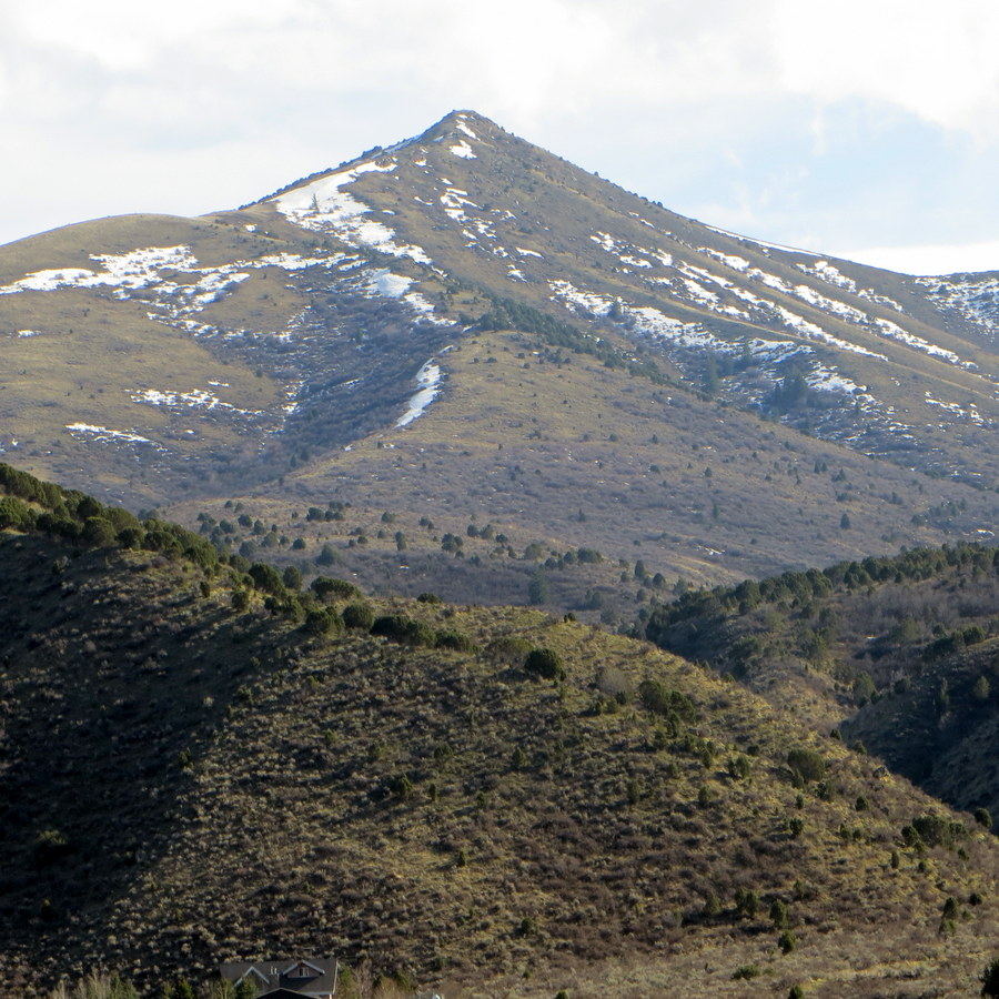
Peak 6495. Steve Mandella Photo
Peak 6495 by Margo Mandella
Getting There
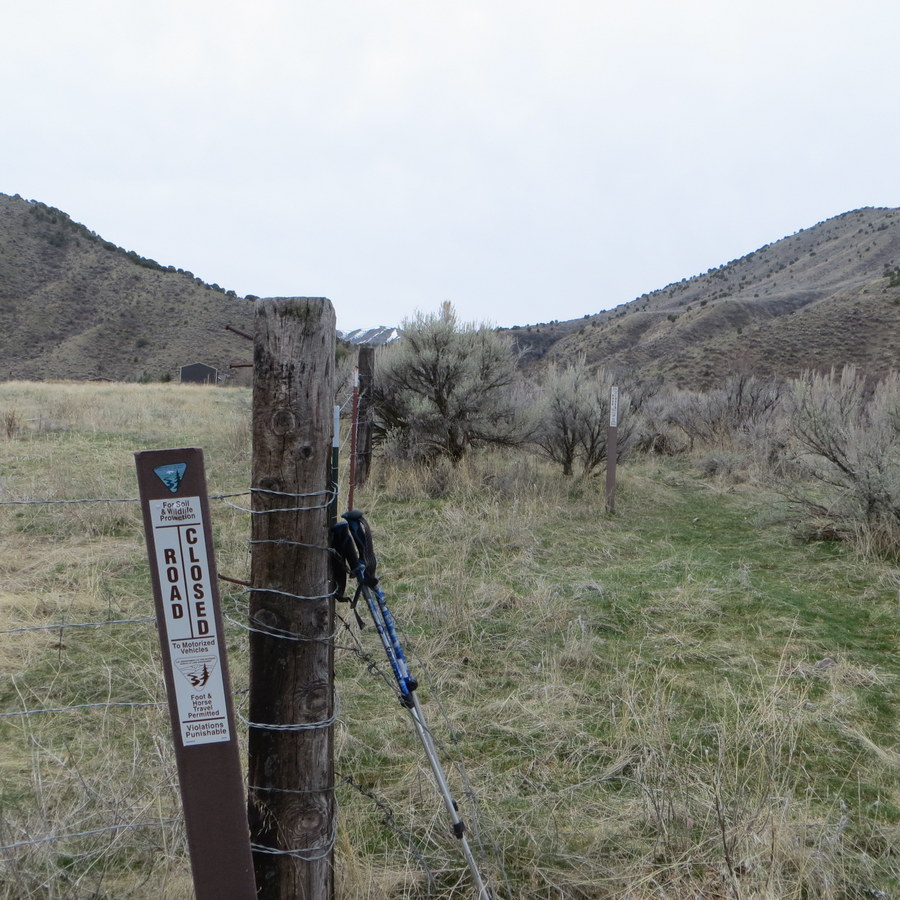
Trailhead for Peak 5762 and Peak 6495. Steve Mandella Photo
The most challenging part of the climb might be finding the trailhead which is located on a strip of public land between two private residences. Starting from Pocatello, take Bannock Highway (which roughly parallels the west side of I-15) southeast to West Portneuf Road and head east toward Inkom. At the intersection of West Portneuf Road and West Blackrock Road, turn right/southeast and continue on West Portneuf Road.
As you drive, look toward your right/south for a BLM trail marker that is next to a fence post. The marker is not easy to spot and there is no parking area or pull-off. But if you pass a private drive on your right that is signed “Dead End” or Tatonka Lane on your left, you have driven too far. When you find the marker, the only legal option to park is on the narrow road shoulder or, as we did…slightly off-road, straddling the small ditch.
North Ridge Route
Hike south through this strip of land, using one of several “paths” until you reach a gate. The gate was open in March 2017 and there was no indication that it is ever closed. Peak 5762 lies to your immediate right/west.
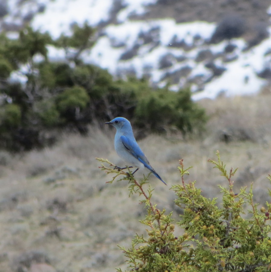
Maybe you’ll be greeted on the summit by this lovely bluebird? Steve Mandella Photo
We climbed this peak with Peak 6495 via the loop route shown in the GPS track below. If Peak 6495 is your only destination, pass through the gate and continue south on a discernible trail toward Trough Canyon. At junctions, stay to your right to stay out of Morris Canyon. Hike for about a mile. At this point, you reach another junction. Here, look for your trail to continue up a short, steep climb to your left/east.
Follow the trail until you find a point to go off-trail and hike up the peak’s north ridge. Or be impatient and immediately bushwhack through tall, thick sage and other scratchy bushes, guaranteeing to collect a few tics (two in my case), clothing snags, and body scratches along the way!
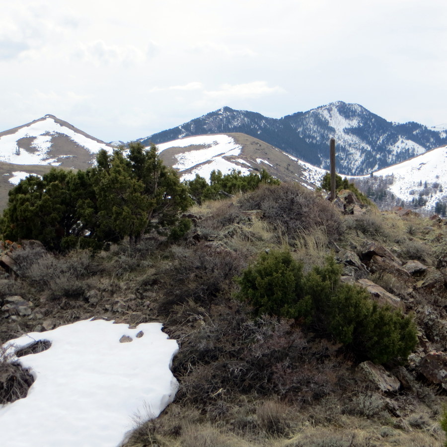
The summit of Peak 6495 with Peak 8037 (right background) and Walker Benchmark (left). Steve Mandella Photo
Climb the ridge until you reach the marked summit. The views of Peak 5762, Peak 8037, Indian Mountain, Walker Benchmark, Scout Mountain and Portneuf Range Peaks (e.g., Bonneville Peak, Snow Peak, and Haystack Mountain) are really nice from the top!
When you’ve finished enjoying the views, reverse your route to the trailhead.
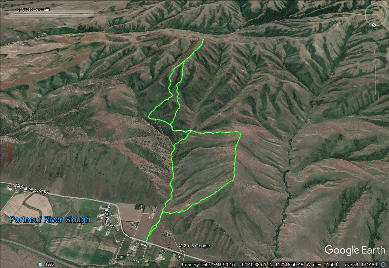
Peaks 5762 (right) and Peak 6495 (back) via a Figure 8 route. Margo Mandella GPS track
North Ridge—WEST, Class 2 by Livingston Douglas
Access
The Papoose Creek BLM “trailhead” is located at a green cattle gate about 100 feet south of the junction of Portneuf Road and Blackroad Road, on the right/west side of Portneuf Road. The aforementioned junction is 1.9 miles east of Fort Hall Mine Road on the east side of the town of Portneuf, ID. The cattle gate is closed but is not locked. Park alongside Portneuf Road in a pullout between the stop sign (with nearby mailboxes) and the green cattle gate. The elevation here is 4,528 feet.
The Climb
Peak 6495 has two distinct north ridges. Consequently, I label them the north ridge–WEST and the north ridge–EAST. The two ridges are separated by Trough Canyon. This route climbs the north ridge–WEST and begins at Papoose Creek. It ascends the west face of the north ridge—WEST, then climbs south over a false summit, drops to a saddle then climbs over the true summit of Peak 5762. It then descends to a small saddle south of Peak 5762. For a further description of the route to this point, please consult the west face/north ridge route for Peak 5762.
From the ridge saddle south of Peak 5762, follow the ridge south then southwest to just east of Point 5902. This saddle is flat, but is a mess of thick, tall sagebrush and brush. There are some weak trails in here, but even they are very overgrown with dense scrub/brush. Work your way south up off this messy saddle to reach easy, open scrub terrain. Unfortunately, there are few more short sections of thick brush/sage to contend with on this journey to the summit of Peak 6495. You will find a weak use/cattle trail near the ridge crest often, but not always.
The north ridge—WEST weaves a bit on its way to joining the west ridge of Peak 6495. Upon reaching the juncture with the west ridge, follow a narrow cattle trail on the left/north side of a cattle fence up the ridge. Leave the fence to climb over a scrub hump then descend to a final saddle. You will re-join the cattle fence on the descent to this saddle. From the final saddle, scramble up the ridge crest to the summit.
The cattle fence disappears early in this final ridge scramble. The terrain here is somewhat rocky and has plenty of brush/scrub mixed in. Stay on the left/north side of the ridge crest for the easiest going. The summit of Peak 6495 is a small, rock-and-scrub area. It has a summit cairn with a large post in the cairn.
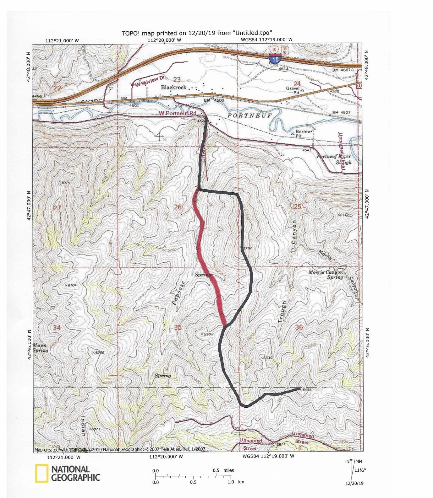
The black line indicates the ascent route. The red line indicates the descent route.
North Ridge—WEST/North Face, Class 2 by Livingston Douglas
Access
Same as for the north ridge—WEST
The Descent
Descend back down the west ridge then the north ridge—WEST to reach the ridge area just east of Point 5902. From here, you have two choices. You can continue down the north ridge—WEST to the clogged saddle at the base of Peak 5762 and then descend a gully west down to Papoose Creek OR you can descend directly down the north face (mostly via a nice shoulder) to reach Papoose Creek. I chose the latter option and describe it here.
From the 5,800-foot level, descend north down a shoulder that leads directly down to Papoose Creek. It merges with a side drainage as it nears the creek. Most of this descent is on a shoulder. The shoulders here are much less clogged with thick brush/tall sage than the gullies are. Consequently, it is a much more attractive route to take. As you descend, aim to reach a cattle trail on the shoulder lower down. This cattle trail is visible from high up on the mountain. When you reach the trail, follow it down to the esat side of Papoose Creek. Pick up a good cattle trail on the east side of Papoose Creek and follow it downstream. Cross the small stream (on the cattle trail) to re-join the BLM trail. Follow the BLM trail back to Portneuf Road and your parking spot.
Additional Resources
Regions: Bannock Range->SOUTHERN IDAHO
Mountain Range: Bannock Range
First Ascent Information:
- Other First Ascent: North Ridge—WEST
- Year: 2019
- Season: Summer
- Party: Livingston Douglas
Longitude: -112.31129 Latitude: 42.76139