Elevation: 7,492 ft
Prominence: 1,962
This peak is identified on Page 353 of the book as the Sublett Range High Point, but I had no information on the peak at the time the book was published and no route information was included. Subsequently, Rick Baugher climbed the peak. His informative trip report is linked below. Livingston Douglas contributed a new route and photos to this entry. Updated January 2023
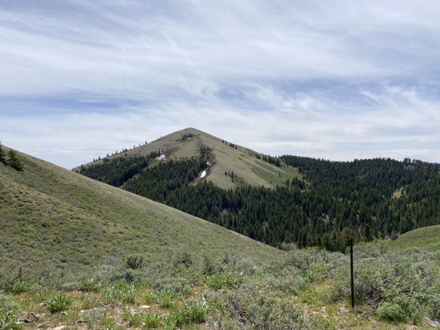
The Sublett Range High Point is an attractive cone-shaped peak located on the eastern edge of the range due west of the former town of Roy, Idaho and ID-37. It is, by a few feet, the highest of the many 7,000-foot peaks found in the range. As with most Sublett Range peaks, the view from the top is expansive. USGS Sublett Troughs
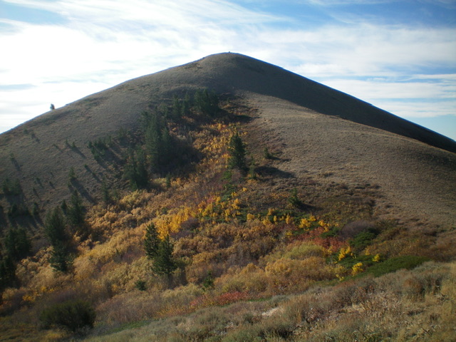
The Sublett Range HP as viewed from the north
Access
There is good primary road access to this peak from both the east or west. Google Maps will provide you with good directions to most points in Sawtooth National Forest portion of the Sublett Range.
From the east and ID-37 take Hartley Canyon Road/FSR-578 west to Hartley Pass. From the west, access Hartley Pass from the North Heglar Canyon/South Summit Canyon Road/FSR-565. This road is the primary north/south route through the Sublett Range. Both ends of the road are accessed from I-84. To reach it from the north, leave the freeway at Exit 228. Head east on East Yale Road for 8.7 miles and then turn onto the North Heglar Canyon Road. This road becomes FSR-565 when it reaches the National Forest Boundary. The south approach leaves I-84 at Exit 245. From the freeway, turn east and follow the road east/southeast into the mountains for 11.0 miles to Sublett Reservoir. This road becomes FSR-565 when it reaches the National Forest Boundary.
Whichever way you get access the road, follow it to its unsigned junction with FSR-578. Turn onto FSR-578. A high clearance vehicle with AT tires is recommended from this point. Follow FSR-578 north up the North Fork Sublett Creek to Hartley Pass. This road was graded in May 2021 but is still rougher than FSR-565. From the pass, follow FSR-571 south for 2.8 miles. This road was also graded in May 2021 but was nevertheless much rougher and occasionally choked by brush. Turn right onto overgrown FSR-569 which leads to the base of the peak. In 2021, this seldom-used road was blocked by a downed tree after 0.6 miles.
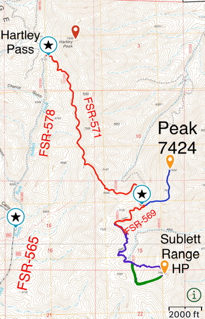
Access to the Sublett Range HP and Peak 7424.
West Side Loop, Class 2
We parked after following FSR-569 for 0.5 miles. If the downed tree is removed the road, although brushy in places, would get you to the base of the peak’s west face. Hike the road to the base of the west face. The lower sections of the base are forested and brushy and, as a result, it is the most difficult part of the climb. Leave the road, bash through the brush to the open slopes above. Our descent line avoided most of the brush but we encountered a bit of downfall.
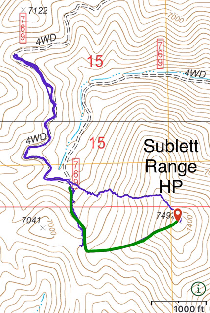
We ascended the blue line and descended the green line
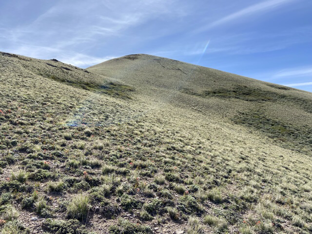
Above the forest and brush the open slopes are easy to traverse.
North Ridge by Livingston Douglas

Peak 7492 and its magnificent north ridge (my descent route) in dead center, coming at the camera. Livingston Douglas Photo
North Ridge, Class 2
The Descent
From the summit, descend northwest then north over Point 7280+ then northwest on easy, open tundra (then scrub) to reach a mature pine forest below. Bushwhack down through the easy but steep forest to Tussing Gulch and FSR-769. Cross to the north side of FSR-769 then drop 10 feet to cross the dry gulch through easy forest. Once across the gulch, scramble north onto a grass/scrub shoulder after almost immediately emerging from the forest. The grass is tall and thick and the scrub is a bit thick too but it soon moderates.
The summit hump of Peak 7492 as viewed from high on the north ridge. See the summit cairn?Livingston Douglas Photo
Look for FSR-769 higher up and to the left/west and aim to intersect it at the base of the west shoulder of Peak 7424. Angle diagonally left and upward to cross a dry gully of sagebrush to reach FSR-769. Side-hilling in the thick-ish sagebrush to reach the middle of the gully isn’t exactly fun, but it goes. Cross the gully and scramble up a short distance to reach FSR-769 at the base of the west shoulder of Peak 7424. Follow FSR-769 back to your parked vehicle.
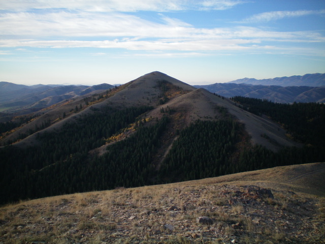
Peak 7492 (the pyramidal hump just left of center) as viewed from Peak 7424 to its north. Livingston Douglas Photo
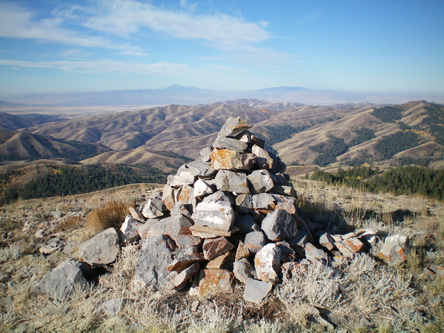
The large summit cairn atop Peak 7492. Livingston Douglas Photo
Additional Resources
Regions: SOUTHERN IDAHO->Sublett Range
Mountain Range: Sublett Range
Year Climbed: 2021
Longitude: -112.93059 Latitude: 42.3701