Elevation: 8,037 ft
Prominence: 337
This peak is not in the book. Livingston Douglas added two new routes and updated access information at this link: Southeast Spur/Northeast Ridge and Southeast Ridge Routes
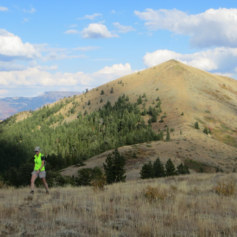
Goodenough Peak, also known as Peak 8037, lies southeast of Scout Mountain in the Bannock Mountain Range within the Caribou-Targhee National Forest. This peak can be accessed from multiple directions. USGS Scout Mountain
From the west, take South Mink Creek road to South Fork Mink Creek road (FS-163) to Scout Mountain Top Road (FS-009). FS-009 is open seasonally, requires a high-clearance vehicle (preferably a jeep or other short wheelbase vehicle) and may be difficult to travel if it is wet or muddy. This road also can be narrow in places, especially in the lower areas of the track shown, which can make encountering other vehicles problematic.
It is approximately 5.60 miles round trip from the gate and cattle guard at the start of the track to the summit. However from a parking pull-off at 7,650 ft, it is a shorter 3-mile round trip hike. Depending on where you begin, hike Scout Mountain Top Road/FS-009, or the more direct hiking trail that bypasses the road switchbacks, until you reach one of two trails (at 7,800 feet and 8,000 feet) that heads east toward the peak. A short and easy scramble at a rock outcrop below the summit’s west side adds some flavor to the climb.
From the east, start at Goodenough Creek Campground and use the pack trail to hike into Mormon Canyon, meeting up with a jeep trail near 7,600 ft and continuing northwest to Scout Mountain Top Road (FS-009). Continue along Scout Mountain Top Road to the summit as presented in the west approach description. The hike from Goodenough Creek Campground through Mormon Canyon to the jeep trail itself is 6 miles round trip.
From the north and the summit of Scout Mountain, descend Scout Mountain Top Road to the distinct trail to the east at 8,000 ft and reach the summit as previously described.
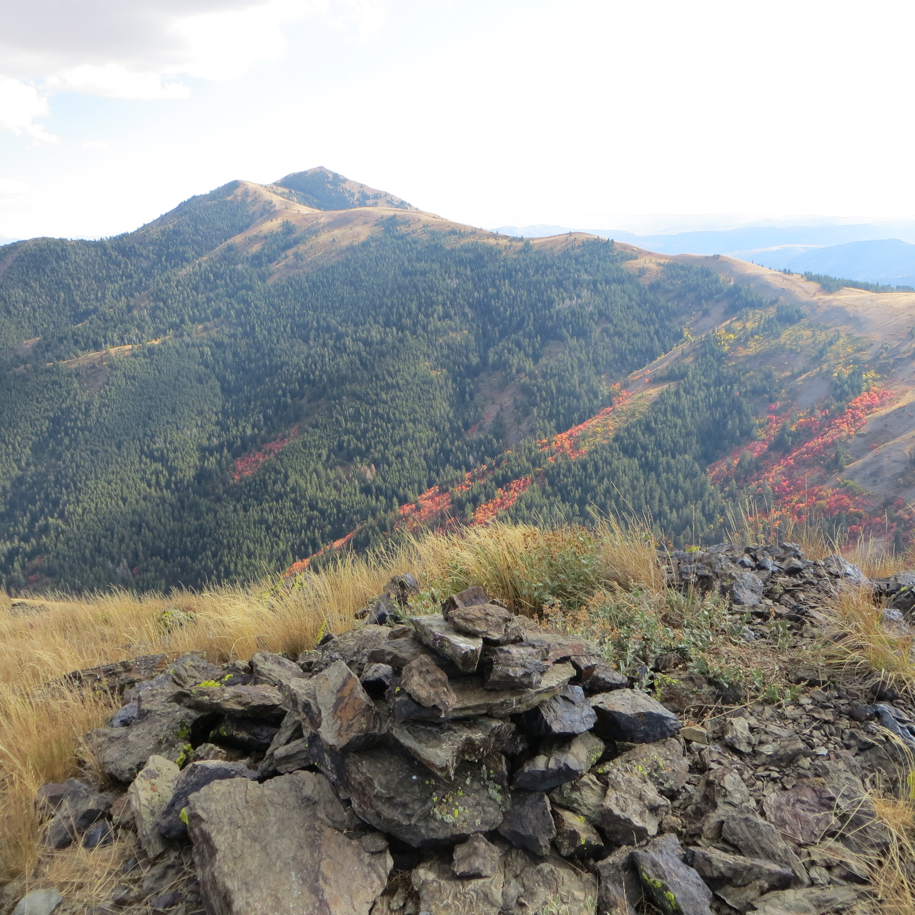
View of Fall colors and Old Tom Mountain from the summit of Goodenough Peak. Steve Mandella Photo
This area is especially beautiful in autumn and is a popular destination for local hunters.
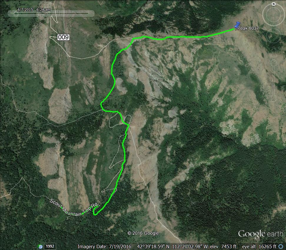
Route to Goodenough Peak via Scout Mountain Top Road. Margo Mandella GPS track
Additional Resources
Regions: Bannock Range->SOUTHERN IDAHO
Mountain Range: Bannock Range
Longitude: -112.32169 Latitude: 42.66449