Elevation: 8,180 ft
Prominence: 330
This peak is not in the book. Updated November 2023
Peak 8180, also known as Lewis and Clark Ridge, is the southernmost Bitterroot Mountain summit along the range’s crest. It is located due west of US-93 at Lost Trail Pass and is the highest point of the Lost Trail Pass Ski Resort. The peak also lies on the border of Idaho County and Lemhi County as well as on the border of the Bitterroot and Salmon National Forests. Its summit is reached by a ski lift and a road. The road is in fair condition and high clearance vehicles and mountain bikes can navigate it. This is a Class 1 hike. USGS Lost Trail Pass
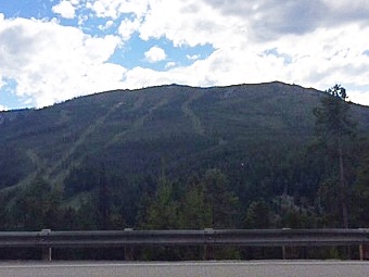
Lewis and Clark Ridge as viewed from Peak 8140 to its west. Livingston Douglas Photo
Access
This is a hiker’s route in case the service road is in poor condition, has snow drifts across it, or you lack a 4WD vehicle. Park in the southwest corner of the large parking lot at the Lost Trail Pass Ski Resort near the buildings (7,070 feet; 45⁰41’32”N, 113⁰57’08”W). Please note that the road to the high junction at 7,930 feet is a well-maintained, smooth gravel road and can easily be driven. A high clearance vehicle is not currently necessary. The distance from Lost Trail Pass to the summit of Lewis and Clark Ridge (via the service road) is at least 2-1/2 miles.
This is the first leg of a 3-peak adventure that includes Lewis and Clark Ridge, Peak 8140, and Saddle Mountain MT (8,460 feet). I do not have mileage or elevation gain figures that focus solely on the two Idaho summits that I climbed during this journey. Both Lewis and Clark Ridge and Peak 8140 are on the ID/MT border.
East Spur/South Ridge, Class 2
The Climb
From the parking lot, walk past the west end of the ski resort buildings to reach the base of the steep east spur, which serves as a ski run during winter months. Scramble west up the steep slope of short grass and scattered, short scrub to reach the top of Point 7720+ and the top of two chair lifts. Descend west and quickly find a 2-track service road that heads downhill and west into the thick pine forest.
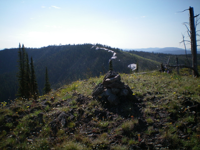
Follow it to an unsigned junction with the smooth, main service road. This is a forest service road that is also used for logging. Hike north-northwest up the forest service road to a signed junction at 7,930 feet (map). Go right/north onto an unsigned, weaker 2-track service road that goes to the top of Lewis and Clark Ridge. The summit area is littered with chair lifts. The high point is a mound of dirt/rock at the top of a chair lift. There is no summit cairn.
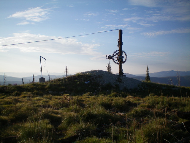
The summit of Lewis and Clark Ridge. Livingston Douglas Photo
West Ridge, Class 2
The Descent
From the summit, follow the 2-track service road west briefly to a sharp left/south turn in the road. Leave the road here and bushwhack west down through open grass/scrub just left/south of the edge of the pine forest. The remains of an old 2-track ridge road will help you initially. The road soon disappears but the terrain is mostly open grass/scrub and goes pretty quickly, albeit with some deadfall to navigate. Reach the 7,859-foot connecting saddle with Peak 8140 and a 2-track forest service road that follows the high ridge crest. This concludes the first leg of today’s 3-peak adventure. Peak 8140 is up next.
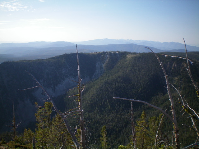
Lewis and Clark Ridge (in mid-ground) as viewed from Saddle Mountain (MT) to its northwest. Livingston Douglas Photo
Additional Resources
Regions: Bitterroot Mountains->NORTHERN IDAHO
Mountain Range: Bitterroot Mountains
Year Climbed: 2016
Longitude: -113.97089 Latitude: 45.70289