Elevation: 8,380 ft
Prominence: 440
This peak is not in the book. Updated October 2018
An impressive East-West ridge line parallels Lick Creek and Lick Creek Road. The ridge has 6 ranked summits and sufficient exposed granite to challenge the most ambitious mountaineers. The West End of the ridge is anchored by Humdinger Peak and the East End by Peak 8409 (Hum #5). In between are (from west to east): Peak 8380 (Hum Peak), Peak 8380 (Ho Peak), Peak 8565 (Hum #3), Peak 8620 (Hum #4). John Platt and John Fadgen climbed 4 of the 6 peaks in August 2015 in one long, difficult day. Their trip reports are linked below. USGS Box Lake
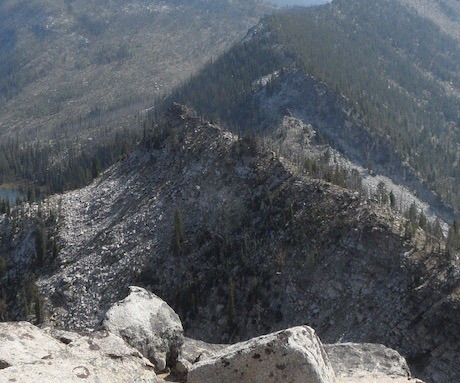
Hum Peak as viewed from Humdinger Peak. John Platt Photo
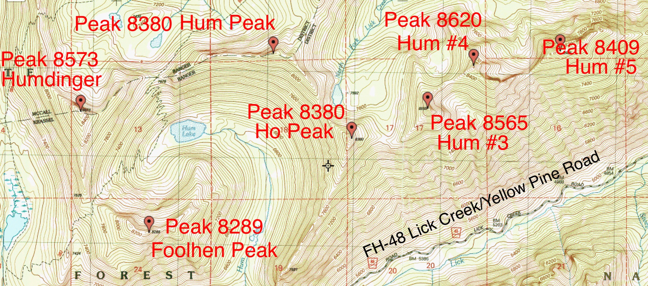
Hum Ridge Peaks
Access
Access this peak from just north of Lick Creek Summit (see Page 136).
(B)(3) FH-48 Yellow Pine/Lick Creek Road
(c) FST-084, Duck Lake Trail
(c.1) FST-083/FST-082 Hum Lake/North Fork Lick Creek Trail
West Ridge, Class 3–4
Platt and Fadgen climbed the peak by traversing from Humdinger Peak. Descend Humdinger’s East Ridge and then climb up the West Ridge of Hum Peak. There is impressive exposure on the North Side of the ridge and plenty of boulders to work around on the ridge.
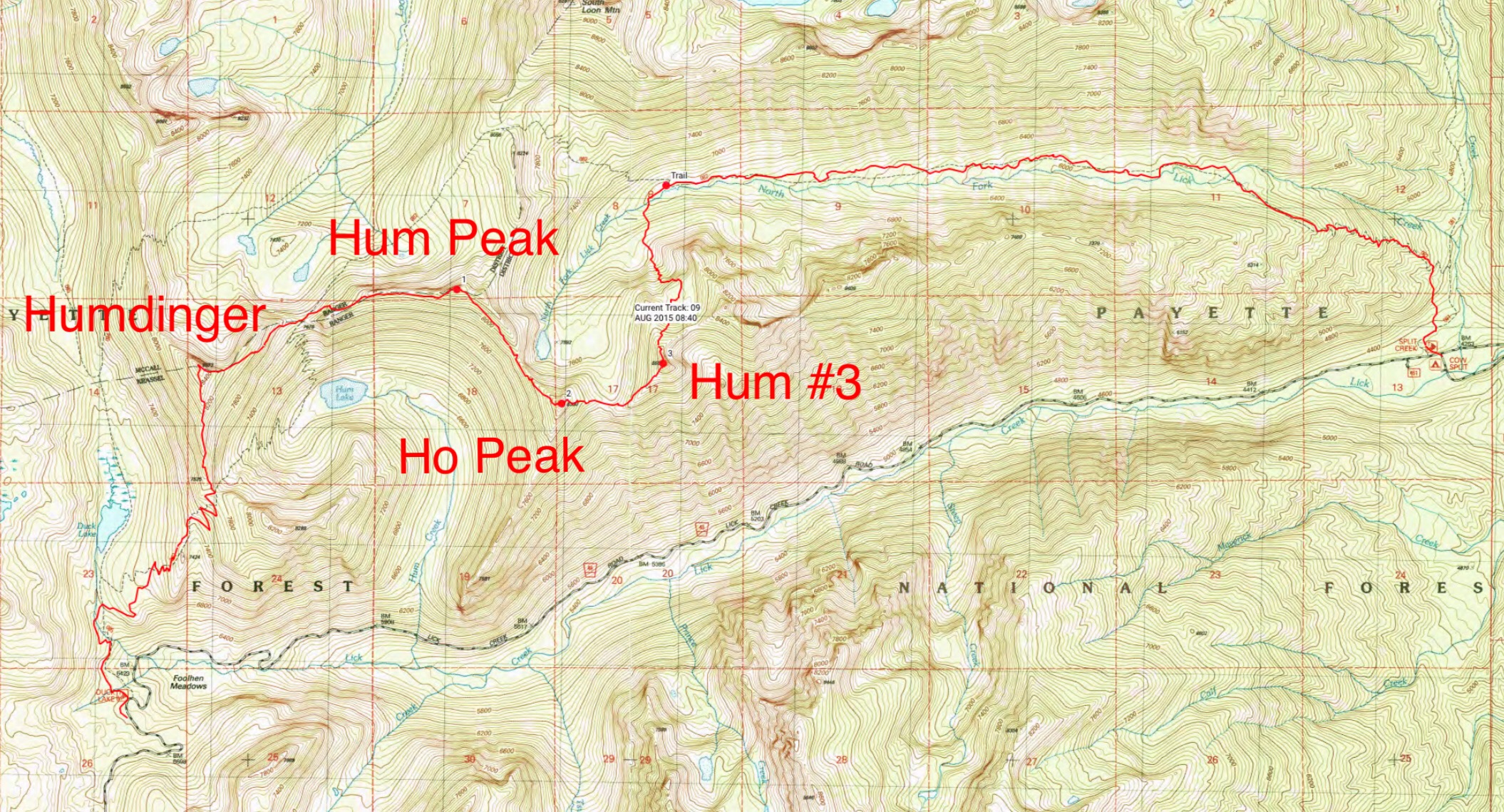
The GPS track for John Platt and John Fadgen’s 2015 traverse of 4 of the 6 Hum Ridge peaks. Their route covered 15 miles with 4,700 feet of elevation gain and even more elevation loss.
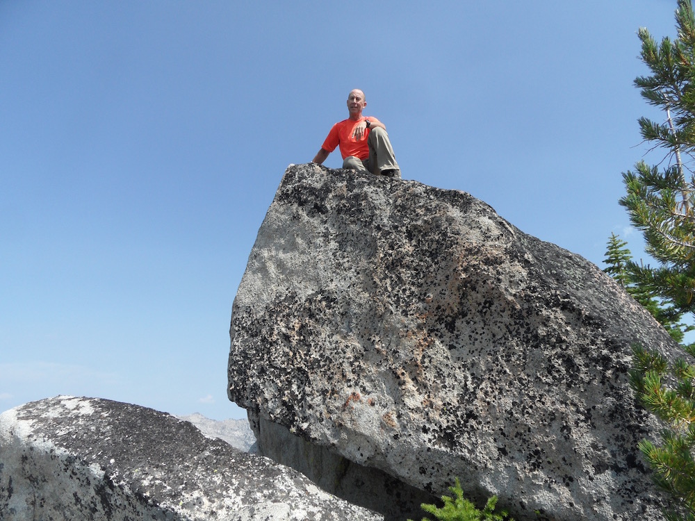
John Fadgen on the summit of Hum Peak. John Platt Photo
Additional Resources
Mountain Range: Western Salmon River Mountains
First Ascent Information:
- First Ascent Year: 2015
- Season: Summer
- Route: East Ridge
- Party: John Platt and John Fadgen
Longitude: -115.89389 Latitude: 45.07789