Elevation: 6,265 ft
Prominence: 485
This peak is not in the book.
Red Top is reached by a trail. You will find remnants of a fire lookout on top. USGS Shorty Peak
The Forest Service describes the route as follows:
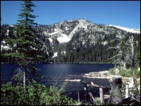
The trail switchbacks through an old burn for the first 0.4 mile at about a 15% grade. It enters the woods at this point and sidehills at an almost level grade for another 0.5 mile and meets Hidden Lake at about 1.0 mile. Fishing is good and there are campsites available around the lake.
The trail to this point is rather easy hiking, but from here on becomes more rugged. The Red Top trail junctions with Trail #21, which leads to West Fork Cabin, at the north end of the lake. This portion of the trail is inaccessible until early July. Trail #102 climbs for about 3 miles, with occasional steep, rocky stretches before reaching Red Top. There are remnants of an old lookout at the top and spectacular views of the Selkirk Mountains and into Canada.
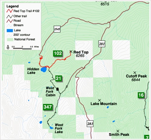
Red Top Mountain Area. USGS Map
Check out the Forest Service page for updates.
Additional Resources
Regions: NORTHERN IDAHO->Selkirk Mountains
Mountain Range: Selkirk Mountains
Longitude: -116.72711 Latitude: 48.89759