Elevation: 10,458 ft
Prominence: 878

Climbing and access information for this peak is on Pages 238-239 of the book. Use the link below to read Mark Jones’ 2016 trip report for his climb from Lake Creek. Updated November 2021
Rock Roll Peak sits on the impressive ridge that divides Trail Creek from Lake Creek just north of Ketchum/Sun Valley. The summit stands at the head of Rock Roll Canyon and is southwest of Trail Creek Summit. It is the southeasternmost point on a magnificent northwest-southeast ridge in the Boulder Mountains. This update covers the third leg of a 3-peak adventure that includes Peak 9617, Peak 10334, and Rock Roll Peak. This route covers 9.0 miles with 3,950 feet of elevation gain round trip. USGS Rock Roll Canyon
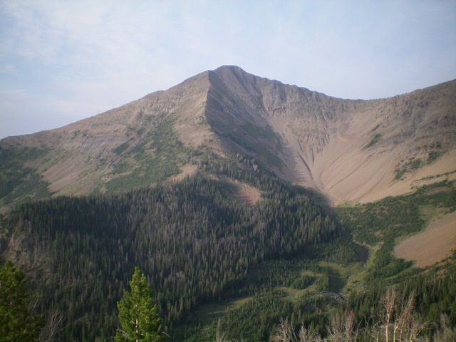
Rock Roll Peak and its north ridge (coming at the camera). Its northwest ridge is the skyline right of center. Livingston Douglas Photo
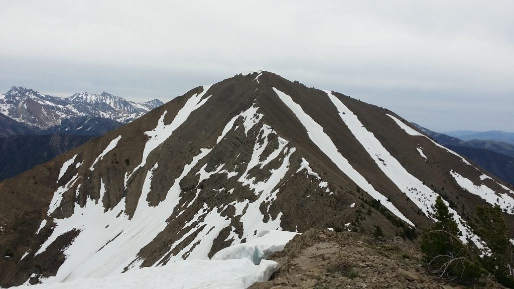
Rock Roll Peak. Mark and Tory Jones climbed the ridge on the right. Mark Jones Photo
Access
Same as for Peak 9617. This is the final leg of a 3-peak journey.
Northwest Ridge, Class 2
The Climb
From the 10,020-foot connecting saddle with Peak 10334, scramble southeast up the open but rocky ridge crest to the summit. The ridge has numerous ridge outcrops but a goat trail on the right/southwest side of the crest often helps avoid them. Side-hilling on this ridge is difficult due to steep, loose talus/scree so stay on the ridge crest or on the nearby goat trail for the best footing. The summit of Rock Roll Peak has a decent cairn and offers magnificent views of the surrounding area.
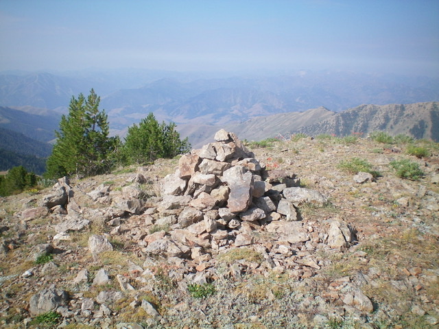
The large summit cairn atop Rock Roll Peak. Livingston Douglas Photo
North Ridge, Class 2
The Descent
From the summit, descend east briefly then northward down the north ridge on loose shale. There is an on-and-off goat trail on the left/west side of the ridge crest. The ridge steepens as it drops into a thick pine forest lower down. The ridge splits at about 9,400 feet. The left/west branch of the ridge is more open and is a shorter route back to the trailhead. It reaches FST-124/High Ridge Trail in an open gully, avoiding the worse of the wicked bushwhack through the thick pine forest.
The right/east branch of the ridge descends a forested shoulder through thick pines and lots of blowdown, but is a shorter route back to FST-124. Choose your poison. I chose the former. Descend the ridge/shoulder through an unpleasantly thick pine forest on the east side of Basin Gulch Creek. Lower down, drop down to creekside and bushwhack through easy scrub to intercept FST-124 at its crossing of Basin Gulch Creek. Follow FST-124 back up over the 9,100-foot saddle, down into Cold Canyon, and back to Trail Creek and the trailhead
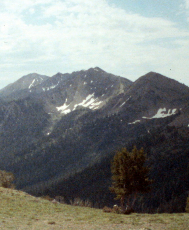
Rock Roll Peak as viewed from the North Fork Trail Creek.
Additional Resources
Regions: Boulder Mountains->EASTERN IDAHO
Mountain Range: Sawtooth Range
Year Climbed: 1992
Longitude: -114.29151 Latitude: 43.8004