Elevation: 8,710 ft
Prominence: 1,240
Climbing and access information for this peak is on Page 356 of the book. Livingston Douglas provided the major updates (below) to the information found in the book. Updated November 2018
Scout Mountain is probably the most visited summit in the Bannock Range because of its close proximity to Pocatello and the relatively easy access from a paved road. It is an attractive peak with over a thousand feet of prominence. USGS Scout Mountain
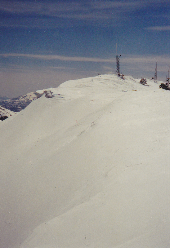
Scout Mountain. Rick Baugher Photo
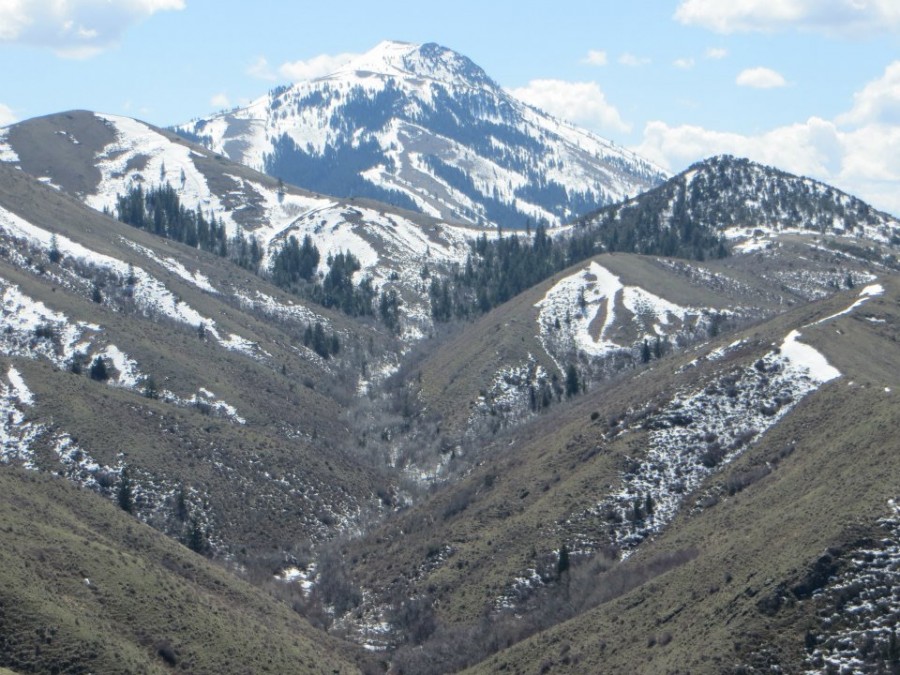
Scout Mountain as viewed from Indian Mountain. Steve Mandella Photo
2018 Updates by Livingston Douglas
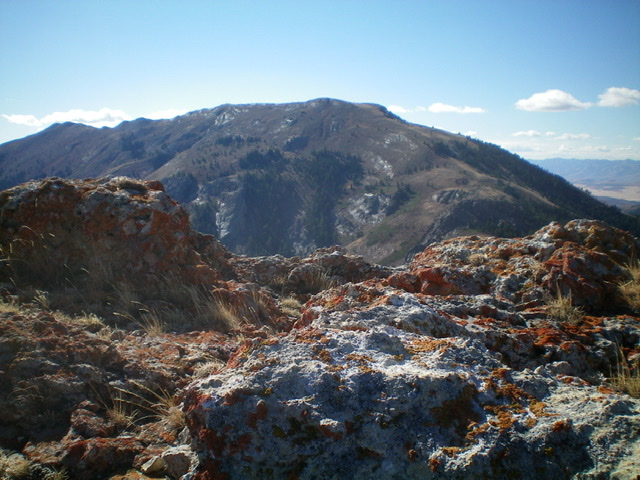
Scout Mountain as viewed from the summit rocks of Peak 8037 to its northeast. Livingston Douglas Photo
Northeast Spur, Class 1 —STANDARD ROUTE
Access
From the junction of Portneuf Road and the Bannock Highway/CR43A at the west end of Portneuf, drive south on the Bannock Highway for 4.5 miles. Turn left/east onto FSR-001 (signed for East Fork Mink Creek). Drive up FSR-001 (paved) for 2.9 miles to a weakly-signed LEFT turn for the Crestline trailhead at a sharp right turn in the road. Drive ¼ mile up this spur road (dirt) to the large parking area and the trailhead. There are 2-3 dispersed campsites along this spur road. This is the old Big Fir Picnic Area, which is long gone now. The elevation at the trailhead is 5,800 feet. The Crestline Trail/FST-148 is a narrow, steep, MC trail.
The Climb
From the trailhead, hike up the Crestline Trail/FST-148 all the way to a 7,740-foot saddle at the base of the northeast spur. This saddle is located just below (and southwest of) Point 7837. Leave FST-148 and follow a good use trail that heads southwest up the northeast spur and then bends left/south higher up as the use trail morphs into an old two-track jeep road. Follow the old jeep track southward up to the long summit ridge crest. Continue along the jeep track as it remains a good 40 vertical feet (or more) below the ridge crest on its west side. After about ½ mile, you reach the true summit of Scout Mountain.
You can either continue to follow the jeep road as it curls east then north to the highest antenna or simply leave the road and scramble about 20 vertical feet to the high point. No summit cairn up here, but there is a large cairn on the [lower] north summit, ½ mile to the north along the ridge crest (you can see the cairn from here). Don’t be fooled—the north summit is 36 vertical feet lower than the true [south] summit. Sometimes cairns are deceiving.
When you descend, you have the option of following a weak use trail along the ridge crest that leads northward to Point 8664 (which has a tall cairn atop it), a false summit. From there, you can descend northwest across easy, open scrub to intersect the old jeep track and return to the Crestline trailhead via either the north ridge or the northeast spur.
North Ridge, Class 3
Access
Same as for the northeast spur
The Climb
From the trailhead, hike up the narrow MC trail (FST-148) for just over ¾ mile to the crossing of a small stream. After crossing to the LHS of the stream, continue up the trail another 0.4-0.5 miles to a point where you have reached (or slightly passed) a shoulder on your RHS. The elevation here is about 6,450 feet. Leave the trail here and bushwhack southwest up onto the shoulder (which is actually the toe of the north ridge), bashing your way through thick brush and aspens. This pain ends in ten minutes or so as you emerge onto the open terrain of the ridge crest in desert scrub. Now you can see the magnificence of this ridge. The views down into the East Fork Mink Creek drainage are amazing, and they are only going to get better as you ascend.
The going is relatively easy, despite no help from game trails, sheep trails, or human trails. The ridge goes south-southeast to 7,400 feet then bends right/south. At the 7,800-foot level, you reach the crux of this ridge climb—a solid wall of ridge blocks. Skirt the left/east side of the first massive block then move across to the right/west side to skirt the remaining ridge blocks on open, large boulders (Class 3 side-hilling on these behemoths). You will gain 200 vertical feet in the process of climbing these boulders. When you emerge at the top of this blocky ridge section, you will be relieved to be back on desert scrub. Move leftward to return to the ridge crest and continue your climb. At about 8,450 feet, the northeast spur merges into the north ridge and you pick up an old two-track jeep road. Follow the old jeep track up to the narrow summit plateau and continue southward for ½ mile to the high point of Scout Mountain at the base of a massive antenna. You have a short scramble up from the road to reach the high point.
When you descend, you have the option of following a weak use trail along the ridge crest that leads northward to Point 8664 (which has a tall cairn atop it), a false summit. From there, you can descend northwest across easy, open scrub to intersect the old jeep track and return to the Crestline trailhead via either the north ridge or the northeast spur.
Additional Resources
Regions: Bannock Range->SOUTHERN IDAHO
Mountain Range: Bannock Range