Elevation: 7,612 ft
Prominence: 792
Climbing and access information for this peak is on Page 86 of the book. Dan Saxton’s important update on this peak will make reaching its summit more likely but it is still going to be a long day. Thanks Dan. USGS Rhodes Peak
The guidebook says that Shale Mountain is best approached from the south, but I believe the north approach is a better option. Start from the end of the Schley Mountain Road (FS-7734) in Montana at a high trailhead (over 6,000 feet). Follow an unmaintained path most of the way. It took me 8-9 hours round trip.
From the Schley Mountain trailhead at the end of the road, follow the State Line Trail/FST-738 to the MT/ID state line. About 50 yards before you reach the sign marking the MT/ID border, look left to see the remnants of an old road forking off to the east (unsigned). That is the continuation of the State Line Trail heading south. Don’t be fazed by its slightly overgrown nature. Follow the track about 1/4 mile to where it clearly becomes a single trail. If in doubt, seek to gain the North Ridge of Peak 6927.
The path reaches the ridge, but then soon goes onto the West Side (the map is incorrect here), climbing up until it reaches a meadow just south of Peak 6927 and abruptly vanishes. I could not find the trail from here both ways. You will have to go cross-country for the next 3/4 mile or so. Turn east and drop into the little valley between Peak 6927 and Peak 6989. Try to follow the “trail” as it is shown on the USGS map, which means sidehilling a bit below the next ridge on its West Side. The trail tread returns just north of “T40N” on the topo map and from there it is fairly easy to follow.
Follow the trail to picturesque Leo Lake and then up the valley behind (the track grows faint) to another tarn across the state line. Scramble west up to the ridge crest and follow it south to the North Summit of Shale Mountain. Some rock-hopping is necessary but is not difficult.
From the North Summit, you can see that the South Summit is higher. Follow the ridge south to where it becomes too narrow, drop onto the East Face, and then traverse to a steep Class 3 grass/rock wall which propels you up to the apex of one of the Great Burn’s most intrepid and spectacular peaks.
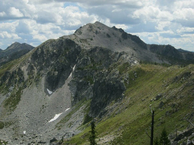
Shale Mountain as viewed from the State Line Ridge to the north. Dan Saxton Photo
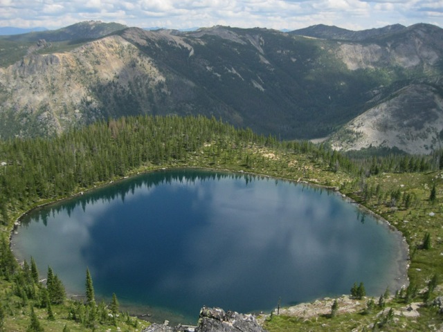
The tarn atop the State Line. Dan Saxton Photo
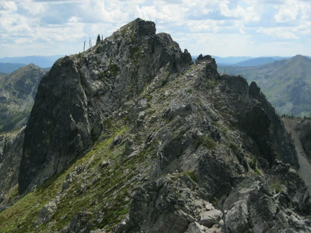
The South Summit of Shale Mountain as viewed from the North Summit. The route goes up the middle. Dan Saxton Photo
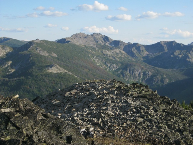
Shale Mountain as viewed from the State Line Ridge to the north. Dan Saxton Photo
Additional Resources
Regions: Bitterroot Mountains->NORTHERN IDAHO
Mountain Range: Bitterroot Mountains
Longitude: -114.78879 Latitude: 46.71409