Elevation: 5,895 ft
Prominence: 475
These peaks are not in the book. I have combined the 3 summits on Sixmile Ridge on this page. The coordinates and map below are centered on the summit of Sixmile Ridge which is the highest point on the ridge.
Sixmile Ridge parallels the South Fork Salmon River between Warm Lake and the junction of the South Fork and the East Fork South Fork Salmon River. Specifically, the ridge is bounded by the South Fork in the east, Buckhorn Creek in the south and southwest, the South Fork Fitsum Creek in the northwest, and Fitsum Creek in the north. There are 3 peaks with prominence on the ridge (from north to south): Krassel Knob (5,839 feet elevation;299 feet of prominence), Peak 5891 (311 feet of prominence), and the highest point, Sixmile Ridge (5,895 feet elevation; 475 feet of prominence). USGS Fitsum Peak
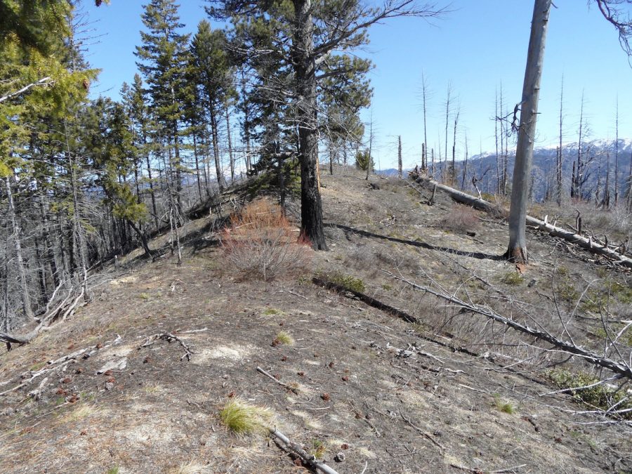
The summit of Sixmile Ridge. John Platt Photo
The Salmon River country is a land of deep canyons and long winding ridges. Many of the ridges either have or had hiking trails. Sixmile Ridge is typical of this magnificent terrain. Its elevation (5,895 feet) ensures that it will melt out by late April in most years. Access is available year-round via Warm Lake Highway and South Fork Road.
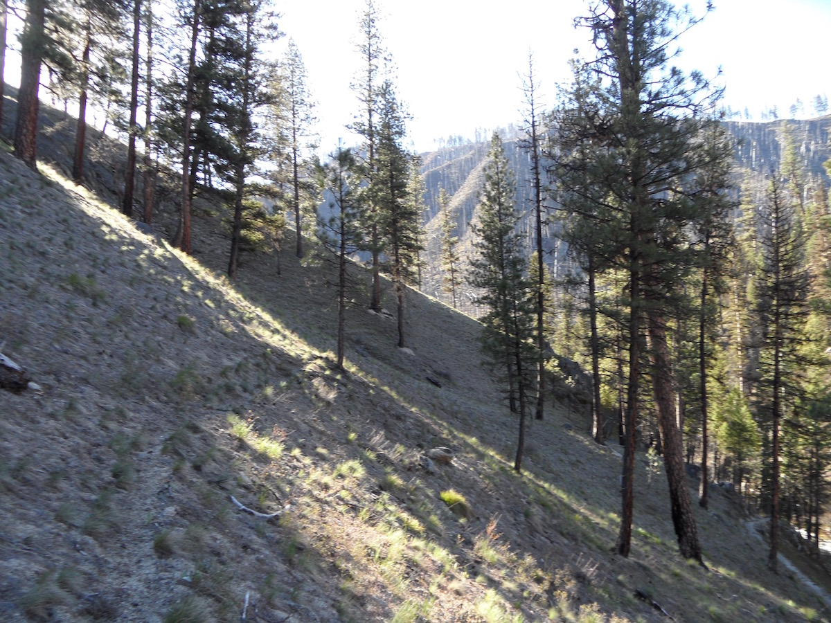
The typical terrain that you will encounter on many ridges in the Salmon River Mountains. John Platt Photo
Sixmile Ridge has a trail that is in fair condition. John Platt and Art Troutner followed the trail to Sixmile Ridge and Peak 5891 in April 2017. Use the link below to read John’s trip report. Class 1+
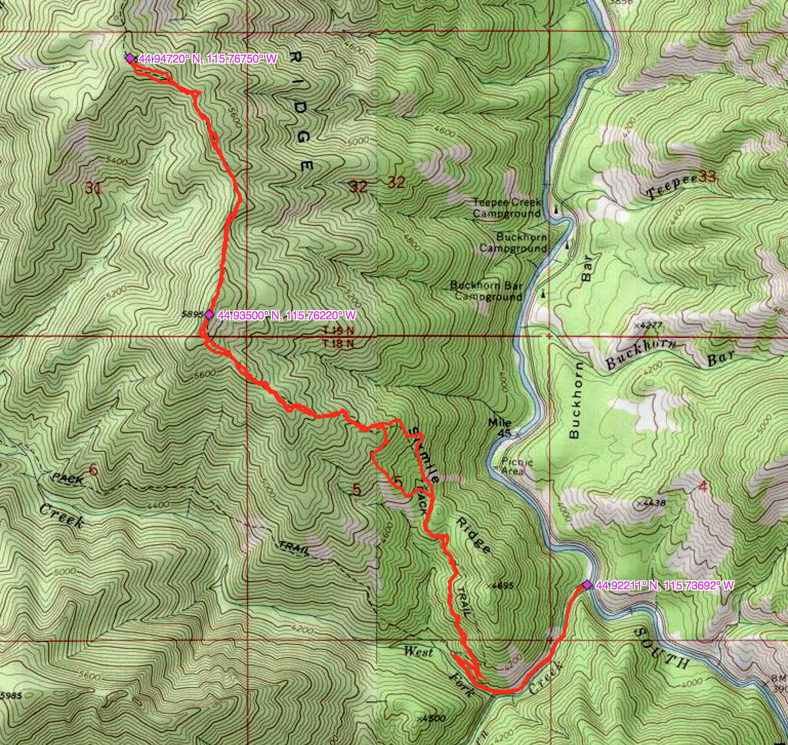
John Platt’s GPS track.
Additional Resources
Mountain Range: Western Salmon River Mountains
Longitude: -115.76219 Latitude: 44.93501