Elevation: 7,404 ft
Prominence: 704
Climbing and access information for this peak is on Page 363 of the book. Livingston Douglas provided the updated route information set out below. Brian Shumway added additional access information in the form of maps and photo. Updated November 2022
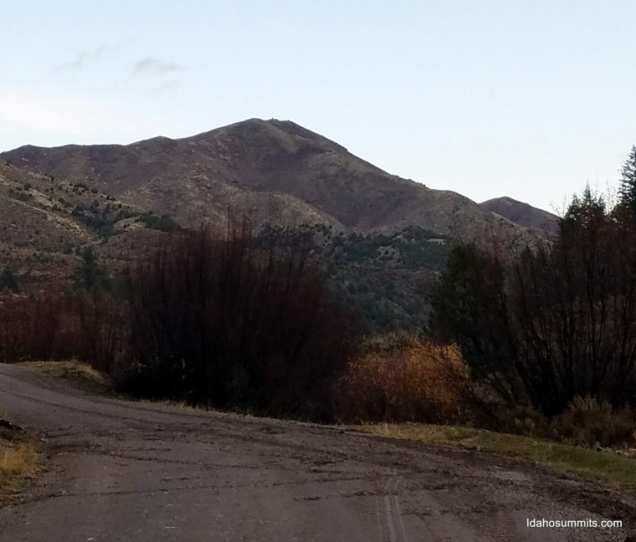
Taylor Mountain sits southeast of Idaho Falls at the northern end of the Blackfoot Mountains. The summit is managed by the BLM but the surrounding land is privately-owned. USGS Wolverine
Taylor Mountain. Dan Robbins Photo
Access and Routes by Livingston Douglas
Access
From the south end of Firth, ID on US-91, drive 1.7 miles south on US-91 to [signed] East 600N. This is Wolverine Road. Turn left/east onto paved Wolverine Road and reset your odometer. At 10.4 miles, go straight at a junction with [signed] Blackfoot River Road to stay on Wolverine Road. Drive through The Narrows and continue a few more miles to reach a parking pullout on the left/north side of Wolverine Road at 16.6 miles. This is the trailhead parking area for Taylor Mountain. Park here (5,800 feet).
Wolverine Road is paved to just before entering The Narrows. It then becomes a well-graded, smooth dirt/gravel road all the way to the Taylor Mountain trailhead. Be very careful with private property in this area because the only public access to Taylor Mountain is via the “ACCESS YES” gate at this trailhead. All other possible routes (e.g., the South Ridge) are blocked by fencing and signage.
Brian Shumway Access Updates
This update provides visual depictions of things already described and is mostly to help locate the trailhead and find the trail since the trail is partially obscured by undergrowth and trees. Parking coordinates are 43°17’33.8″N 111°55’14.3″W.
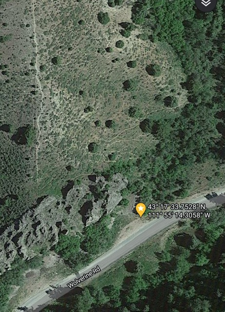
This satellite photo shows the trailhead location along the road.
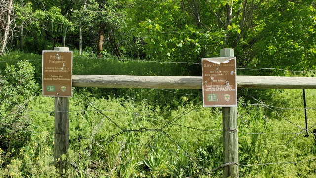
The trailhead. Brian Shumway Photo
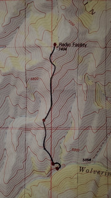
The route.
Southeast Gully/Southeast Ridge, Class 2
The Climb
Hike northeast up a use trail (then cattle path) that follows a dry gully. After ascending 700-800 vertical feet, the foot path dies out in an area surrounded by impending faces and ridges. You are now on BLM land. Exit the gully left/west and climb steep scrub in open terrain onto a ridge that leads west then northwest to join the summit ridge just south of the summit at a ridge hump. Follow the easy, open scrub ridge to the antenna-clad summit.
Southeast Ridge/South Spur, Class 2
The Descent
From the summit, descend the southeast ridge to 6,600 feet (a narrow ridge line) then continue southeast then south (on the right/east side of a fence row) on a well-beaten use trail on the ridge crest to reach the top of some rugged, rocky towers just above the trailhead parking area. Do NOT continue on the South Ridge proper from 6,600 feet downward or you will end up on private, posted land.
The use trail heads left/east from just above the towers and drops steeply down to the gully and meets the “gully trail” (see Southeast Gully Route) only about 50 yards above the ACCESS YES gate/trailhead. There is no visible trail at all here heading up to the South Spur, which is why I missed it on the ascent route. This use trail is the standard route on Taylor Mountain but if you are not aware of where it leaves the [better] “gully trail,” you won’t find it.

The antenna-clad summit of Taylor Mountain. Livingston Douglas Photo
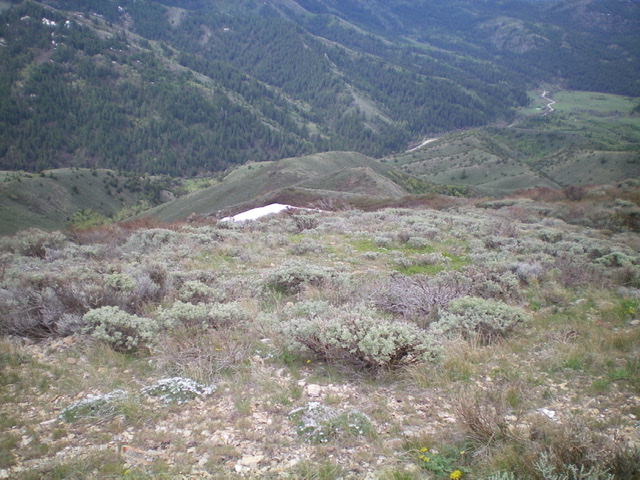
Looking southeast down to the valley floor from near the summit of Taylor Mountain. Livingston Douglas Photo
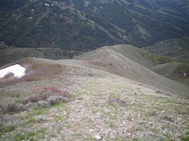
Looking down the southeast ridge of Taylor Mountain. Livingston Douglas Photo
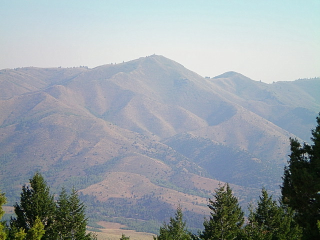
Taylor Mountain (center) as viewed from Peak 6796 to its southwest on a very smoke-hazy morning. Livingston Douglas Photo
Additional Resources
Regions: Blackfoot Mountains->SOUTHERN IDAHO
Mountain Range: Blackfoot Mountains
Longitude: -111.92079 Latitude: 43.30609