Elevation: 8,753 ft
Prominence: 893
Climbing and access information for this peak is on Page 147 of the book. Updated August 2021
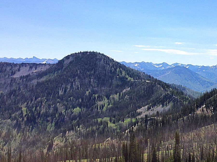
Tyee Mountain is an isolated, seldom visited peak and an amazing spot to view the Sawtooth Range. USGS Tyee Mountain

Tyee Mountain as viewed from Peak 8498.
Access
To access the peak via FSR-312, Graham Road [(B)(2.1) on Page 153], take ID-21 from Boise for 55 miles to the turn for FS-384 at the [signed] Edna Creek Campground turn. Turn onto the excellent FS-384 gravel road and follow it to FS-312 in 4.0 miles. FS-312 is a relatively good road but it has rough, steep spots. It is not recommended for passenger vehicles. The main intersections are signed for Graham Road. Note: Google Maps does not give good directions for this area.
The road crosses a pass between Archie Mountain and Peak 7561, continues to another pass and a junction with Jackson Peak Road, and then descends into the upper reaches of Crooked River. The road climbs out of the Crooked River drainage to yet another pass and then crosses the East Face of Peak 8498. Once across the face park on the left.
West Ridge, Class 1+
An ATV track leads up the hill. At the top of the hill you will find an unofficial trail which leads down to the saddle between the road and Tyee Mountain. The trail continues up out of the saddle staying for the most part on or near the top of the broad West Ridge until disappearing roughly just below the summit. From this point climb the open slopes to the summit. The journey covers 3.6 miles with 1,300 feet of elevation gain round trip.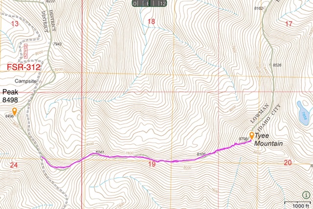
Additional Resources
Regions: Boise Mountains->WESTERN IDAHO
Mountain Range: Boise Mountains
Year Climbed: 2021
Longitude: -115.30409 Latitude: 44.01789