Elevation: 10,713 ft
Prominence: 773

Climbing and access information for this peak is on Page 305 of the book. This entry provides updated route information. Contents included (1) Brief notes on The Knoll to Umpleby Traverse, (2) The north ridge route, (3) The Bell Mountain to Umpleby Traverse, (4) The Basinger Canyon route and (5) Livingston Douglas’ west gully route. Updated December 2019
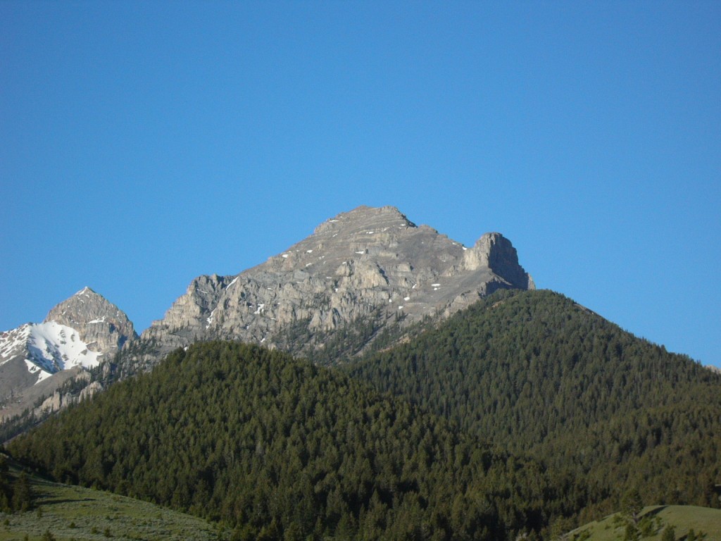
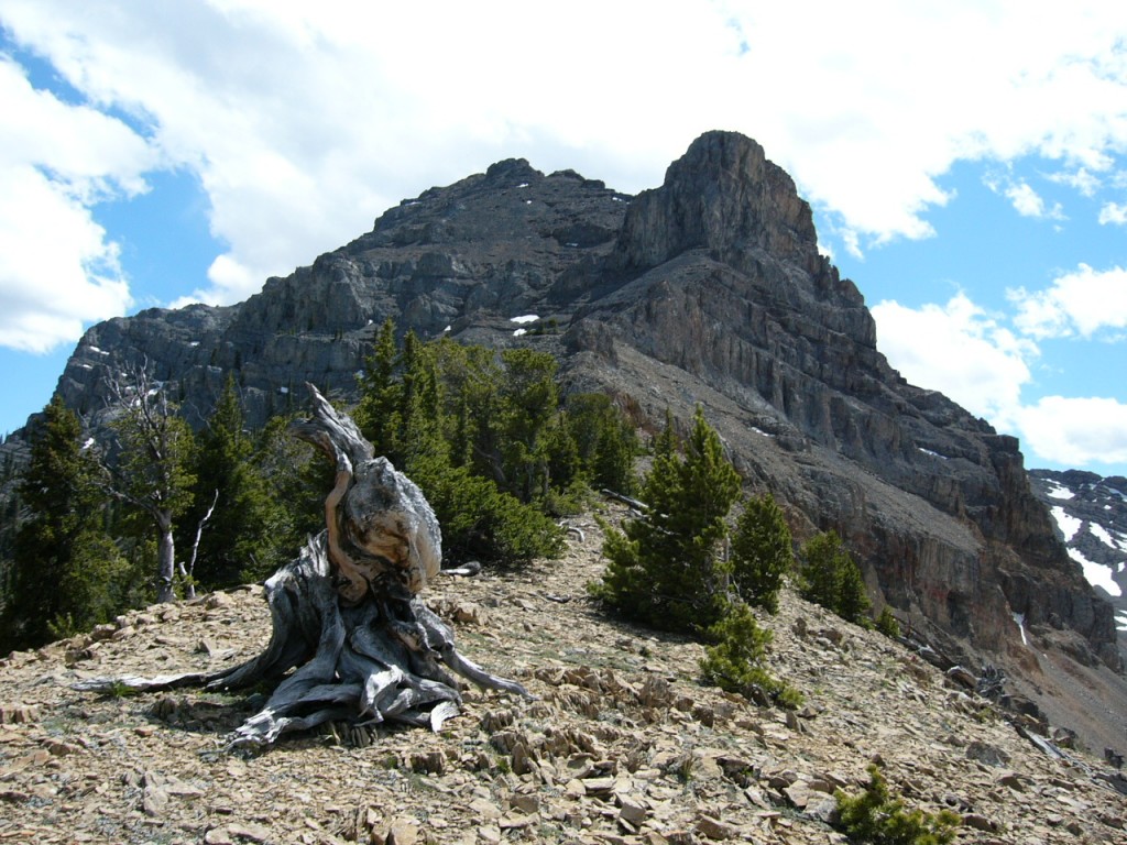
Umpleby is one of four ranked peaks that tower above Basinger Canyon. It is a unique peak with lots of good routes. I highly recommend that you add it to your “to do” list. There are great, scenic camping spots on both sides of the mountain and superb views of Bell Mountain from its summit. USGS Coal Kiln Canyon
(1) The Knoll-to-Umpleby Traverse, Class 3
From the summit of The Knoll, traverse southeast down the main Lemhi Range Crest to the Knoll/Umpleby saddle. Climb Umpleby’s west ridge, staying as close as you can to the ridge crest. Roughly 450 feet from the top, traverse onto the face and follow a Class 3 gully up to the ridgeline just south of the summit. You will find talus-covered ledges and some minor climbing on this route.
(2) North Ridge Route, Class 3
The north ridge is a classic line mixing hard rock, talus, cliffs and great views together into an enjoyable climb.
The north ridge is on the right skyline. The route climbs up through the trees, skirts the big tower on the left, and then follows the ridge to the summit.
Camp in the vicinity of Bell Mountain Canyon [(A)(4.1.1) on Page 313]. There are lots of good spots to camp. If you have a 4WD, you can reach 8,000 feet at the base of the ridge.
Once above tree line, the route opens up.
The crux of this route is a band of cliffs at the bottom left of the tower. Look for an obvious line on the left-hand side of the cliffs and then follow a ledge up to the right.
The route through the cliffs starts above the highest snow patch.
Once above the cliffs, you will find steep talus as you work your way up to the top of the ridge which leads up to the summit.
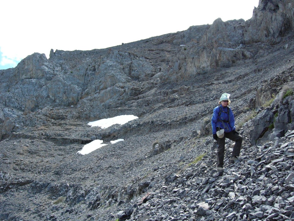
(3) Bell Mountain-to-Umpleby Traverse by Earl McAlister
We started in Basinger Canyon, ascended Bell’s west face, descended its east face (a little tricky in places), walked the north ridge of Bell Mountain to Umpleby Peak. We climbed its southwest ridge/face, which is a Class 2 talus walk. After that, we descended one of the gullies I have pictured on Umpleby’s northwest face. We then walked up the ridge to The Knoll and descended its west face back to Basinger Canyon.
Umpleby Peak. Photo by Earl McAlister
—————————————————
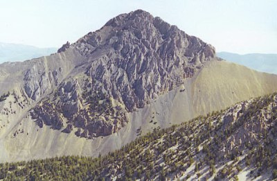
(4) Basinger Canyon Route
Larry Prescott climbed the peak from the west via Basinger Creek. See his trip report for additional photos and details.
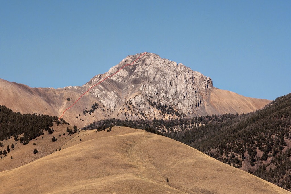
The west face of Umpleby Peak with Larry Prescott’s route shown in red. Larry Prescott Photo
(5) West Gully, Class 2+ by Livingston Douglas
Access
Basinger Canyon Road is located along the Little Lost River Highway exactly 5.8 miles north of Clyde. From the highway, turn right/east onto [unsigned] Basinger Canyon Road. At 0.8 miles, pass sheep pens on the right side of the road. At 1.0 miles, cross a bridge. At 1.1 miles, go left at an unsigned road fork. At 3.9 miles, reach the Challis National Forest boundary. Park here (6,675 feet). If road conditions permit, you can drive another mile up narrow, rocky Basinger Canyon Road/FSR-840 to shorten this climb.
The Descent
This route is the final leg of a loop route that begins and ends at the mouth of Basinger Canyon. From the small, rocky summit of Umpleby Peak, descend directly west down a steep gully of talus, scree, and gravel. The gully parallels the west ridge for a while then curls west-southwest and finally southwest to reach the valley floor. Thankfully, there are no hidden cliffs to contend with.
This is a rather tedious descent because you can’t boot-ski the loose rock. The talus is too chunky and the gravel is too hard-packed. Lower down, the slope eases and you can make good progress on a wide-open scree slope to reach the floor of Basinger Canyon and Bell Mountain Creek. This is the terminus of the west gully. There is no exposure on this route and the visibility of the route is outstanding because it is open rock terrain the whole way. No bushwhacking or sagebrush weaving is required.
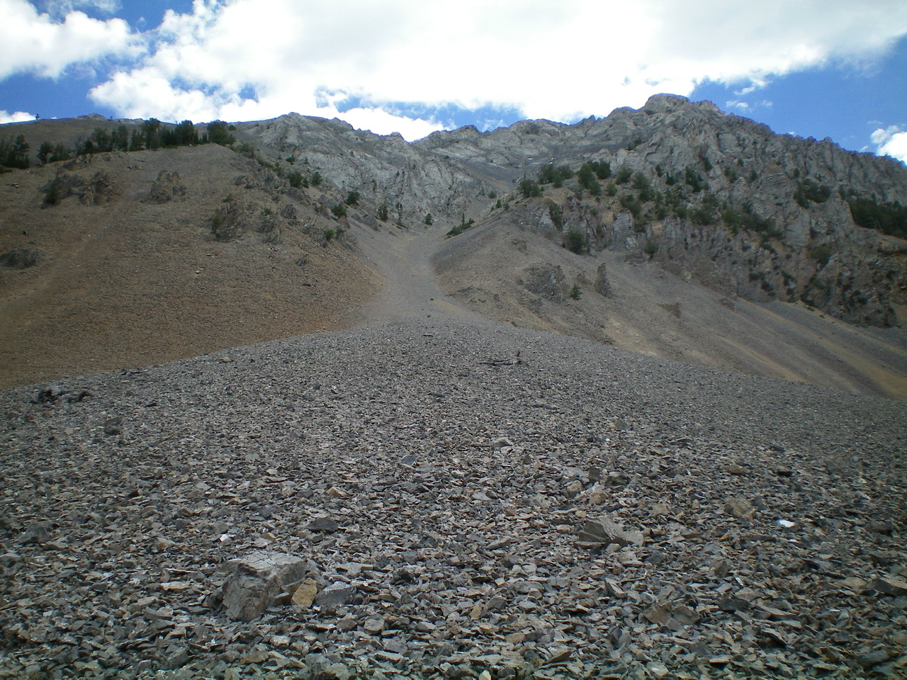
The west gully of Umpleby Peak, as viewed from its base. This gully goes directly to the summit, albeit with a few bends along the way. Livingston Douglas Photo
Additional Resources