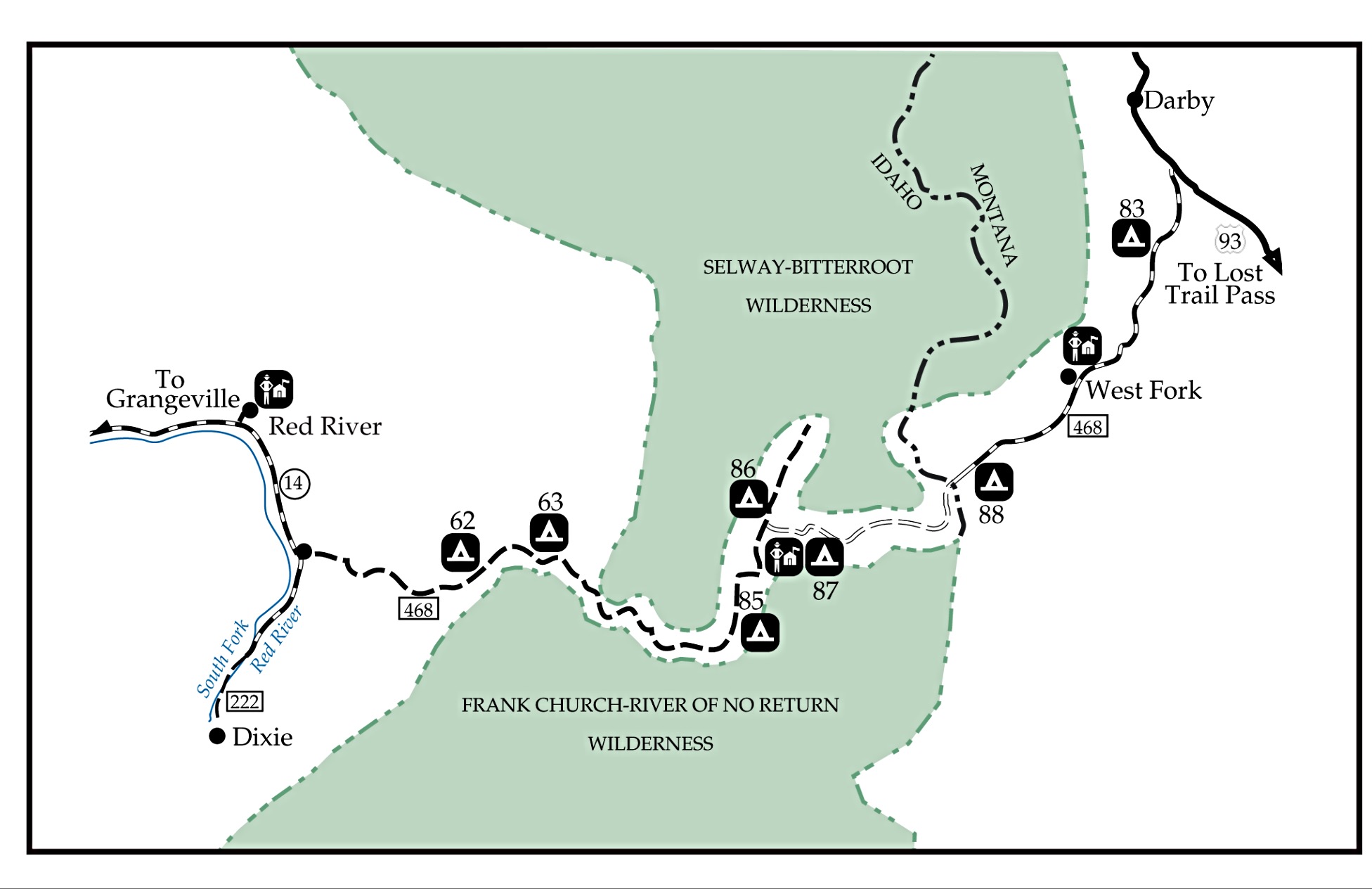
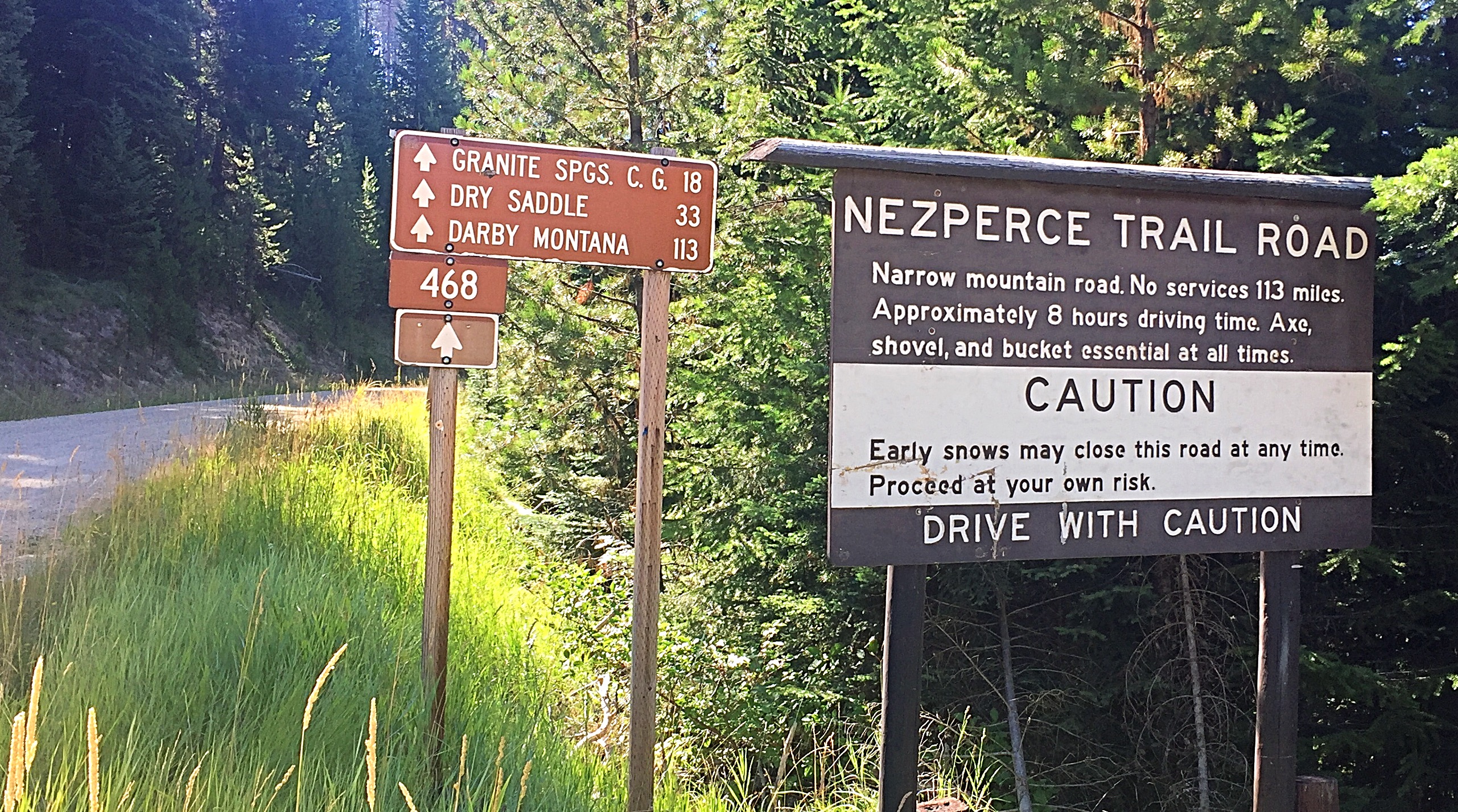
This entry updates the Nez Perce Trail Road entry (G) on Page 80 of the book. To reach the start of this road, see (F)(1) Elk City and Dixie Access.
Background
The Nez Perce Trail/FS-468 is part of a backcountry road system designated as the Magruder Corridor by the Forest Service. The Magruder Corridor is a remote road that passes through the Southern Clearwater Mountains between the Selway-Bitterroot Wilderness to the north and the Frank Church River of No Return Wilderness to the south.
This Forest Service map provides an overview of the entire route.
The Forest Service officially designates the Magruder Corridor as the route between the former Red River Guard Station and Darby, Montana. For purposes of this update, the relevant part of the corridor is the Nez Perce Trail Road/FS-468 which encompasses 61.6 miles of the corridor between the old ranger station and the Selway River. Additional information for trails leaving this road are on Pages 80-81 of the book.
Current Conditions and Recommendations (2017)
The Forest Service accurately describes FS-468 as a “primitive one-lane road [that] is rough, steep and winding with few turnouts for passing oncoming vehicles.” High clearance and “good” tires with strong, multi-ply sidewalls are a must. There are plenty of places where, without extra care, rocks can cut into your sidewalls. Be sure to have a fully-inflated spare tire, a shovel and plenty of water. Four-wheel drive is an extra security measure that I also recommend. Travelers need to be self-sufficient and ready to face obstacles like downed trees, washouts, flat tires and hot conditions. A strong wind storm could easily knock hundreds of dead trees across the road. A chainsaw (or at least an ax) would not be extravagant extra to include in your travel kit.
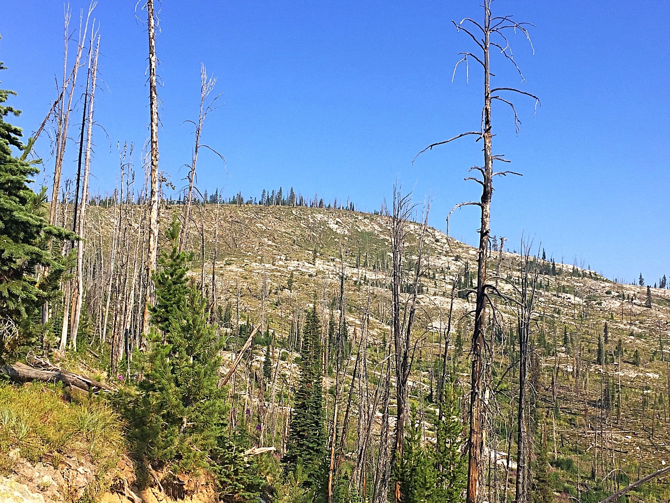
Although the Forest Service claims that, “The landscape is much the same as when the Nez Perce Indians and other early travelers crossed the area,” the area has been significantly changed by large forest fires in 1996, 2000, 2005 and 2007. In fact, these fires have destroyed huge swaths of forest, leaving only dead trees and fireweed in their wake. In my opinion, the Forest Service has overstated the benefits of these fires and needs to strike a balance between natural fire progression and common sense.
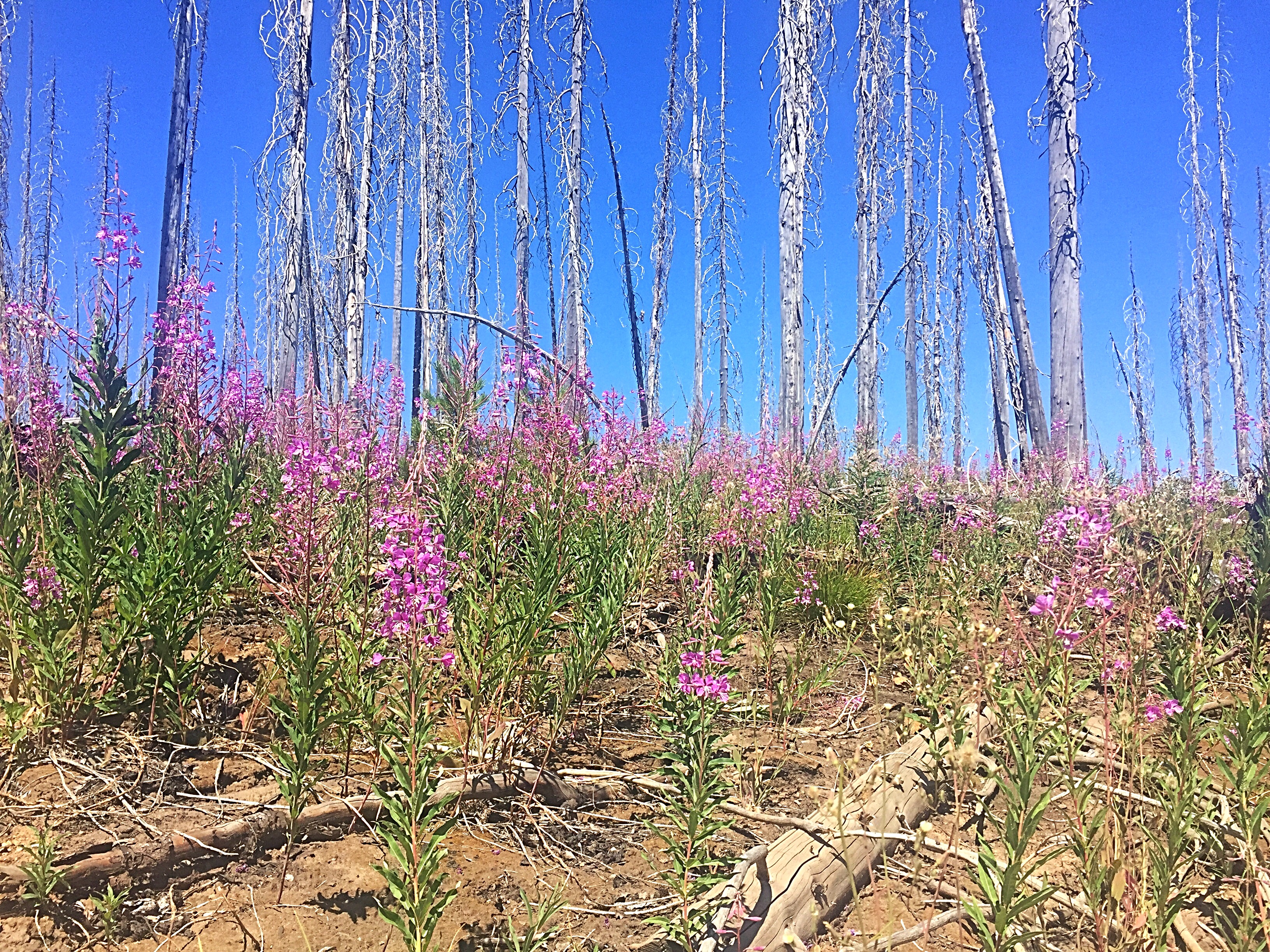
The new normal along the Magruder Corridor courtesy of climate change.
After seeing all the destroyed forests along the Magruder Corridor, I am convinced that climate change has already reached the tipping point for Idaho’s forests. It will take a while, but most of our forests are going to be destroyed by fire because the temperatures today are too warm for the existing forest ecosystem. Simply put, the Forests Service can no longer stop the burning cycle but only slow it a bit. In August, it was 95 degrees in Grangeville, Moscow, Kellogg and Coeur d’Alene. When I lived in Moscow in the mid-1980s, it never got close to those temperatures.
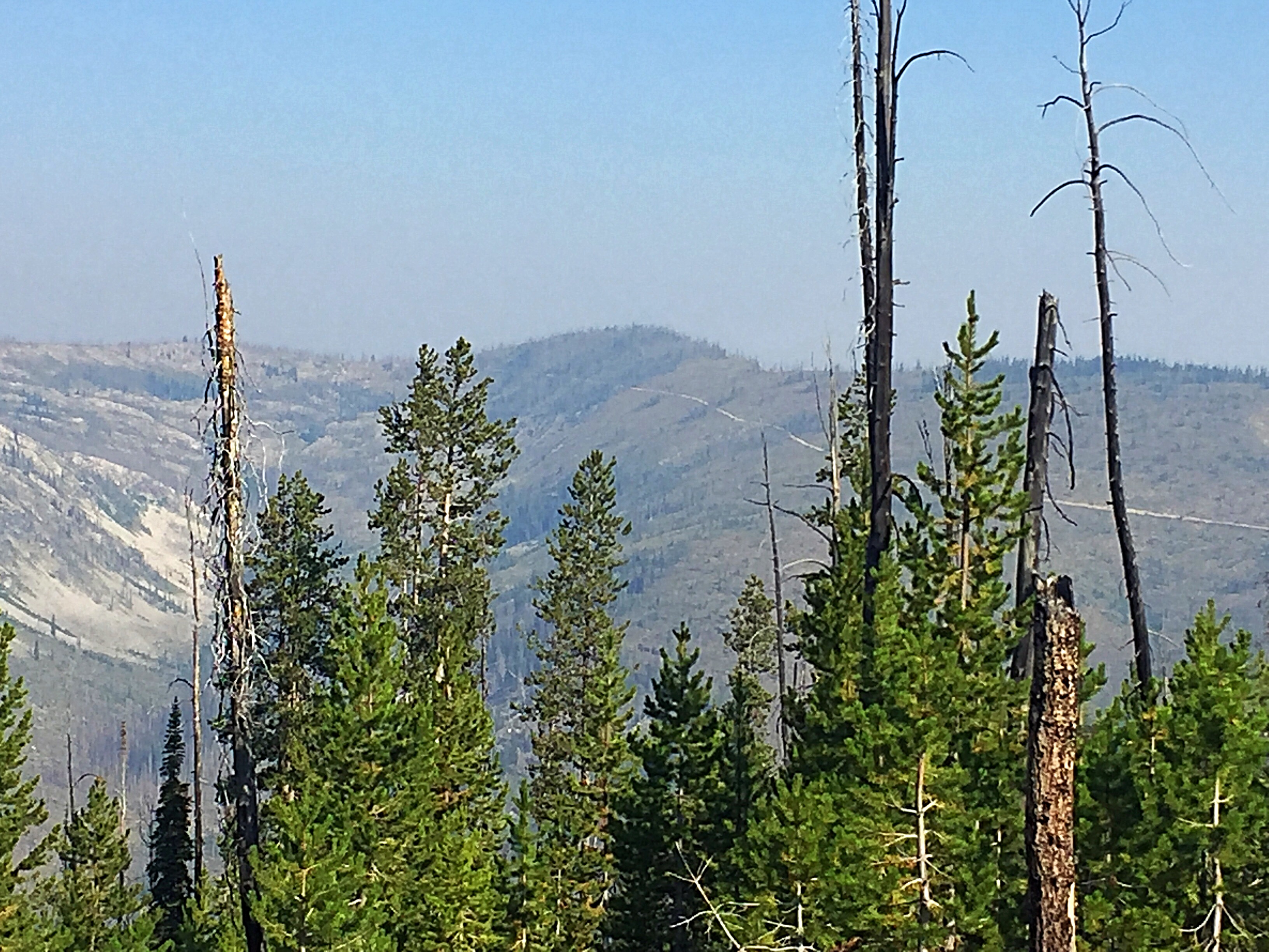
The burned forest is measured in square miles not acres. When I drove the road in 1985, there were few vistas because the thick forest hid the road. Now you can see the road stretching out ahead of you for miles.
Peakbagger Points of Interest
The remainder of this article focuses on spots along the road that are of interest to peakbaggers. Elk City, Idaho is the last place you may be able to pick up supplies and current information on conditions. I recommend stopping at the Elk City Forest Service Ranger Station to get the latest updates especially if there are active fires. The staff was friendly and helpful when we visited.
Note: Mileages from the start of the route are provided in parentheses.
(0.0) Former Red River Ranger Station. This is the beginning of FS-468. This station is closed to the public but has a few information signs. Follow FS-222 south a short distance to a well-signed junction. This is the start of FS-468.
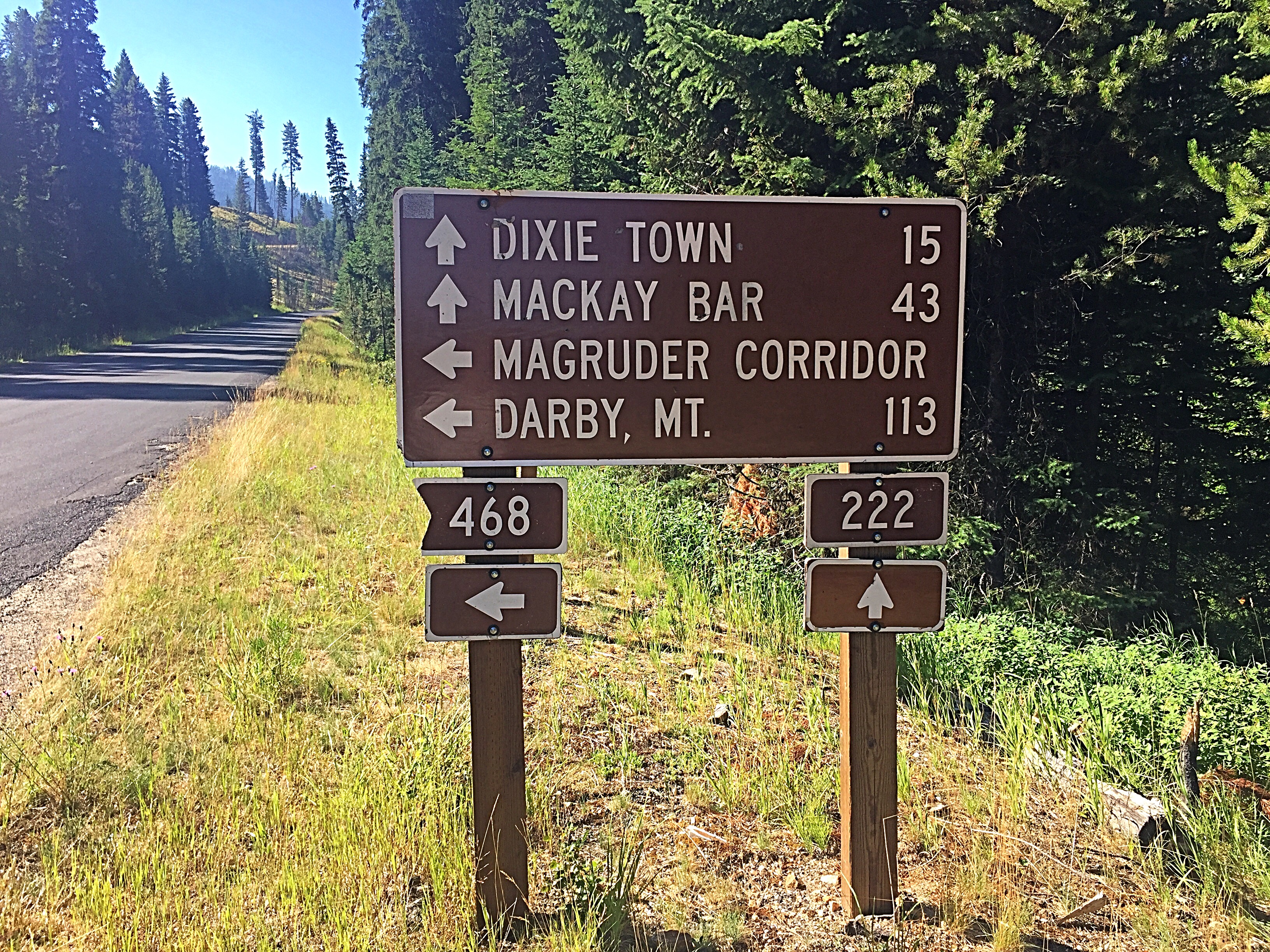
Turn here.
A few more signs at the start.
The first 14 miles are in the best condition of the entire FS-468 route. The following are points of interest along this section.
(1.8) North Soda Creek Road/FST-1172
(5.2) Trapper Creek North Road/FS-9560. This road leads north and provides access to a large swath of the Clearwater Mountains.
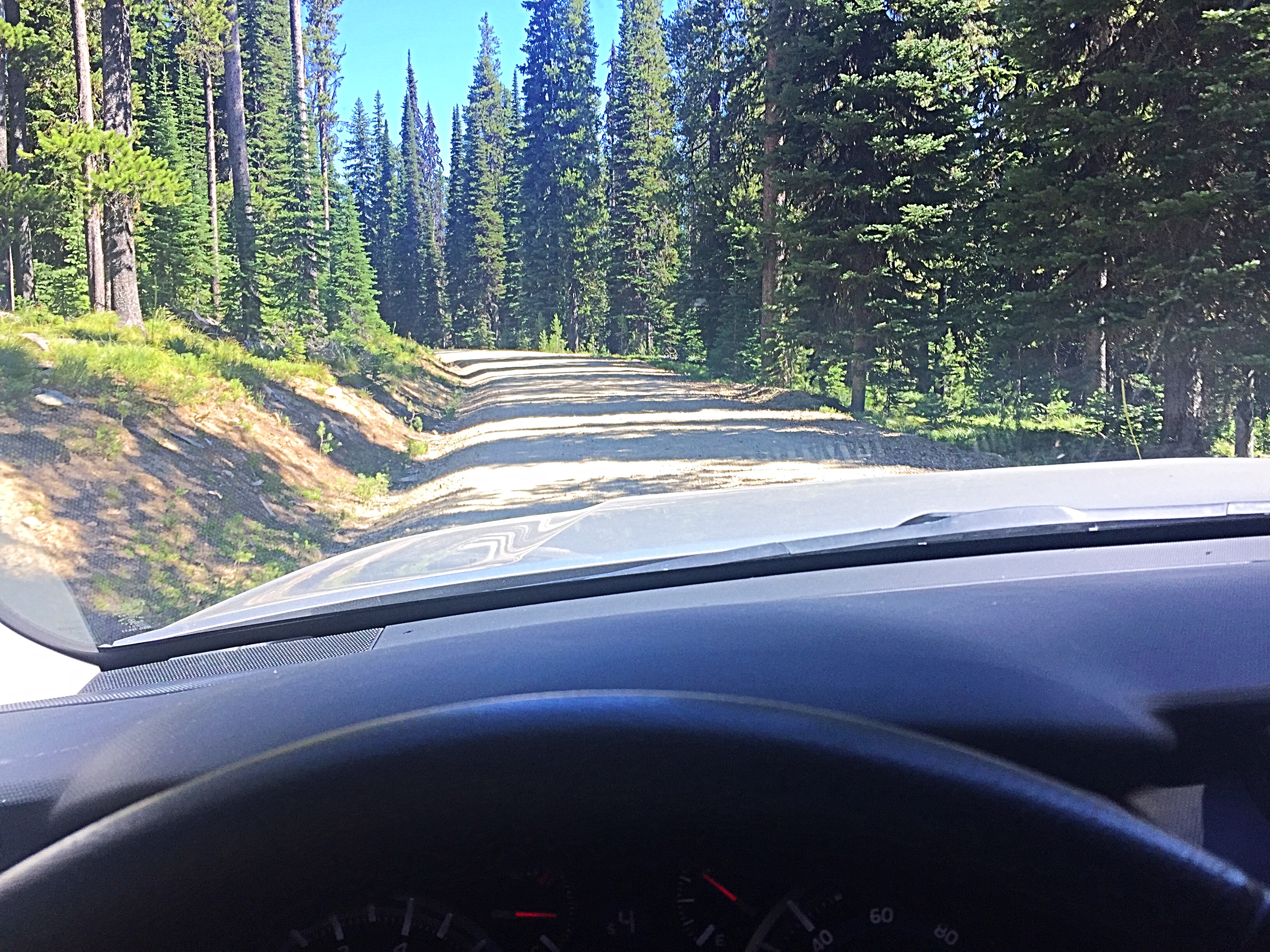
The first 14 miles are smooth in a relative sense and are still forested.
(7.5) Trapper Creek Crossing
(8.1) Divide Trail/FST-502
(9.5) Mountain Meadows. The first available camping is near this spot.
(14.4) 14-Mile Tree trailhead (7,000 feet). As you reach this point along the road, you enter an extensive and relatively-recent burn zone. There is a toilet and trailhead facilities. There are 2 trails that leave this spot: FST-501 and FST-580 lead south into the Frank Church River of No Return Wilderness. FST-580 takes you to Boston Mountain (Page 73 in the book). FST-501 takes you to Peak 7390 as well as Sheep Hill Lookout and Bear Point Lookout.
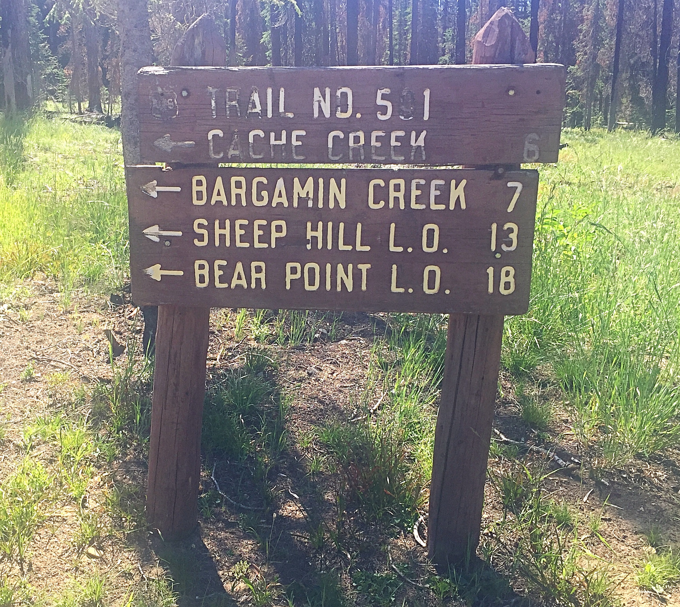
The sign for FST-501 at the 14-Mile trailhead. This trail leads to Peak 7390.
The road becomes progressively rougher from this point on.
(18.1) Granite Springs Campground (6,654 feet). There are camping spots but, because of the extensive fire damage, extensive rehabilitation is needed to make the campground attractive to visitors.
(19.9) Elk Mountain Road/FS-285 junction (6,764 feet). Elk Mountain Road leads north to the slopes of Elk Mountain in 14.0 miles. This road is passable to the junction with the short side road that leads to the summit of Green Mountain. I am not sure of the condition of the road past Green Mountain.
Green Mountain and its tall, nearly-abandoned lookout.
(24.9) Bargamin Creek Trail/FST-502 (5,000 feet)
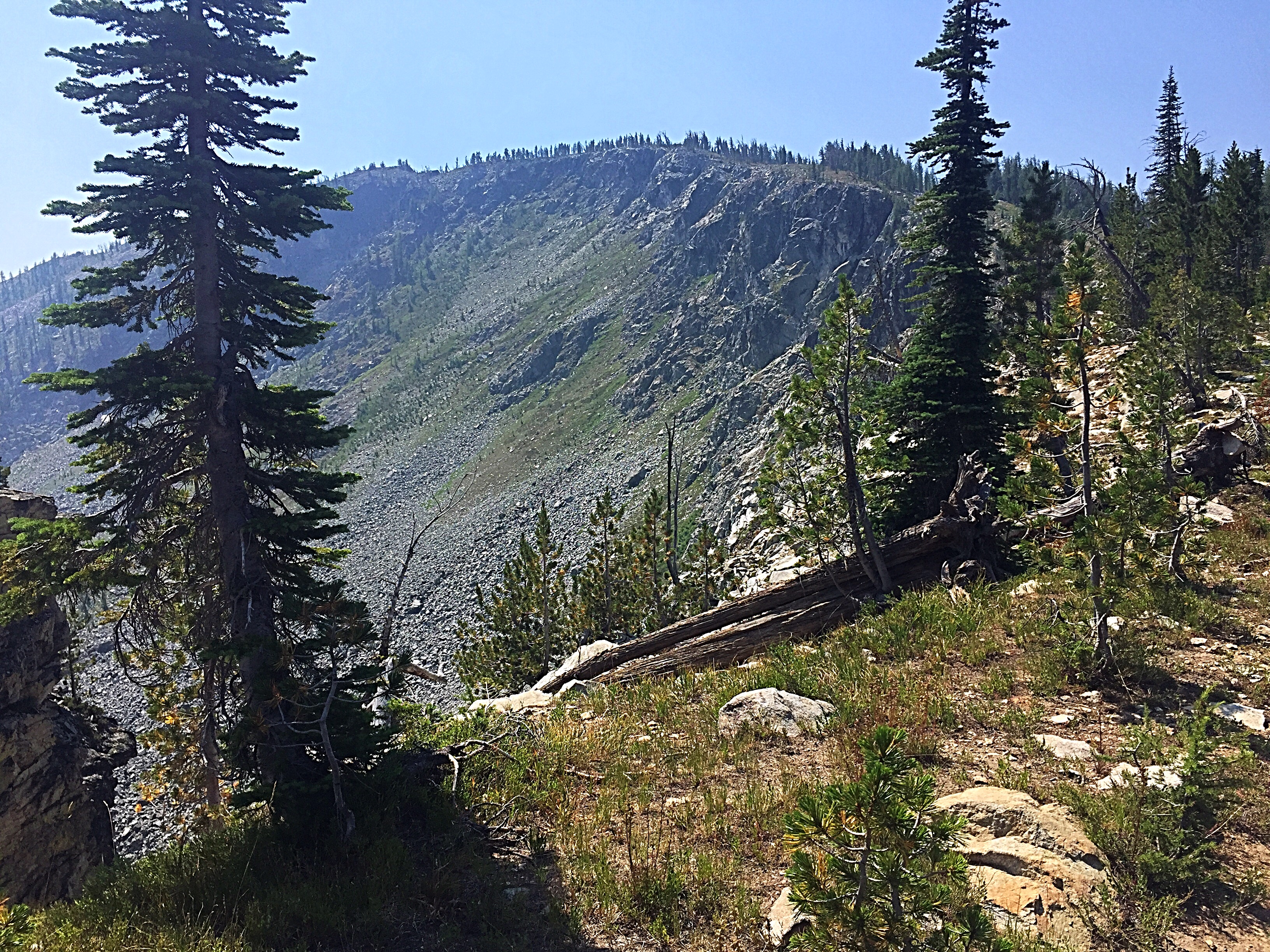
(25.0) Poet Creek Campground (4,973 feet). This is one of the lowest destinations along the road. The area directly around the campground has not burned. However, the campground is not very attractive and there is no potable water. When we passed by, it was 88 degrees and all of the campsites were full.
(31.1) Burnt Knob Road/FS-453C (7,200 feet). This road leads to the summit of Burnt Knob, the most spectacular peak along the road. It is a road that is difficult to drive even with a 4WD or ATV. The trailhead for Three Prong Mountain Trail/FST-539 is located 1.1 miles up the road. The summit is another 0.4 miles from the trailhead. See the Burnt Knob page for additional details. FST-539 eventually leads to Three Prong Mountain.
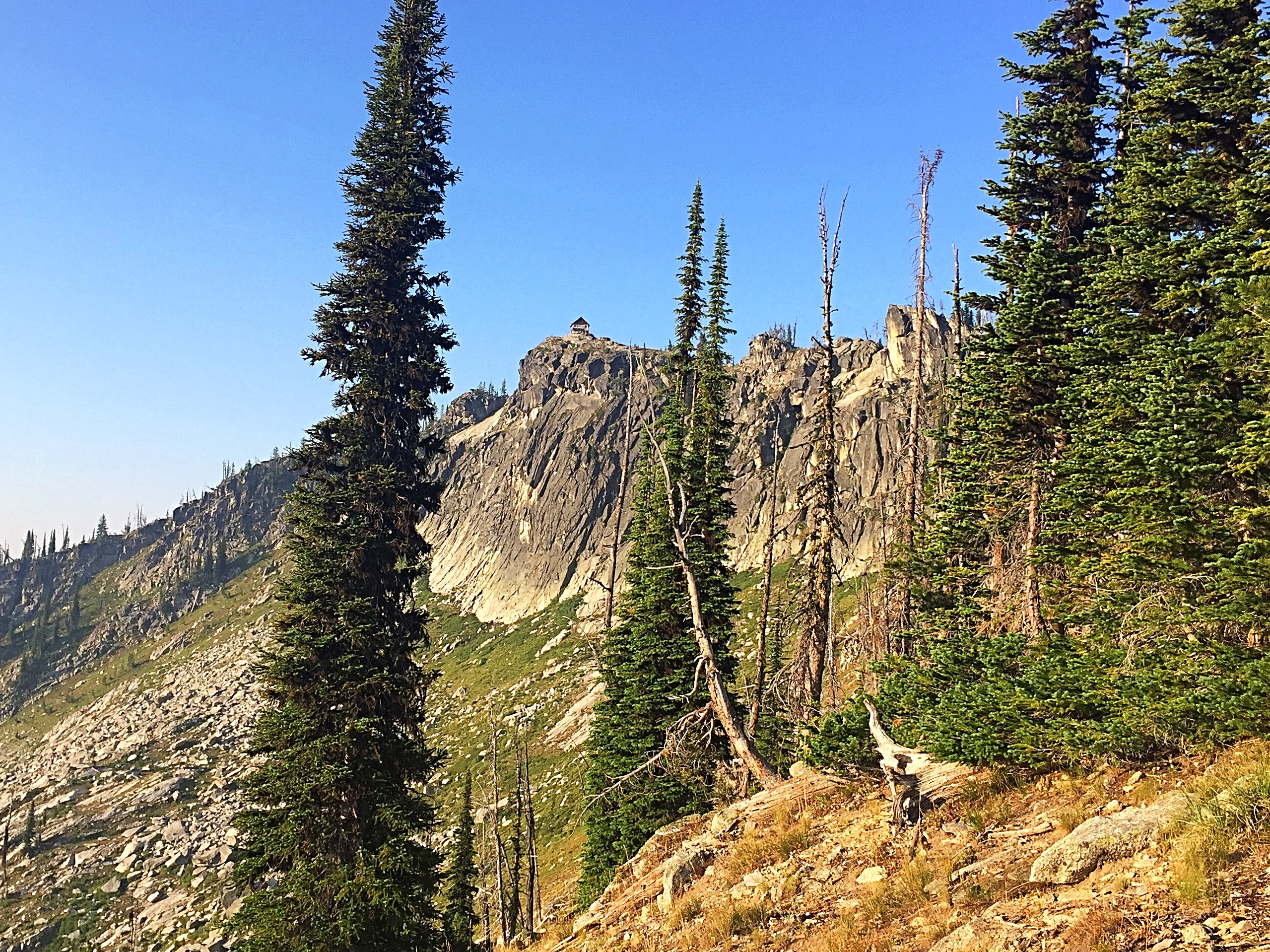
Burnt Knob
(32.5) Dry Saddle Trailhead/Campground (7,920 feet). This saddle is located at the base of Peak 8040/Dry Saddle Peak. There is a toilet at this stop and a nice camping area is nearby. The campground was fully occupied during our mid-week visit. The Sheep Hill Trail/FST-575 leaves from the saddle.
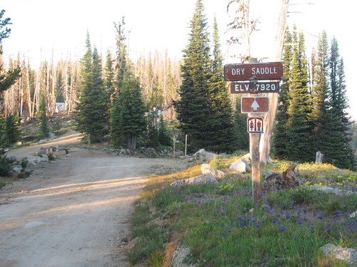
Dry Saddle. Mike Hays Photo
(38.3) Sabe Vista Point (7,476 feet). A short road leads from FS-468 to the viewpoint. Dry camping is possible here.
(38.8) Sabe Mountain Trail/FST-061 (7,620 feet). There was no sign marking the start of the trail and no dedicated parking. However, there is room for 1-2 vehicles to park alongside the road. See the Sabe Mountain page for additional information.
Sabe Mountain as viewed from the west.
(41.6) Horse Heaven Saddle (7,066 feet). This broad saddle has some camping spots. Additionally, a short spur road (signed for FST-028) leads to Horse Heaven Cabin. The cabin can be rented through www.recreation.gov.
(44.0) Salamander Creek/Slide Creek Pass (7,382 feet)
(45.1) Salamander Ridge Trail/FST-027 (7,546 feet)
(45.9) The site of the former Salmon Mountain Ranger Station which was established in 1911.
(46.3) Salmon Base Camp (7,546 feet). FST-019 heads south from this spot. This trail provides the best access for those looking to climb Stripe Mountain, the highest point in the Clearwater Mountains. The camping potential has been degraded by fire damage. According to the Forest Service, this is a popular spot with hunters.
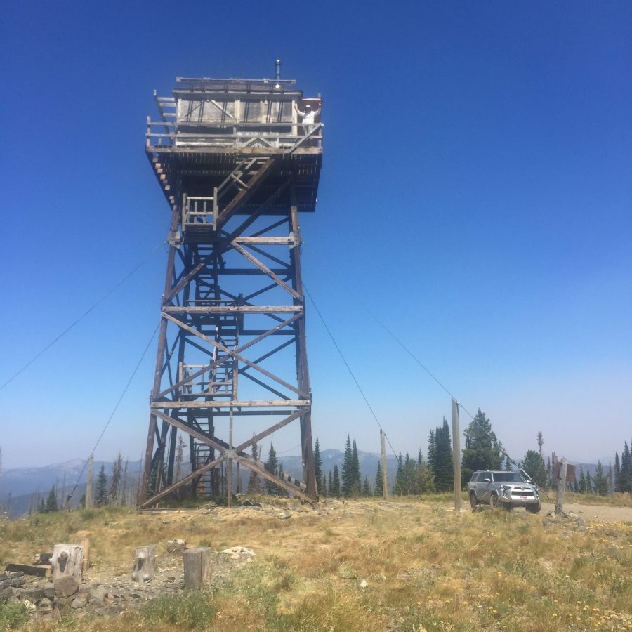
(47.5) Salmon Mountain Lookout Trail/FST-705 (8,030 feet). A wide spot in the road provides parking for 3-4 vehicles. The trail to the lookout is 1.3 miles and gains just under 700 feet in elevation. See the Salmon Mountain page for additional details.
The Northeast Face of Salmon Mountain.
(50.2) Observation Point/Campground (7,620 feet). There are several camping spots and great views of the Bitterroot Mountains to the east.
(51.6) Magruder Saddle (7,055 feet). In my opinion, this is a better starting point for climbing Magruder Mountain than originally reported in the book on Page 73 because it is 500 feet higher and is much closer to the summit than the Magruder Mountain trailhead.
(52.6) Trailhead for the Magruder Mountain Trail/FST-007 (6,552 feet). This trailhead has limited off-road parking.
The remainder of the road weaves in and out of drainages and their associated saddles (Kim Creek Saddle and Haystack Saddle) before arriving at a the Selway River and FS-6223 at 61.6 miles. The primitive road ends at this point and improved roads take you upstream along the Selway River and then over Nez Perce Pass and to US-93.
If you are still up for remote country, you can follow FS-6223 downstream along the Selway River to Paradise. You will find 3 campgrounds along the road and several trailheads.