Devils Bedstead West

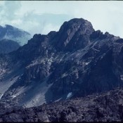
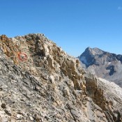
Climbing and access information for this peak is on Page 244 of the book. Pat McGrane’s Wildhorse Classics Guide is the definitive reference for technical climbing routes on Devils Bedstead West. The standard route up this beautiful mountain is the West Ridge. The saddle at the bottom of the West Ridge can be reached from Kane Creek but the easiest … Continue reading

USGS Peak

Climbing and access information for this peak is on Page 284 of the book. Livingston Douglas has provided detailed route information (below) for his first recorded ascent of the Upper Cedar Creek/Southwest Couloir.  USGS Peak, unofficially named in honor of all USGS surveyors, is a mighty peak protected on all sides by steep walls and in many places by towering … Continue reading

Peak 10744 (Gilmore East)

Gilmore East viewed from Gilmore Peak. John Platt Photo

This peak is not in the book. It is the east summit of officially-named Gilmore Peak. Based on my visual observation, I believed there was a 50/50 chance that it is actually the highest point on the Gilmore Peak massif. My observation was recently confirmed by LiDAR measurements. Gilmore Peak is discussed on Page 304 of the book. Updated December … Continue reading

He Devil

Climbing and access information for this peak is on Pages 99-100 of the book. The latest official elevation for this peak is 9,420 feet which replaces the prior 9,393-foot measurement. As you will read below, there is a question about whether He Devil or She Devil is the highest peak in the Seven Devils Mountains. Both peaks now have official … Continue reading

Monument Peak 8940

Climbing and access information for this peak is on Page 103 of the book. Since I published the book, I have climbed the peak via a new route, descended the route in the book and heard from other climbers about their experiences on the route in the book. So please read below for more details. Advanced route-finding skills are essential … Continue reading

SEVEN DEVILS MOUNTAINS

The Seven Devils Mountains extend along the Idaho/Oregon border for roughly 40 miles between the towns of Whitebird and Council. They are bounded by the Snake River on the west and the Salmon and Little Salmon Rivers on the east. The range, which ranks high among Idaho’s mountain chains in terms of ruggedness and scenic quality, is the state’s most … Continue reading