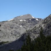
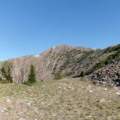
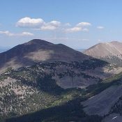
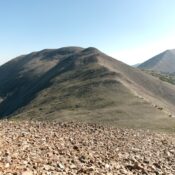
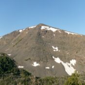
The Tusk by Ray Brooks

This formation is not in the book. The Tusk is an enticing spire, located just south of Elephants Perch. I climbed it twice back in the mid-1970’s. I think these photos were taken on my second climb of it, in 1975 with Harry Bowron & Chris Puchner. I had climbed it a few years earlier with Harry Bowron. USGS Mount … Continue reading

Peak 10202

Peak 10202 viewed from the south. John Platt Photo

This peak is not in the book. Peak 10202 is located due east of Massacre Mountain and north of Pass Creek Road. Seldom visited, John Platt and Dave Pahlas climbed the peak and suggested the name “Little Lost Peak.” Use the links below to read their trip reports. USGS Massacre Mountain Access and Route The easiest, but not necessarily easy, … Continue reading

Peak 10648

Peak 10648 viewed from the southeast ridge of Ferguson Peak blends in to Massacre Mountain.

This peak is not in the book. There are 16 ranked summits on the Massacre Mountain quadrangle. Peak 10648 may be the least known of the bunch. It is located above Long Lost Creek, due west of Massacre Mountain, and south of Ferguson Peak. Rick Baugher is probably the first person to climb this peak. USGS Massacre Mountain Access This … Continue reading

Peak 10100 (Petes Peak)

This peak is not in the book. Livingston Douglas tracked down the history for this entry. Peak 10100 is located two miles northeast of Wright Peak and just over 0.5 miles due east of Point 10116. Michael Darcy made the first recorded ascent of the peak on September 3, 2011. Michael suggested naming the peak “Petes Peak.” He ascended the … Continue reading

Gallagher Peak

Gallagher Peak. John Platt Photo

This peak is not in the book. Updated April 2020 Gallagher Peak is located in the southwest corner of the Salmon River Mountains, just north of the South Fork Payette River. John Platt first pointed this peak out to me, noting it was a great early season destination. He said this peak, which he has climbed three times, is a … Continue reading

Teapot Mountain

Teapot Mountain. John Platt Photo

This peak is not in the book. Teapot Mountain is located north of Warm Lake and just west of the South Fork Salmon River. John Platt and John Fadgen climbed the peak in January 2018 starting at the Buckhorn Creek Trailhead on South Fork Road. They made a loop over the summit which covered 5.9 miles with 1,877 feet of … Continue reading