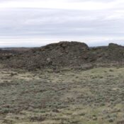
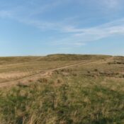
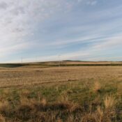
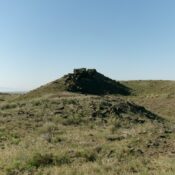
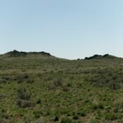
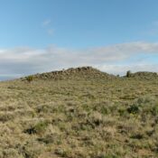
Peak 8763 by Livingston Douglas

This peak is not in the book. Published February 2025 Peak 8763 is a rather insignificant ridgeline hump that is overshadowed by Johnstone Peak (9,949 feet) to its northeast. Indeed, it is just a ridge hump (albeit a ranked one) on the long southwest ridge of Johnstone Peak. Peak 8763 is most easily climbed from the Parker Gulch Trail to … Continue reading

Striped Peak by Livingston Douglas

This peak is not in the book. The elevation is based on LiDAR measurements. The map elevation is 10,601 feet. Published December 2024 Striped Peak is a rocky bump high on the east ridge of Shril Benchmark. It sits on a ridge corner where the south ridge of Shril Benchmark descends to the valley floor. USGS Eightmile Canyon Access Same … Continue reading

Peak 9121 by Livingston Douglas

This peak is not in the book. The elevation is based on LiDAR measurements. The map elevation is 9,108 feet. Updated October 2025 Peak 9121 is an unranked bump on the southwest ridge of Peak 9625. It is most easily climbed in combination with Peak 9625 or directly from Pierce Canyon Road to its west. USGS Copper Mountain Access From … Continue reading

Reno Point by Livingston Douglas

This peak is not in the book. Updated October 2025 Reno Point sits at the southern tip of the Beaverhead Mountains on the east side of the Birch Creek Valley. It is most easily climbed from a BLM spur road to its west. USGS Scott Butte Access From ID-28 just northwest of the [signed] northern boundary of INL land (at … Continue reading

Peak 8540

This peak is not in the book. Published December 2024 This rugged peak sits directly north of Joes Gap and White Mountain. It is west of Black Lake. USGS Purgatory Saddle Access Same as for White Mountain Routes The peak’s south ridge is probably a broken, talus Class 3 slog from Joes Gap. Steve Grantham climbed the peak from FST-218 … Continue reading