Peak 8260 (Hawk Peak) by Livingston Douglas

This peak is not in the book. The name was suggested by Rick Baugher. He explains this suggestion in the trip report linked below. Published October 2025 Peak 8260 is located about midway between Sal Mountain to the west and K Mountain to the east. It is most easily climbed from nearby FSR-041. USGS Sal Mountain Access From ID-28 in … Continue reading

Peak 8285 by Livingston Douglas

This peak is not in the book. The elevation and prominence figures are based on recent LiDAR updates. Published October 2025 Peak 8285 sits above the headwaters of both Withington Creek and Sevenmile Creek in the northern Lemhi Range. It is most easily climbed from an old jeep trail that comes up from a saddle on its north side. USGS … Continue reading

Peak 8069 by Livingston Douglas

This peak is not in the book. The elevation is based on recent LiDAR measurements. Published October 2025 Peak 8069 is the northernmost Lemhi peak that is located on the primary Lemhi Range Crest. It is most easily climbed from an old 2-track Forest Service road that leads up to a saddle on its south side. USGS Sal Mountain Access … Continue reading

Mill Benchmark by Livingston Douglas

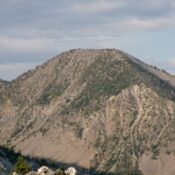
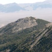
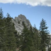
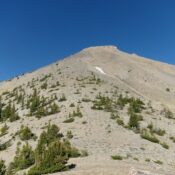
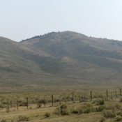
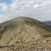
This peak is not in the book. Published October 2025 Mill Benchmark is a Lemhi foothill that separates Baker Creek from Mulkey Creek. Given the mix of private and public land in this area, this peak is best climbed from Withington Creek Road and its southwest ridge. USGS Sal Mountain Access Same as for Peak 7100. This is the second … Continue reading

Poison Peak by Livingston Douglas

Climbing and access information for this peak is on Page 296 of the book. Published October 2025 Poison Peak is a magnificent, rocky peak that is located east of the Salmon River and north of Poison Creek. It is most easily climbed from its southeast side. USGS Poison Peak Access Same as for Peak 8740 South. This is the third … Continue reading