Register Rock by Livingston Douglas

This peak is not in the book. Published October 2025 Register Rock is a perplexing objective. There is no rocky outcrop or obvious hump (as LOJ and the USGS topo map suggest). It seems like the high point is on minor ridge (with a fence row) on the southeast side of I-86, not too far above the highway. USGS Register … Continue reading
Massacre Rocks by Livingston Douglas

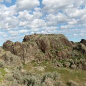
This butte is not in the book. Published October 2025 Massacre Rocks is a handsome, rocky set of outcrops located along I-86 and just south of Massacre Rocks State Park. The summit area is easily accessible from a side road on the southeast side of I-86. While LOJ shows Massacre Rocks on private land, it seems to be readily accessible … Continue reading

Ferry Butte by Livingston Douglas

This butte is not in the book. Published October 2025 Ferry Butte is a ranked summit that sits on the Fort Hall Indian Reservation. It is accessible from a public service road that leads to the antenna-clad summit. USGS Fort Hall Access From Exit 89 on I-15, drive south on US-91 for a few miles to a signed junction with … Continue reading

Raumaker Butte by Livingston Douglas

This butte is not in the book. Published October 2025 Raumaker Butte is located northeast of Hamer and I-15 in Jefferson County. This is an area of mostly farmland and is mostly private property. Raumaker Butte is surrounded by irrigated farmland and has a private residence on its summit hump. It is closed to the public. This page is for … Continue reading

Beacon Butte by Livingston Douglas

This butte is not in the book. Published October 2025 Beacon Butte is located northeast of Hamer and west of Raumaker Butte (5,039 feet) in Jefferson County. This is an area of mostly farmland and is mostly private property. Raumaker Butte is surrounded by irrigated farmland and is closed to the public. This page is for informational purposes only. USGS … Continue reading

Big Grassy Butte by Livingston Douglas

This butte is not in the book. Published October 2025 Big Grassy Butte sits between Little Grassy Butte (5,128 feet) and Gerber Butte (5,215 feet) in Fremont County. This is an area of mostly farmland and is mostly private property. Big Grassy Butte is surrounded by irrigated farmland and is closed to the public. This page is for informational purposes … Continue reading