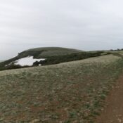
Antelope Butte by Livingston Douglas

This butte is not in the book. Published October 2025 Antelope Butte is a double-humped butte that is located in a remote area of the Snake River Plain, northwest of American Falls. It is easily reached on decent roads to within about a mile of the summit. USGS Sunset Lake Access From ID-39 about six miles west of Springfield and … Continue reading

Packsaddle Butte by Livingston Douglas

This butte is not in the book. Published October 2025 Packsaddle Butte is a minor, rocky outcrop in a desolate area of the Snake River Plain northwest of American Falls. It is easily reached on decent roads coming up from the American Falls area. It requires only a 10-minute scramble from a nearby 2-track road. USGS Split Top Access From … Continue reading

Clay Butte by Livingston Douglas

This butte is not in the book. Published October 2025 Clay Butte is a minor hump that sits above Mud Lake. It is in the Mud Lake Wilderness Study Area land and is open to the public, contrary to the LOJ land management map. Clay Butte can be easily reached on good BLM and State of Idaho roads in this … Continue reading

Lone Butte by Livingston Douglas

This butte is not in the book. Published October 2025 Lone Butte is a minor hump with two rocky outcrops as potential high points. It can easily be reached from I-15 north of Idaho Falls and south of the ID/MT state line. USGS Lone Butte Access From Exit 172 on I-15, cross to the west side of I-15 on an … Continue reading

Camas Butte by Livingston Douglas

This butte is not in the book. Published October 2025 Camas Butte is a gentle hump on the Snake River Plain due west of I-15. A good gravel 2-track road gets you pretty close to the summit area. This double-humped peak has two summits. Contrary to LOJ, the east summit is the high point (5,140+). USGS Cedar Butte Access Same … Continue reading