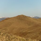
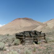
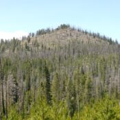
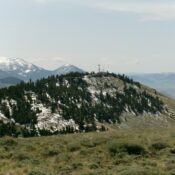
Peak 9965 by Livingston Douglas

This peak is not in the book. The map elevation is 9,961 feet. Published November 2024 Peak 9965 is one of several foothills on the southwest side of the Lost River Range. It is a ranked bump on the northwest ridge of Mount McCaleb (11,679 feet). Peak 9965 is most easily climbed from a gully on its south side. Most … Continue reading

Peak 7210 by Livingston Douglas

This peak is not in the book. Published November 2024 While not a ranked summit, Peak 7210 is a beautiful peak in the Arco Hills. Its northwest shoulder is a magnificent scramble and I highly recommend it. USGS Arco Hills Access From US-20 at the south end of Arco, turn right/east onto a paved side road (just north of Pickles … Continue reading

Peak 5681 by Livingston Douglas

This peak is not in the book. Published November 2024 Peak 5681 is the northernmost of the Howe Hills. Unlike the other Howe Hills, Peak 5681 is quite rugged and rocky on its eastern ramparts. It can be climbed with relative ease via its east gully and south ridge. USGS Howe Access From ID-33 in Howe, drive northwest on [paved] … Continue reading

Peak 5502 by Livingston Douglas

This peak is not in the book. Published November 2024 Peak 5502 is a hidden peak that is located northwest of Howe in the Howe Hills. It is easily reached on BLM land from the north. USGS Howe Access From ID-33 in Howe, drive northwest on [paved] Little Lost River Highway for 2.6 miles to a signed junction with 3720N … Continue reading

The Needles by Livingston Douglas

This formation is not in the book. Published November 2024 The Needles is a rocky outcrop that sits above the headwaters of Leadbelt Creek in the Pioneer Mountains. Its first recorded ascent was in 2024. Based on my visual observations, The Needles appears to be a Class 5 endeavor. It is most easily climbed from Leadbelt Creek Road. USGS Blizzard … Continue reading

Cold Benchmark by Livingston Douglas

This peak is not in the book. Published November 2024 Cold Benchmark is the high point on a lengthy ridge that separates Dry Fork Creek from Cold Spring Canyon in the Pioneer Mountains. It is most easily climbed from Leadbelt Creek Road to its northwest. An old mining road leads up to its north ridge. Cold Benchmark has a whopping … Continue reading