Peak 10474 (Little Inyo)

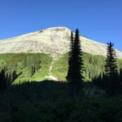
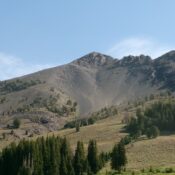
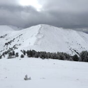
This peak is not in the book. The elevation and prominence figures are based on recent LiDAR updates. The USGS quad shows an elevation of 10,472 feet. Published November 2025 This peak sits west of the main Lemhi Crest on a subsidiary ridge that runs from Basin Peak in the north to Inyo Benchmark in the south. Little Inyo sits … Continue reading

Peak 6290 (Beehive Dome)

This peak is not in the book. Published November 2025 This peak sits northeast of Twin Peaks and Beehive Lake on a ridge that extends east from the main Selkirk Crest. USGS The Wigwams Access Use the link below for the Inland NW Routes website to access the southern side of this peak. … Continue reading

Peak 10009 (Red Sentinel)

This peak is discussed on pages 170-171 of the book. There are two errors in the book. First, this peak is NOT also known as Flatrock Needle. Second, the route description in the book is for Flatrock Needle, which is a formation located southeast of the summit at roughly 9,060 feet. I am responsible for these errors. The name “Red … Continue reading

Peak 10940 by Livingston Douglas

Climbing and access information for this peak (shown as Peak 10920) is on Page 257 of the book. When LiDAR updates become available, it is likely that neither of these elevation figures will be correct. Published November 2025 Peak 10940 is the high point on a rugged, rocky ridgeline that sits on the west side of Brockie Lake in the … Continue reading