ARTICLE INDEX
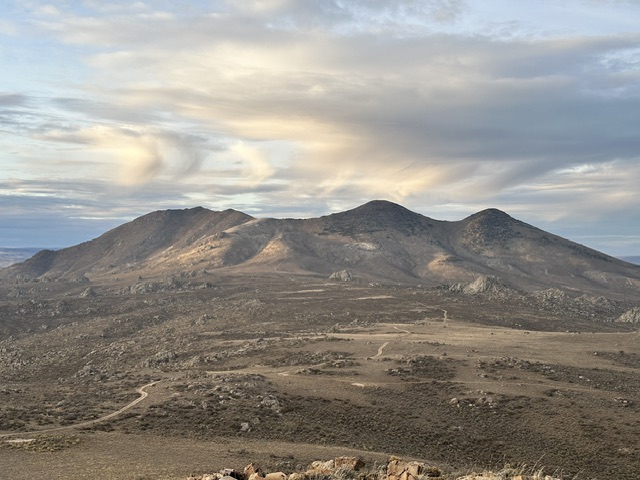
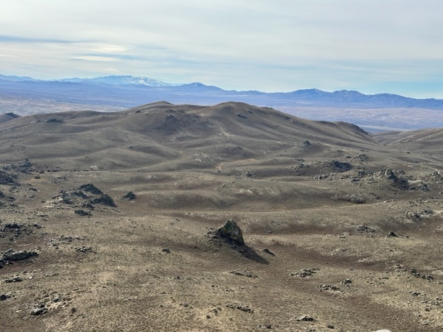
Elko County’s Granite Range is located east of US-93 just south of the Idaho Nevada border. This compact range runs from north to south for 18 miles. It is 9 miles wide at its widest point. Geologically the range is made up of granite and granite outcroppings, domes and towers are found throughout the range. I first drove by the range in 1974 but did not start exploring the area until 2014. Every trip I made to this range was in the month of November
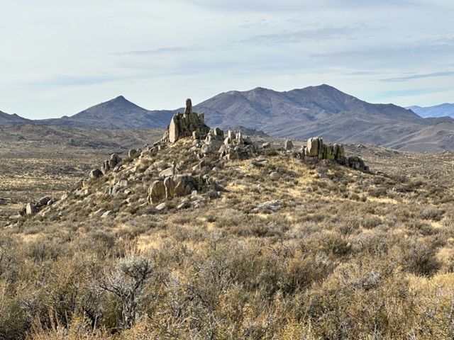
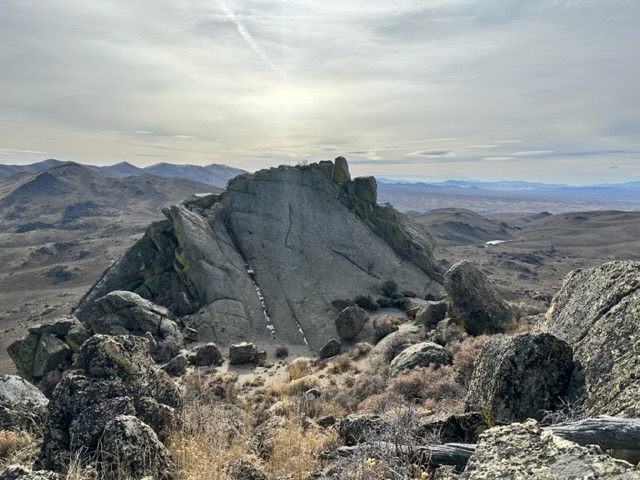
One of many granite formations along the Granite Range crest.
To say the range is unknown to all but a few local ranchers and maybe hunters would be an understatement. Wikipedia has this to say about the range “The Granite Range is a mountain range in Elko County, Nevada.’’ That is it. A Google search for information on the range’s geology and it’s history was equally futile. Even finding information on the few mining remnants scattered about the range turned up nothing useful.
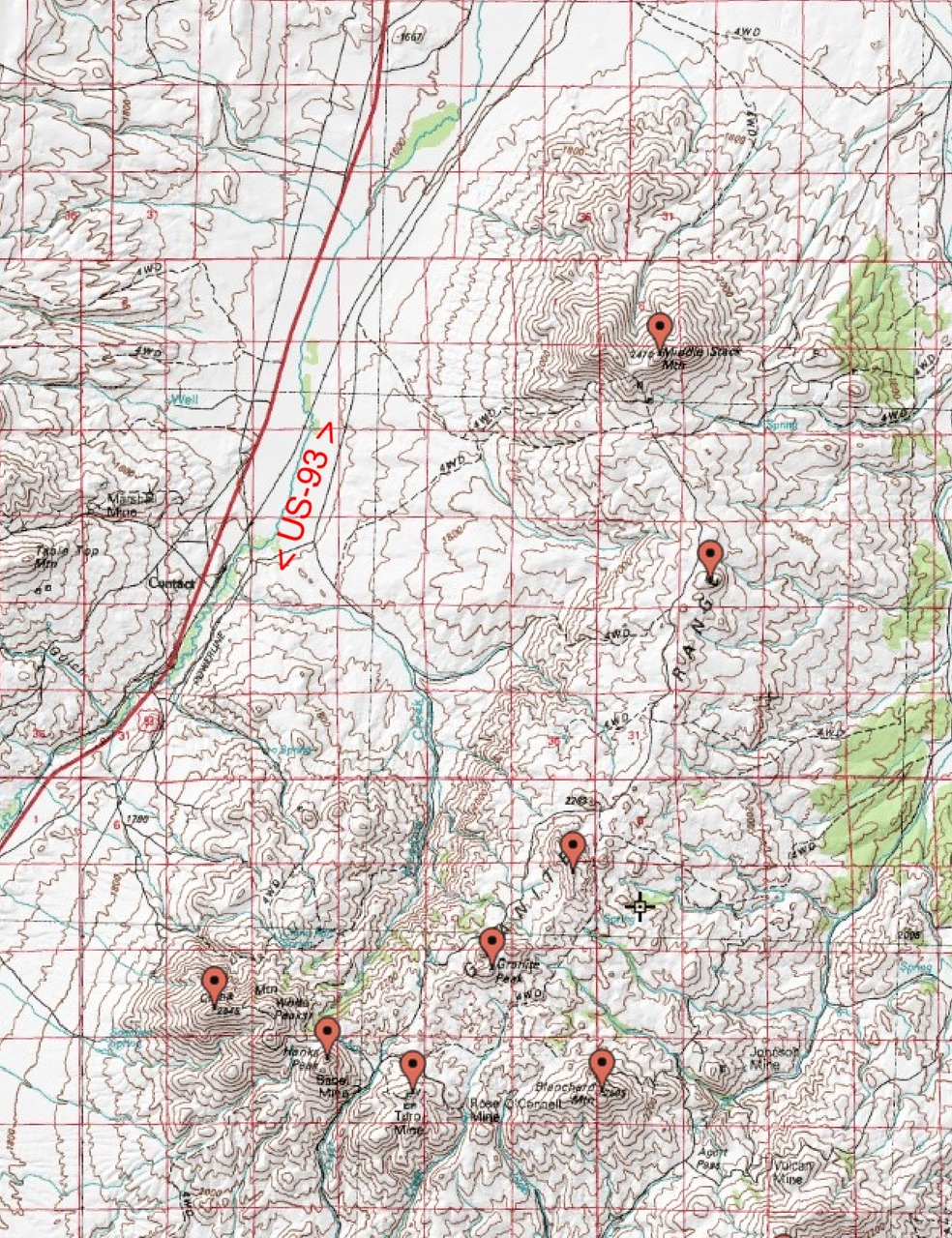
Granite Range, NV
The range is high desert terrain. There are a few cattle troughs filled with filthy water along the crest but no reliable natural water sources. Be prepared for difficult and sometimes treacherous travel conditions including bad and/or impassable roads, heat, rattlesnakes and every other conceivable hazard found in desert terrain. Take a 4WD vehicle with good all-terrain tires (6 or more ply sidewalls). There was cell phone coverage throughout the range for the most part. Don’t expect anyone to find you if you get stuck or your battery goes dead. A shovel is a necessity and chains are essential in wet weather.
Access
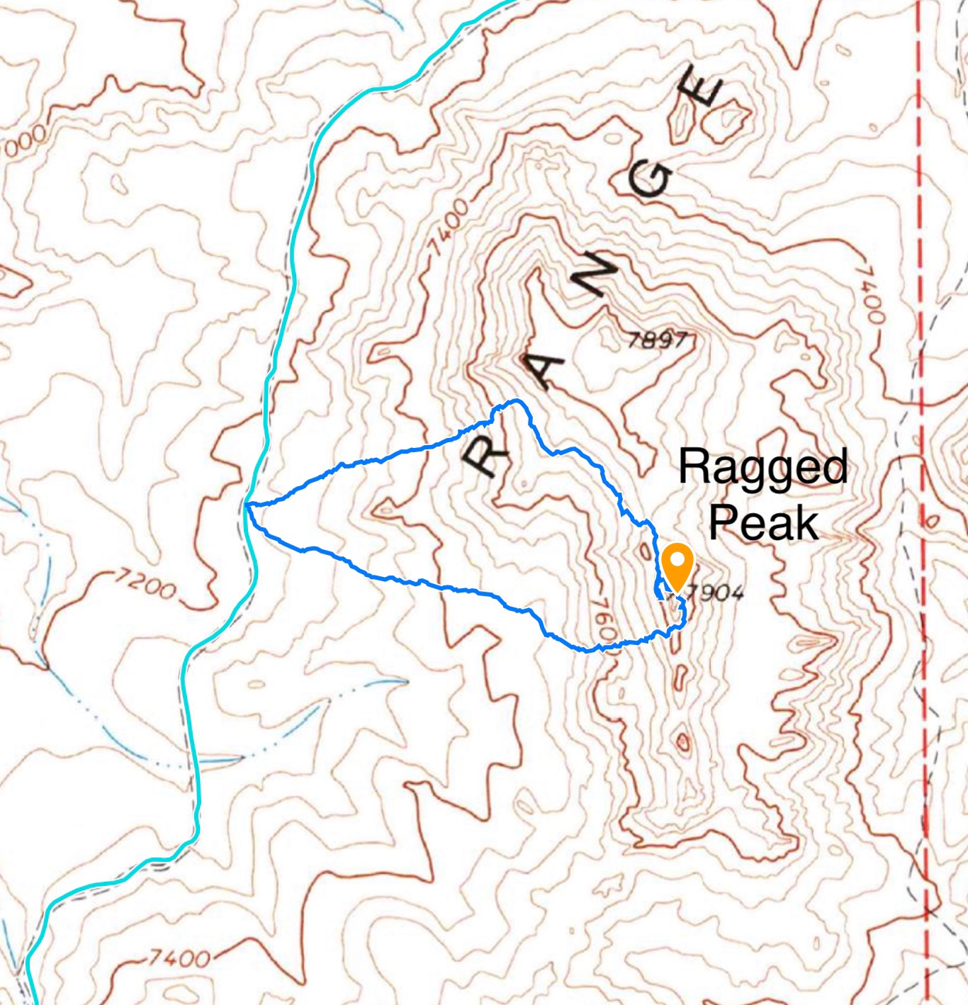
Primary access is from US-93 south of Jackpot, Nevada. The two major access points off of US-93 are the Delaphain Road in the north and the Knoll Creek Road in the south. Either of these roads will provide you access to the Granite Range Crest Road. The Granite Range Crest Road provides good access to all of the range’s peaks except Blanchard Mountain.
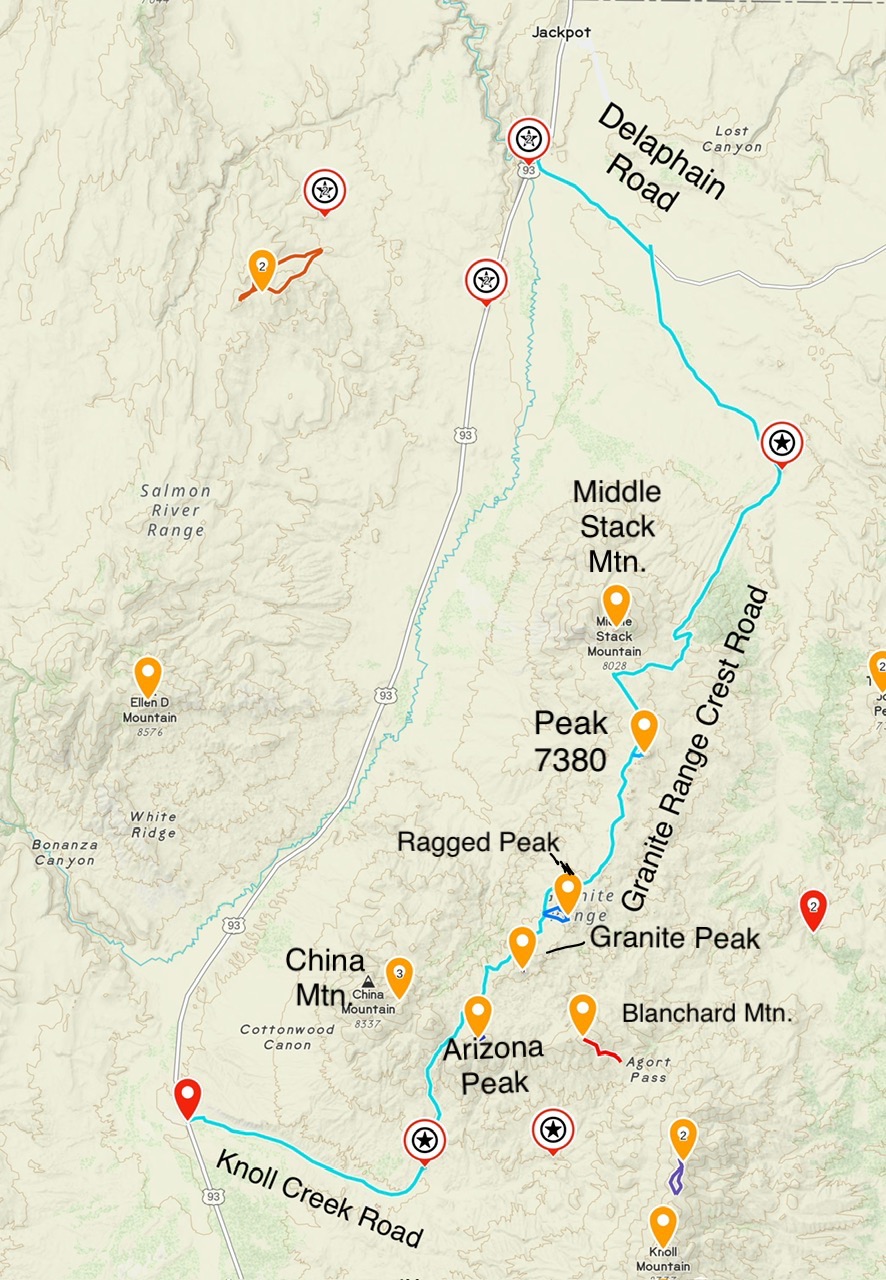
Granite Range Crest Road Access Overview
Northern Access to the Granite Range Crest Road
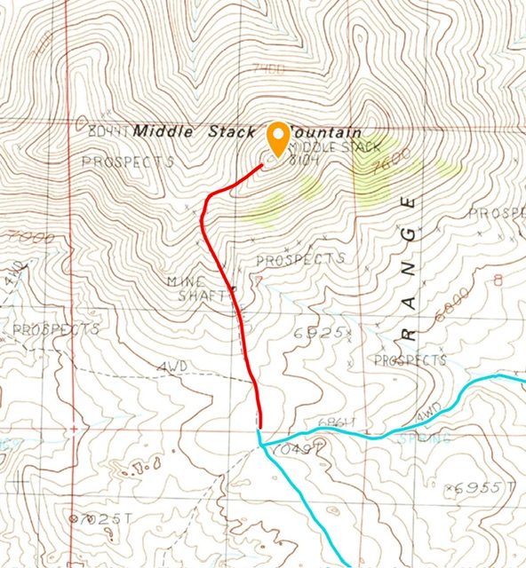
Follow US-93 south from Jackpot for 2.5 miles to the signed turn for the Delaphain Road. Turn right/east and follow this good gravel road for 3.4 miles to an unmarked junction. Turn right and follow this occasionally maintained road for 5.6 miles to an unmarked junction. Turn right and follow this rough road for 6.8 miles to the Granite Range crest south of Middle Stack Mountain. A high clearance vehicle is recommended for this road.
The Granite Range Crest Road —North to South
This road requires a 4WD with off road capable tires and an experienced driver. The mileages listed below are from north to south.
- 0.0 Middle Stack Mountain Access
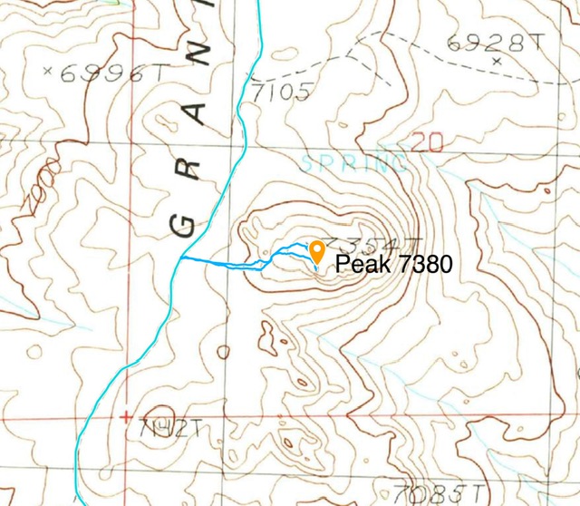
- 1.9 Peak 7380 Access
- 6.5 Ragged Peak Access
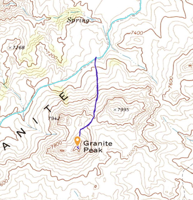
- 7.2 Granite Peak Access
- 9.8 China Mountain Access. The crest road north of this junction is located east of where it is shown on the USGS topo map. Thus, the mileage for this junction may be a bit off.
- 13.3 Knoll Creek Road (turn right/west to reach US-93).
- 18.8 US-93
Southern Access to the Granite Range Crest Road
Follow US-93 south from Jackpot for 25 miles to the unsigned junction for the Knoll Creek Road. Turn left/east and follow this road for 5.7 miles to an unsigned junction for the southern terminus of the Granite Range Crest Road. The road crosses through two gates. Make sure you close them after you pass through.
Blanchard Mountain Access
The most efficient access to Blanchard Mountain is via US-93 and the Southern Access using the Knoll Creek Road.
- 0.0 US-93
- 5.5 Granite Range Crest Road. Keep on the Knoll Creek Road which will eventually turn north and lead you to Argot Pass. A high clearance vehicle is recommended for the Knoll Creek Road.
- 11.3 Argot Pass. Turn onto the two track that leads west up the lower slopes of Blanchard Mountain for 0.4 miles. A two track leads north west from the pass toward Blanchard Mountain. A 4WD is recommended for the two track/
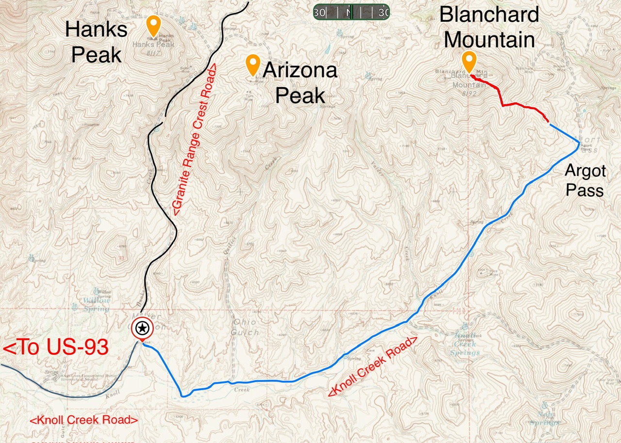
Access to Blanchard Mountain.
Peaks from North to South
There are nine ranked summits in the range and two unranked peaks. Additionally, there are numerous other granitic towers that would make for interesting climbing. All of the peaks with the exception of Blanchard Mountain are accessible from the Granite Range Crest Road.
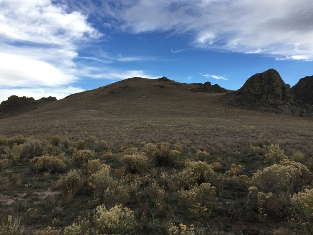
Middle Stack Mountain, 8,104’, prominence 1,124’, Class 2
Middle Stack Mountain has a long summit ridge which runs from east to west including three large humps that evidently looked like haystacks to someone. The origin of the name is unknown. According to the Board of Geographic Names the source of the name was a Rand McNally and Co. ‘Pocket Map and Shippers Guide of Nevada’, published in 1901.
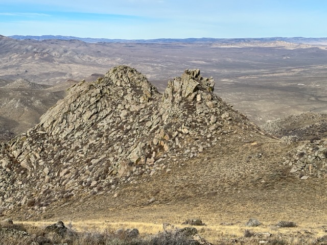
Middle Stack Mountain viewed from the south.
A steep 4WD road climbs up the south face of Middle Stack Peak to the saddle between the summit and point 8044. Turning around on the last 600 feet of the ascent would be problematic as would backing down. John Platt and I walked the road. Once we reached the saddle it was an easy climb with just over 300 feet of elevation gain to the summit.
Links: Peakbagger, Lists of John
Peak 7380, 7,380’, prominence 320, Class 2
John and I climbed this peak as the day was waning. It is an easy walk from the Granite Range Crest Road. The highest point is a rocky outcrop that is located just south of the grass covered hump that summit imitates the highest point. This isn’t a challenging peak but the views of the surrounding country are expansive.
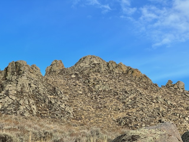
Peak 7380 viewed from the Granite Range Crest Road.
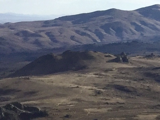
Peak 7380 viewed from Middle Stack Mountain.
This is by far the easiest ranked peak in the Granite Range. My GPS device measured this route as 0.6 miles with a massive 180 feet of elevation gain round trip.
Links: Peakbagger, Lists of John
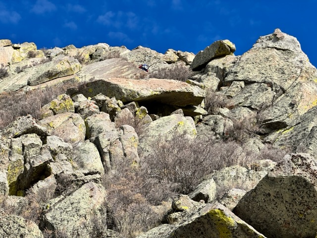
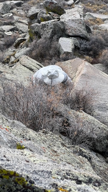
Peak 7904 (Ragged Mountain), 7,904’, prominence 364’
This granite encrusted peak has two summits of nearly equal height. Steve Grantham and I intended to climb both the higher southern summit as well as the northern summit. However, the November day was short and we still had to drive back to Boise. So, part way to the northern summit we changed course and headed for the true summit. The closer we got the more perplexing the mountain became. Upon reaching the northern base of the west face we questioned whether we could find a nontechnical line up the peak.
The west face of Ragged Peak viewed from the west.
West Face, Class 4
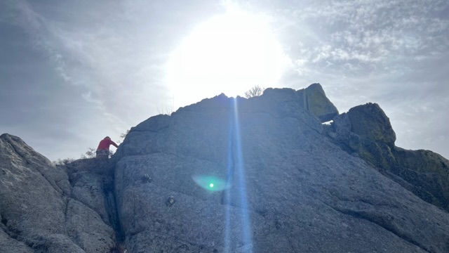
We split up. Steve climbed up through large granite boulders surrounded by thick brush and I continued along the base. My efforts proved fruitless as every potential line ended in vertical walls. I did see what looked like a potential line cutting up through the slabs from south to north. It also looked like a technical line. I yelled for Steve. A minute later I spotted him at the base of the crack I thought might work. He quickly informed me it was an open book climbing at 45 degrees to a point just below the summit. He reported “I think we can climb this. I’m not sure I want to down climb it.” I told him I would join him and started traversing back across the base of the face. As I started up the boulders and the interspersed brush I heard a whoop. Steve was on top. I soon reached the base of the open book.
Looking up the west face. The route climbs from bottom center to the right. Steve is starting up the open book.
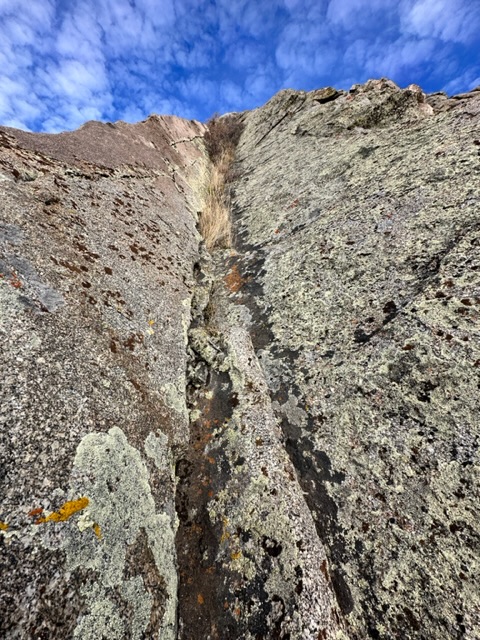
Looking up the open book.
In this photo I am at the top of the open book staring into the bush that capped it. Steve Grantham Photo
I asked Steve what he thought about the climb. He simply reaffirmed that he didn’t know if he wanted to down climb it. I asked if he saw another way down. He responded “maybe.” Well, I thought, “maybe” is better than “no.” And, not yet having climbed the open book I thought if I can get up it I can get down it. After all it was more like a steep playground slide than a vertical climb. Up, I climbed using small holds on my right and the small crack in the bottom of the open book. At the top a bush capped off the top. It was the only real obstacle encounter. Once past the bush it was a hop, skip and a jump to the summit.
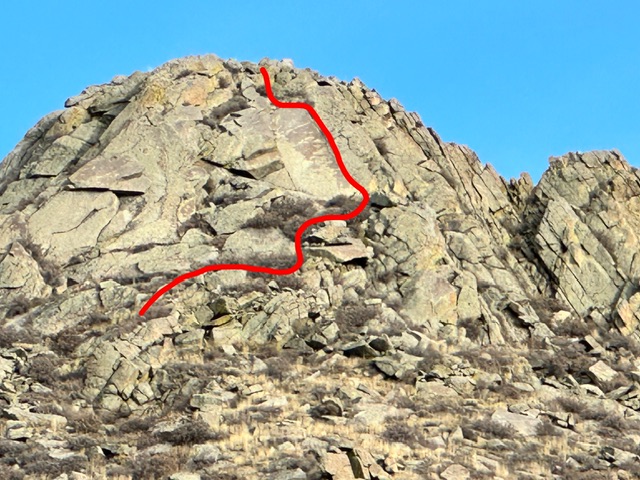
This photo shows our line up the face.
‘Rating a route Class 4 is always subject to criticism. In California the open book would no doubt be rated Class 3. I tend to use the following definition from the Mountaineers book Fredom of the Hills;
- “CLASS 4 Belayed climbing. These routes involve climbing that may be no more difficult than Class 3 climbing, but does subject the climber to increased exposure where a fall will likely cause serious injury. Training and proper equipment is essential.”
So, what ever you want to rate it, falling down the open book was “likely to cause serious injury.”
On top there was no evidence anyone had visited that lofty spot. The mountain dropped off precipitously in every direction. So, we decided to name the peak after its many ragged tower, cliffs and slabs, Ragged Peak. Once on top, you still have to get down. We debated down climbing the open book.
South Ridge, Class 3+
The narrow summit dropped off precipitously on its east side in a series of large blocks which formed a staircase for a giant. We looked down both the east and the south sides which dropped off so steeply that we could not see farther than the top of the next step. Steve suggested we descend to the south. As we dropped down each step, the route to the next step revealed itself. After four steps we reached the crux which was a couple of vertical granite blocks about 10 or 12 feet high split by an awkward v-shaped crack. Both of us managed to wedge our right boot in the crack but otherwise the descent off the summit was uneventful. We continued traversing the base of the east ridge wall to the first break and then descended to Steve’s truck.
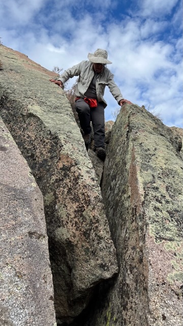
The crux move descending the south ridge. Steve Grantham Photo
Our route covered 1.4 miles with 545 feet of elevation gain.
Links: Peakbagger, Lists of John
Granite Peak, 8,060’, prominence 640’, Class 3
Granite Peak has two summits and a nice assortment of granite towers on its flanks. The summit is not visible from the Granite Range Crest Road. The USGS topo does not do this peak justice. While the topo shows a singular summit structure there are actually two potential high points separated by a hundred feet or so nestled in the final contour line. The easternmost is the highest point on the mountain.
The highest point of Granite Peak.
We hiked to the saddle separating the two summits then hiked southwest under a broken tower to the base of the peak’s north ridge.
Two of the granite towers that are passed on the way to the summit.
Climb the summit block on its left side.
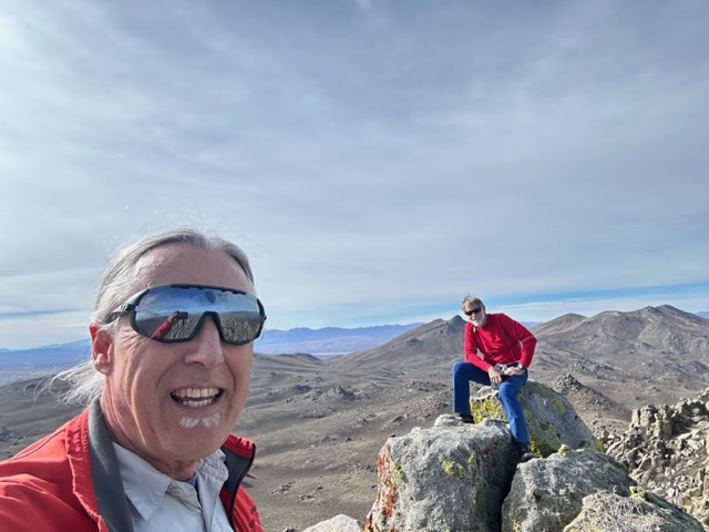
On the summit.
Links: Peakbagger, Lists of John
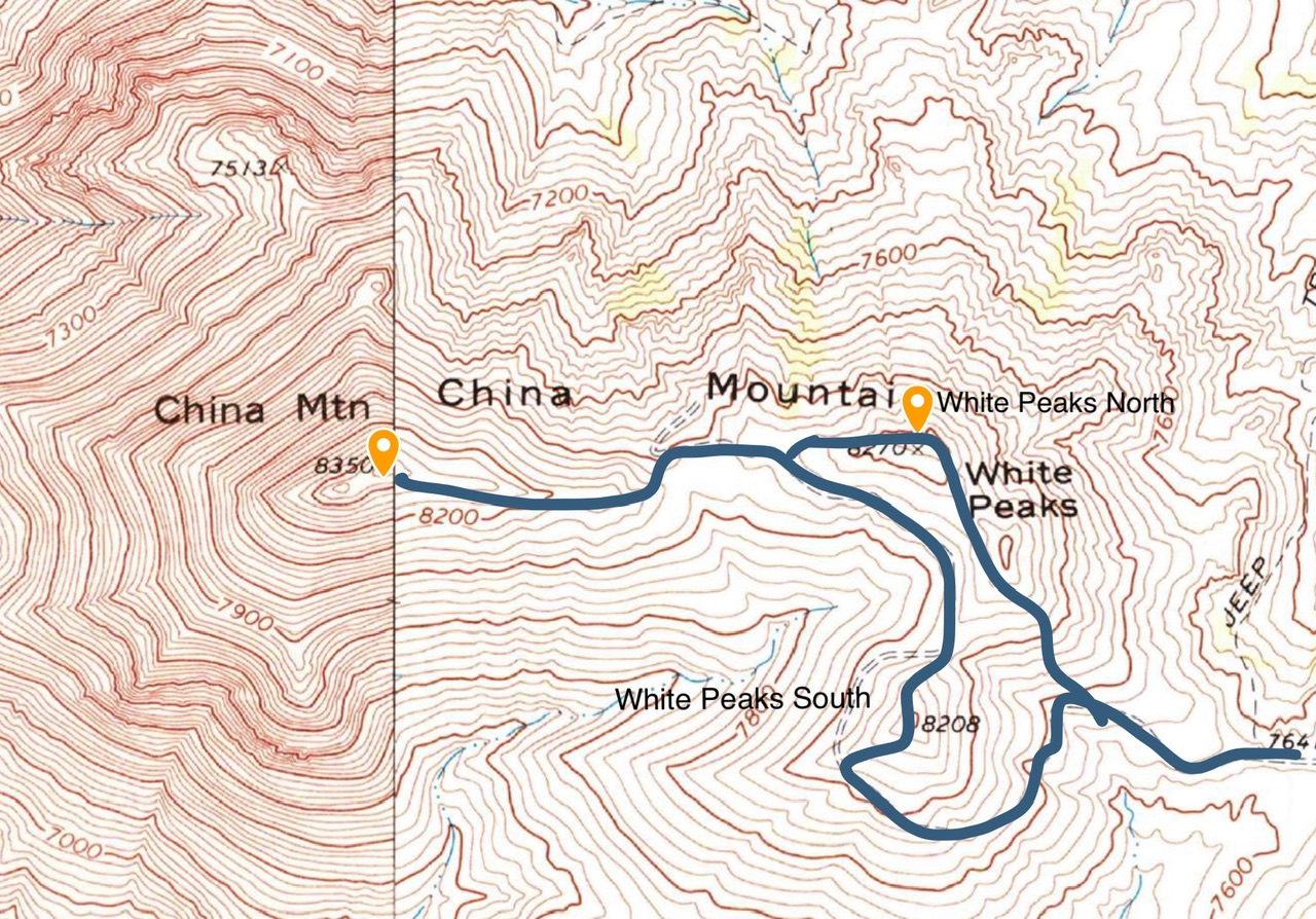
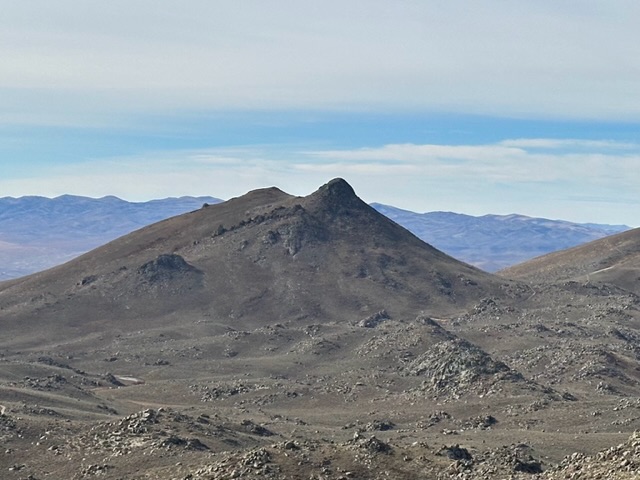
China Mountain 8,350’, prominence 1,490’, Class 2
China Mountain dominated the south end of the Granite Range. As you approach the range along US-93 from the south the highway passes between China Mountain and Ellen D Mountain. China Mountain is towers over the highway.
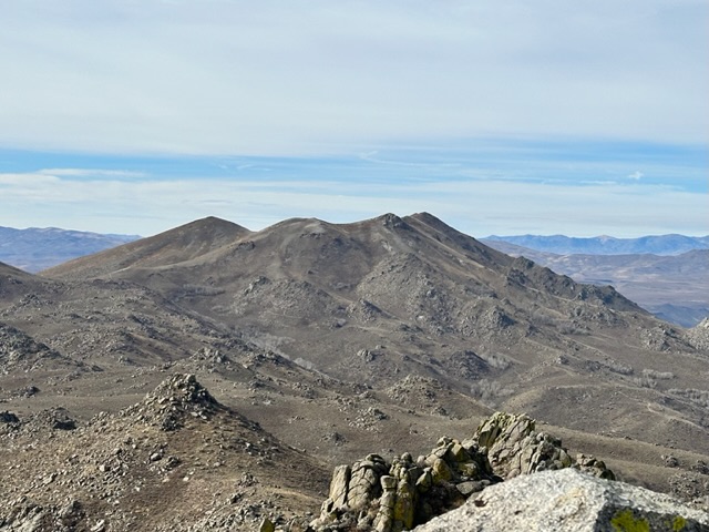
China Mountain is the highest point on the right. The two points on the left side are White Peaks South and White Peaks North as viewed from Granite Peak.
East Ridge, Class 2
I climbed China Mountain on November 28, 2014 with Dan Paulson. We approached the peak via the southern end of the Granite Range Crest Road. We parked after the road became icy in Hanks Creek Canyon at roughly 7,200 feet. We continued up the road to its junction with the China Mountain Road. We followed that road to the peak’s east ridge and then hiked up the ridge to the summit. We climbed unranked White Peaks South on the way to China’s summit and unranked White Peaks North on our way down.
The side road to China Mountain from the Granite Range Crest Road is a two track which was in fair condition in 2014.
China Mountain viewed from the east.
I did not have a GPS device in 2014 so this route is drawn from memory. This is wide open country and the route is easy to follow.
Links: Peakbagger, Lists of John
White Peaks North, 8,270’, prominence 210’ and
White Peaks South, 8,220’, prominence 80’
Both these peaks are unranked and are easy walks across moderate sagebrush and grass covered slopes from the road leading to China Mountain. See the map above.
Links: Peakbagger, Lists of John
Links: Peakbagger, Lists of John
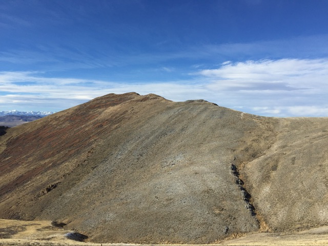
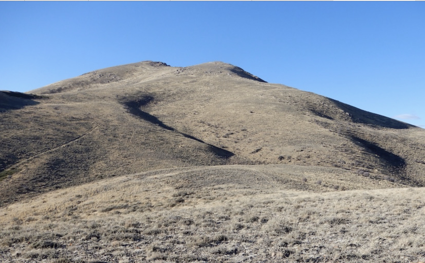
Hanks Peak, 8236’, prominence 616’
Dan Paulson and I traversed Hanks Peak after returning from China Mountain. We ascended the west face from the China Mountain Road. This route is brushy in places and has a short section of Class 3 climbing at the end. We were surprised to find a climber on the summit. He wasn’t very talkative but he did tell us was on his way home to southern California from Montana. He parked along US-93 and started hiking and ended up on Hanks Peak. We descended the east face back to the China Mountain Road near its junction with the Granite Range Crest Road. This was all Class 2 terrain.
Hanks Peak viewed from Granite Peak.
West Face, Class 3
Dan and I traversed over Hanks Peak from west to east. Leave the China Mountain Road at roughly the point 7641 on the USGS topo and climb southeast to the summit. The route is brushy at first. The only Class 3 climbing is at the very top.
East Face, Class 2
The descent down the east side of the peak has a few steep loose sections but is an easy walk.
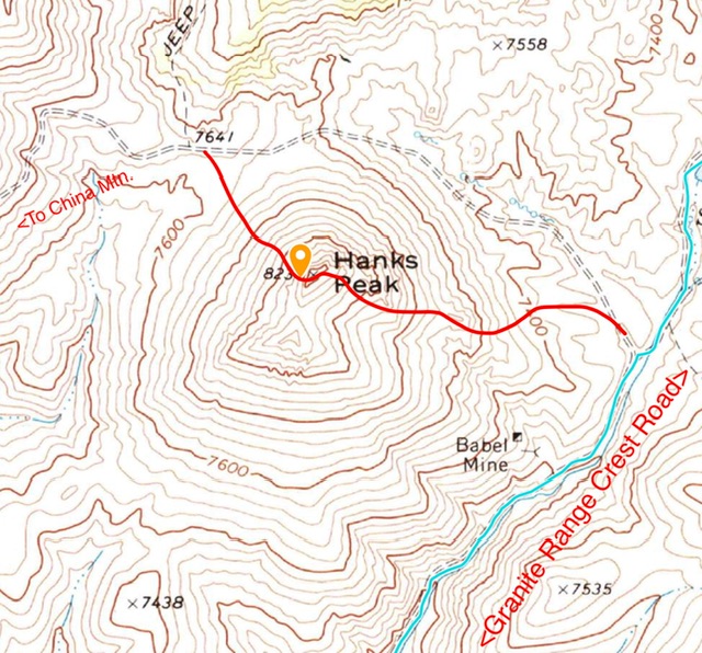
I climbed this peak before I owned a GPS device. This map shows the route Dan and I took while traversing Hanks Peak.
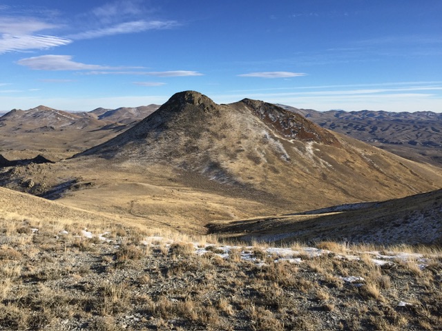
Hanks Peak viewed from China Mountain.
Links: Peakbagger, Lists of John
Peak 7850 (Arizona Peak), 7,850’, prominence 400’
This two-summited, treeless hump is an easy walk from the saddle between its lower eastern summit and the higher western true summit. The road to tue saddle requires a 4WD.
Arizona Peak viewed from Granite Peak.
Northeast Ridge, Class 2
The Granite Range Crest Road is not where it is shown on the USGS topo map. It is located east of its mapped location. Nevertheless, route finding is not difficult. Drive to the saddle and ascend the peak’s northeast ridge to the summit.
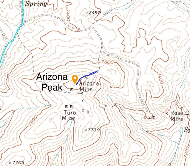
The round trip from the saddle to the summit is only 0.3 miles and gains only 124 feet.
Links: Peakbagger, Lists of John
Blanchard Mountain, 8,218’ prominence 798’
Blanchard Mountain viewed from the east.
East Slopes, Class 2
John Platt and I climbed Blanchard Mountain, 8,218 feet on November 16, 2018. Blanchard Mountain is a straight forward climb via its eastern slopes. The climb covered 2.0 miles with 1,098 feet of elevation gain round trip.
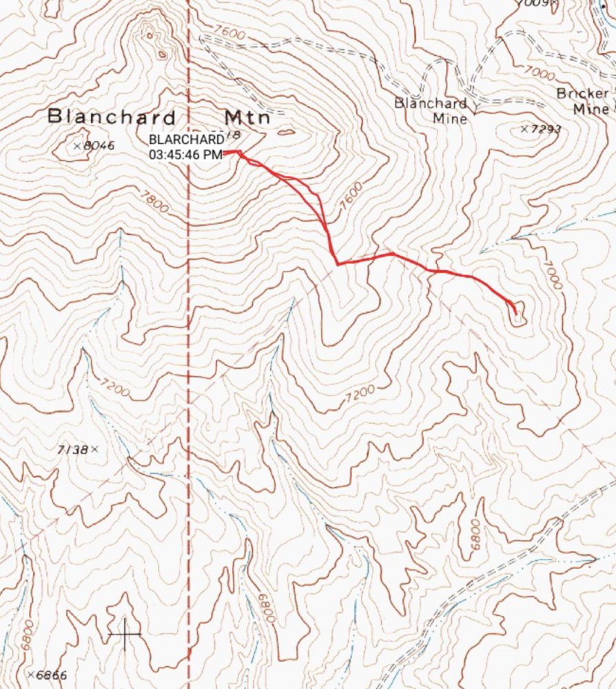
Blanchard Mountain. We were able to follow an unmapped 4WD road toward the summit.
Links: Peakbagger, Lists of John
Favorite Climbs Part One
ARTICLE INDEX