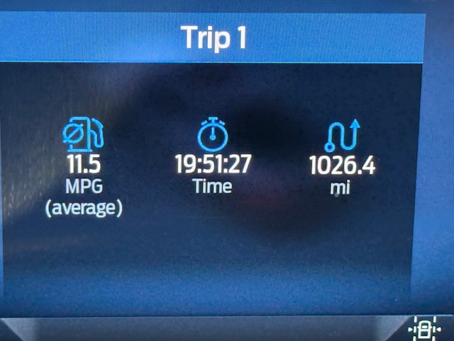
 Call me crazy. After watching a YouTube video I decided it would be a good idea to drive more than 3,000 miles to the Arctic Ocean. Laurie was profetic when she said “once you get there you still have to return.” As planned the trip would have traversed Idaho, Washington, British Columbia, the Yukon and the Northwest Territories. In the end we made it 2500 of those miles reaching Tombstone Territorial Park in the Yukon. A combination of fires along the Dempster highway, mechanical problems, and driving fatigue made the decision to turn around short of our goal easy. I totally under estimated the immensity of Canada.
I can sum up the Canadian portion of the trip briefly: Endless forests of fir and aspens, rivers that make Idaho’s Snake River look like a creek, lakes large and small and mountains of every shape and description. Did I mention endless forests? And the fauna—black and grizzly bears, caribou, elk, fox and bison. Massive fire scars and new fires popping up everywhere. Yet these huge fire scars were minuscule in this massive country. Did I mention forests that stretched on to eternity or the cool temperatures or the daylight that lasts 24 hours a day? And rain, cooling rain every day. The driving seemed endless as we drove the Alaskan, the Yukon, the Dempster and the Stewart Cassiar Highways. 100 hours of driving and 5,000 miles in 15 days. What we saw and did was only an hors d’oeuvre of this great land. The main course is still waiting for us.
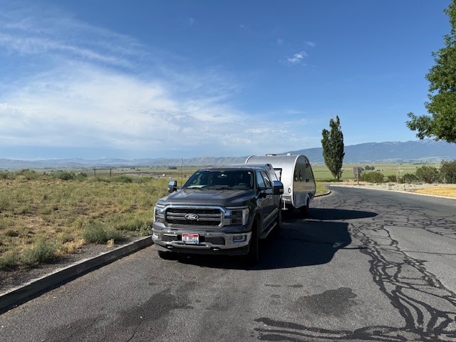
7/1: Boise to Oroville, WA.
Oroville is a pleasant town on the Washington/British Columbia border. The elevation is only 948 feet. It is a hot, dry place in the summer and the center of a fertile river bottom full of fruit orchards.
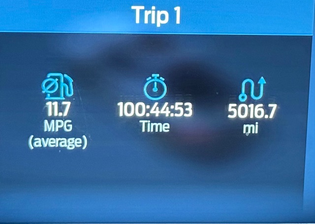
Three hours into our 100 hours of driving odyssey. The I-84 rest area west of Baker, Oregon
The River Oaks RV Park in Oroville was a nice, quiet place to stop on the shores of the Similkameen River. The temperature was nearly 100 degrees when we arrived. The drive from Boise took over 8 hours. It was one long day to begin the trip.
River Oaks RV Park Oroville, Washington
7/2: Oroville to Prince George, BC
We entered Canada at 7 AM and made the 470 mile drive to Prince George, Laurie recounts “when we cross the border into Canada we were mildly concerned about protocol. The man at the station said in response to a question that Tom asked “Here, I am the one who asked the questions.”
British Columbia is a massive province and larger than every USA state but Alaska. Southern BC is composed of steep, dry mountains with deep river valleys and many fruit orchards. As we drew closer to Prince George the land was higher and greener. With the exception of Highway 5C the roads were great, the traffic was moderate. Only Google Maps knows why were directed onto 5C, a backroad rather than the main highway. We stopped in Merritt, BC which was an interesting place much like a 1960s USA city. Fairly strong rain storm hit us as we near Prince George 1005 miles from Boise
The Washington British Columbia border area is characterized by steep, dry mountains and deep, hot canyons. Four hours north of the border the more typical British Columbia environment of green, well watered land with thick forests starts.
It took us over ten hours to reach the Northern Experience RV Park on the southern end of Prince George, BC. Along the way the occasional heavy rain and the higher elevation made for cooler temperatures.
It’s a long way to Prince George.
7/3: Prince George to Dawson Creek.
We started the day at SMP RV business where I had made arrangements to have a new Jack-stand installed on our trailer. While we waited for the repair we visited the city’s Cottonwood Nature Reserve which is located on the shores of the Frasier River. The preserve’s trails led us past large trees. A sign at the beginning warned to be on the lookout for bears.
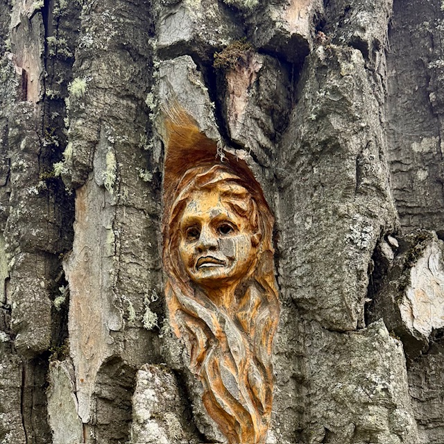
The trails through the park had occasional carvings in the bark of massive trees. A sign also warned us to keep any eye out for grizzly bears.
From Prince George we drove northeast for 244 miles to Dawson Creek which is the official start of the Alaskan Highway. As we drove the forest began to thin out a bit. Dawson Creek is located in a drier and windier area known as the Peace River Country. The day was cold and rainy with a high of 57°. Dawson Creek is often referred to as the “Mile 0 City” because it is the official start of the Alaskan Highway. We were scheduled to meet our friends Karin and Scott Bates in Whitehorse, Yukon on July 7th so we had planned on six days to get to Whitehorse. It dawned on me at this point that we should have planned at least 10 days to get to Whitehorse. We simply did not have time to explore the towns we visited or to make any side trips.
7/4: Dawson Creek to Fort Nelson
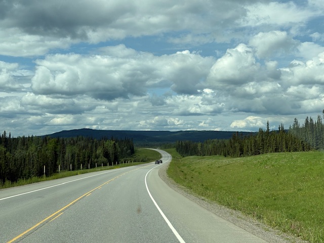
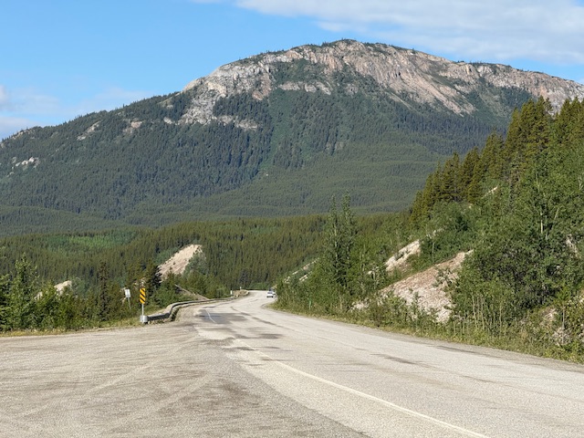
The Alaskan Highway was built during World War Two to provide a land link to the 49th State. Amazingly a dirt highway was completed in less than a year. The highway has been constantly improved over the years. There are lots of passing lanes and rest areas. As with all of the highways we traveled north of Prince George the forests have been cut back a significant distance from the pavement. The lush natural vegetation is constantly growing back in these clearings. We saw many work crews using a variety of power equipment cutting back the vegetation. It must be a never ending task.
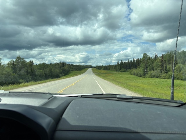
A windshield view of the Alaskan Highway north of Dawson Creek.
Driving north from Dawson Creek we learned that the Dempster Highway was closed at Eagle Plains due to wildfire. A quick search turned up a map of wildfires in Alaska, the Yukon and the Northwest Territories.
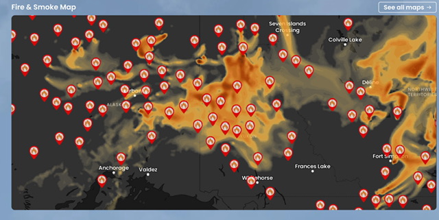
While this map of current fires was somewhat concerning the vastness of the area covered demonstrated that these fires were spaced far apart.
Traffic was light most of the journey.
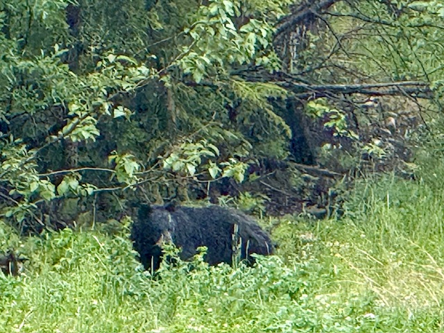
The first bear we spotted along the Alaskan Highway.
Fort Nelson was named after British naval hero Horation Nelson. It was founded in 1805 as a trading post. Interestingly, due to fires, floods and feuds the settlement has moved five times. It is a small town on the eastern slopes of the northern Rocky Mountains.The drive to Fort Nelson cover 282 miles. When we arrived in Fort Nelson, we discovered we had about a half a gallon of gas left in our tank. After filling our gas tank we checked in to the Triple G Hidaway RV Park. We had a nice meal at the park’s restaurant.
7/5: Fort Nelson to Watson Lake
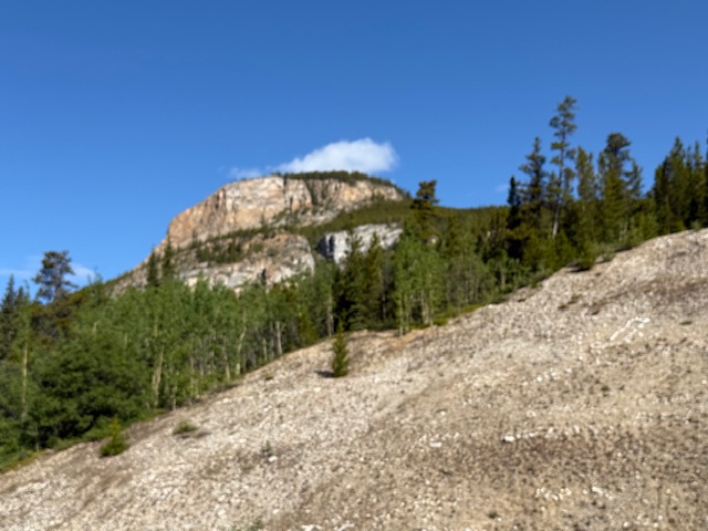
We knew from our research that Stone Mountain Provincial Park was perhaps the most spectacular landscape along the Alaskan Highway with big peaks and alpine meadows and lakes. West of Fort Nelson the highway reached its highest point where it crosses the Stone Mountains. Timing is everything. In this case our timing was bad. When we arrived at the high point it was drizzling and visibility was less than 100 feet. We canceled our dayhiking plans and continued on. Fortunately, the skies cleared as we continued west.
This photo, courtesy of the BC park system, shows what we missed.
Descending out of the fog we were treated to a view of the lower Stone Mountains.
As we drove the Alaskan Highway there were lots of marked viewpoints. Unfortunately, the views from most of these sites were blocked by vegetation which had grown up and blocked the view.
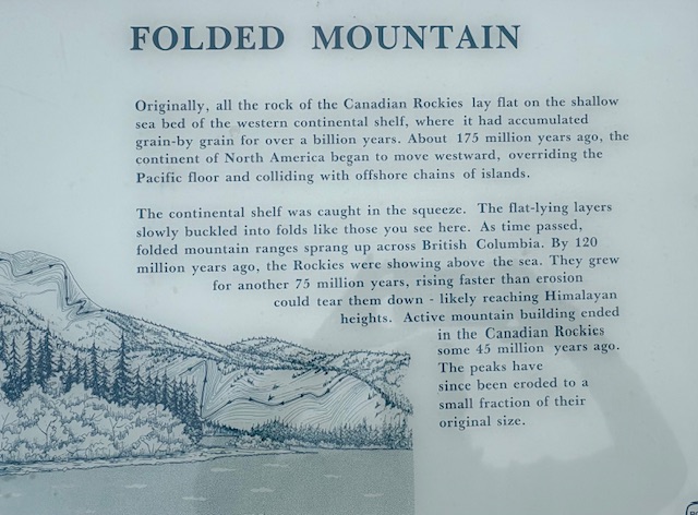
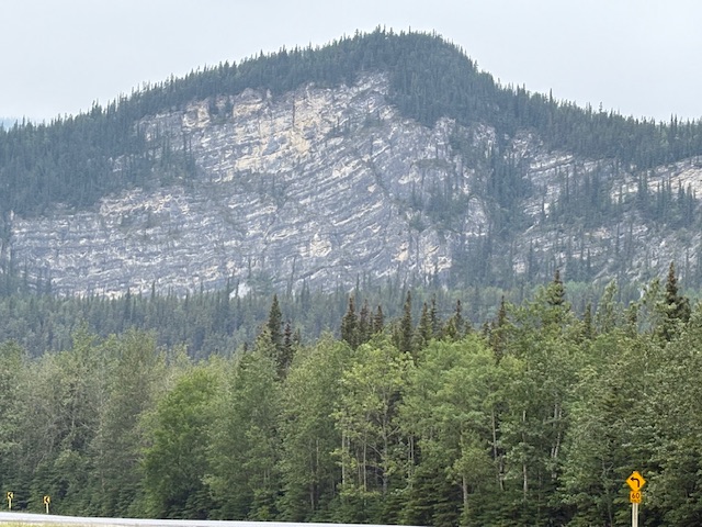
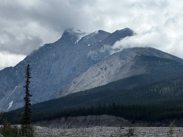
Folded Mountain is in Muncho Lake Provincial Park.
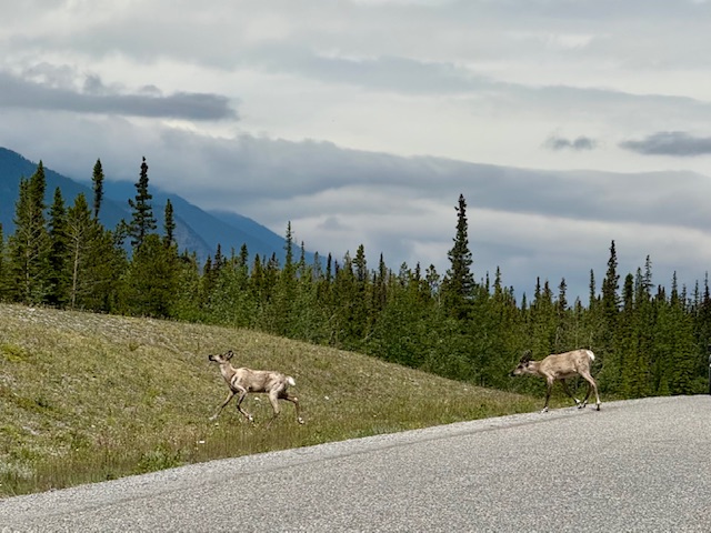
Caribou crossing the road.
Driving break along the Toad River.
Toad River
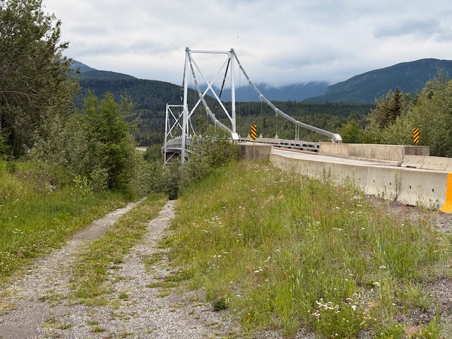
Laird River Bridge
Laird River
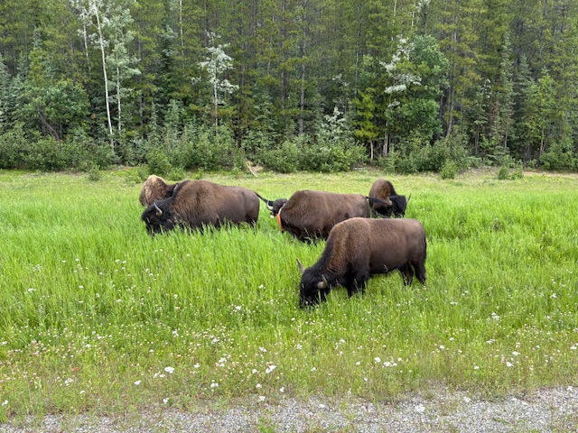
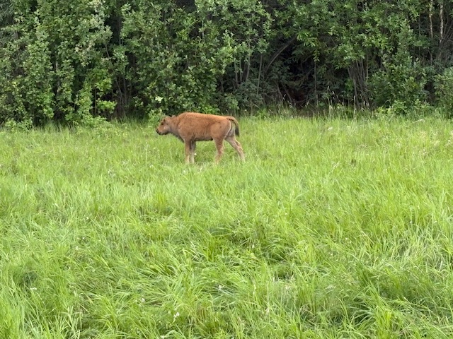
Bison along the highway between Fort Nelson and Watson Lake.
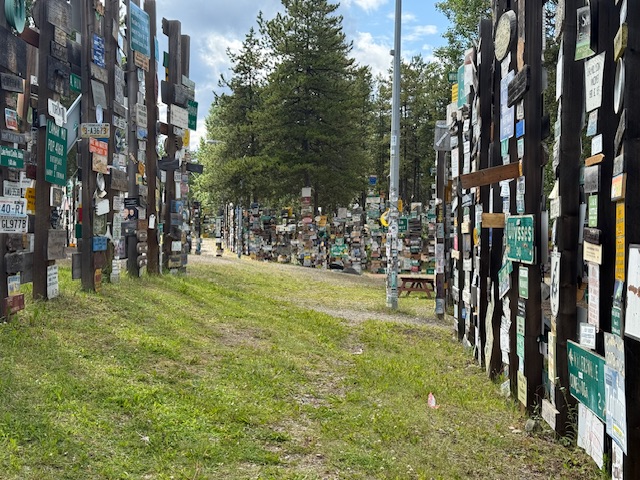
Watson Lake is located at mile 635 on the Alaskan Highway. The town was named after Frank Watson, a trapper and prospector, who settled in the area at the end of the 19th century. Besides being a refueling and resupply stop it is famous for its Sign Post Forest. The Forest was started in 1942 by an American soldier who erected the signpost for his hometown: Danville, Ill. 2835 miles. Now there are than 100,000 signs.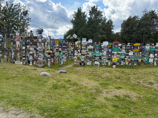
7/6: Watson Lake to Whitehorse
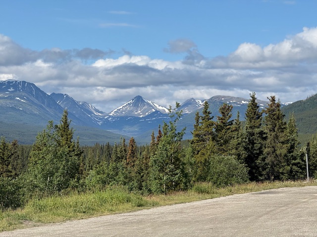
Yes, we had another long day of driving ahead of us. This 272 mile drive took us into the Yukon Territory. The Yukon River is the primary watershed of the Yukon and Alaska. The river starts to the south on the east side of the Costal Range and flows 2,300 miles north and then west to the Bering Sea. Other notable rivers include the Stewart, Peel, White, Laird and Tatshenshini. Once the Sun came out we had many delightful views of mountains and several large lakes.
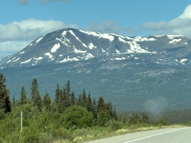
The terrain between Watson Lake and Whitehorse progressively gets more mountainous.
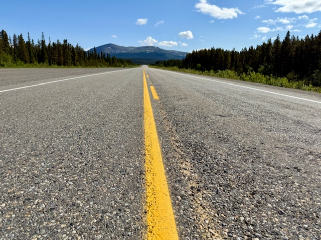
The Alaskan Highway seems never ending.
In Whitehorse we had reservations at the Caribou RV Park which can only be described as the most eclectic RV park we have ever experienced. A French couple ran the park which has an outdoor restaurant with the kitchen housed in an Airstream trailer. The chefs are from France and the cuisine is European. The food was great as was the ambiance.
7/7: A Day in Whitehorse
We were both exhausted by the six days of long drives and no exercise. It was good to have a day off from driving. Whitehorse is an interesting town with, despite its remote location, a cosmopolitan feel. We explored the MacBride Museum which is full of interesting artifacts. The SS Klondike Historical Monument was also interesting although access to the boat was closed due to a refurbishing project. We watched an interesting video on the history of the river boats on the Yukon River. 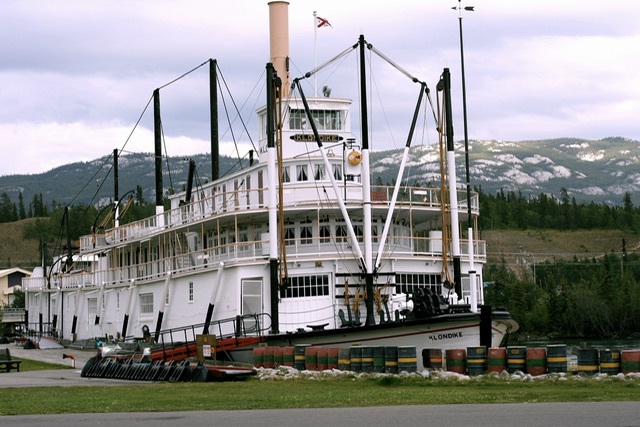
Before we returned to the RV park we ate lunch at a Japanese restaurant and walked around the downtown.
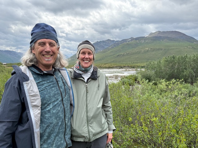
Scott and Karin arrived at the RV park at 5:30pm. The rainy weather earlier in the day cleared up and the afternoon was sunny and pleasant. We had beers and dinner at the park’s restaurant. Besides catching up we debated our options considering the status of the Dempster Highway which was still questionable.
7/8: Whitehorse to Dawson City
At 5:30am Scott came by the trailer and told us the Dempster Highway was still closed north of Eagle Plains due to the wildfires. Just before Scott arrived I read a special weather statement stating that a strong storm was descending into the Yukon from the Beaufort Sea, with rain, snow and wind. After digesting our options, the four of us decided to drive through to Dawson city and reevaluate our plans at that time.
The Klondike Highway leads from Whitehorse to Dawson City following the Yukon and Klondike Rivers. The terrain rolling with fewer mountains and densely forested.

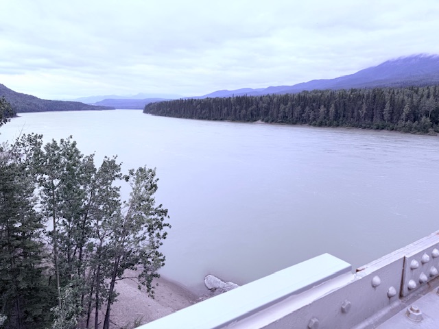
Yukon River Basin
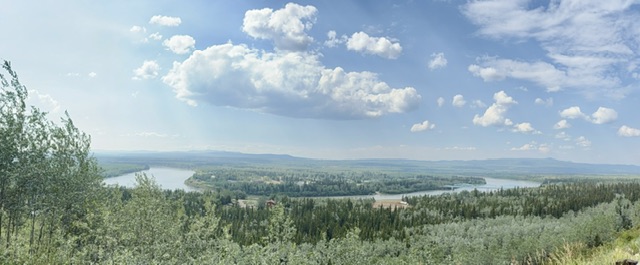
A panoramic of the Yukon River Basin.
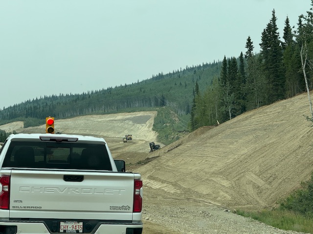
The Klondike Highway had some rough spots but was still a good highway. There was one 20 kilometer construction zone.
We had an hour wait at the construction zone.
This drive to Dawson City took us 8 hours. We hurried along with the hope that we could find someone in Dawson City who could figure out why our refrigerator would not work. Scott theorized that the problem was a propane leak. With all the rain we couldn’t rely upon our solar panel to keep the fridge running while we boondocked. Arriving just before 5pm we talked with the attendant at the propane station. We thought he fixed the problem. We checked in to the Dawson City RV Park which was just a big gravel parking lot with hookups.
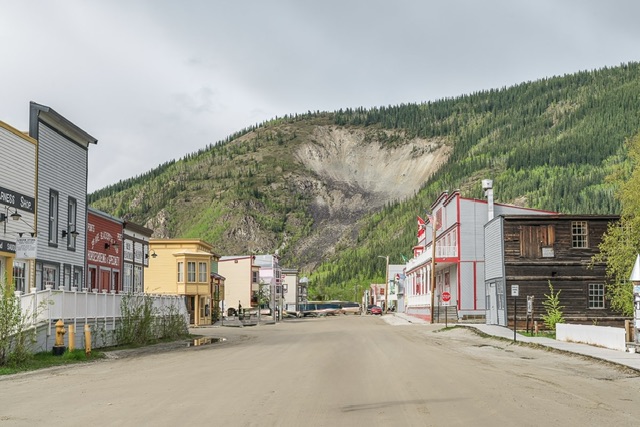
Dawson City
7/9: Tombstone Territorial Park to Teslin
We were now on the doorstep of the Dempster Highway which connects the Klondike Highway to Inuvik. From Inuvik the Inuvik-Tuktoyatuk Highway leads to the Arctic Ocean in 485 miles. These two gravel roads were the primary goal of our trip. In retrospect we realized that we had missed so much of the country we traveled through because we had been so focused on reaching Arctic Ocean. We were up early anxious to start on what should be the epic part of our journey.
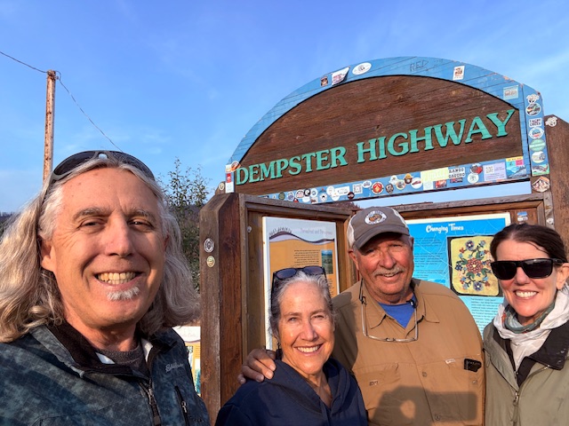
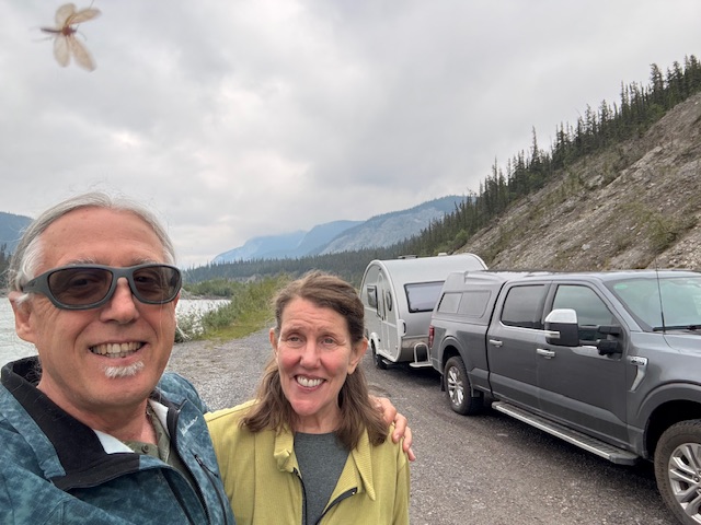
With our friends, Scott and Karin Bates, with high hopes we began our journey up the Dempster Highway.
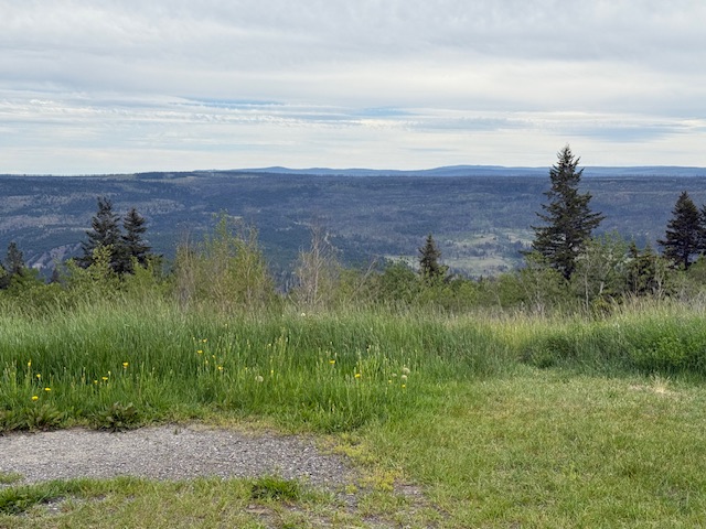
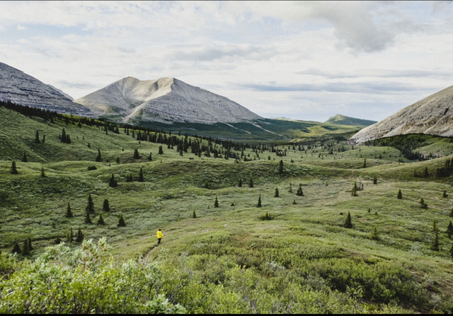
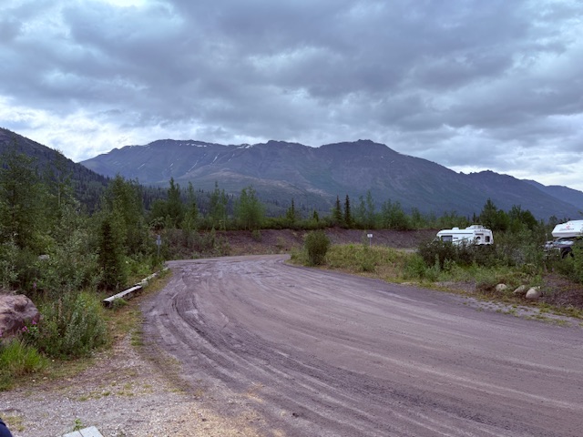
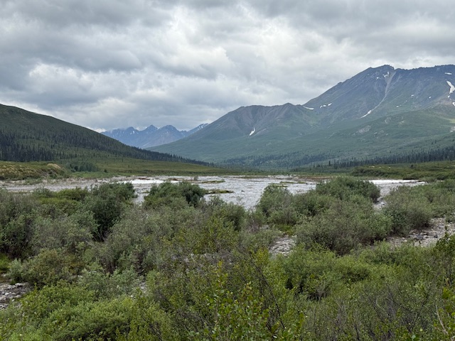
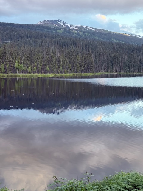
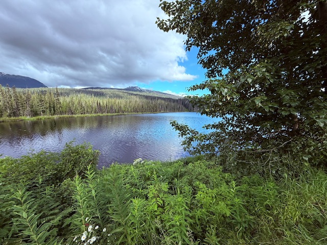
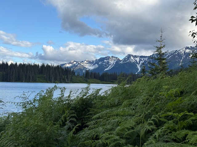
Tombstone Territorial Park was always going to be the crown jewel of our trip as far as hiking goes. The park is located near the southern end of the Dempster Highway. It encompasses rugged peaks of the Blackstone Uplands and the Ogilvie Mountains as well areas of permafrost. The Park is named for its preeminent summit Tombstone Mountain.
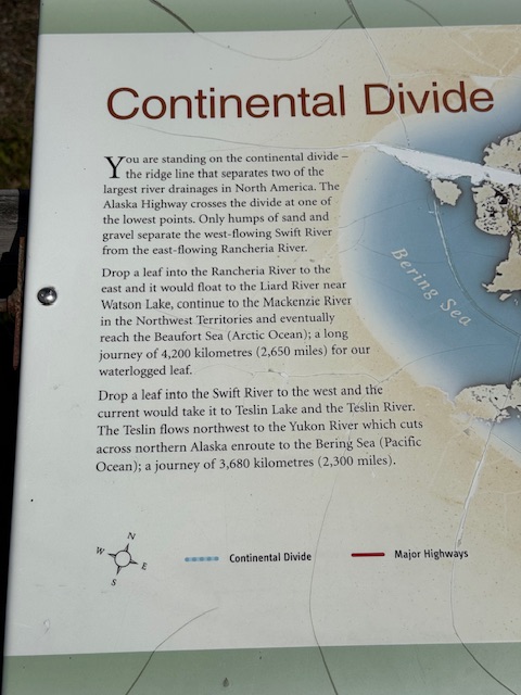
It is an interesting area geologically and ecologically diverse. A divide running through the park separates the Yukon River drainage (Bearing Sea) from the Mackenzie River (Beaufort Sea) drainage. Dall sheep, caribou, moose, black and grizzly bears and 150 species of birds can be found in the park.
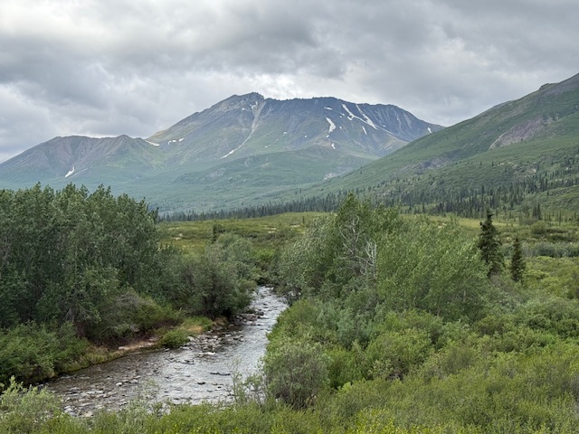
The Dempster Highway approaching Tombstone Territorial Park.
The park’s campground.
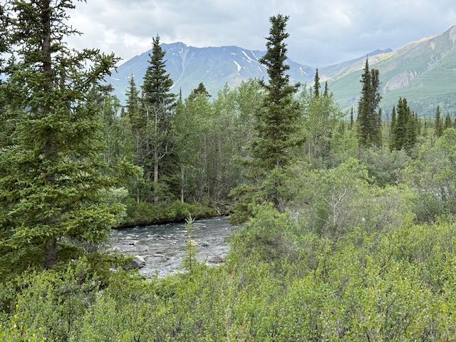
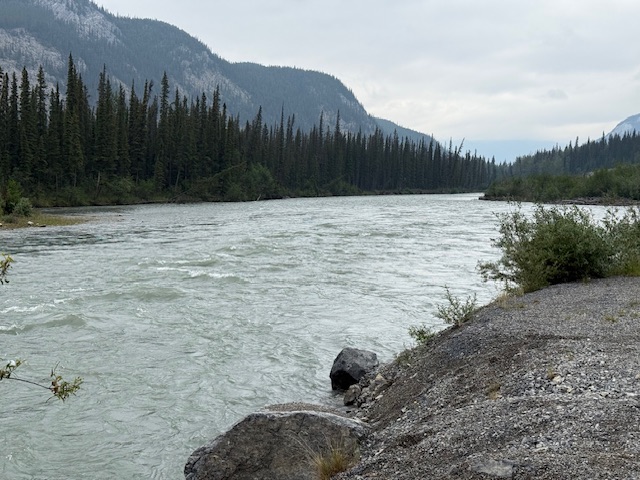
The north fork of the Klondike River.
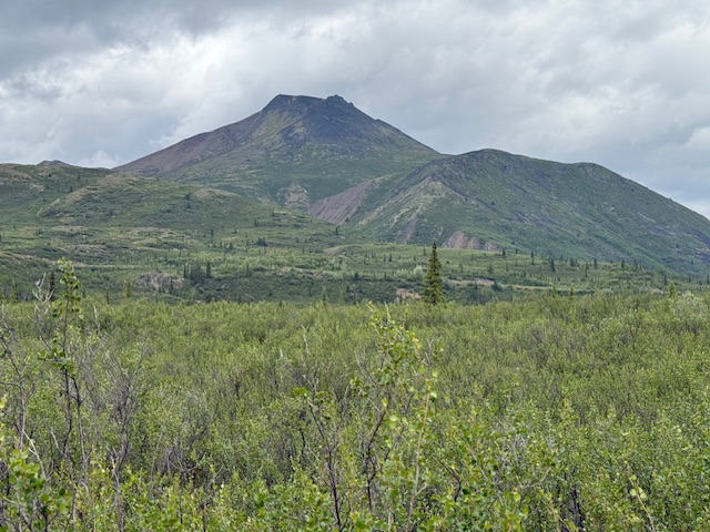
Goldensides Mountain.
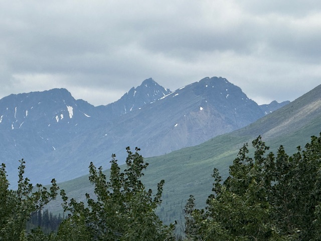
Tombstone Peak in the distance.
7/10: Our Propane System Fails
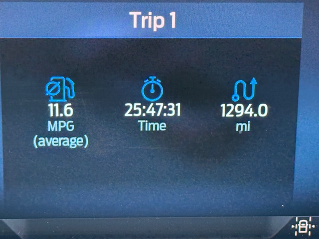
1:30am. I’m dreaming of something pleasant when the trailer’s propane/CO alarm wakes me. “What the . . .?” I go out and turn off the propane. 3:30am. Once again the alarm goes off. I’m perplexed. The gas was off. How could this happen? I couldn’t get back to sleep. I get up at 4:30am. After a discussion we concluded that the gas leak must be a bigger problem than we thought and that boondocking without the propane working was not going to work. We decide to head for home. We were roughly 2,500 miles from Boise. Although we were disappointed we still had the extremely scenic Stewart Cassiar Highway as an alternative way back to Prince George. We bid a sad farewell to Scott and Karin and drove off into the mist.
7/11: Tombstone Territorial Park to Teslin Lake
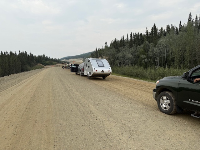
This highway, British Columbia Highway 37, is famous for its remoteness. It runs for 455 miles from just west of Watson Lake in the north to Stewart, BC in the south passes through stunning wilderness encompassing mountains, glaciers, and lakes. There are only a few spots along the road where the wilderness is dotted with human enclaves. However, before we drove the Stewart Cassiar we still had to drive over 600 miles to get to its start. After abandoning our friends we spent this day driving 470 of those miles reaching Teslin Lake around 6pm.
7/12: Teslin Lake to Mehan Lake
As usual we were up early and soon on the road. Roughly 150 miles later we turned on to the Stewart Cassiar Highway. Soon after starting south we drove into a huge burn scar that stretched for miles. Eventually we exited the burn scar and entered more of the areas primeval forest as we drove by lakes and many mountain vistas. One of the few touristy stops along the Cassiar is Jade City. Jade City has only one store and not surprisingly it sells locally mined jade. While there were some impressive items carved out of Jade we resisted buying anything. We continued on another 72 miles to Dease Lake the only town along the highway. We filled up the gas tank and continued on our way.
Although the scenery was spectacular and the country wild there were few places to camp for the night. We finally found a spot next to Mehan Lake and called it a day.
British Columbia’ costal mountains.
Mehan Lake
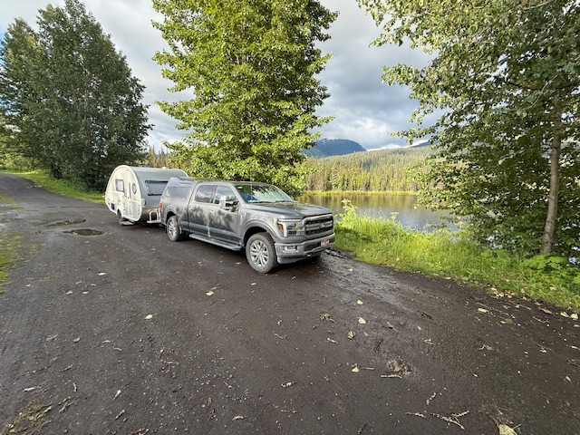
Our campsite next to Mehan Lake.
7/13: Mehan Lake to Williams Lake, BC
Another rainy day. We had originally planned to make the short drive to Hyder, Alaska but when we woke to rain with a low ceiling we changed plans and decided to make tracks for home. Our goal for the day was Williams Lake which was 600 miles and over 10 hours away. At the end of the day when we were roughly 25 miles north of Williams Lake Google Maps alerted us to an accident which had closed the highway. It offered us an alternative route which we selected. Big mistake! The alternative utilized a twisty, narrow dirt road with massive drop offs above the Frazier River. If this wasn’t bad enough most of the Highway 97 traffic also decided to use the alternative. We were lucky to survive as the oncoming traffic was going too fast for conditions and the dust was so thick visibility was sometimes down to a few feet.
When we finally arrived in Williams Lake we discovered that the RV park where we had reservations was just south of the point where the highway was closed. So, we had to drive north on Highway 97 for 17 miles. To add injury to insult the RV park was completely run down with people camping everywhere. We were lucky to find a spot as someone had parked in the space we had reserved. Not surprisingly, the highway reopened soon after we arrived at the RV park.
7/14: Williams Lake to La Grande, Oregon
If you haven’t caught on yet let me clarify for you—we were ready to get home. We were on the road at the break of day. We drove for 13 hours and 682 seemingly endless miles before calling it a day at La Grande. Once again Google Maps inexplicably directed on to a narrow secondary road which climbed over a mountain range rather than on the main road. While this route was scenic it added another hour or more to our trip.
7/15: Home
In the morning we made the relatively short drive to Boise. Laurie helped me (and I needed help) back our trailer into the garage without incident and the trip was over.
While we didn’t make it to the conclusion we still thought it worth the effort. The journey is always more important than the destination in my mind. Maybe we will give it another go next year. We learned a lot that would help us plan for a better trip like taking the ferry both ways
This is the 4th Stanza from Robert Service’s poem The Call of the Yukon. It encapsulates the Yukon’s land and mystique better than any thing I could conjure.
“There’s a land where the mountains are nameless,
And the rivers all run God knows where;
There are lives that are erring and aimless,
And deaths that just hang by a hair;
There are hardships that nobody reckons;
There are valleys unpeopled and still;
There’s a land— oh, it beckons and beckons,
And I want to go back— and I will.”
——-Robert Service