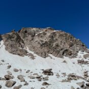
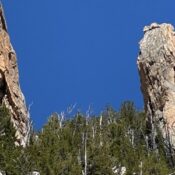
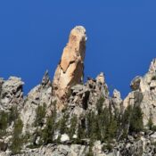
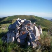
Peak 6482 by Livingston Douglas

This peak is not in the book. Published October 2025 Peak 6482 is a scrub hump that separates the Right Fork East Fork drainage from the Left Fork East Fork drainage in the foothills of the Deep Creek Mountains east of Rockland. It is most easily climbed from a gully on its south side and the Right Fork East Fork … Continue reading

Peak 6423 by Livingston Douglas

This peak is not in the book. The elevation and prominence figures are based on recent LiDAR updates. The USGS quad shows an elevation of 6,408 feet. Published October 2025 Peak 6423 is a scrub hump that separates Pete Lish Canyon from Left Fork East Fork Canyon in the foothills of the Deep Creek Mountains east of Rockland. It is … Continue reading

Peak 8388 by Livingston Douglas

This peak is not in the book. The elevation and prominence figures are based on recent LiDAR updates. The USGS quad shows an elevation of 8,384 feet. Published October 2025 Thanks to LiDAR updates, Peak 8388 is now a ranked summit. It sits on a high, bumpy ridgeline due south of Peak 8437. USGS Deep Creek Peak Access Same as … Continue reading

Peak 7312 by Livingston Douglas

This peak is not in the book. The elevation and prominence figures are based on recent LiDAR measurements as reported on peakbagger.com. The USGS quad shows an elevation of roughly 7,300 feet. Published October 2025 Peak 7312 separates Hillhouse Canyon from Stewart Canyon in the Deep Creek Mountains. It can be climbed from either Stewart Canyon or Box Canyon. The … Continue reading

Bull Benchmark by Livingston Douglas

This peak is not in the book. Published October 2025 Bull Benchmark sits at the headwaters of both Goddard Canyon and Stewart Canyon in the Deep Creek Mountains.This area is a mix of private and public land, so be careful. This climb is entirely on public land. USGS Cedarhill Access From ID-37 at about 42°24’00”N, turn east onto Stewart Canyon … Continue reading

Peak 6804 by Livingston Douglas

This peak is not in the book. The elevation and prominence figures are based on recent LiDAR updates. The USGS quad shows an elevation of 6,807 feet. Published October 2025 Peak 6804 separates Harwood Canyon from Hillhouse Canyon in the Deep Creek Mountains. Access to this area is from Sagehen Springs Road (public) but continues on a 2-track road across … Continue reading