There are between 53 and 75 points in Colorado over 14,000 feet. Depending on who is counting and what they consider to be a peak will determine their “official” list of 14ers. These peaks are collectively known as the 14ers and I think the 53 with at least 300 feet of prominence are the most generally accepted peaks comprising the “official” 14ers list. Some of the peaks with less than 300 feet of prominence are worthwhile goals and others are just bumps on ridges. I have climbed 37 of the 53 and 2 of the others (Mount Cameron is just a bump on a ridge; North Eolus was a bit more challenging).
I worked as a backcountry ranger at Rocky Mountain National Park in 1975 and climbed quite a few peaks in the Park that year but no 14ers. Over the next 21 years, I climbed a few other Colorado peaks but once again, no 14ers. In 1997, I was traveling for work and managed to arrange a weekend stop in Denver to visit my family. On a whim, I asked my brother if he and his wife were interested in climbing a peak. They both were agreeable and the next day we climbed Mount Bierstadt, my first 14er. I guess I caught the 14er bug as a result of that climb. From 1999-2006, I traveled to Colorado to climb 14ers each year, racking up another 35 peaks. After a 3-year break, I returned in 2010 with the idea of climbing 14ers and added one more peak to my total.
Chicago Basin is surrounded by 3 Fourteeners.
Climbing Colorado 14ers is extremely popular and has taken on somewhat of a cult status in Colorado. This activity is so popular that you will seldom find yourself alone on a peak and many of the peaks have trails to their summits. Some of these trails are paths followed by climbers and others are trails recently constructed to protect the fragile alpine tundra that is found on many of the peaks. All of the peaks have been climbed in Winter and assorted speed records have been set. Popularity and trails set aside, climbing all 53 ranked 14ers will take most of us a lot of time and effort. Several of the peaks are located deep in the backcountry. You can seldom climb a Colorado 14er without gaining at least 3,000 vertical feet. On most climbs, you must gain more than 5,000 feet and even up to 6,000 feet. Only a few of the 53 peaks can be combined in a single day.
The objective difficulty of climbing the 14ers runs from relatively easy to difficult and dangerous. Several peaks can only be reached by exposed Class 4 climbing. The subjective dangers are primarily governed by the weather, lightning and avalanches. For the Summer climber, the proclivity of thunderstorms often make the summits unattainable. Early starts are a necessity in all but the most stable weather. Thunderstorms are most frequent when a monsoon pattern draws moisture up from the Gulf of Mexico. The resulting storms can cause flash flooding and can develop early in the morning.
There are several excellent comprehensive guidebooks the 14ers available as well as 14ers.com and a 14er App for both IOS and Android devices. If you are interested in climbing these peaks, these are all great resources. I climbed my 37 Fourteeners over the course of 10 different years, climbing mostly in August. The most successful trips were blessed with dry weather. The least successful trips were accompanied by nearly continuous storms. What follows is a brief summary of my climbs.
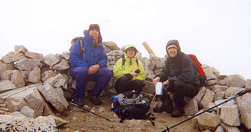
1997: Mount Bierstadt (14,060 feet), September 28th.
Mount Bierstadt
Mount Bierstadt is one of the shortest climbs thanks to a high approach via a gravel road that crosses Guanella Pass. The climb gains less than 3,000 feet in a little more than 3 miles. I climbed this peak with my brother Bill and his wife Diane on a cold, cloudy day. It was my companions’ first peak and they did well. There were probably another 50 people on the peak that day which gives an idea of how popular climbing is in Colorado. It was September 27th and the weather was so-so at best and still more than 50 people were on the route.
1999: Uncompahgre Peak (14,309 feet), Mount Democrat (14,148 feet), Mount Elbert (14,433 feet), Mount Sherman (14,036 feet), August 10th – 14th.
In 1999, I traveled to Colorado with the idea of climbing a few 14ers. First up was Uncompahgre Peak in the San Juan Mountains near Lake City, Colorado. This peak is in my Top Ten for scenic 14ers with its rugged, pointed summit block. This peak had a good trail almost all the way to the summit and required a 3,000-foot elevation gain in 3.5 miles. This was my first introduction to Colorado 4WD roads. Thankfully, we had a 4WD vehicle as the road was in bad shape.
Uncompahgre Peak
Next up was Mount Democrat which may be the easiest 14er if you climb the peak via the East Slopes where you can reach the summit with just over 2,000 feet of elevation gain in 2 miles. However, we were staying in Leadville, Colorado on the West Side of the range and climbed the peak from the west, which added a little more distance and elevation gain to our climb.
Our base camp in Leadville was the perfect starting point for ascending Mount Elbert, the highest peak in Colorado. Our Leadville motel was expensive. My brother and his wife joined me. We climbed the peak via the trail that runs up the peak’s Northwest Ridge which gains 4,700 feet in 4.5 miles. We finished the trip by climbing Mount Sherman from the west which was easily accessed from Leadville. This was another fairly easy peak as the climb gained only 2,100 feet of elevation in 2.6 miles. While we were up on the ridge, we also climbed Mount Sheridan (13,748 feet).
2000: North Eolus (14,039 feet), Mount Eolus (14,083 feet), Handies Peak (14,048 feet), Mount Lincoln (14,286 feet), Quandary Peak (14,265 feet), Mount Bross (14,172 feet), Mount Cameron (14,238 feet), Grays Peak (14,270 feet), Torreys Peak (14,267 feet). September 1st-7th and September 30th.
After my experiences climbing Colorado 14ers in 1999, I was fully committed to climbing more 14ers and planned a big year for 2000. I enlisted my friend Jay Weiss and we set off from Boise taking the long route to Colorado. We climbed Cleve Creek Baldy near Ely, Nevada and Mount Humphrey, the highest point in Arizona. Jay lives in Miami and we took this roundabout route so that he would have an opportunity to acclimatize.
Our first stop in Colorado was Durango. We hopped on the Durango-Silverton Railroad. The old steam-powered train is a huge tourist attraction and it is the best way to reach the trailhead for Chicago Basin which sits at the bottom of Windom Peak, Sunlight Peak and Mount Eolus. We backpacked into the basin after the very overrated train ride. We awoke to pleasant skies and headed off toward the peaks. We discovered that the basin was filled with campers located in every wide spot along the upper trail.
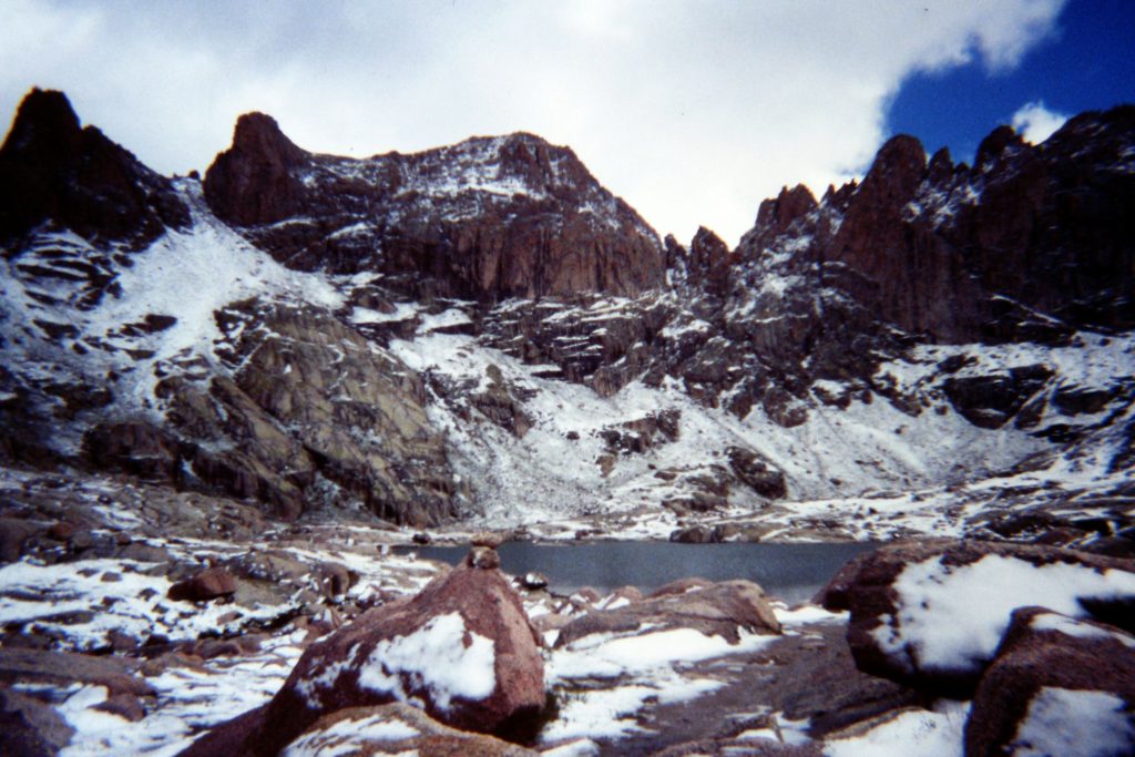
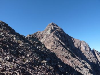
We scrambled up North Eolus which was a nice easy climb. We headed over to Eolus and ran into 3 different rope teams staging to climb the peak. The peak is only rated Class 3 so I was perplexed as to why teams were roping up and carrying protection. I will admit that the peak looked daunting, steep and cliffy from our vantage point. Jay decided he was through for the day and headed back to camp. I rushed off to stay ahead of the rope teams and found the route description accurate–a Class 3 climb.
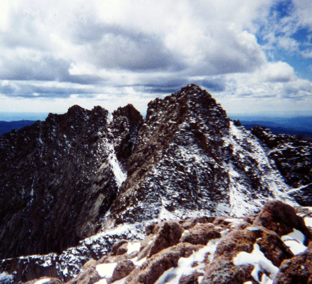
Mount Eolus as viewed from North Eolus.
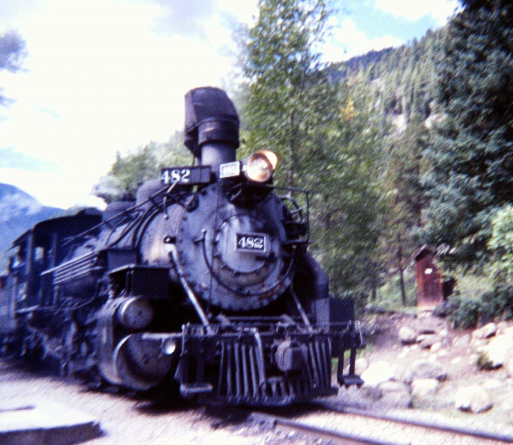
The slow train to Silverton.
Around dinner time, it started to rain. It poured all night and was still raining in the morning. We started up the trail but the rain got the better of us and we decided to hike out. I vowed to return, but after suffering through the even more boring ride on the train back to Durango, the vow was forgotten. I have never returned to climb Windom and Sunlight.
We moved to Lake City, Colorado and the next day climbed Handies Peak where we found a trail leading to the summit in just under 3 steep miles. The elevation gain was only 2,500 feet. We stayed in Lake City that night and then headed for Breckenridge, Colorado where we met up with my brother and his wife. Along the way, I climbed Bent Peak (13,393 feet) which was a short climb from a difficult 4WD road. The next day, we climbed Quandary Peak via its East Ridge which gains 3,500 feet in 3 miles. My recollection of this route is focused on a band of loose talus and the windy conditions that we encountered.
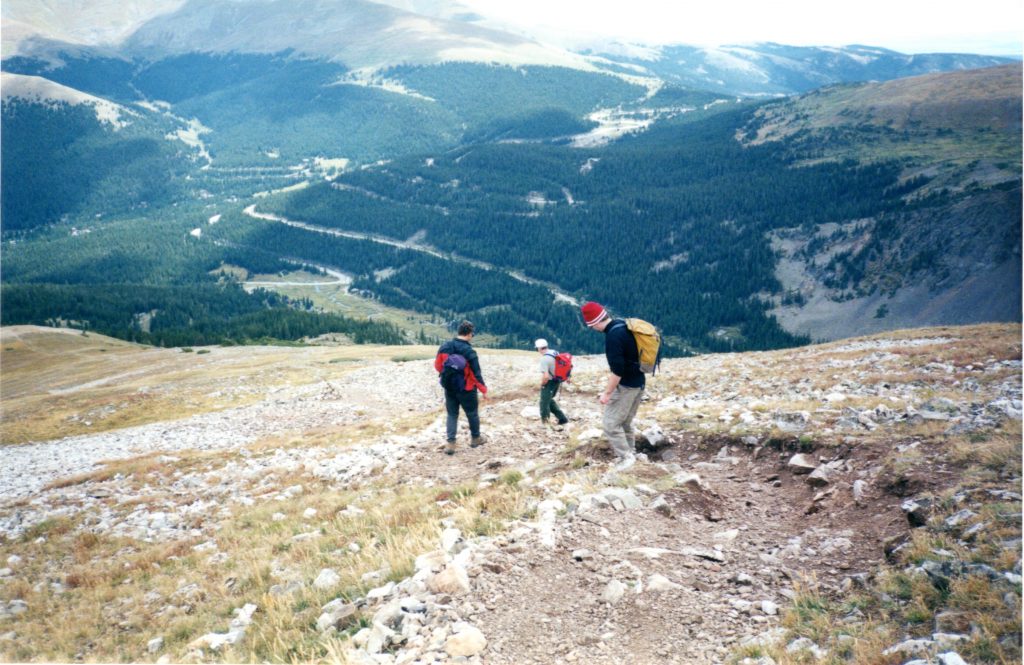
Descending Quandary Peak on a climber’s trail. Diane Lopez Photo
After another night in Breckenridge, we climbed Mount Bross, Mount Cameron and Mount Lincoln from the east. These peaks are accessed by a decent road with high access. Round trip was about 6 miles with roughly 2,200 feet of elevation gain.
The summit of Mount Bross.
I returned to Colorado to celebrate birthdays at the end of December and, on September 30th, I climbed Grays Peak and Torreys Peak with my brother Bill, his wife, my sister Nancy and her son Alex. The upper portions of the mountains were covered by 6-10 inches of snow but there was a path beaten down in the snow. There were more than 50 other climbers on the peaks.
Nancy, Alex, Bill and Diane on the summit of Torreys Peak.
2001: Mount Sneffels (14,150 feet), Mount Wilson (14,246 feet), Wilson Peak (14,017 feet), Red Cloud Peak (14,034 feet), Sunshine Peak (14,001 feet), Wetterhorn Peak (14,015 feet), Castle Peak (14,265 feet), August 4th-13th.
This was another trip with Jay Weiss. I picked Jay up in Salt Lake and we drove to Moab. The next day, we attempted to climb Mount Peale in the Manti Lasal Mountains. We were chased off the mountain just short of the summit by a thunderstorm. Our first peak in Colorado was Mount Sneffels, the 3rd-highest summit in the San Juan Mountains. We climbed the peak from Yankee Fork Basin via a Class 2 route that gained 3,000 feet in 3 miles. There were a lot of people on the peak.
We next moved on to Telluride, Colorado to climb in the San Miguel portion of the San Juan Mountains. We had 3 peaks in mind: Mount Wilson, Wilson Peak and El Diente. We arrived in Telluride in the middle of a forceful downpour. Clearly, the monsoon season had arrived. Water and rock was flowing over the highway in places. It was an experience of nature not be forgotten.
The next morning, despite bad weather forecasts, we drove into the mountains. We backpacked through constant rain to Navajo Lake which was reached after 5 miles with 2,000 feet of elevation gain. The next day, we were up early and climbed Wilson Peak. Along the way, we passed a guided group of 4 climbers. This route had a lot of Class 3 climbing but minimal exposure. The most difficult part of the climb was descending off the false summit and crossing the connecting ridge. We had gained 3,000 feet in just more than 2 miles to reach the summit. By the time we arrived on the summit, it was obvious that we were in for more rain as thunderheads were already building. We hurried down the route. We were about a half-mile from camp when the storm hit us with marble-sized hail. I have seldom walked in harder rain. By the time we got back to camp, the ground was covered with hail.
Fortunately, the skies cleared that evening and we were able to prepare to ascend Mount Wilson the next day. We climbed the peak via its North Slopes which was a 3,200-foot climb from our camp. This route is now rated Class 4 but I don’t recall our line crossing any really exposed sections. I think if you climbed a little farther south than our line you would run into Class 4 terrain. At any rate, we made the summit in good time. Once again, on our return to camp we encountered another, more impressive, storm. This time when we returned to our tents, it was raining and hailing so hard that we were hesitant to open our small tents (without vestibules). Finally, I got so cold, I climbed in the tent anyway. I spent the next 10 minutes sponging water out of the tent with a sock. Once again, as the sun went down, the sky cleared. The next morning, we hiked out and drove to Lake City where we met my brother Bill, his wife and my mother.
On August 10th, we left my mom in town and headed out to climb Redcloud Peak and Sunshine Peak which can easily be climbed together. The route to Redcloud follows Silver Creek to its head and then climbs up to the peak’s Northeast Ridge. There was a trail for nearly the entire distance. Bill and Diane decided to return to the trailhead and Jay and I followed the ridge south to Sunshine Peak. From the summit, we dropped down the Northwest Face and returned to Silver Creek where, fortuitously, we met Bill and Diane. Our totals for the day were roughly 9 miles with 4,300 feet of elevation gain.
On the 11th, we left my mom and Diane in Lake City and headed out to climb Wetterhorn Peak. The Wetterhorn is one of those peaks that looks like it will be difficult to climb from a distance but ends up with a fairly easy route to the summit. We climbed the peak via its Southeast Ridge which is rated Class 3. This route had a bit more than 3,000 feet of elevation gain in 3.5 miles. We ran into several sections of actual climbing but nothing too difficult.
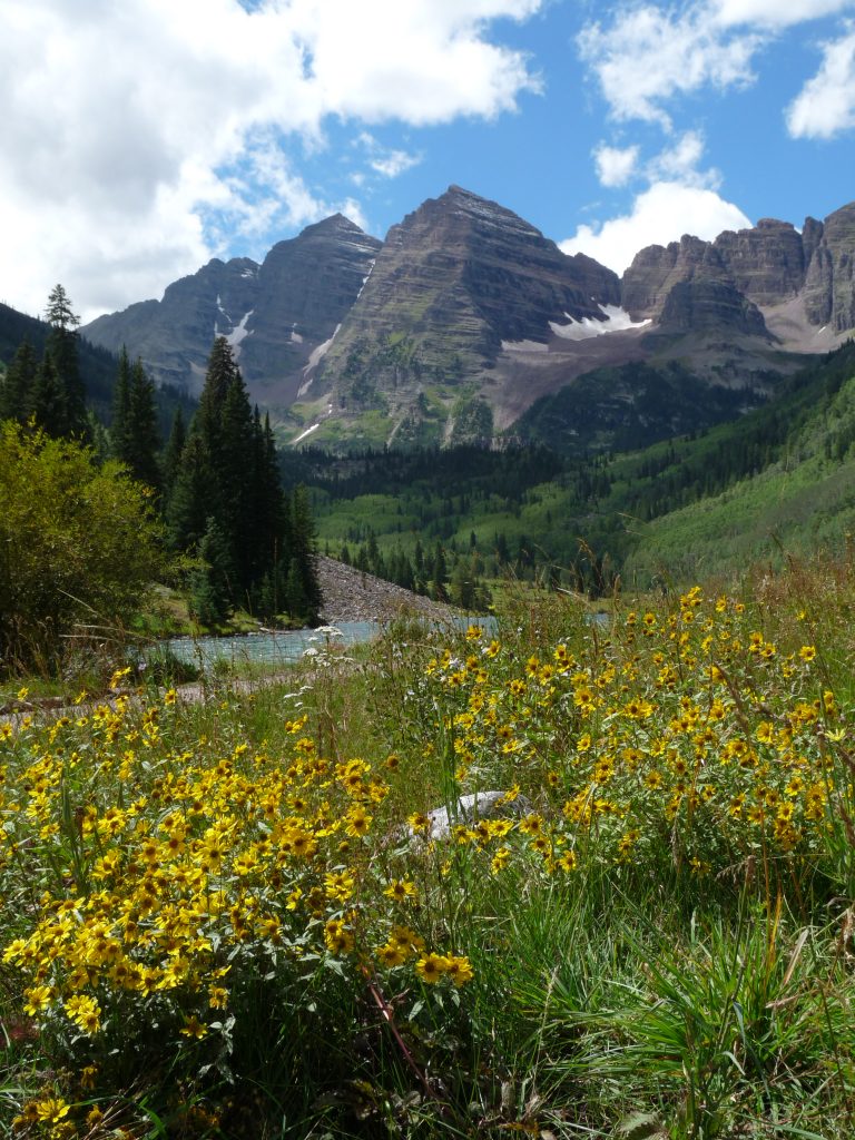
On the 12th, Jay and I moved to Aspen, Colorado to attempt our first peak in the Elk Mountains which is the home of the famous Maroon Bells and Snowmass Mountain. On the 13th, we set our sights on Castle Peak, the highest summit in the Elk Mountains. The real crux was the mining road that led to the trailhead at the Montezuma Mine. Once we safely made the trailhead, the climb up the Northeast Ridge (Class 2) was simple with just over 1,400 feet of elevation gain. If you had to walk the mining road, this peak would take a long day. We spent the night back in Aspen with the intent of taking on Maroon Peak but at 5:00AM the next morning, we awoke to thunder and lightning and decided to terminate the trip.
2002: Mount Princeton (14,197 feet), Mount Antero (14,269 feet), September 11th-13th.
I had big climbing plans for 2002, but on June 2nd I broke my fibia and screwed up my ankle sliding into second base during a softball tourney. I had surgery a couple of days later and was told I was going to be off my feet for 3 months. I was given clearance by the Doc at the end of August and was on a short backpacking trip in the Salmon River Mountains 2 days later on August 31st. Although my leg was weak, I did alright on the overnight trip and wanted to salvage something of my Summer plans. I called Jay and we quickly put together a 14er trip. Jay picked me up in Denver on September 10th and we drove to Leadville with my brother Bill and Diane.
On the 11th, we climbed Mount Princeton which I had picked because you could drive to 11,000 feet. We awoke early to valley fog. The fog only got worse as we drove to the trailhead. Our route climbed up the East Ridge. Either we missed it or there was no defined trial but we still found our way to the peak’s East Summit. The fog cut visibility to less than 10 feet. If not for a compass, we would not have known which way to go as we were completely disoriented. Using the compass, we dropped off the false summit and found the top of the East Ridge which we followed to the summit. Our route gained 3,200 feet in a couple of miles.
The summit of Mount Princeton.
Bill and Diane headed back to Denver and Jay and I took the 12th off. On the 13th, we set out for Mount Antero. We decided on the shortest route available which climbs the peak from the west. Our rental 4WD vehicle had only highway tires so we stopped short of the end of the 4WD road. By the time we parked, the sky was threatening to unleash lightning upon us. I was hesitant to go but Jay hoisted his pack and started up the road. I sat in the truck for 20 minutes and then said, “What the hell.” Jay had made the right decision and I caught up with him at the peak’s 13,800-foot false summit. We continued on to the summit together. I believe we gained about 3,000 feet in 5 miles.
2003: San Luis Peak (14,014 feet), Crestone Needle (14,197 feet), Humboldt Peak (14,064 feet), Tabeguache Peak (14,155 feet), Mount Shavano (14,229 feet), La Plata Peak (14,336 feet), Mount Massive (14,421 feet), Mount Belford (14,197 feet), Mount Oxford (14,153 feet), August 10th-20th.
Hoping to make up for the prior year, I planned an ambitious itinerary for 2003. The first peak was San Luis Peak which is one of the more isolated 14ers. Access starts near Gunnison, Colorado and ends 47 miles later at the Stewart Creek trailhead. There is a trail all the way to the top. I was accompanied by Bill, Diane and Jay for this 14-mile round-trip jaunt. We had to stop a couple of times because thunderstorms were swirling around the neighborhood. Finally, we had a brief opening between storms and made a dash for the summit.
Next up was my first excursion into the Sangre de Cristo Mountains. While the San Juan Range is a jumbled mountain mass with a great variety of peaks, the Sangre de Cristo Mountains are a long linear range which rises abruptly on all sides. With the exception of Culebra Peak, all of the range’s 14ers are found in 2 groups. We decided to attack the north group first. Access is from South Colony Lakes. We approached from the east and the farther we proceeded, the rougher the road became. I am no slouch when it comes to following difficult 4WD roads but I gave up and parked a mile short of the upper trailhead to avoid damaging my Sequoia. It is my understanding that the upper reaches of the road are now closed and you must park at 9,900 feet. At any rate, we backpacked 3.0 miles from our parking spot to South Colony Lakes where we set up camp. The lakes were crawling with people but big enough that finding a camping spot was not too difficult.
Crestone Needle is an imposing summit. We decided to climb it via the South Face Route. There was a good trail up to the crest and then headed north toward the South Face. We met a volunteer trail crew working on the trail. They were part of the Fourteener Initiative which has put a lot of effort into building approach trails to the 14ers across fragile ground. We got to the base of the climb. The route climbed steeply with smallish broken steps up a gully. Jay decided he did not want to climb so I proceeded up alone. Once on the summit ridge, it was a short climb to the high point. I met 3 climbers on top. After a brief conversation, they started down and I spent about 30 minutes enjoying the view.
I started down the summit ridge but mistakenly dropped off it too early. My chosen route looked identical to the gully I ascended at first. Eventually, I opined that I was in the wrong gully but kept descending anyway. The going was now exposed beyond what is reasonable without protection or equipment to rappel. I had a walkie-talkie and I called Jay who was waiting below and asked him if he could see me. He spotted me and I asked him to describe what was below me. He told me there was a ledge 20 feet farther down that I could use to traverse to the east to easier ground. With this information I started down, facing the mountain thinking if it is this difficult and exposed now, I should go back up. Nevertheless, I got down to the ledge which was about a foot wide and traversed over to the easier ground. I had given myself a fright and when I reached Jay, I no longer felt like trying Crestone Peak that day. We returned to camp.
On the 13th, we climbed Humboldt Peak which, after Crestone Needle, was a walk in the park. Still, the route crossed a lot of big blocks and was a bit tiring. By the time we returned to the pass west of the summit, storms had erupted and we called it quits for the day. The next day, we hiked out deciding Crestone Peak could wait for another year. We spent a night in Colorado Springs and then moved on to Poncha Springs where we got in a fight with a motel owner over our smoke-filled, smoke-free room. He finally relented and gave us another room.
On the 16th, we climbed Mount Shavano and Tabaguache Peak which were easily linked together via a 9.5-mile walk with 4,600 feet of elevation gain. The only downside of the route is that you have to climb Mount Shavano coming and going. On the 17th, we climbed La Plata Peak by way of its Northwest Ridge which was 6.5 miles round trip with around 4,500 feet of elevation gain. We then moved to Leadville where we once again hooked up with Bill and Diane.
On the 17th with a predawn start, we made the 14-mile round trip to the top of Mount Massive. This peak is truly massive and is a twin of Mount Elbert. We had good weather and were down off the peak in good shape. After a rest day, Jay and I climbed Mount Belford and Mount Oxford, another 2 peaks that we linked together and another climb that required climbing the first peak twice. The hike to Mount Belford was mostly on trail and the crossing between the 2 peaks was not difficult. Round trip was 10.5 miles and the total elevation gain was 5,800 feet. Our time was up and we returned home.
2004: Mount Evans (14,264 feet), Pikes Peak (14,110 feet), August 9th-10th.
I am not sure why I had so little time for Colorado in 2004 or if the weather kept us from climbing more peaks. We started in the Front Range with Mount Evans. There is a paved road that leads to the top of this peak. We decided to climb the peak from Guanella Pass to make the climb more sporting. After hiking almost 5 miles and gaining 3,100 feet we arrived at the based of the peak’s summit block. The parking lot was full and the last little bit to the summit was swarming with people. It was a letdown to say the least and we still had a 5-mile return walk. All in all, Mount Evans with its road was a disappointment.
The next day, we scheduled Pikes Peak, another peak with a road (and a cog wheel train to boot) to its summit. After our experience the prior day, we decided against the long walk and drove partway to the summit. We stopped 3 miles short and then hiked the ridge to the top, where we were once again disappointed by the civilization we found there.
2005: Mount Harvard (14,420 feet), Mount Columbia (14,073 feet), Missouri Mountain (14,067 feet), Mount Yale (14,196 feet), August 1st-7th.
 Laurie Durocher and I drove to Colorado at the end of July and hooked up with Jay in Leadville. We backpacked into the basin south of the Mount Harvard from the North Cottonwood Creek trailhead on August 1st. The weather was great and so we continued on after setting up camp to climb Mount Harvard. Our camp was at 12,000 feet just west of Mount Columbia. We climbed Mount Columbia the next day and then hiked out. All in all, we put in 14 miles and gained 6,000 feet. We drove to Denver to visit with my family after returning to the mountains.
Laurie on the summit of Mount Harvard.
We returned to Leadville on the 5th and then climbed Missouri Mountain on the 6th. We started at the Missouri Gulch trailhead and climbed the peak via its Northwest Ridge Route which gained 4,500 feet in a little more than 5 miles. Finally, on the 7th, we climbed Mount Yale which was another long hike (8 miles) with over 4,000 feet of elevation gain.
The summit of Mount Yale.
The year 2005 had the best weather that I have had on any of my Colorado trips. We had no rain and no threats of rain. Next year would be different.
2006: Huron Peak (14,003 feet), August 7th.
Laurie and I returned to Colorado at the beginning of August with the intent of climbing as many of the Sangre de Cristo 14ers as we could. We arrived in Alamoso, Colorado along with the monsoon weather pattern. The next morning we awoke at 5:00AM to thundershowers which continued off and on, morning and night for the next several days. We finally decided to try our luck elsewhere and drove north to Buena Vista. On the 7th, with thunderstorms threatening, we made a predawn start and managed to get up and down Huron Peak before the monsoon let loose. This climb covered 6.5 miles round trip and roughly 3,200 feet of elevation gain. With the forecast calling for continued monsoon weather, we called it quits and drove back to Idaho. I was so disgusted with the weather that I vowed to quit climbing in Colorado, a vow that I knew would be difficult to keep.
2010: Pyramid Peak (14,018 feet), August 27th-30th.
Pyramid Peak
On this trip, I was accompanied by Basil Service. We planned to climb Longs Peak and some of the peaks around the Maroon Bells. We had a reservation to camp high on Longs Peak but on the appointed date, there were several feet of fresh snow high up on the mountain and we discarded the planned climb since we had not brought crampons or ice axes. We spent a couple of days at lower elevations in Rocky Mountain National Park climbing Sundance Peak, Flattop Mountain, Hallett Peak and both summits of Twin Sisters Peak. We decided that the snow above 13,000 feet was not going to melt and drove to Aspen where we camped in the shadow of the Maroon Bells. On September 1st, we set out for Pyramid Peak via its Northeast Ridge Route. The route is rated Class 4 but seemed no more difficult than Class 3. The crux was really route finding our way around more difficult pitches. The summit of the Maroon Bells as viewed from the summit of Pyramid was enticing but, alas, we were out of time. It took 8.25 miles round trip and 4,500 feet of elevation gain to climb this most impressive peak.
To be continued . . . ?
Maroon Peak. Basil Service Photo
Longs Peak. Basil Service Photo
Next: A Brief Visit to the Canadian Rockies