Why visit Las Vegas to climb mountains? After all, it is a big city. Its metropolitan population exceeds 2.2 million people and the metropolitan area continues to grow at a rate sure to soon exceed its water supply. Traffic is horrendous. It is known as Sin City because of its predilection for adult entertainment and its tolerance for gambling. Crime is on par with any large American city and impacts some trailheads. As a result of Vegas’ prevalence of vices and a history of organized crime, it is often a setting for movies. Few of these films have painted a pleasant picture.
Despite the downsides of Vegas, the city is situated in a basin surrounded by mountains of varying elevations, sizes and shapes. While some of these mountains reach over 10,000 feet, most of the ranges do not exceed 6,000 feet. These ranges are steep, rocky and arid. The terrain is covered with desert flora and inhabited by desert fauna including bighorn sheep, rattlesnakes, and tarantulas. While Las Vegas summers are deadly hot and thunderstorms often cause flash floods, the short winters are relatively mild with plenty of sunshine. While winter rain and even snow are a possibility, October through March is an excellent time for snow-free climbing.
John Platt and I have taken advantage of Southern Nevada’s mild winter weather to get an early start for our peakbagging addiction over the last five years. While we had previously climbed in the Las Vegas area, this was the first year we decided to concentrate our efforts solely on the Las Vegas-area peaks. We set up a base camp at a Quality Inn in Boulder City, Nevada after making the long drive from Idaho. Boulder City is a fantastic little town. It has many good restaurants and its location is perfect for bagging peaks.
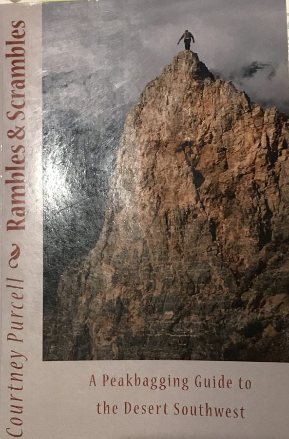
The peakbagger.com and Lists of John websites are great planning resources. Courtney Purcell’s Rambles and Scrambles: A Peakbagging Guide to the Desert Southwest is the “book” to buy for planning purposes.
403 pages of peaks!
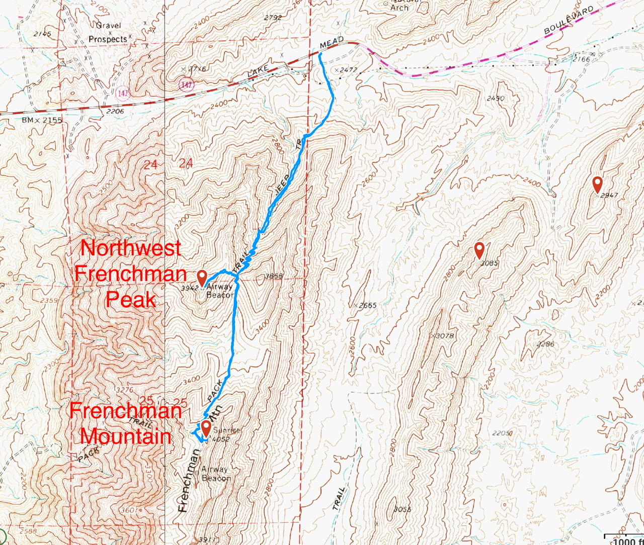
Peaks Climbed: Frenchman Mountain, Northwest Frenchman, The Minefield, Lava Butte, White Eagle Peak, Rough Benchmark, The King, Dam View Point, New Peak, Kraft Mountain, Lone Mountain and Bootleg Mountain.
Read John’s TR at this link: Nevada Spring Trip 2020
February 20th
Frenchman Mountain and Northwest Frenchman Peak (4.5 miles/2,207 feet of elevation gain)
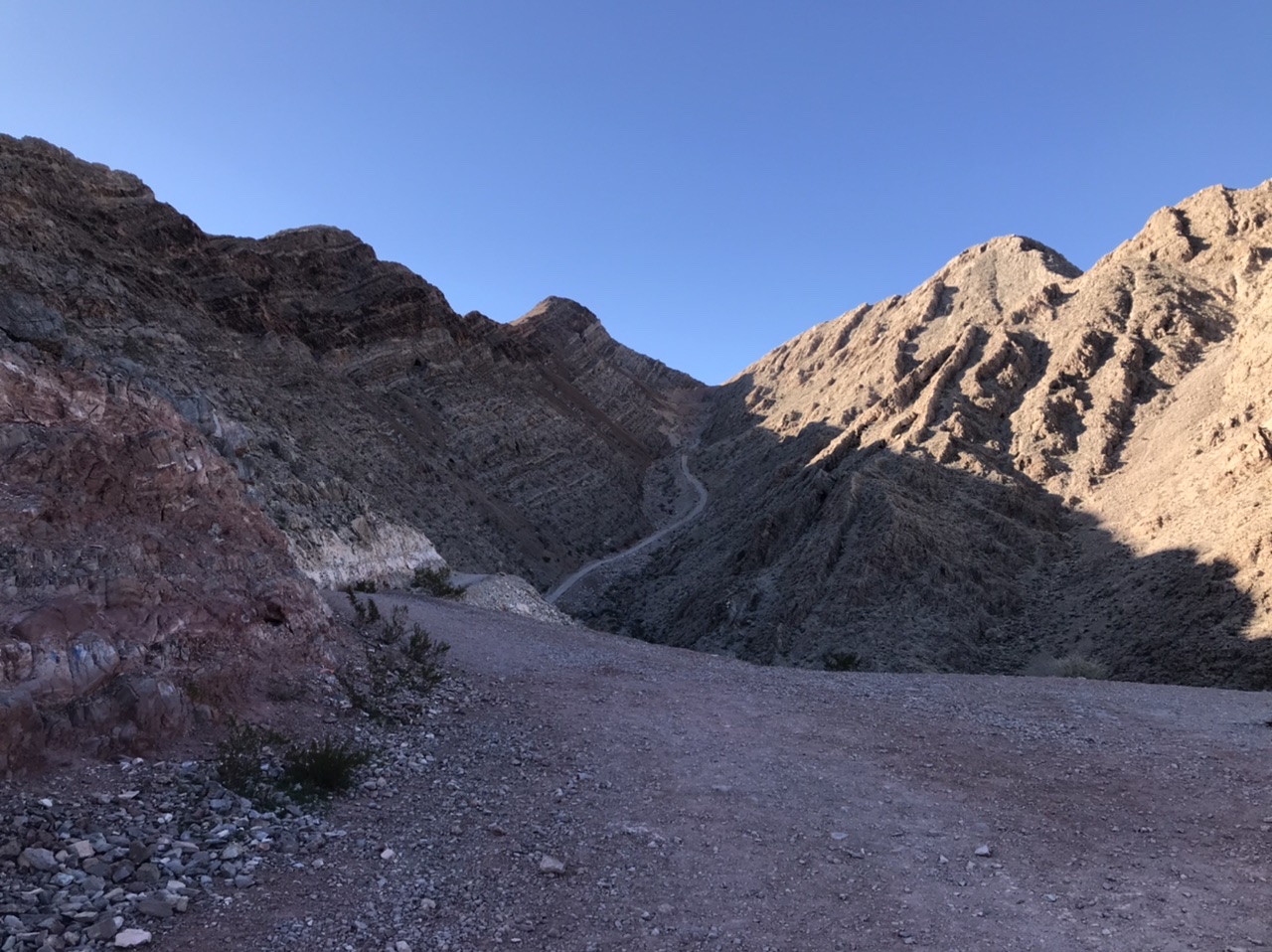
We picked these two peaks as our starting point because a closed road covers much of the distance. After 12 hours in the car the day before, a road walk would be a good way to loosen up our legs. The Frenchman Mountain trailhead is located at a pass north of the summit on Lake Meade Boulevard. The parking spot is notorious. Car theft and vandalism happen with such a frequency that many climbers leave their vehicles at a grocery store parking lot two miles from the pass.
The road to Frenchman Mountain. Northwest Frenchman Peak is on the right.
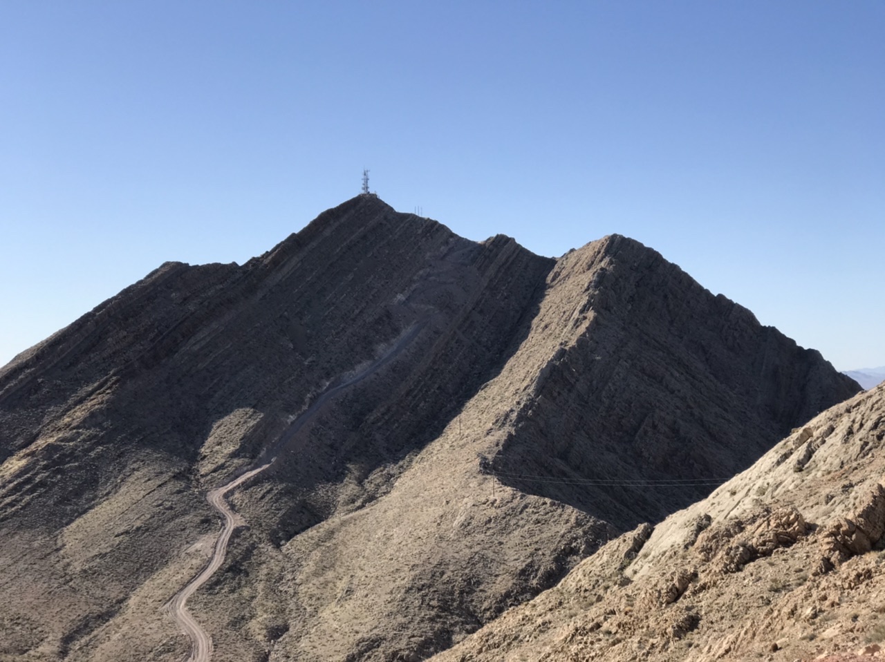
The road to the summit of Frenchman Mountain is steep. My 4Runner could navigate the road. However, even if the road was open to the public, walking is the wiser option.
Frenchman Mountain as viewed from the pass.
The peak’s twin summits are both covered by electronic equipment surrounded by chain-link fences. On our return hike, we scrambled up the east ridge of Northwest Frenchman Peak.
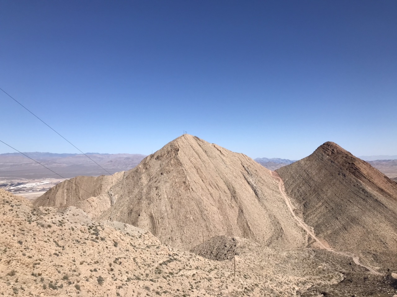
Northwest Frenchman Peak as viewed from Frenchman Mountain. The east ridge is on the right.
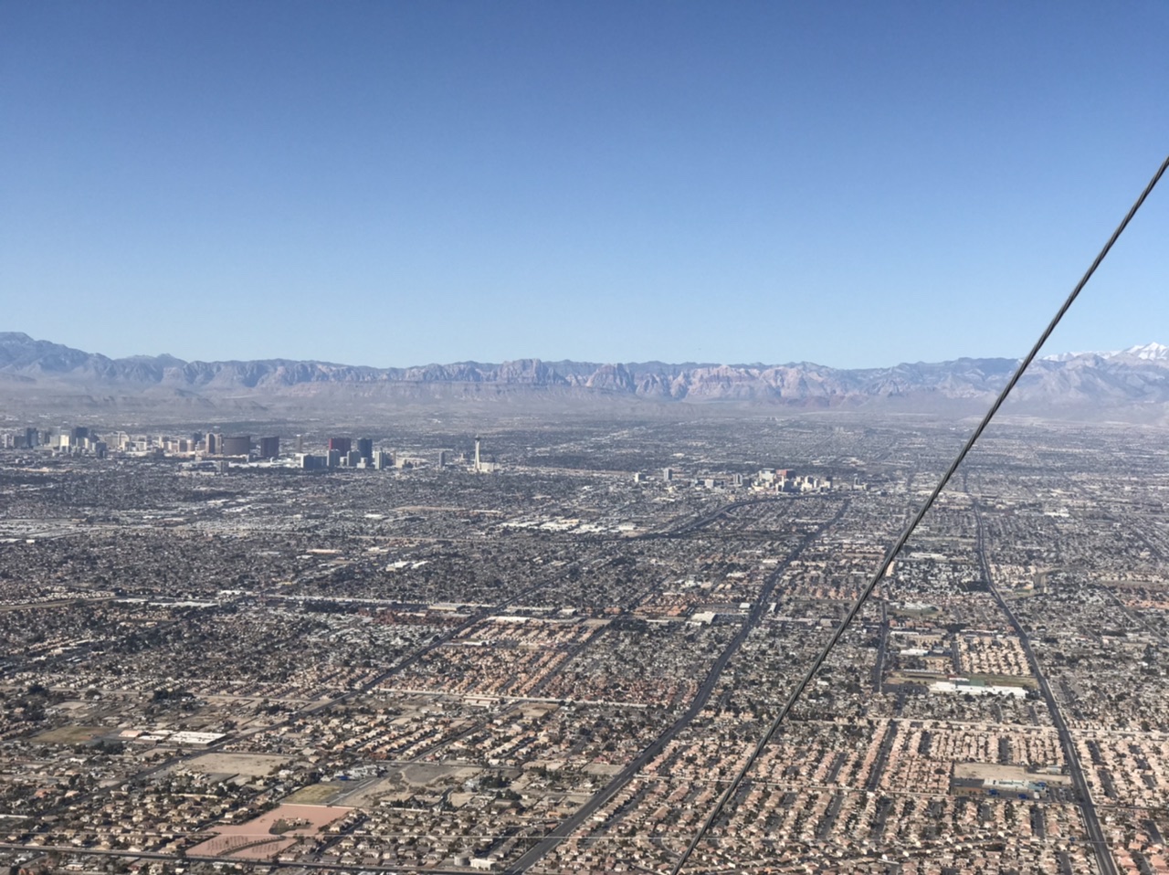
Las Vegas as viewed from Frenchman Mountain
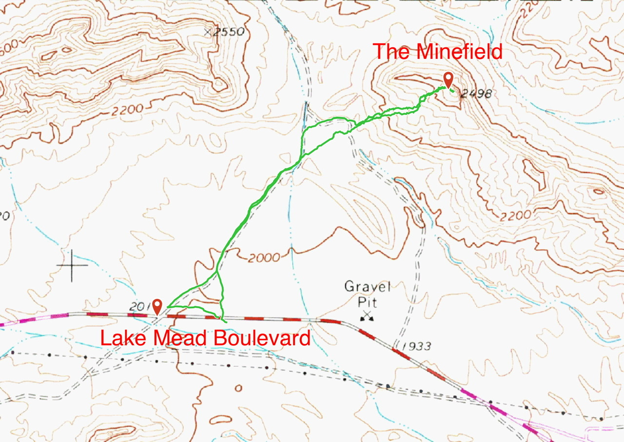
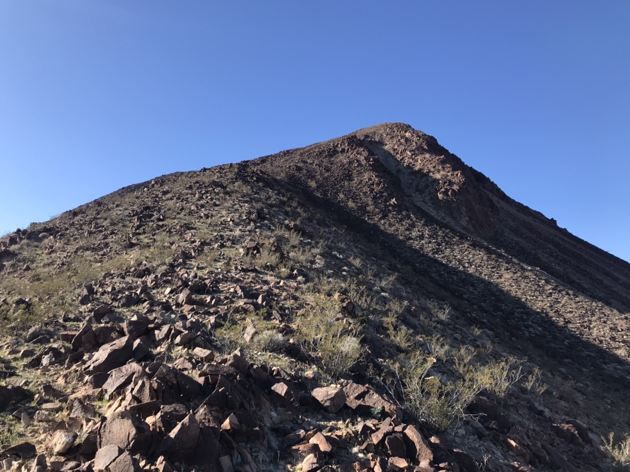
The Minefield (2.0 miles/389 feet of elevation gain)
This is a minor summit located northeast of Frenchman Mountain on the north side of Lake Meade Boulevard. A closed road leads to the base of the peak. This area has experienced a great deal of abuse in the past. Broken glass sparkles over acres and acres of the approach. The climb to the summit was highlighted by hundreds of barrel cactus.
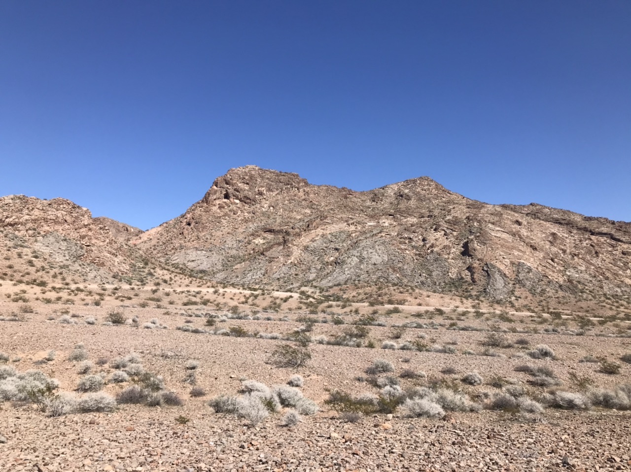
The Minefield
February 21st
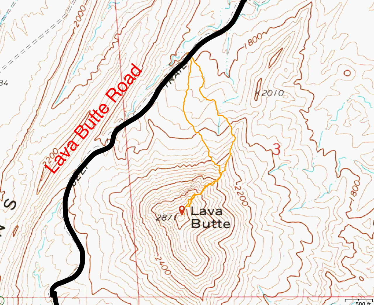
Lava Butte (1.5 miles/954 feet of elevation gain)
We spotted Lava Butte from Frenchman Mountain and immediately decided we needed to climb it. The area around the peak is part of the BLM’s Rainbow Gardens Area of Critical Environmental Concern. The dirt roads in this area receive occasional maintenance and access is fair. We climbed the peak’s north ridge. Once we started up the ridge’s west face, we found a use trail which we followed most of the way to the summit.

Lava Butte as viewed from White Eagle Mountain. The north ridge is on the left side of this photo.
The north ridge of Lava Butte.
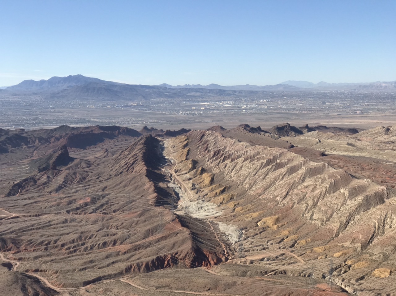
Rainbow Gardens as viewed from Lava Butte.
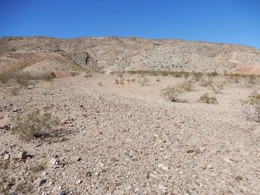
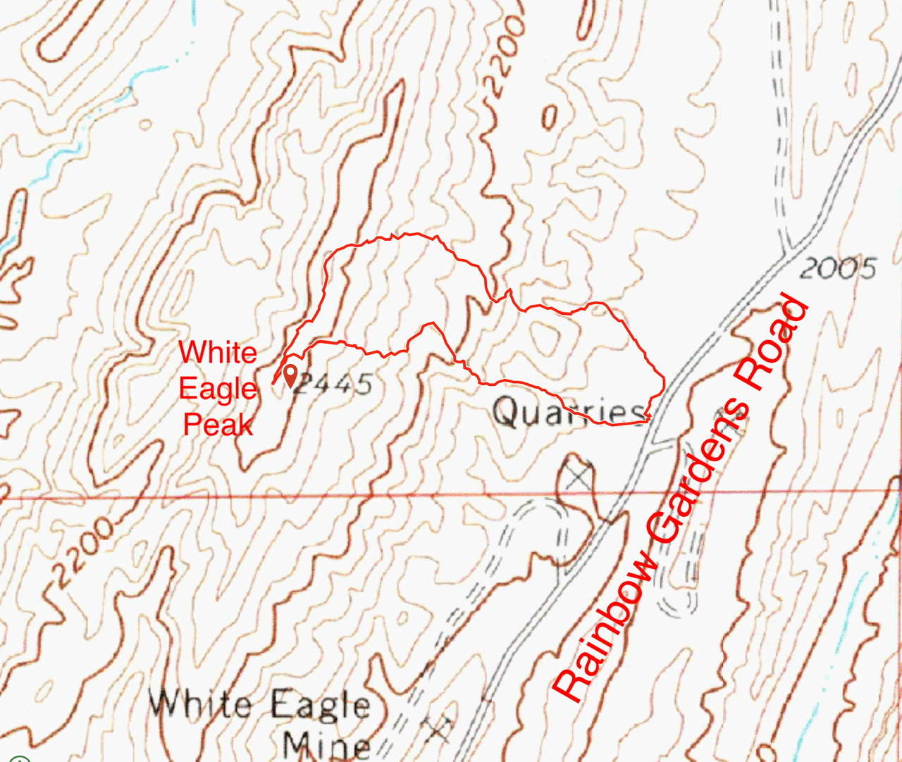
White Eagle Peak (1.0 miles/391 feet of elevation gain)
White Eagle Peak is the culmination of a long north-south ridgeline that rises west of the Rainbow Gardens Valley. The [good] Rainbow Garden Road provided excellent access to our starting point.
White Eagle Peak as viewed from our starting point. John Platt Photo

The summit of White Eagle Peak
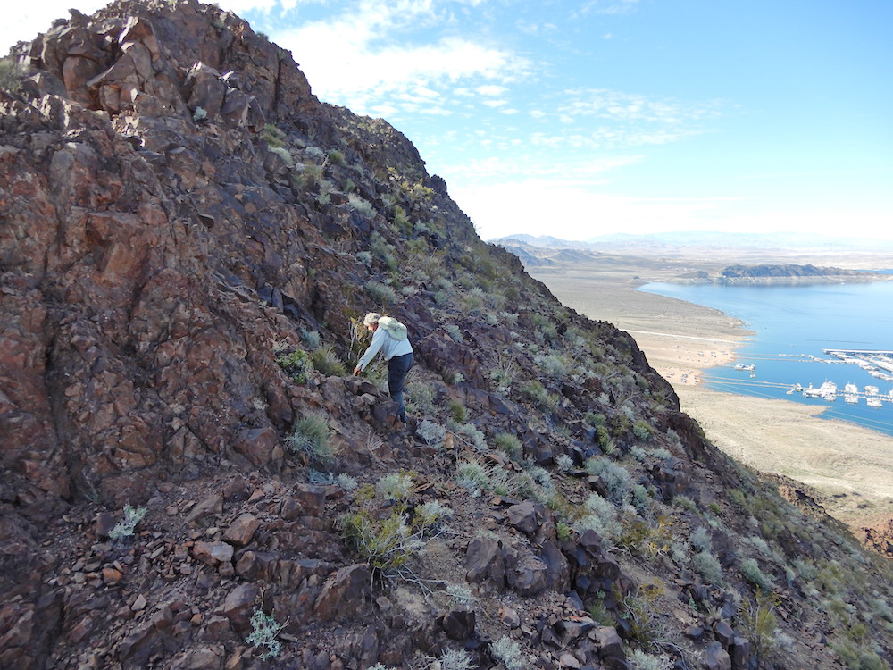
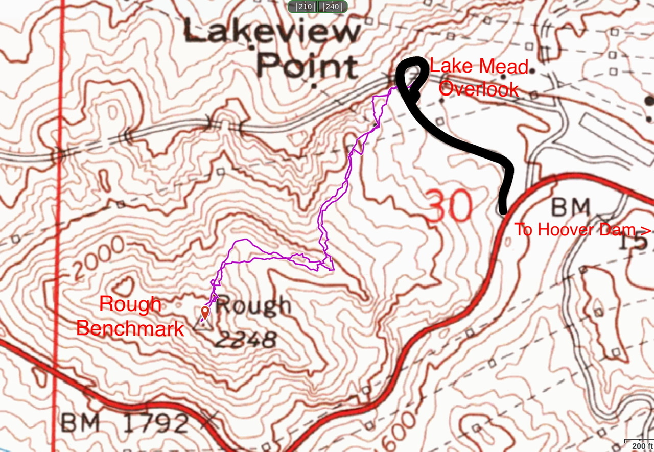
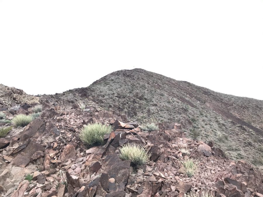
Rough Benchmark (1.0 miles/495 feet of elevation gain)
Rough Benchmark is one of three peaks on a ridge that starts due west of Hoover Dam. The best starting point is the Lake Mead Lakeview Overlook which is located on the peak’s east side. The route from the trailhead looks imposing with a 20-foot high band of broken cliffs on the skyline. We followed a use trail up to the south end of the cliff band. The closer we got, the less imposing the rock looked. It turned out that the cliff band was actually a ridge top. We traversed the ridge toward the summit at first on its east side and then crossed through a gap where we could see the summit. To reach the summit, we dropped off the ridge and into a saddle. From the saddle, John led us up a couple of Class 3 sections and then on to easier ground to the summit.
Approaching the rock wall. John Platt Photo
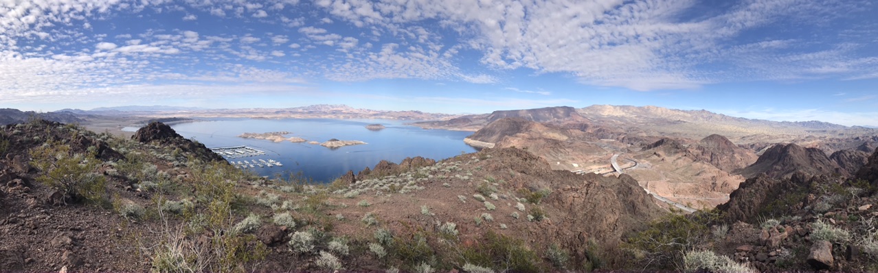
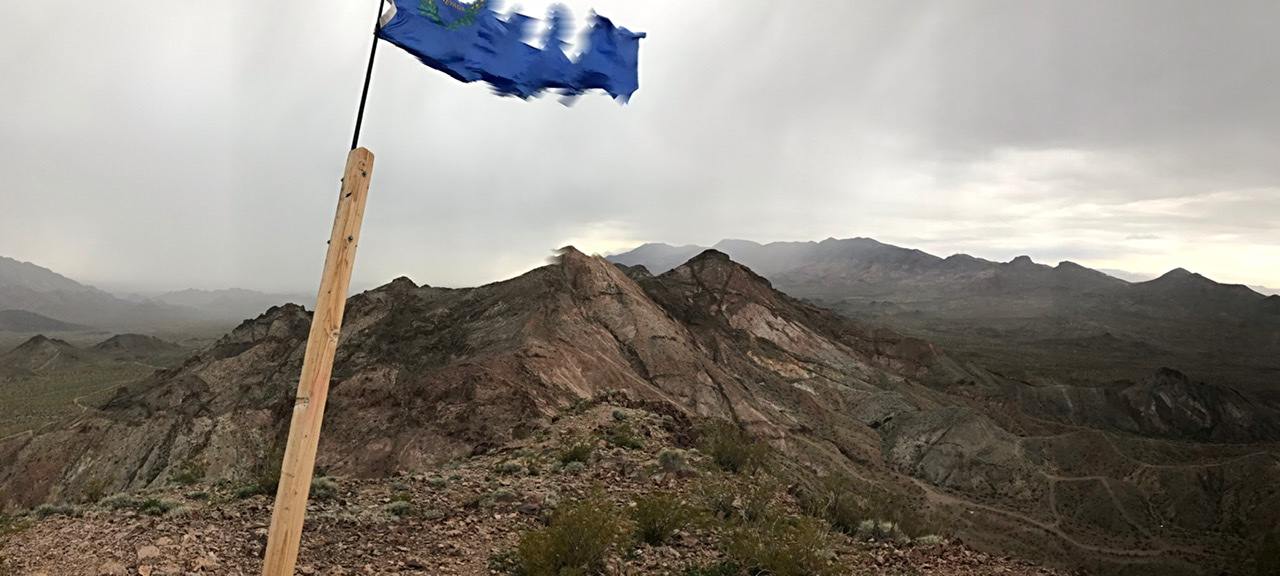
The view from Rough Benchmark.
February 22nd
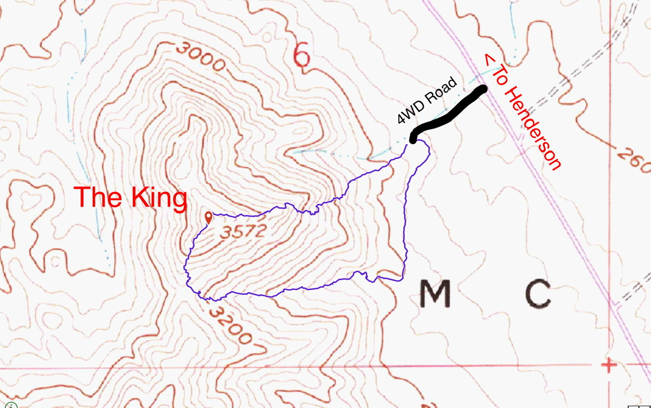
The King (1.2 miles/610 feet of elevation gain)
The forecast today showed a 90% chance of precipitation. As a result, we changed our plans and picked a group of peaks that were much closer to the motel. These peaks were located south of Henderson, Nevada and are identified on the map as part of the McCullough Range. There were numerous options but, in keeping with the Las Vegas motif and in honor of Elvis Presley, we decided to start with a peak known as “The King.” The closer we got to the base of the peak, the darker the sky. We took a 4WD road to an abandoned mine and parked. The steep slopes above us looked doable. We decided to climb straight up. Although we encountered a lot of loose talus and debris- covered slabs, the route was not difficult.
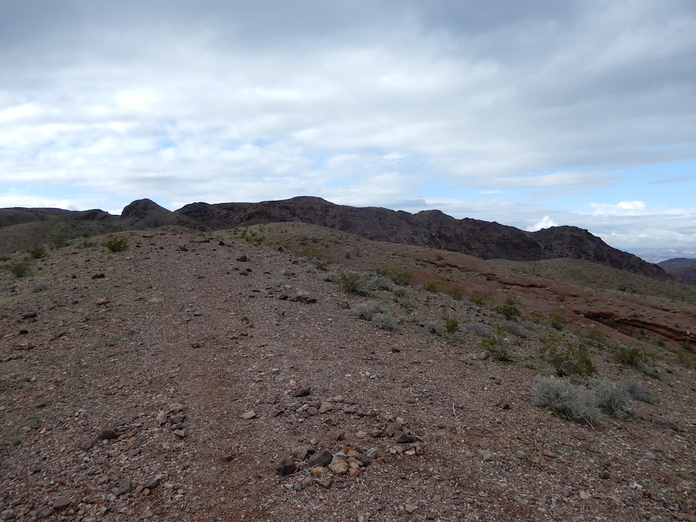
The King
The higher we climbed, the closer the rain came. As I reached John on the summit, the rain hit us. The wind picked up. Our plan was to continue on to “The Queen.” We dropped down to the connecting saddle but the rain picked up and we decided to retreat.
Looking toward “The Queen” as the rain and wind picked up.
The barrel cactus seems is the most prevalent plant in the McCullough Mountains. John spotted two bighorns near the summit of “The King.”
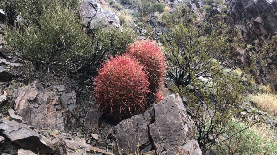
Barrel cactus
Dam View Point (1.6 miles/571 feet of elevation gain)
After climbing The King, we returned to our motel to wait out the rain. Three hours later, the rain let up and we headed for Arizona and Dam View Point. After crossing into Arizona on US-93 we took Exit 2 and drove up the Kingman Wash Road to a pass south of the summit. The road is somewhat maintained and we found a trailer parked at our trailhead. From our parking spot, we followed a ridge line north to the base of the peak. we avoided the peak’s rugged south face by climbing a gully on its left.
Dam View Point is on the horizon. John Platt Photo
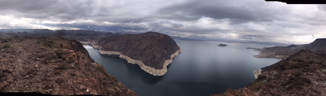
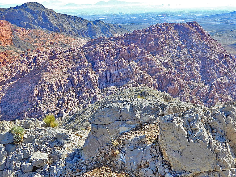
The panoramic view from Dam View Peak.
February 23rd
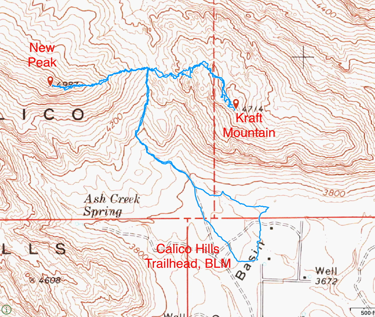
New Peak/Kraft Mountain (3.7 miles/1,552 feet of elevation gain)
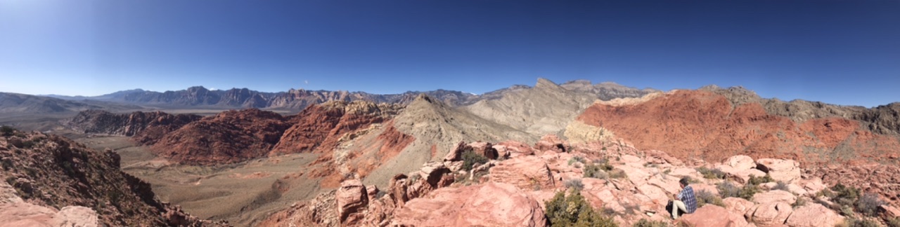
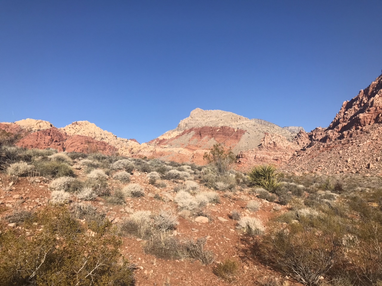
On Sunday, we finally arrived at the Red Rocks Canyon National Conservation Area on the southwest side of Vegas. The area encompasses a dizzying array of rugged peaks and cliffs. As a result, it is extremely popular with Las Vegans. Sunday is not the best time to visit if you are averse to crowds. John had sung the praises of Kraft Mountain which he had climbed years before. His description of the route, which crossed unique sandstone formations, easily convinced me to give it a try.
New Peak
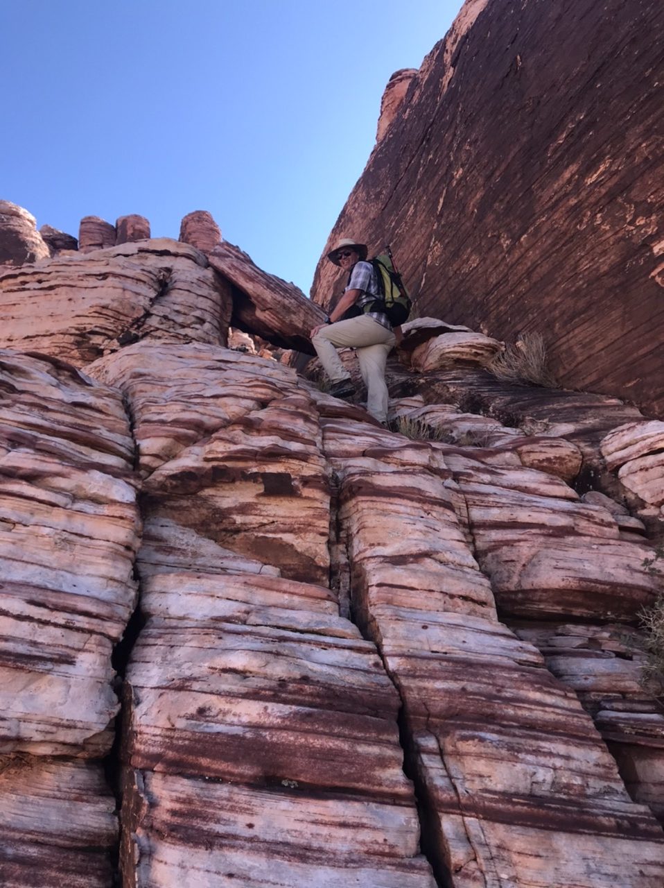
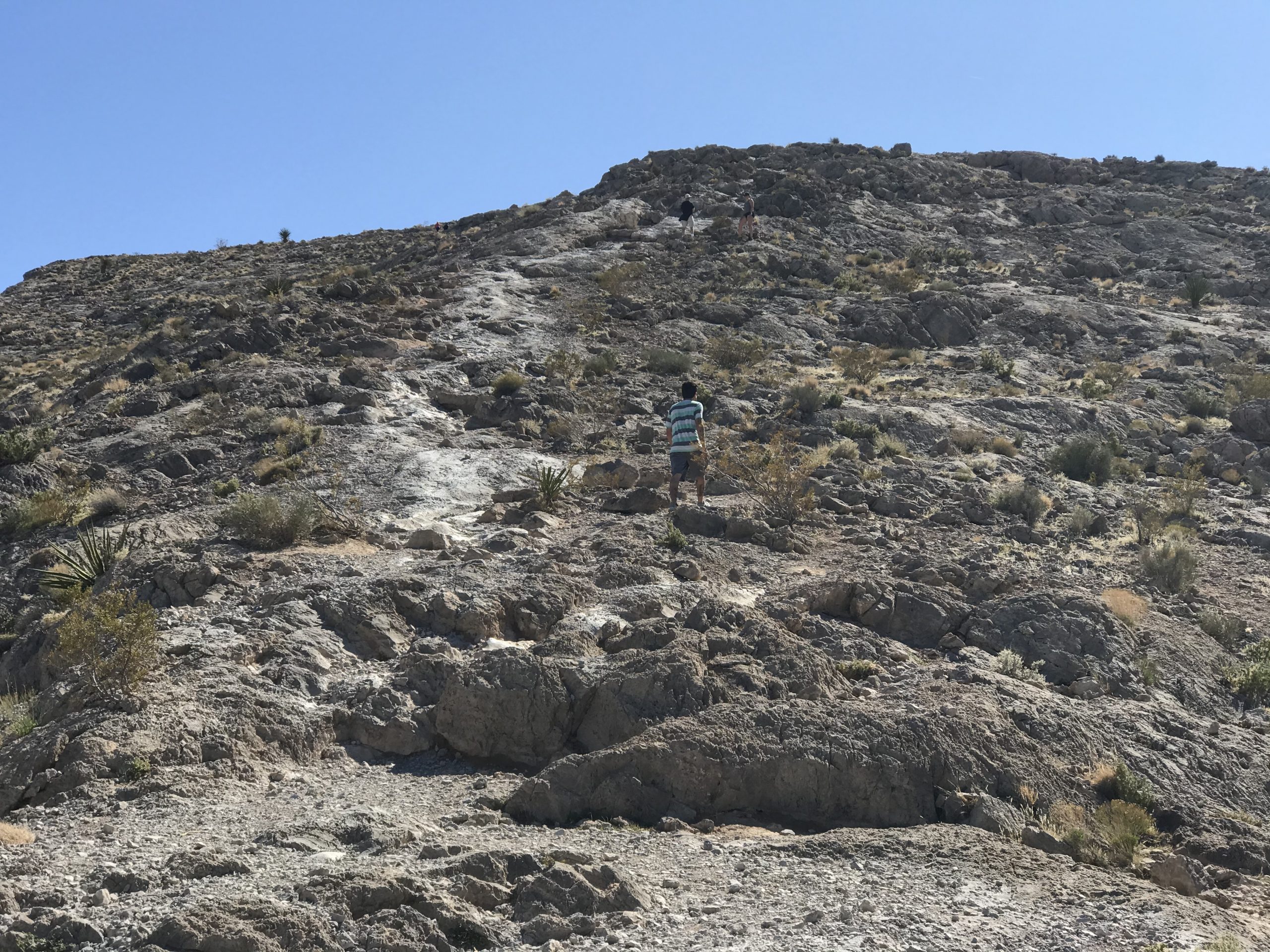
We started our hike at the Calico Hills trailhead. A loop trail circumnavigates Kraft Mountain from this point. We followed the trail clockwise to the pass between Kraft Mountain and New Peak. We decided to climb New Peak first because it is the higher of the two peaks. The route was delineated by a use trail much of the way. Several times we had to climb over rocky outcrops. Eventually, the route narrowed and we climbed the final, easy Class 3 fin to reach the summit block.
Climbing the east ridge of New Peak
The summit of New Peak
As we descended New Peak, I looked for routes through the sandstone maze that constitutes Kraft Mountain’s west slopes. Nothing was readily apparent from that distance.
Kraft Mountain’s west slopes as viewed from New Peak. John Platt Photo
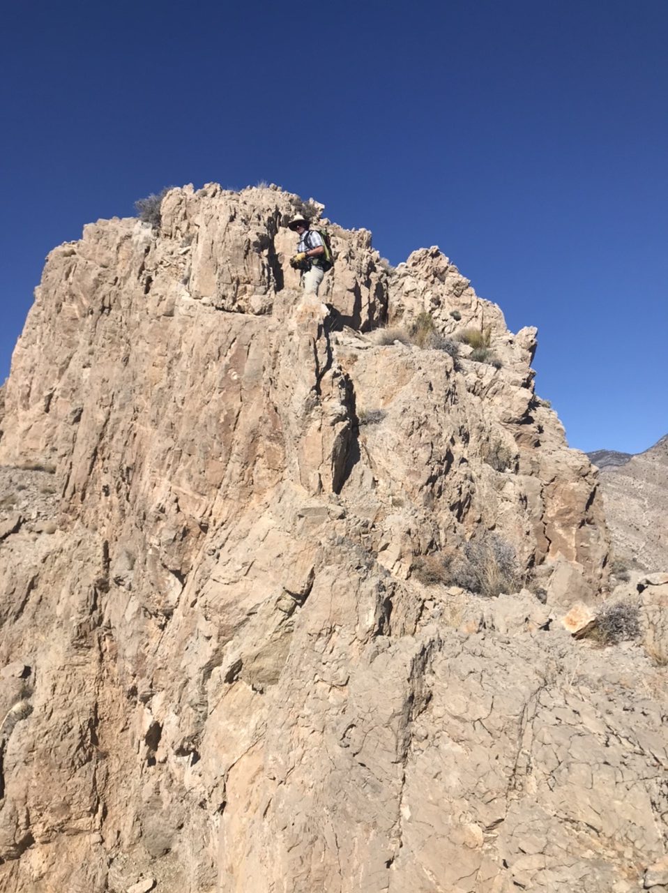
Although from the distance it looked like route finding might be a problem, finding our way was easy. John remembered the general direction he had previously followed and there were a few cairns marking the route along the way. This turned into the most enjoyable route of the ten routes we climbed during the trip.
Climbing up Kraft Mountain

The summit of Kraft Mountain
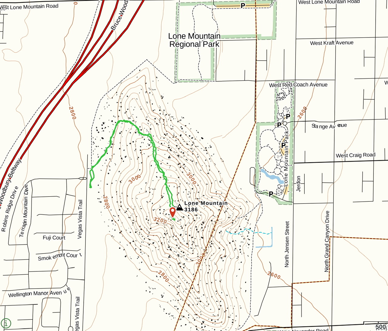
Lone Mountain (1.3 miles/493 feet of elevation gain)
Lone Mountain is a quintessential urban peak. It is completely surrounded by subdivisions. We arrived at the trailhead on Sunday afternoon to find the peak and the surrounding trails were jammed with people. Many of the people were hiking the trail that circles the mountain. Dozens of others, of all ages and sizes, were either ascending or descending the peak via a well-worn trail.
Lone Mountain is surrounded by Las Vegas
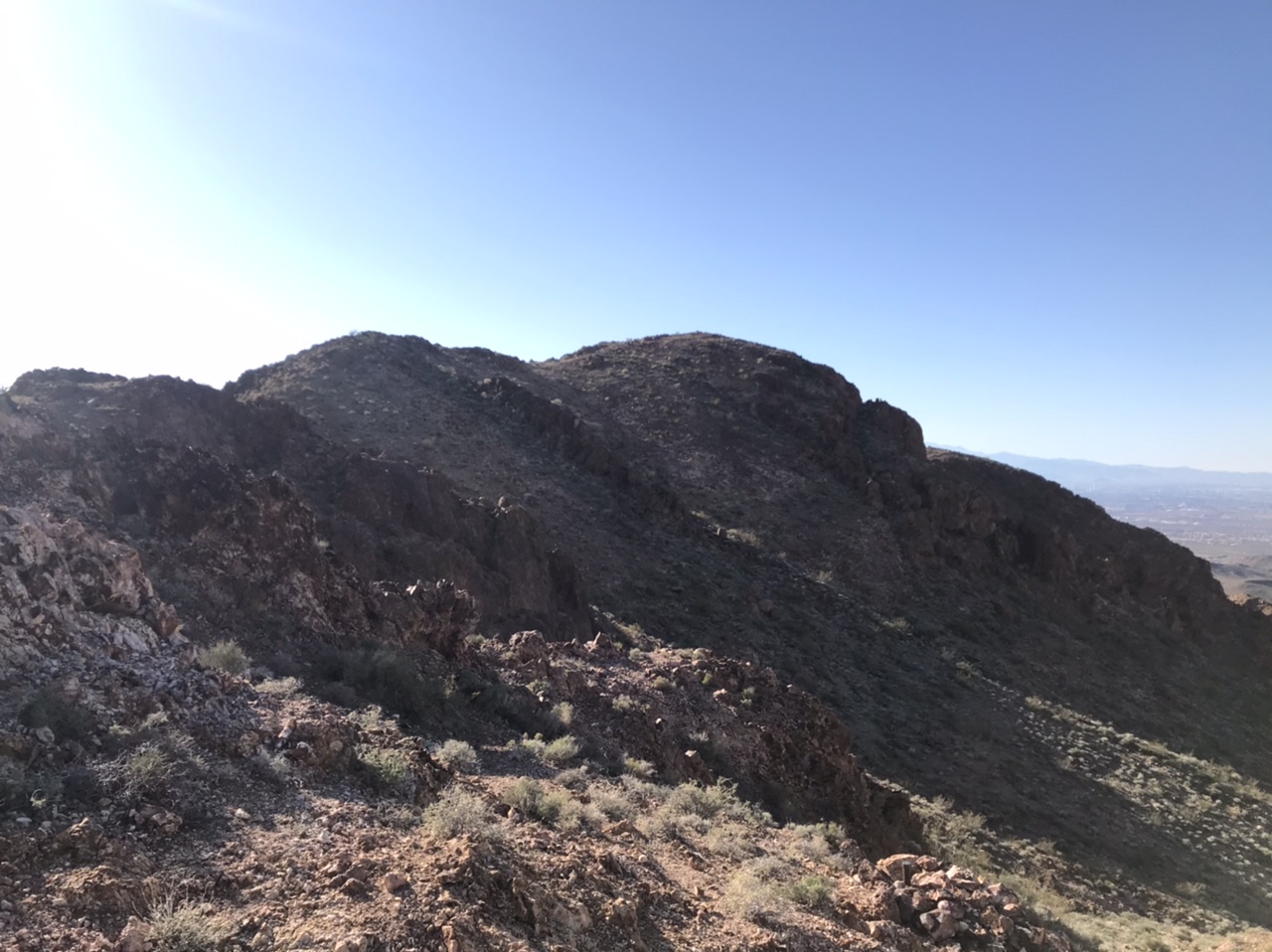
Bootleg Mountain (0.9 miles/438 feet of elevation gain)
Bootleg Mountain sits behind Boulder City and west of Red Mountain. We climbed Red Mountain in 2019 and we were familiar to with the access to Bootleg. The area is also the home of great looking mountain bike trails. As we were were driving up the access road, we almost had a collision with a van pulling a trailer. It was a surreal experience. I have no idea how we avoided a collision.
Bootleg Mountain
The climb to the summit was uneventful. The view to from the top was expansive.
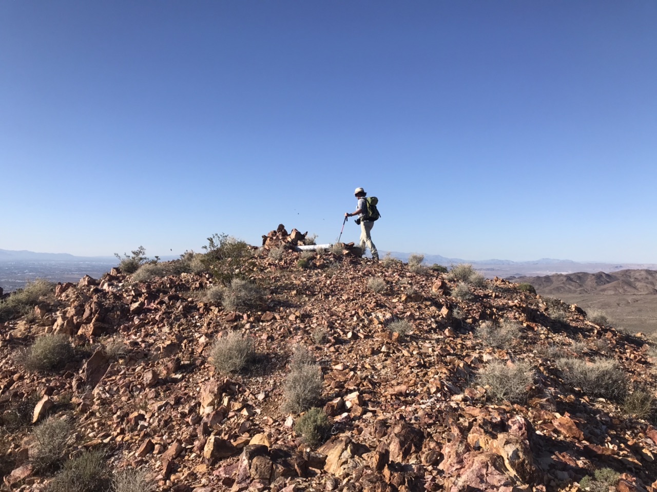
The final summit
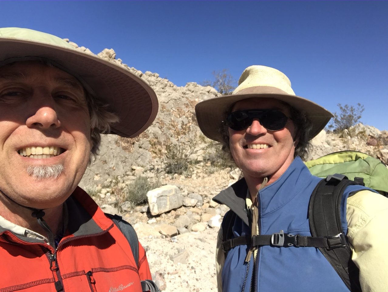
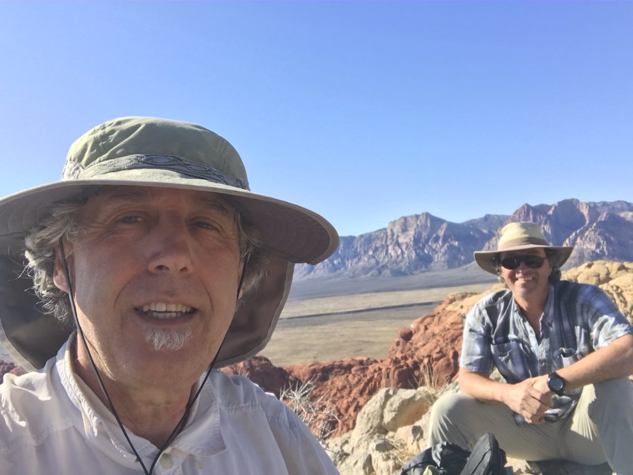
Two old guys on top of the world
Epilogue: Nevada is mostly comprised of public lands and much of it is wild and remote. There are more than a lifetime’s worth of peaks to explore. All of my Nevada climbing trips have been rewarding and challenging. The peaks come in all sizes, shapes and difficulty. You can find difficult Class 4 and 5 terrain that blocks your way. Don’t leave your good judgment at home.
The peaks are desert peaks. Even though the area around Las Vegas is somewhat civilized, you need to remember that, away from the paved roads, these peaks are wild and remote. This is desert country. Be prepared for difficult and sometimes treacherous travel conditions including bad and/or impassable roads, heat, rattlesnakes and every other conceivable hazard found in desert terrain.
Take a 4WD vehicle with good all-terrain tires (with at least 6-ply sidewalls). While cellphone coverage was surprisingly good during our climbs, don’t depend on cell coverage. The USGS quads for the Las Vegas area don’t show the new roads that have come with the area’s explosive growth. Buy BLM Surface Management maps to supplement topographic maps. Keep your gas tank full.

The view from Dam View Point.
Next: Bell Mountain—a Forty Year Journey 1980 – 2020