Article Index
The Wallowa Mountains are a mountain range located in northeastern Oregon. The range, although a popular destination for Oregonians, might be the least known of America’s major mountain ranges. The range is a rectangular-shaped upland roughly 40 miles wide. The Wallowa Batholith, surrounded by Columbia River basalt, forced the range skyward between 160 million and 120 million years ago. Ice Age Glaciers carved out several major valleys and left moraines and scenic Wallowa Lake. However, much of the batholith granite is still covered by slate, quartzite and metamorphosed marble. The range is drained by three major rivers: the Wallowa River in the north, the Minan River in the west, and the Imhaha River in the east.
A large section of the range is designated as the Eagle Cap Wilderness. The Eagle Cap Wilderness was named after Eagle Cap (9,572 feet) which was once thought to be the range’s highest peak. As mapping improved, it was determined that Sacajawea Peak (9,838 feet) is actually the highest point. The wilderness is the largest in Oregon with 565 square miles of protected land. The range encompasses lands that stretch between 3,000 feet to nearly 10,000 feet with thick timber at lower elevations and high lake basins and immense stretches of barren country above treeline.
There are no roads that cross the heart of the range and most trailheads start at low elevations. Thus trips to the high country throughout the range involve long, arduous approaches. Nevertheless, the high peaks see a lot of ascents. Sacajawea, as the range high point, is one of the more popular climbs.
The Hurricane Drainage is located due south of Enterprise, Oregon. There is a small Forest Service Campground near the trailhead with 14 sites. It fills up most summer nights. The trailhead is located at 5,005 feet and has a large parking area and an outhouse. The trail climbs just over 400 feet in its first two miles and the unmarked junction that leads to Thorp Basin at the base of Sacajawea’s southeast ridge. I recommend downloading a GPS track of the route so you don’t miss the junction.
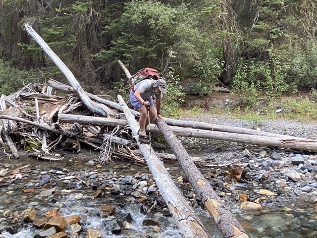
The first two miles follow climb up Hurricane Creek gaining around 400 feet. An unmarked junction leads to the crossing of Hurricane Creek.
Hurricane Creek can carry a lot of water early in the Summer. The two log makeshift bridge shown above is a bit shaky but would make the crossing safer when the water is up. The water level in late August 2021 would have been easy to wade.
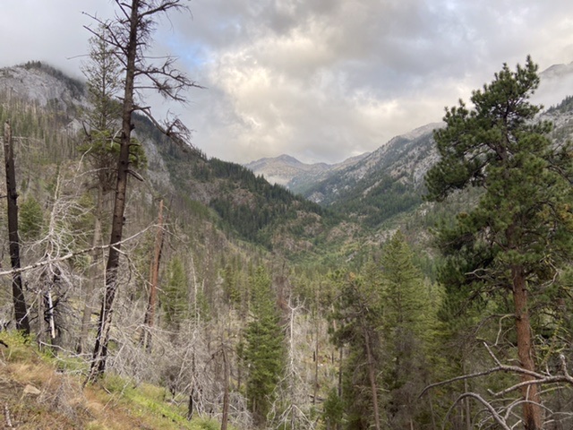
We started in the dark. As we climbed out of Hurricane Creek the sky looked threatening.
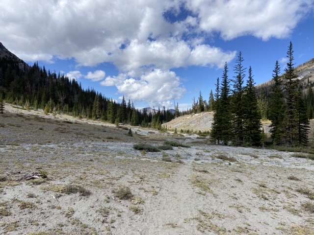
Once across Hurricane Creek, the trail winds through the forest and reaches a meadow. The trail goes straight across the grassy meadow and into the woods. At first, the trail climbs moderately out of Hurricane Creek and is brushy with some downfall. After crossing Twin Creek the trail begins to climb steeply up well constructed but steep switchbacks.
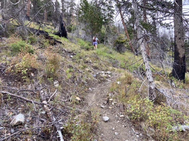
Although not shown on the Forest Service maps, a trail climbs up to the meadows on the east side of Sacajawea Peak.
After climbing 2,000 feet the trail reaches a nearly mile long section of nearly flat ground that is Thorp Basin. The trail gets sketchy in the meadows. Just keep heading south. A small cairn marked the beginning of the route up the southeast ridge.
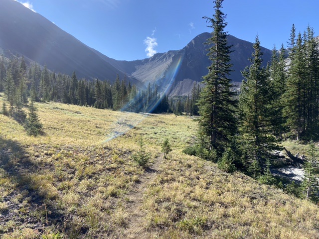
The series of meadows in the basin lead to the start of the climb.
A hunter told us the large meadow-filled basin at 7,500 feet is called Thorp Basin.
From the cairn (if it is still there), hike uphill and due west on a use trail that quickly improves and work your way up on the broad row of the southeast ridge.
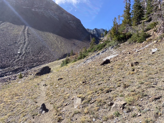
At the south end of the last meadow, a climbers trail leads up and around the base of the peak’s northeast ridge.
The use trail leads you into the moonscape basin between Sacajawea and Hurwal Ridge and then turns sharply up. The use trail is easy to follow and is nearly continuous.
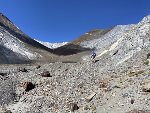
Starting up the northeast ridge. Sacajawea is the dark summit just right of center on the skyline.
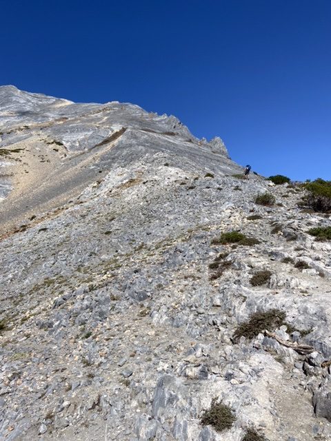
The northeast ridge is steep and loose but traversed by a climbers trail for its entire distance.
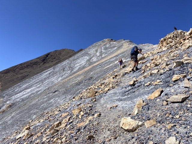
Steve and Alex climbing the ridge as Abbey watches. The footing is occasionally tenuous.
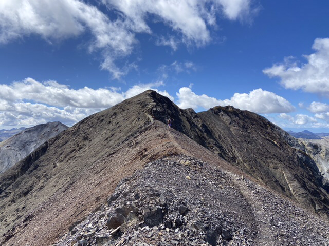
The last stretch to the summit
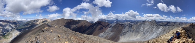
A pano from the summit, east to south to west from left to right.
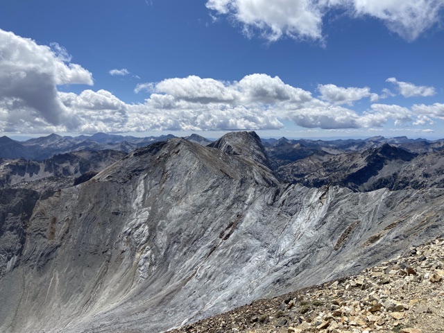
The Matterhorn
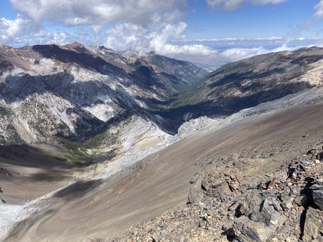
It is steep country
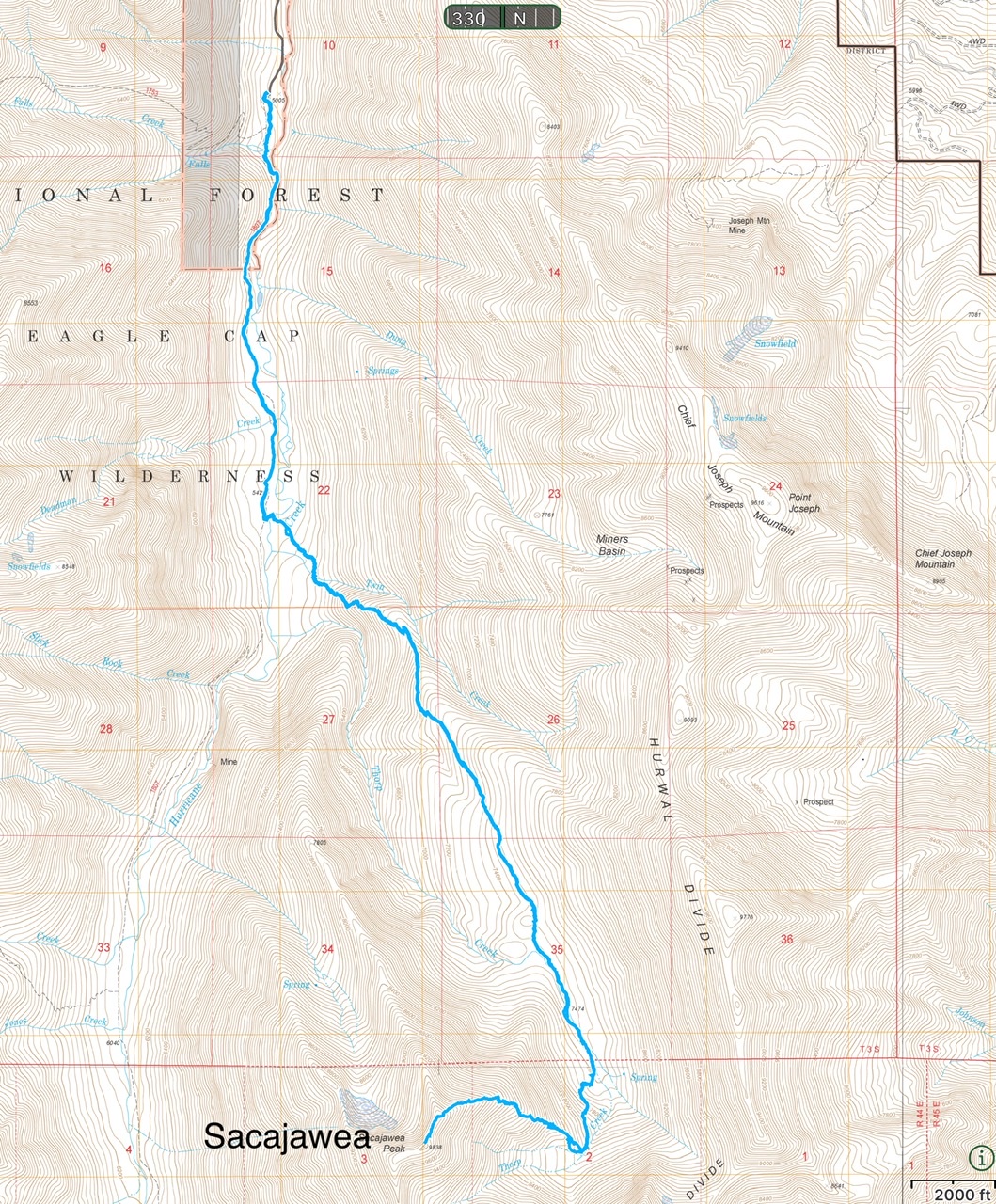
My GPS track recorded 13.8 miles with just over 5,000 feet of elevation gain round trip.
Next: The Grand Slam