Our Spring 2014 motorhome trip was our longest trip to date as we traveled through Nevada, Utah, New Mexico, Texas, Oklahoma and Colorado before returning home. All in all, it was an incredible trip.
March 19. Boise to Wells, Nevada. Nice windy drive to Mountain Shadow RV Park. 23 degrees overnight.
March 20. Arrived at St. George, Utah at 4:00PM. Picked up a rental car and checked into Temple View RV Park.
March 21-23. Spring Worlds Tournament. I was 11 for 12 on Sunday with 3 home runs. Unfortunately, the one time I did not get a hit was the last out of the game for the championship. We took 2nd place. 70 degrees.
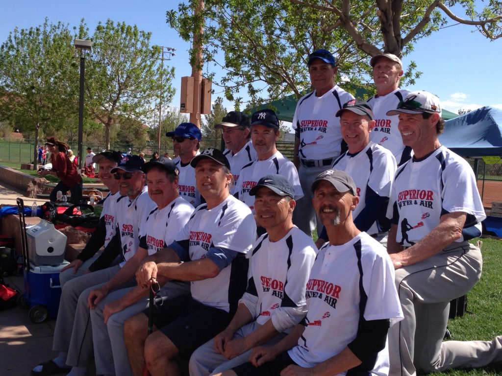
We finished 2nd at The Spring Worlds Tournament in St. George.
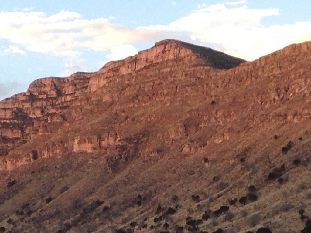
March 24. Drove to Navajo National Monument located on the edge of a high plateau covered with juniper and piñon pine. Continued on to Goulding Trading Post next to Monument Valley.
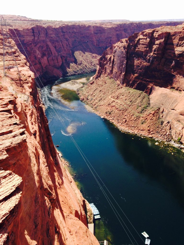
Just downstream from the Glen Canyon Dam.
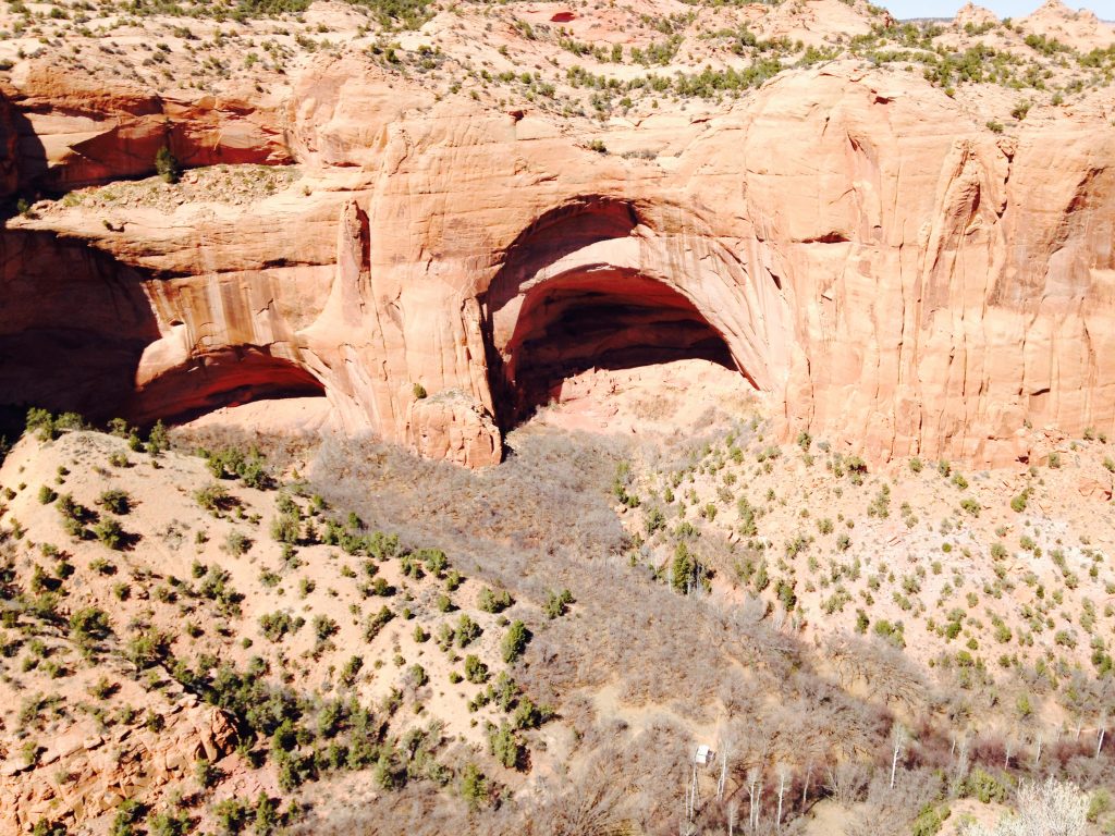
On the Navajo Reservation.
March 24. The Navajo Reservation (centered in Arizona) takes up a huge part of 3 states. Laurie and I have been fortunate to visit the reservation on 3 occasions. While most of the reservation is off-limits to non-tribal members, there are still a lot of places open to the public including Navajo National Monument, Monument Valley Tribal Park (partially open to the public), Canyon de Chelly and the Hubbell Trading Post National Historic Site.
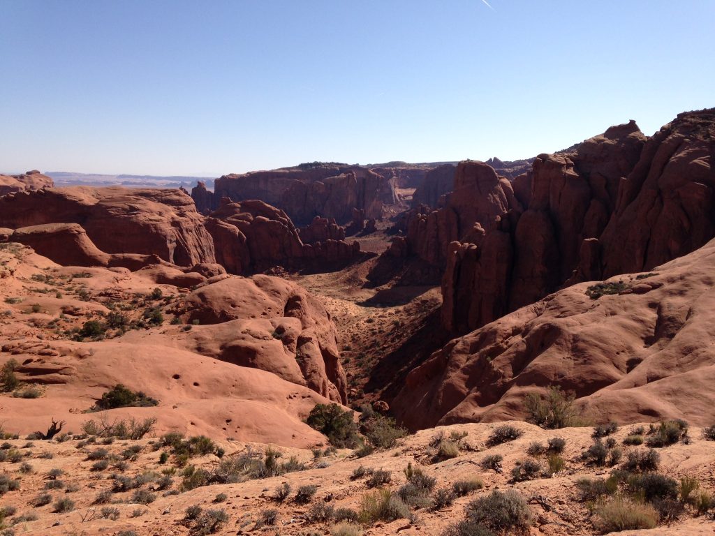
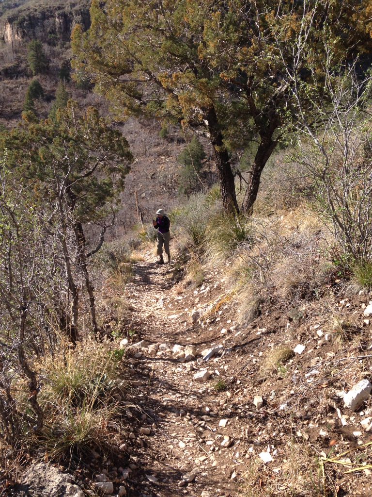
The Monument Valley Tribal Park encompasses one of the most iconic terrains in the United States thanks, in part, to all of the Westerns filmed there but, more specifically, to the Park’s amazing sandstone towers. Only a small portion of the park is open to the public. Exploring deeper requires the hiring of a guide or taking a tour. After looking into the options, we decided to partake of a guided hike. We read the following entry on Simpson’s Trailhandlers Tours website.
Hunt’s Mesa
5 Hours. Trail. Category: Strenuous. We hike and climb a switch back trail, a 1,200-foot (400-meter) elevated mesa: one of the highest plateaus in Monument Valley. As we go about the trail, we’ll show you the evidence of different geological events, and how the sediment sandstone developed through eons of time. This ‘island in the sky’ mesa has a view that is so spectacular that it puts people in awe as they wander about, overlooking the Valley. The crystal-clear atmosphere shows the valley floor as it stretches as far as the eye can see. It seems that you are saluting the spires, buttes and mesas that surround the area, as they are standing proudly saluting you back for your accomplishment. Every angle, every corner you turn, the impact is of a one-of-a-kind beauty. The colors of nature let you imagine and create your own conclusions. For this is ‘The land of room enough and time enough.’
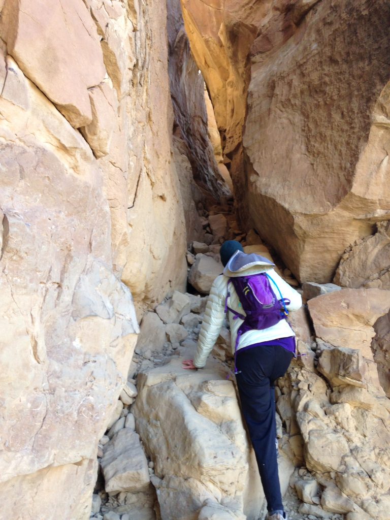
The rates are a bit steep for this hike ($200 each plus a tip). We met our guide John at the visitor center and he drove us to the start of the hike. The drive took us by many of the most impressive towers. We could picture John Wayne riding by as we trundled along. The hike started out crossing sand dunes and then worked its way up a steep sandstone alcove. The crux was too steep to climb free. We made an aid climb using a long rope ladder installed by the Tribe.
Laurie noted in our trip journal:
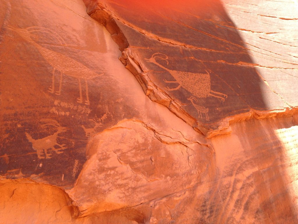
Great hike. Sand was deep in the washes. The rock’s arches, pockets and ridges played off the blue sky. Our guide was kind with classic Native features. He was soft-spoken and knowledgeable. Cool petroglyphs.
The hiked ended at the top of the mesa where there was a campsite and great views. You can arrange to spend the night at the campsite. I’m not sure how much that costs.
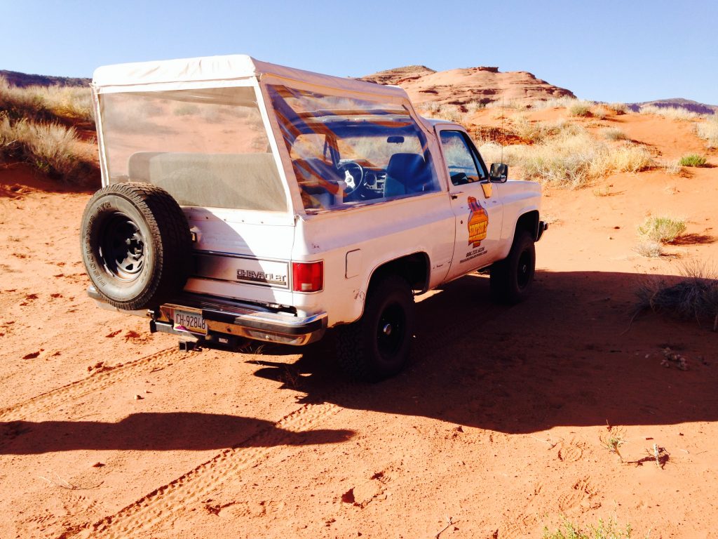
Monument Valley transportation.
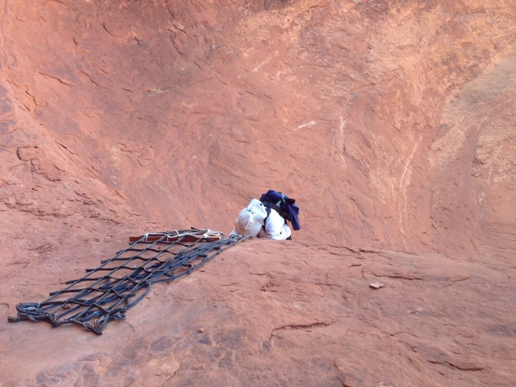
Laurie climbing the rope ladder up the crux of the hike to Hunt’s Mesa.
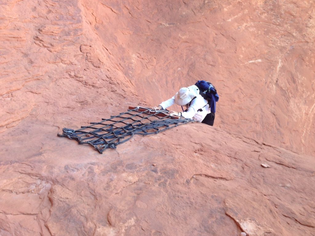
If you don’t hang on, you will fall.
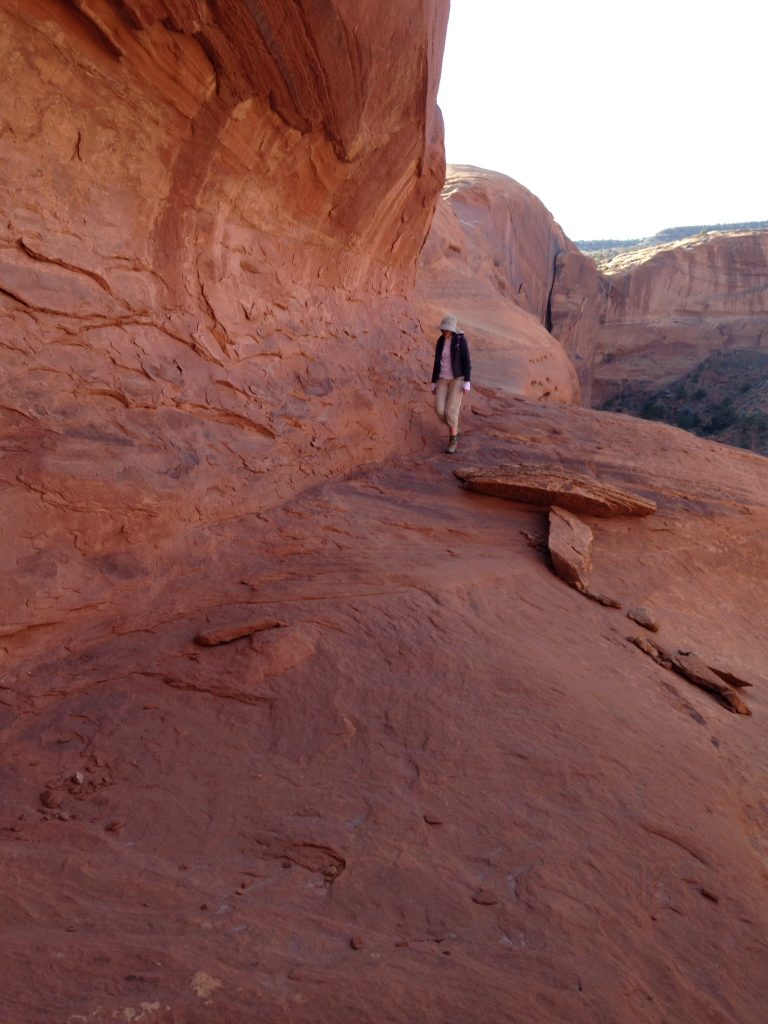
Hunt’s Mesa hike.
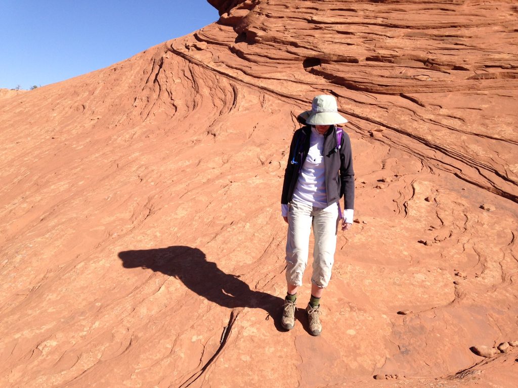
Hunt’s Mesa hike.
Near the top of Hunt’s Mesa.
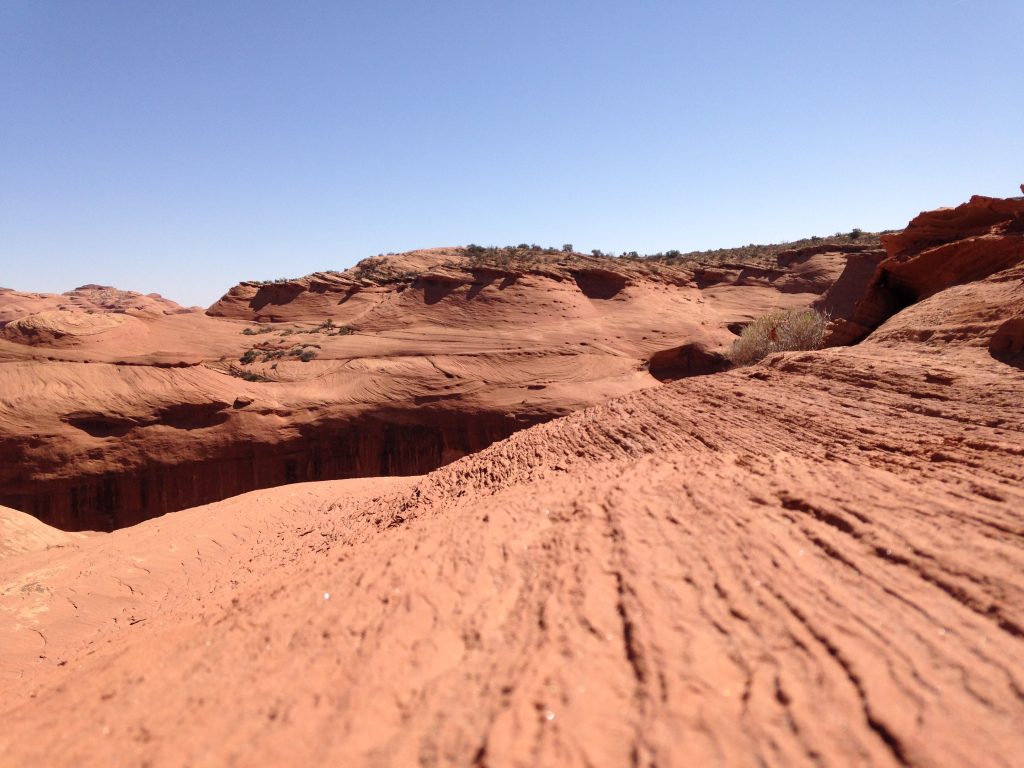
Hunt’s Mesa hike.
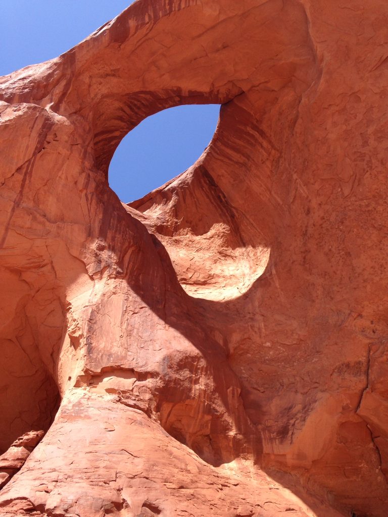
An arch along the way.
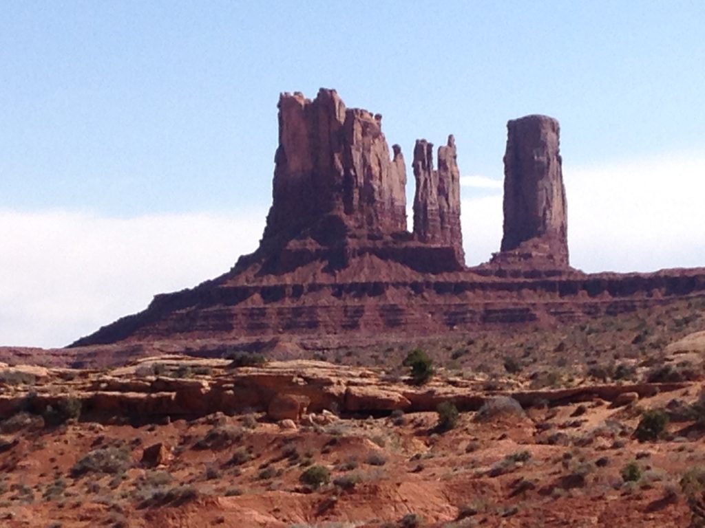
Monument Valley
March 26. Drove to Chaco Canyon. The road from the main highway varied from good extremely rough. It was impossible to go more than 10MPH for the final 10 miles. We experienced a horrendous windstorm overnight.
March 27. Hiked to Pueblo Alto. 5.6 miles round trip. Lots of fossils in the rocks. Rode my bike around the Park Loop Road 14.4 miles.
Chaco Canyon
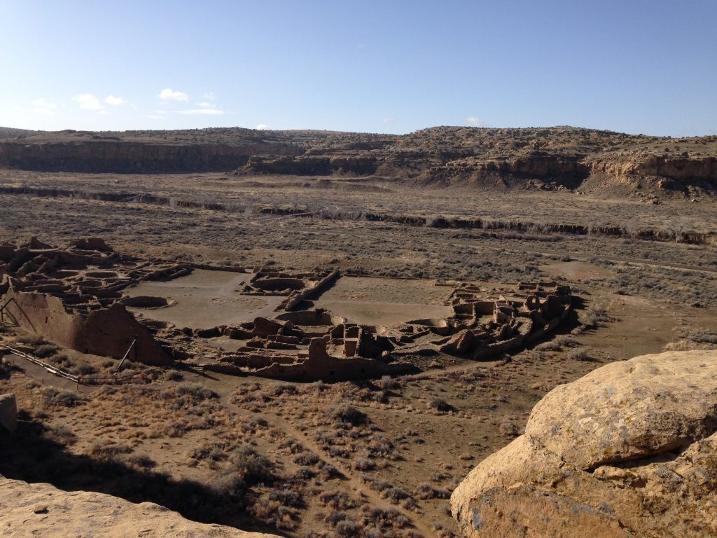
Chaco Canyon
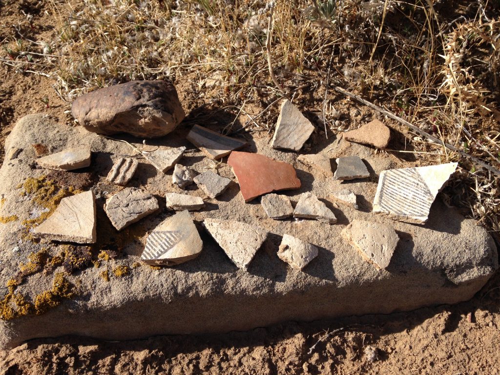
Pot shards in Chaco Canyon.
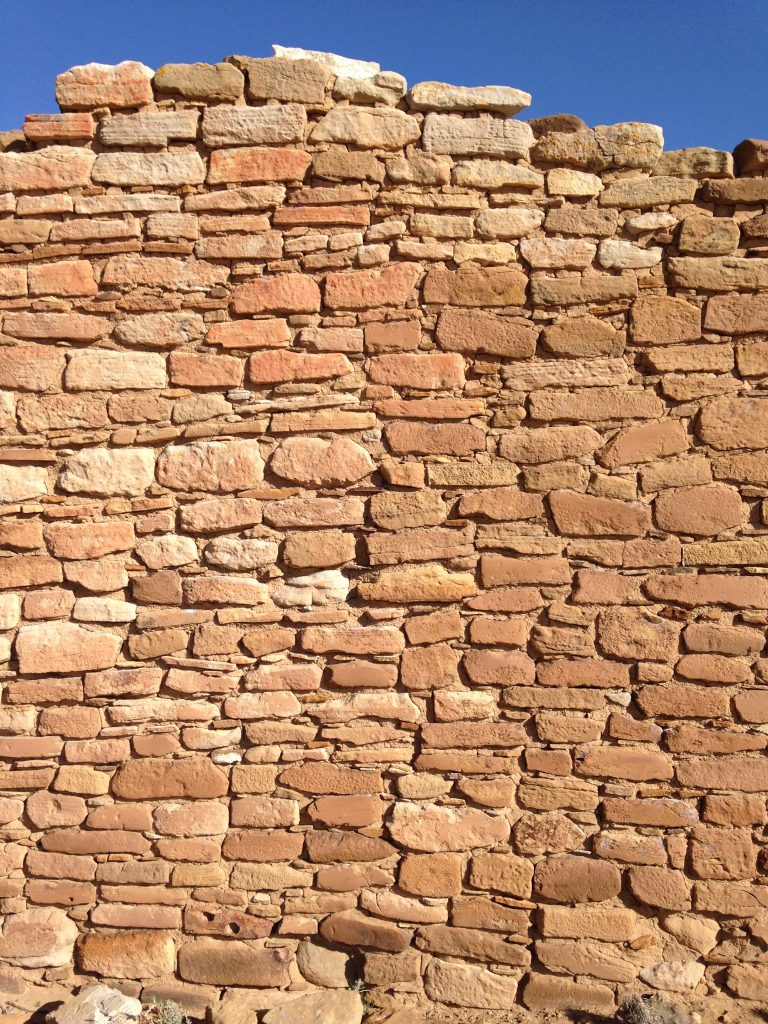
Chaco Canyon ruins.
March 28. Chaco Canyon in the morning. Hiked to the top of South Mesa (4 miles). Also rode the loop road again. Headed for god knows where. Took NM-126 across the Jemez Mountains. The drive turned into a 31-mile dead end as snow blocked our way. Ended up in Bernalillo, NM at a KOA.
March 29. Bandelier National Monument. Drove here via NM-4 through the Jemez Pueblo–a twisty, picturesque route that also traveled through the bottom of a large caldera. In the Monument, we hiked the main and Alcove trails near the visitor center. We saw the ruins in both weather- and human-carved tuff pockets.
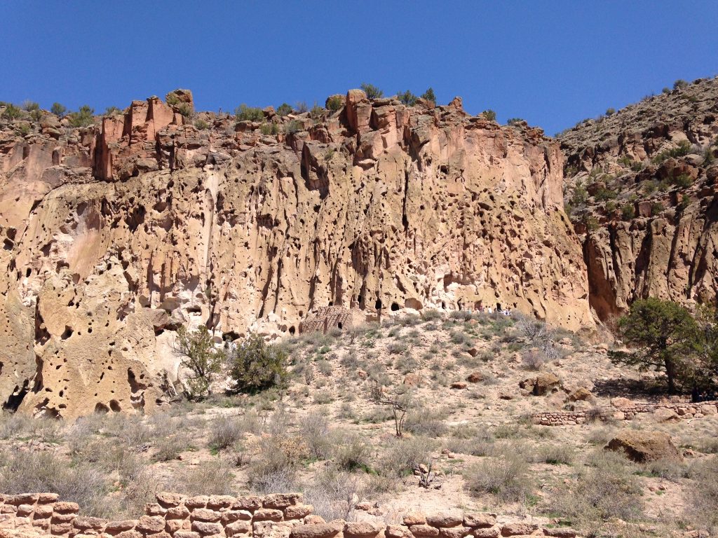
Bandelier National Monument
We reached the Alcove after climbing 4 long wooden ladders, ascending 140 vertical feet. It was a unique experience. We camped at Juniper Campground on the rim above the visitor center.
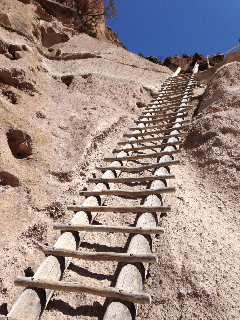
The largest of the 4 ladders to ruins in the Alcove at Bandelier National Monument.
Camping at Bandelier National Monument.
March 30. Spent the morning at Bandelier National Monument. Cloudy skies and calm. We drove through Los Alamos on poorly-signed roads and on to Santa Fe. Lunch at the Cowgirls Restaurant with great food and live music. Bought a painting and explored the town including the cathedral.
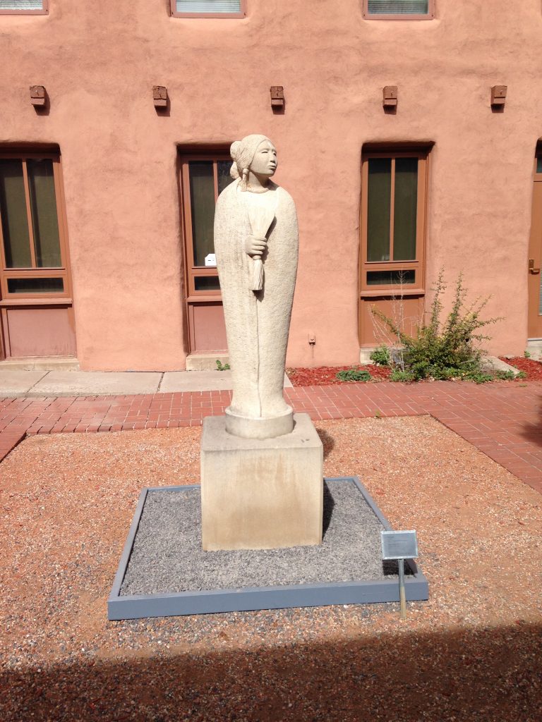
Santa Fe
Santa Fe is a special place even though it is crowded with tourists. The culture, food and art are amazing. Returned to the Bernalillo KOA for the evening.
March 31. Drove to Acoma (the Pueblo in the sky) and took the tour. We bought 3 beautiful pieces of pottery from Native artists.
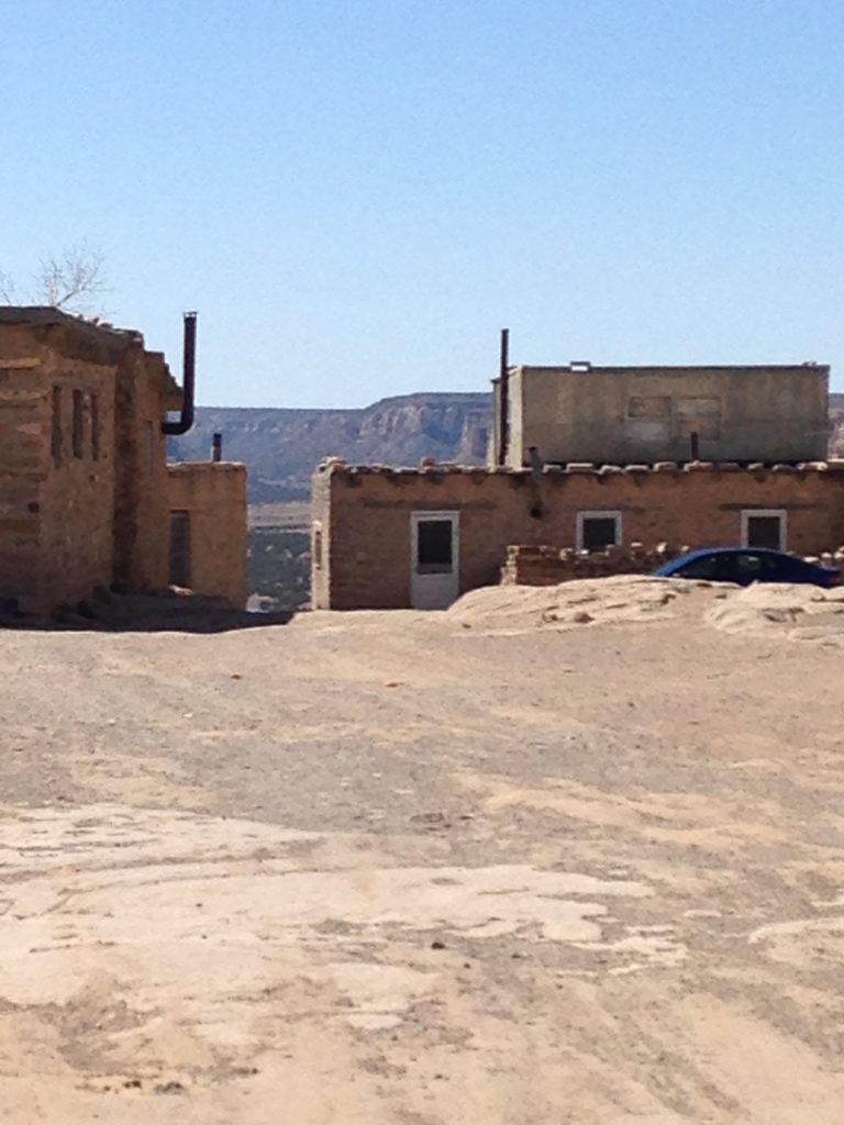
Acoma Pueblo
Camped at the Valley of Fire BLM recreation site. Windy. The recreation site is 4 miles west of Carrizozo on the west side of the White Mountains. Desolate but beautiful.
April 1. After a nice morning at the Valley of Fire Recreation area, we drove through Carrizozo, Artesia and Roswell on our way to Dog Canyon on the north side of Guadalupe Mountains National Park. Ate lunch at a Mexican restaurant and walked around Roswell. Now it is hot.
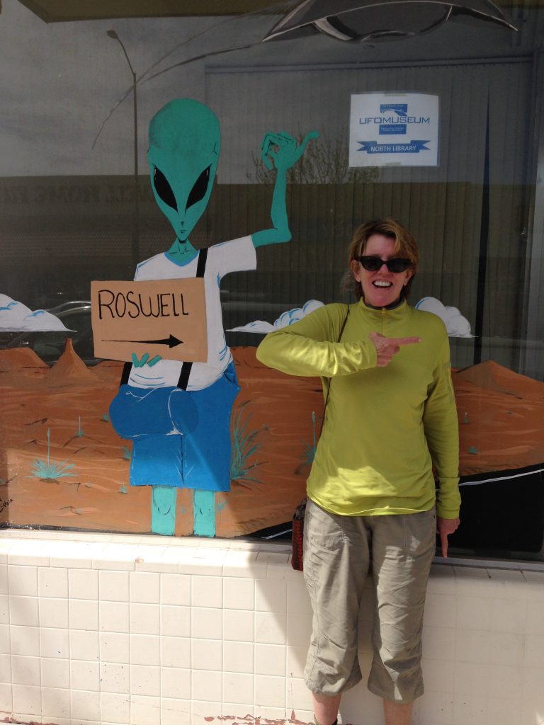
Roswell, New Mexico.
The 53-mile drive from US-285 to Dog Canyon was on a twisty, up-and-down paved road from US-285 to the Texas border. The drive took us 1-1/2 hours. Along our drive, there were many oil wells in the first 25 miles. We saw several signs warning of poisonous gas and we smelled gas fumes several times. Clearly, by driving a motorhome, we are part of the problem. We have spent $635 on gas so far.
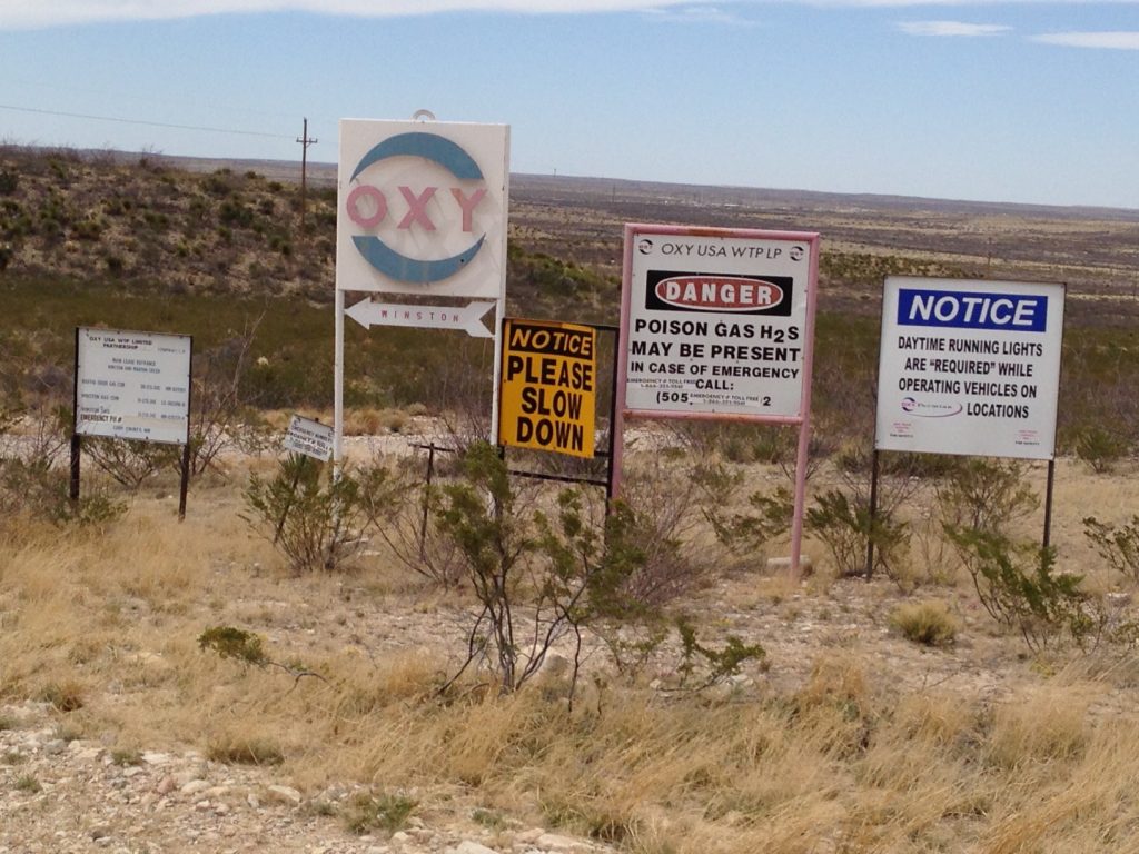
Southern New Mexico poison gas warnings. Aren’t fossil fuels great?
This may be the least-developed National Park that I’ve visited outside of Alaska. A wide spot for 5 RVs and several walk-in tent sites, a National Park Work Center Facility, a kiosk and 1 house are all that is present.
Dog Canyon, Guadalupe National Park.
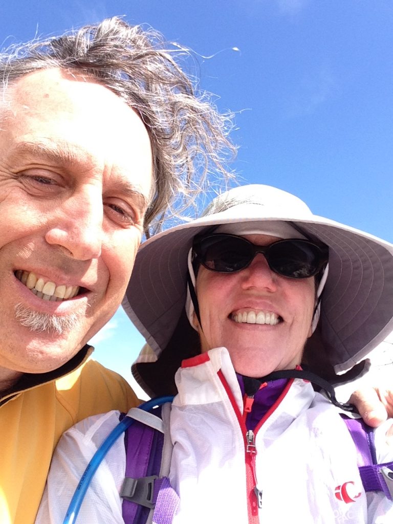
April 2. Dog Canyon Camp. Laurie cooked steak and eggs for breakfast. Another gourmet meal and 15 days on the road. We hiked to the top of Lost Peak (7,830 feet) in 6.4 miles round trip. Very windy up high–at least 30MPH wind gusts. A nice hike with a great variety of vegetation.
Laurie recalls, “Our hike to Lost Peak crossed a lot of rock which looked like mudstone. It is an old reef uplifted and the rocks and fossils are interesting. The vegetation is much different than we are accustomed to. Big yuccas with long leaves and fat agaves, oaks with alligator-like bark, junipers and fire scars. Amazing views of the canyons. A pregnant doe scurrying up a rockwall.”
Hiking in Guadalupe National Park.
On the summit.
April 13. We left Dog Canyon and drove toward the main visitor center for Guadalupe Mountains National Park which is located on the east side of the mountain range. It is very windy today. We canceled plans to hike and camp at the park because of the wind.
We drove from Dog Canyon to the main highway (US-285) and then south to Carlsbad, New Mexico to the main entrance for Guadalupe National Park. It was very, very, very windy–a gale force wind in fact. Headed south in hopes of finding better conditions. The wind moderated somewhat and we ended up at Davis Mountain State Park in a big campground in a canyon with good shade.
April 14. Davis Mountain State Park. We rode our bicycles around the park roads this morning. It is a nice State Park with lots of camping spaces and even a hotel. However, it is missing one important element: any place to hike in the Davis Mountains. All of the surrounding land is private and is off-limits to the public. This is a shame as the Davis Mountains are very scenic. Nice weather so far today with no wind. We decided to drive to Big Bend National Park. We got lucky and found a campsite in the Chisos Basin campground. It is around 70° with a light overcast and light wind.
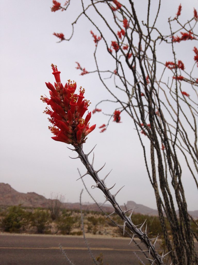
As we drive into the Park, the ocotillo is in bloom–large orange cluster flowers what appeared to be dead sticks, a very striking 4-6 foot tall plant. Plant leaves out when it rains a couple of times a year. Big Bend National Park.
April 5. Chisos Basin Campground, Big Bend National Park. A cloudy cool morning turned into a nice sunny afternoon. We walked up the Pinnacles Trail and then scramble to the top of Tall Mountain (7,450 feet). Trees, cactus and rock covered the summit. It was a nice walk. Big Bend is mighty big country with big rock peaks. Chisos Basin has a nice campground, a lodge, a restaurant and a store in addition to the visitor center.
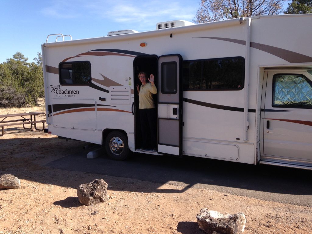
We both brought too many clothes. I’m hardly touched my vast store pants, shorts and shirts. Laurie has only used 4 of the 23 pairs of shoes she brought. We have eaten as though we were at home. Very good food. We have not used the generator more than 30 minutes on the entire trip. The motorhome is holding up well. It uses enormous amounts of fuel. If we feed it, it treats us well. It is a demanding master.
Better be careful.
Big Bend National Park
Morning at Big Bend National Park.
April 6 (Day 19). We are leaving Big Bend National Park today. Leaving early. We decided to drive most of the way to Johnson City which is near Austin, Texas. Going to visit Laurie’s childhood friend, Penny Ney. On the road at 6:33AM. It was pitch dark as we drove out of the Park past the northeast entrance. We saw beautiful mountains as we drove to Marathon, Texas. From there, we drove east on US-90 to Del Rio, Texas. From Del Rio we drove north on US-277/377 and then northeast on US-377 to Rocksprings, Texas.
The terrain became a rolling and tree covered. We then drove north on TX-41 and then onto US-260. We ended a long day at a KOA just east of Fredericksburg, Texas, the home of Admiral Chester Nimitz. The sky was filled with clouds for the final 100 miles and sprinkles at 8:30PM. This is the first moisture we’ve experienced since leaving Idaho. The border patrol was everywhere along our drive today.
April 7 (Day 20). Fredericksburg Texas. We had a quiet night in the campground. Took a nice bike ride in the hills south of town for 12 miles. We have arrived at Penny Ney’s extraordinary house in the hills south of Johnson City.
April 8. Visited the Bernini Sculpture Garden. Very interesting setting and extremely large sculptures. Sat in on a radio performance by Penny and Tom Corbert at KFAN in Fredericksburg.
April 9. Time to move on. Today we are heading to the Old Settlers Music Festival.
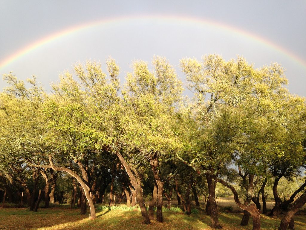
Rainbow at Penny Ney’s near Johnson City, Texas.
April 10-12. Old Settlers Music Festival. We are camped at Camp Ben McCollock, a private establishment with a lot of other people. People are crammed in here like sardines but the motorhome protects our personal space. Shuttle buses take us to and from the music venue. On Thursday, we were treated to great music in the campground’s pavilion including a long performance by one of our favorites, Peter Rowan.
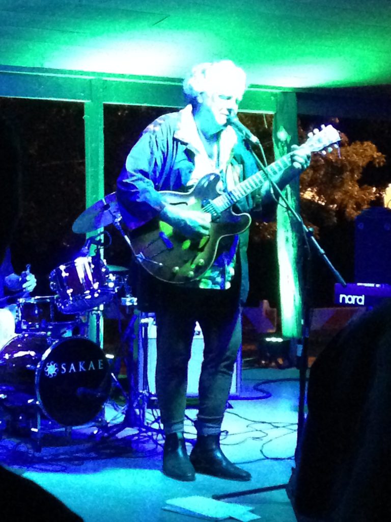
Peter Rowan at the Old Settlers Music Festival.
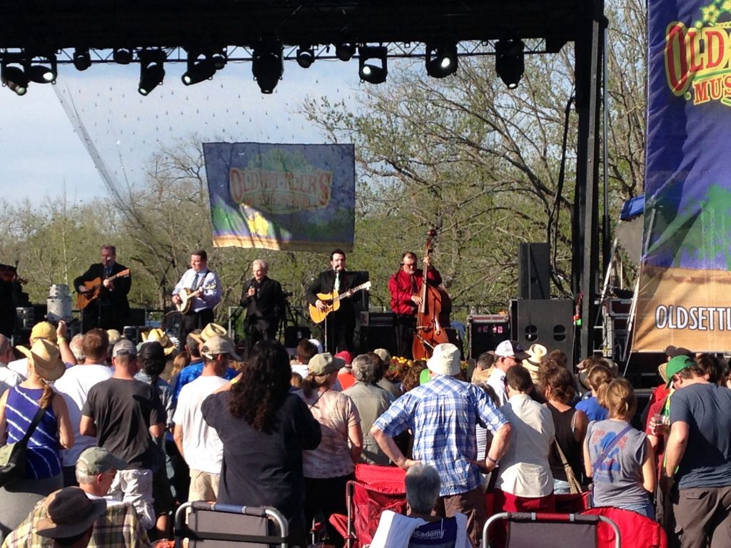
The main stage
The musicians we heard at the festival were Penny Ney, Tom Corbet, Parker Bradley Trio, K. Phillips and the Concho Pearls, the Rhythmic Statues, Peter Rowan, Front Country, Saint Paul and the Broken Bones, Parker Milsap, Wood and Wire, Donna the Buffalo, Rose Kimball and Judy Painter, Judy Kirby, Red Wine, Ralph Stanley and the Clinch Mountain Boys, Shovels and Rope, Jeff Bridges and the Abiders, the Deadly Gentlemen, Della Mae, Peter Rowan’s Groove and Twang, Elephant Revival, John Fulbright, Peter Rowan, Tim O’Brien and Darrell Scott, Gaelic Storm, Sarah Jaroz, and Robert Randolph and the Family Band.
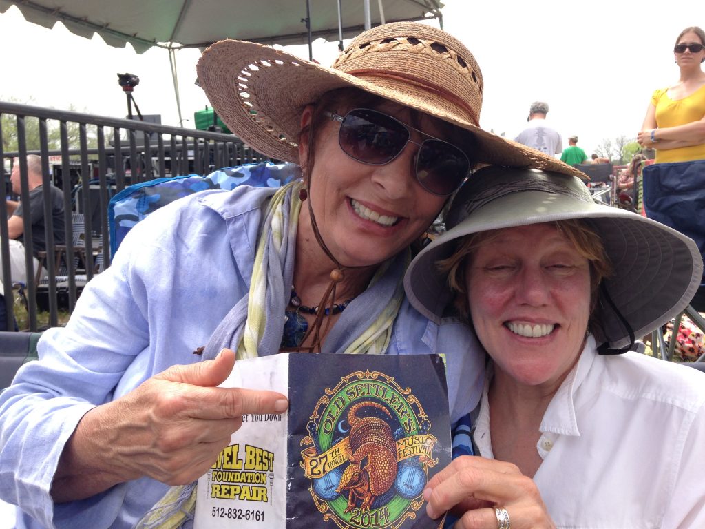
Penny and Laurie enjoying the music.
April 13. On the road again. We drove through Amarillo, Texas to Boise City, Oklahoma. Secured a spot in the Wild Bill’s RV park. What a total dump! Boise City is bleak. I can imagine that the dust bowl is still happening here. Today started out with the temperature at 69°. As we drove north, it rained for a couple of hours and then it heated up. The temperature was in the mid-80s in the Texas Panhandle. When we arrived at Boise City, it dropped to 18° and the wind was blowing at 40MPH. It soon started snowing and the wind blew all night.
April 14. We awoke to a world covered in ice and caressed by 20MPH winds. We hit the road early. The road was completely ice-covered for the first 100 miles. We could only drive 35-45MPH. It was not as bad as I imagined it would be with the motorhome but it was still dangerous. We arrived at my brother’s house in Lakewood, Colorado around 2PM. Had dinner with Bill, Diane, Nancy, Cliff and Sandy.
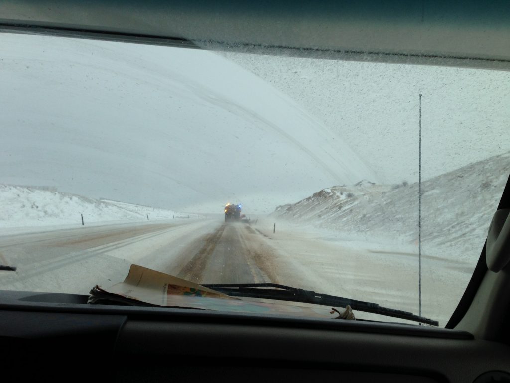
North of Boise City, Oklahoma.
April 15 (Day 28). Spent the day in Denver. Took a bike ride through Bear Creek Park and had dinner with the family.
April 16. We were now anxious to get home. We drove from Denver to Boise in 14 hours. It’s snowing south and west of Laramie but, otherwise, the roads were dry. Traveled 4,800 miles in 29 days.
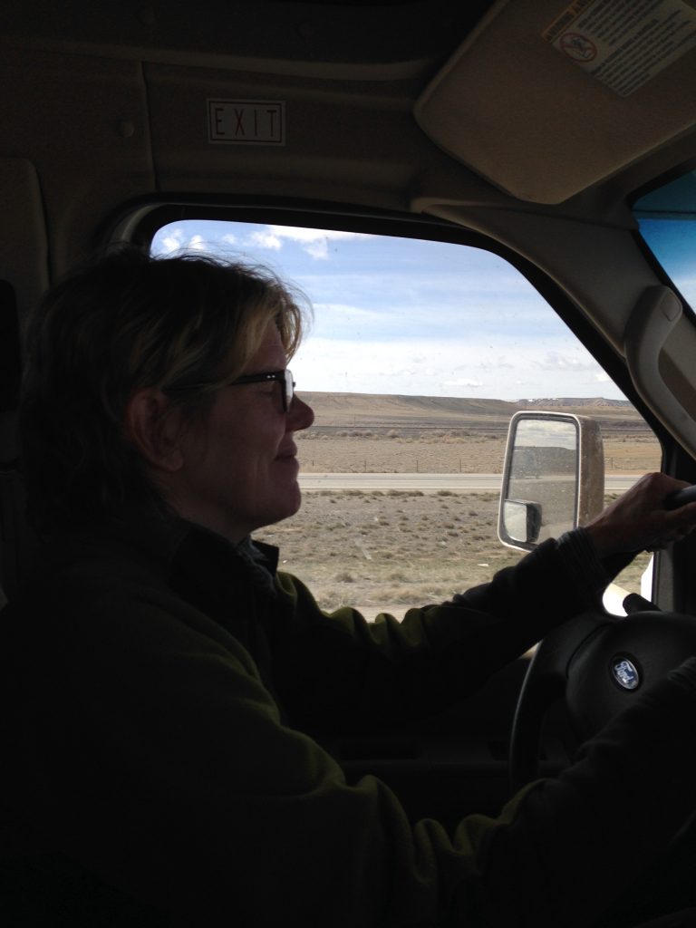
On the road again.
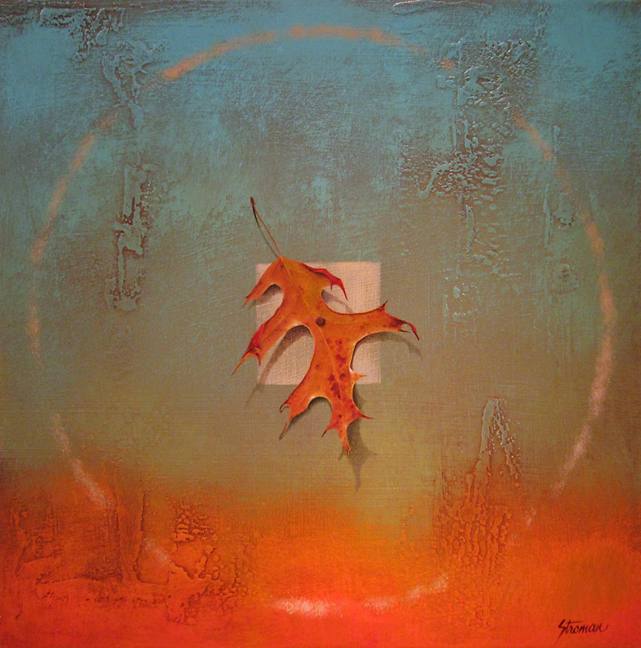
A painting we bought along the way.
Next: Fall Trip 2014: Nevada, Utah and California