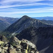
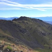
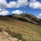
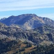
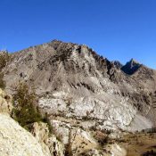
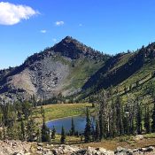
Peak 8180 (Purgatory Peak)

This peak is not in the book. Peak 8180, sometimes referred to as Purgatory Peak, sits east of Black Lake Road and north of Smith Mountain. This peak covers a lot of space and has 4 high points. 2 of the high points are so close in elevation that it is impossible to determine which is higher without sophisticated equipment. … Continue reading

Smith Mountain

Climbing and access information for this peak is on Page 103 of the book. Smith Mountain is the southernmost Seven Devils summit to top 8,000 feet. The summit has a Forest Service Lookout which is available for emergency use. USGS Purgatory Saddle Access is via Black Lake Road. A road leaves Black Lake Road and climbs to the summit in … Continue reading

Peak 8933 (John Milton Peak)

This peak is not in the book. Peak 8933 is unofficially named after John Milton, the author of the classic poem of Lucifer becoming the Devil–Paradise Lost. The peak is located in Adams County and is the second highest summit in the southern Seven Devils Mountains. Peak 8933 has a long north-south trending summit ridge, which is very rugged on … Continue reading

Peak 10769 (Long Ridge Peak)

This peak is not in the book. Elevation and prominence figures are based on recent LiDAR measurements. The USGS Quad shows an elevation of 10840. Updated January 2026 Unofficially called Long Ridge Peak by Rick Baugher, Peak 10769 is located east of The Box and just north of Upper Box Lake in the Pioneer Mountains. The summit sits on the … Continue reading

Peak 6582

Peak 6582 (left) and Slate Mountain (right). photo - Steve Mandella

This peak is not in the book. Margo Mandella and Livingston Douglas provided the access and route information. Updated November 2020  Peak 6582 lies approximately 3.8 miles due west of Scout Mountain on public land managed by the State of Idaho in the Bannock Range. This peak is easily accessed from its east side. USGS Clifton Creek Access From the … Continue reading

Peak 7682

This peak is not in the book. Peak 7682 sits roughly 1.0 miles northeast of Peak 7714, the Boundary County High Point. Access is via the trail that crosses the connecting ridge between the two peaks. Class 2. USGS Pyramid Peak … Continue reading