Article Index
The Basin and Range National Monument was created by Presidential Proclamation on July 10, 2015 in recognition of its unique geologic, natural, cultural, and scientific resources. This little known monument covers an immense area. It’s dimensions stretch 45 miles from east to west and 50 miles north to south. That amounts to 700,000 acres of basin and range country. Some of the physical highlights found in the monument are the expansive Garden and Coal valleys, the Worthington and Seaman Mountains, the Golden Gate and Mount Irish ranges and the White River narrows. It is quintessential Nevada.
Cirque of the Bovines
When John Platt and I visited the area in 2018 we climbed Cherry Springs Benchmark in the Golden Gate Range. Gazing eastward across Coal Valley to the Seaman Range we spotted a number craggy peaks. Looking at the map we decided the peaks circled a valley containing Oreana Springs. We decided to explore the valley. Arriving late in the day we managed to climb three of the eight peaks that surrounded the valley before the March evening descended on us. The next day the weather was changing quickly and we decided to head home, saving the remaining 5 peaks for our next visit. Honoring the historical cattle grazing in the area we jokingly called the area the “Cirque of the Bovines.”
John and I were in the habit of taking climbing trips to Nevada each March and November. Covid put a hold on these always enjoyable sojourns. As 2022 dawned we decided it was time once again to head to southern Nevada and specifically to the Basin and Range National Monument. Although there are almost unlimited peaks to chose from finishing off the remaining peaks surrounding Oreana Springs was high on our list.
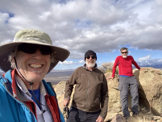
Unfortunately, two days after our last conversation in February John unexpectedly passed away while crosscountry skiing near his home. The shock of his loss extended beyond his family to a great many people including many of us who had been fortunate enough to have climbed with him. This extensive group included Steve Grantham and Alex Feldman. They agreed to join me on a memorial trip in John’s honor to visit the to the Basin and Range National Monument.
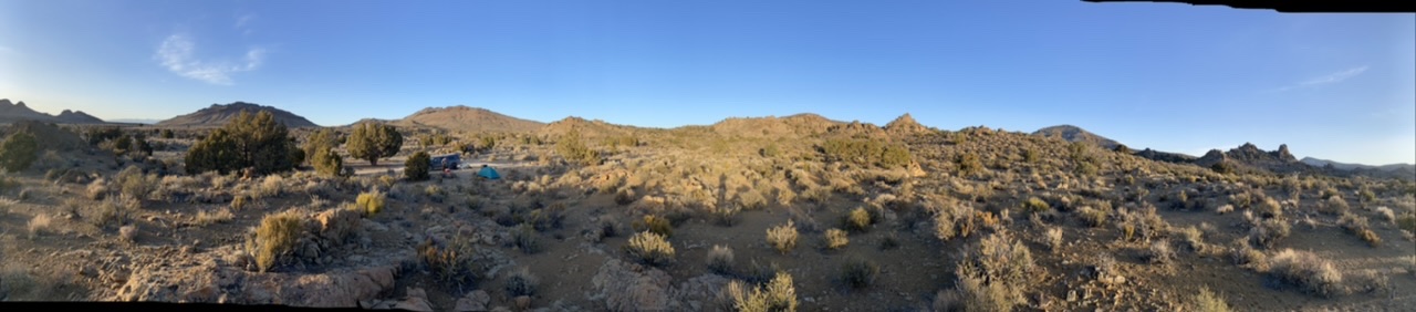
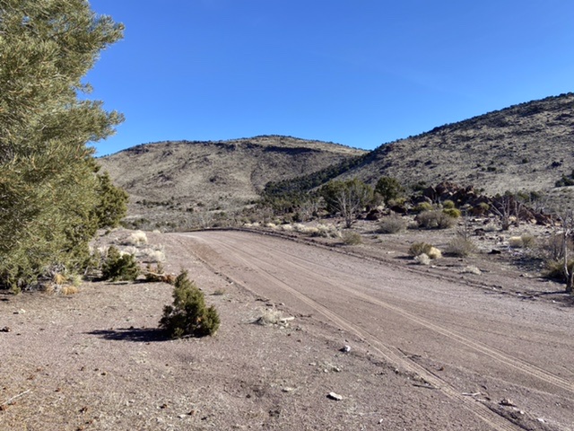
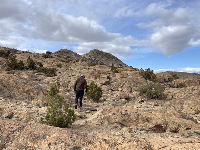
It is a nine hour drive from Boise to the Cirque of the Bovines. Unlike the Idaho BLM the Nevada BLM does an excellent job of maintaining its roads. From Nevada 318 we took the well graded road west over Timber Mountain Pass and into the vast Coal Valley. We then drove south along the base of the Seaman Range to a junction with the Oreana Springs Road. Although the road is shown as a two-track on the USGS quad it is in fact a well graded road that leads up into the center of the cirque. We continued into the valley to the spot where John and I camped in 2018 and set up camp. (All of the roads in the valley are graded and should be passable by 2WD vehicles when they are dry.)
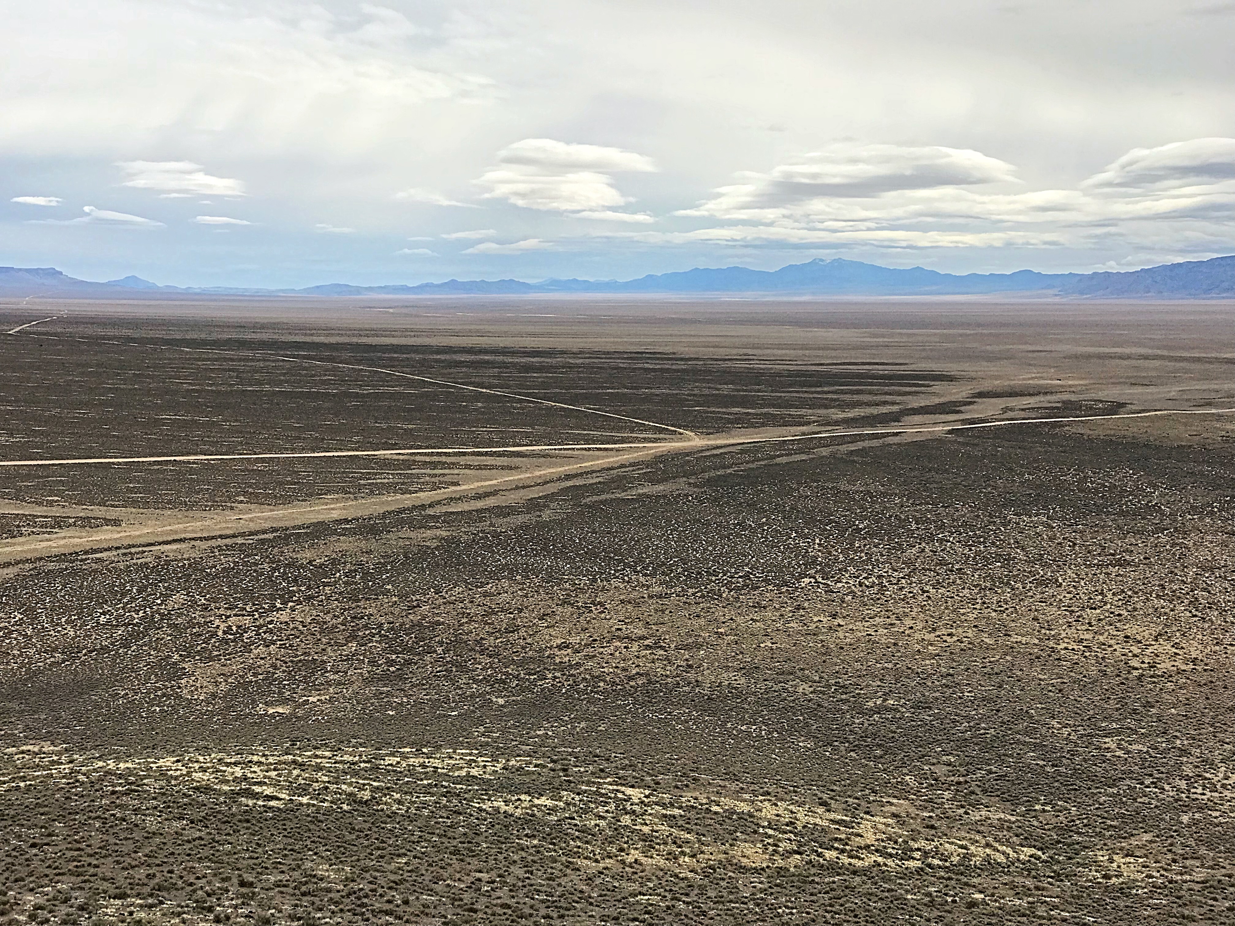
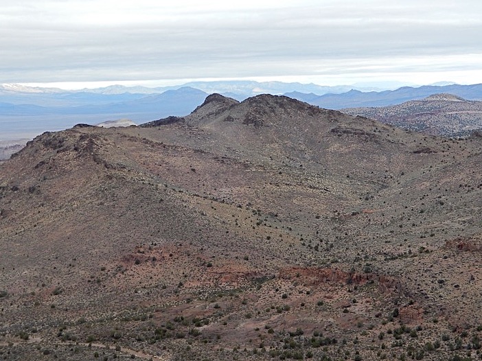
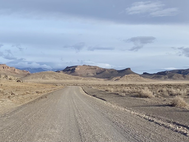
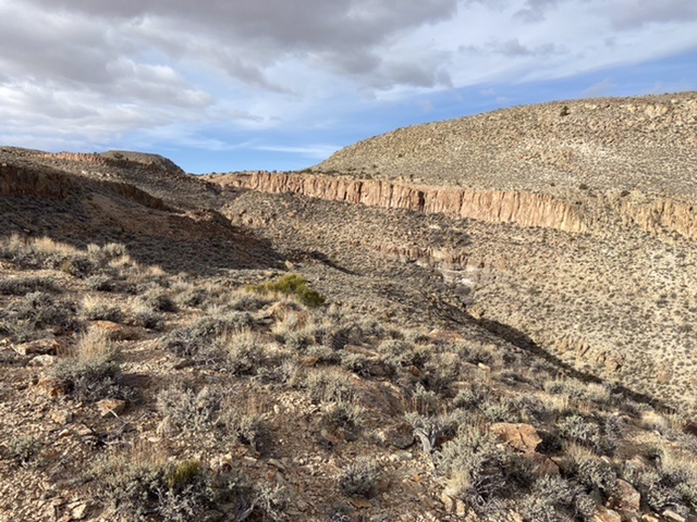
Expansive Coal Valley.
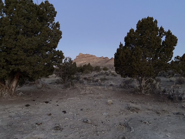
The Oreana Springs area is high desert with a volcanic rock substructure covered by grass, sage, yucca, cactus and junipers. The springs has been developed to provide water for cattle but happily cattle are not using the area in mid-March. Although the area is reached by a good road the camping is still remote. There is no cell service. Nevertheless, civilization (if you can call it that) frequently creeps into the valley in the form of US Air Force fighters practicing overhead. This includes an occasional F16 flying low over the ridges and sonic booms from high flying supersonic jets which shake the stillness.
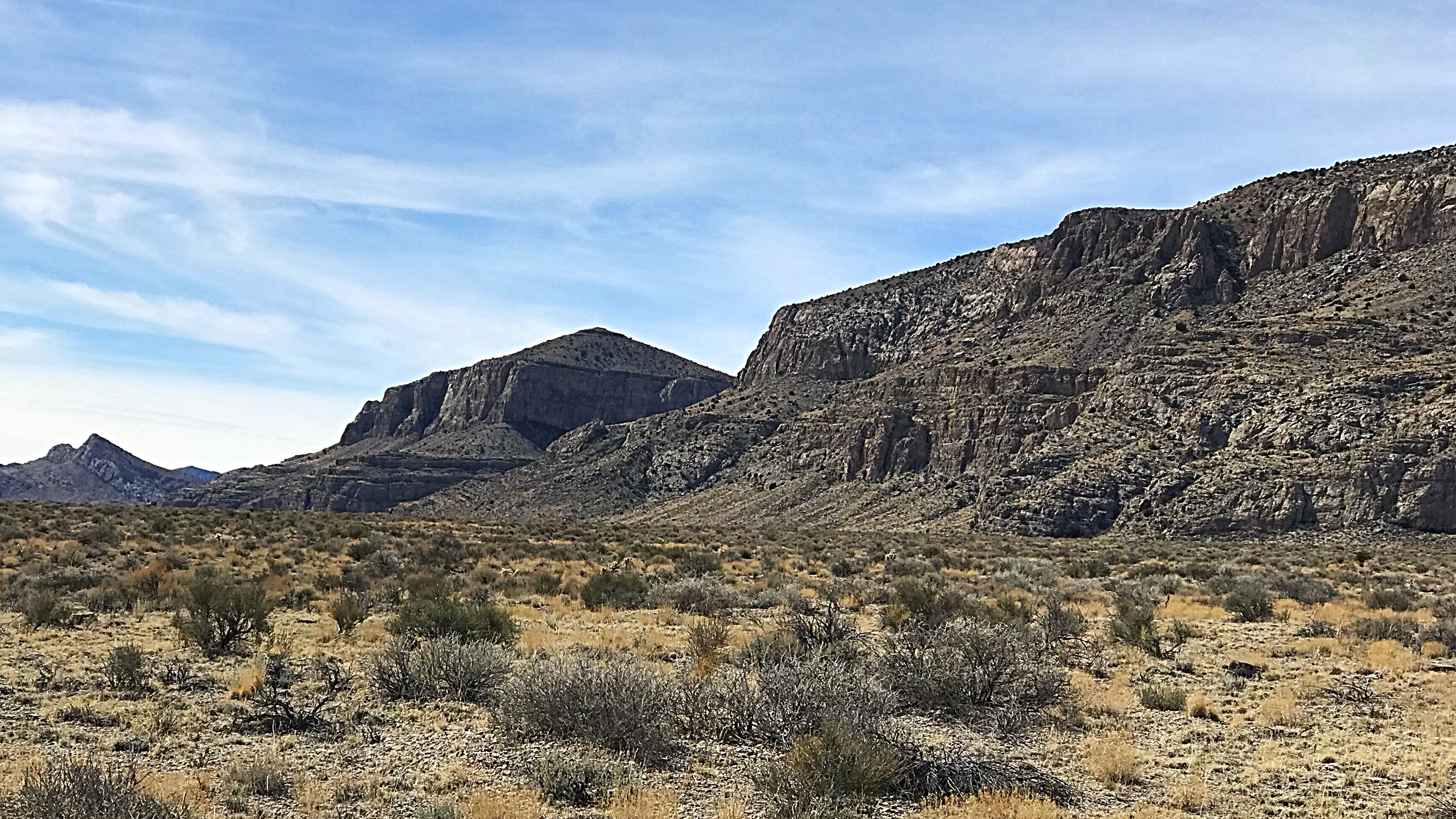
From left to right Peak 6351, Peak 6727 and Peak 6797.
Peak 6351 presents a few route finding conundrums when viewed from the south. Alex and I climbed it via its broad yet cliffy, broken west ridge. While Steve ascended the steep, narrow gully which spits the peak’s broad south face. He encountered a short move verging on Class 4 midway up the gully. Steve and Alex then traversed east from the summit to Peak 6727 which John and I climbed in 2018.
Looking north toward Peak 6531.
Peak 6727 sitting in the Weepa Spring Wilderness viewed from the south.
Peak 6797 can be climbed from the pass on its north side without too much trouble. Once again having already climbed it, I relaxed while Steve and Alex scrambled to it’s summit.
Peak 6350 is the most difficult of the eight peaks to climb and the only one that has a bit of Class 3 terrain. Having climbed this peak in 2018 I relaxed in camp while Steve climbed it.
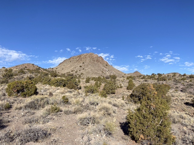
Peak 6350 viewed from our camp. This peak’s southern face is composed of steep, nearly vertical volcanic rock. The recommended route crosses over to the north side of the peak and then traverses west until a line can be climbed up to the summit.
Peaks 6963, 6848 and 6851 can all be climbed from the pass separating Peak 6973 and 6848. The pass is reached by a well graded road. We climbed 6963 first and then made a loop over Peaks 6848 and 6851.
Looking east to Peak 6963.
Peak 6642 is easily reached from the east by hiking to the saddle on its southern side and then climbing northeast up its steep southern face.
Peak 6642 viewed from the east.
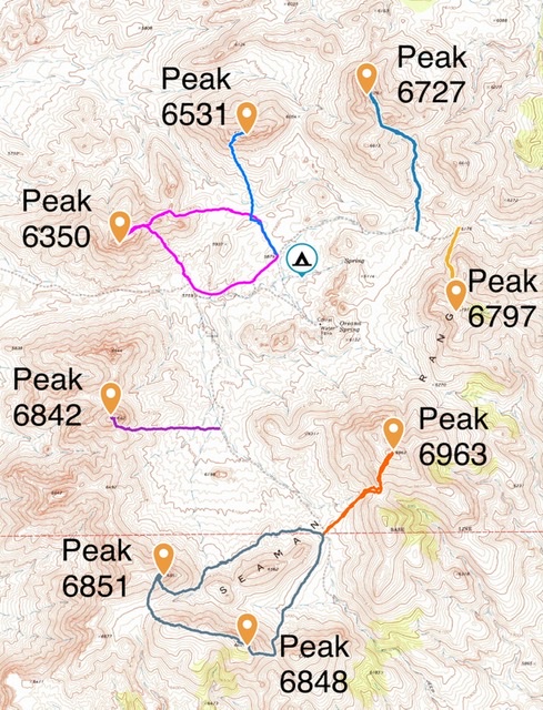
The eight peaks surrounding Oreana Springs with my GPS tracks to each peak.
Steve climbed all eight of the peaks in two days. If you were ambitious it would be possible to climb all of them in one day by following starting at either 6350 or 6842 and following the connecting ridges around the cirque.
On our final day we decided to head over to the Golden Gate Range and climb Peak 6260. Peak 6260, like all of the Golden Gate Range peaks, is protected by vertical cliffs on its eastern face.
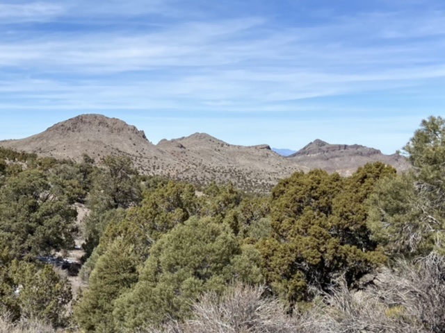
A small sampling of the Golden Gate Range terrain.
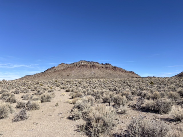
Approaching Peak 6260 from the southeast.
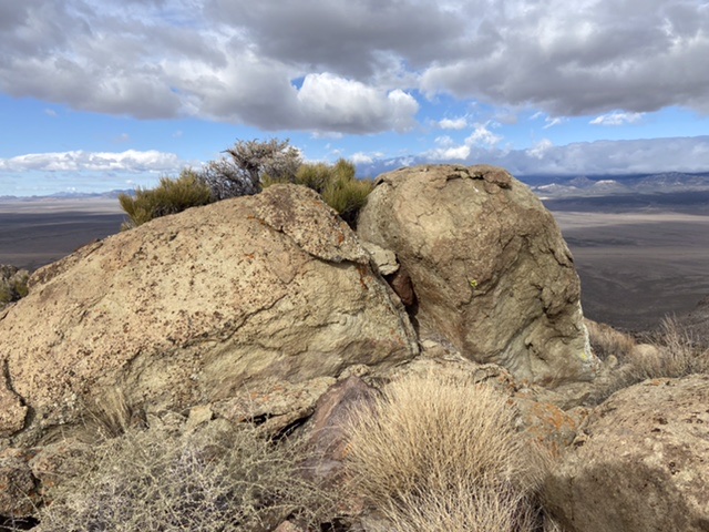
The Golden Gate Range is a limestone range composed of many uplifts which are separated by wide, low gaps. Each rise looks like an island jutting out of the Coal Valley sea of sagebrush. We had originally planned a climb up the peak’s south ridge but the access roads shown on the USGS quad no longer existed. So, we drive around to the peak’s north side and ascended from that side.
Mid climb approaching the crux, a 20 foot high wall.
Above the wall.
The summit.
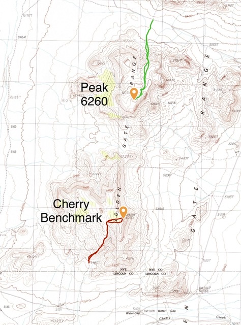
My GPS tracks for Peak 6260 and Cherry Benchmark (which John and I climbed in 2018).
Rest In Peace John
Morning Walks Up Table Rock, California 2023