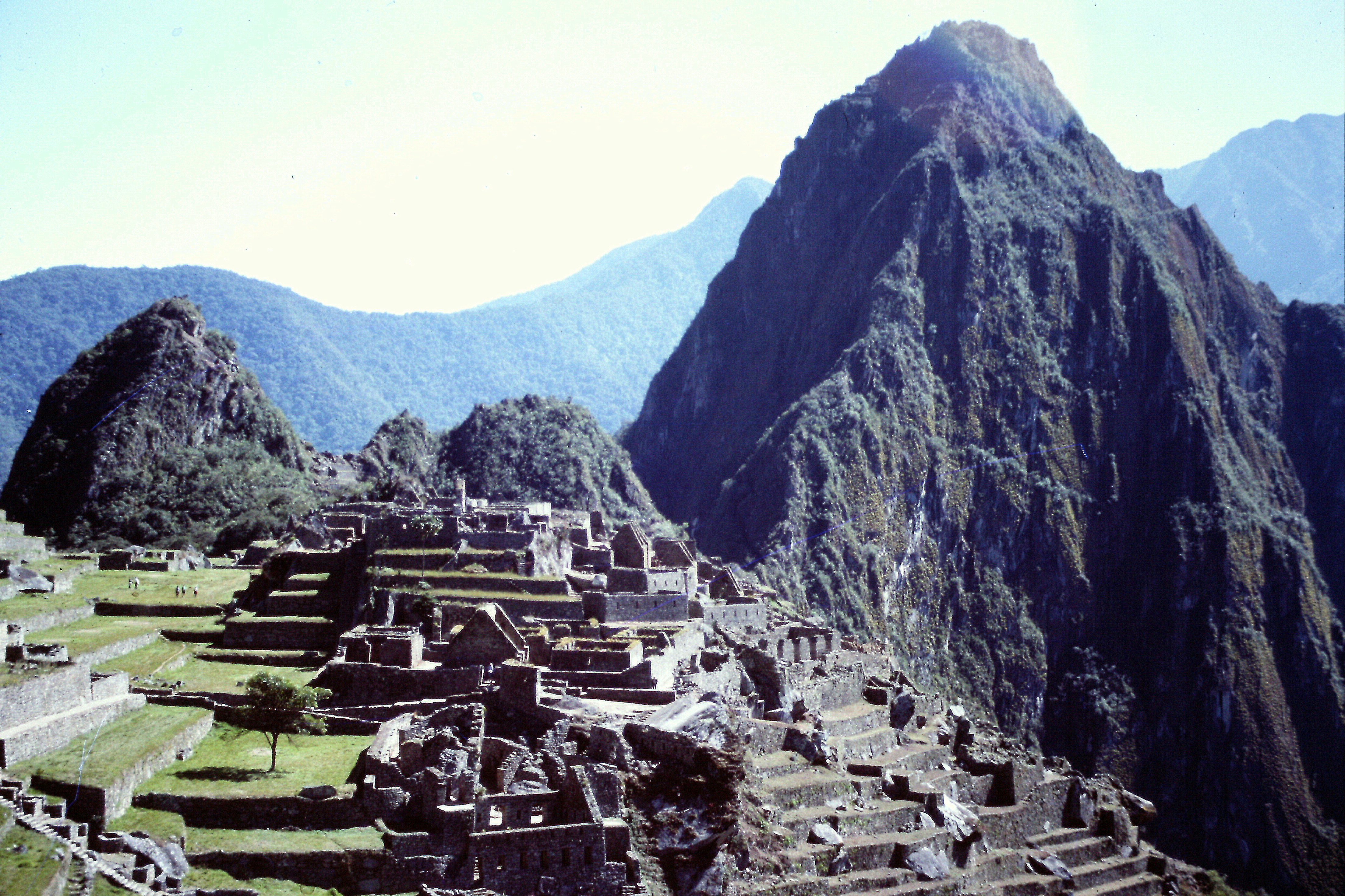
 In 1988, I spent the month of July in Peru and Bolivia with an American Alpine Institute (AAI) guided trip. I had previously visited Peru and Bolivia in 1977. See my article Five Days on the Inca Trail to read about that trip. The Peruvian portion of the 1988 trip was primarily for acclimatization both to the elevation and the culture. We did a lot of hiking and sightseeing in Peru. The only peak we climbed was Haunya Picchu which stands guard over the Machu Picchu.
July 1. Miami to Lima, Peru. We flew into Miami a few days early to spend time with my long time friend Jay Weiss. United screwed up the flights and we ended up arriving in Miami after midnight but that was not the real problem with the flight. My bag with almost all of my equipment never arrived. For 3 days, United tried to find the bag but with no success. The only equipment I had with me was my plastic double-shelled boots. As you might imagine, buying equipment in Miami was a nonstarter. I did pick up underwear and a few other items but when we left for Lima, Peru on July 1st, I had a day pack, climbing boots and the clothes on my back. The AAI assured me that the guide would be able to outfit me when I made it to Bolivia. In Lima, we met Kitty Calhoon who was an AAI guide and she gave us a bottle of water purification tablets. I was now more confident than ever that I would have no trouble getting outfitted to climb the big peaks.
July 2. Lima to Cuzco. The next morning we flew to Cuzco and met our guide for the Peruvian part of the trip: Sarah (an Australian). We had the day to ourselves and I was able to visit with Senora Flores who had adopted me on my 1977 visit.
July 3. Exploring the ruins around Pisac, Peru. We managed to hike quite a few miles on this day through deep canyons and past ruins. In Pisac, we took in the local culture and food.
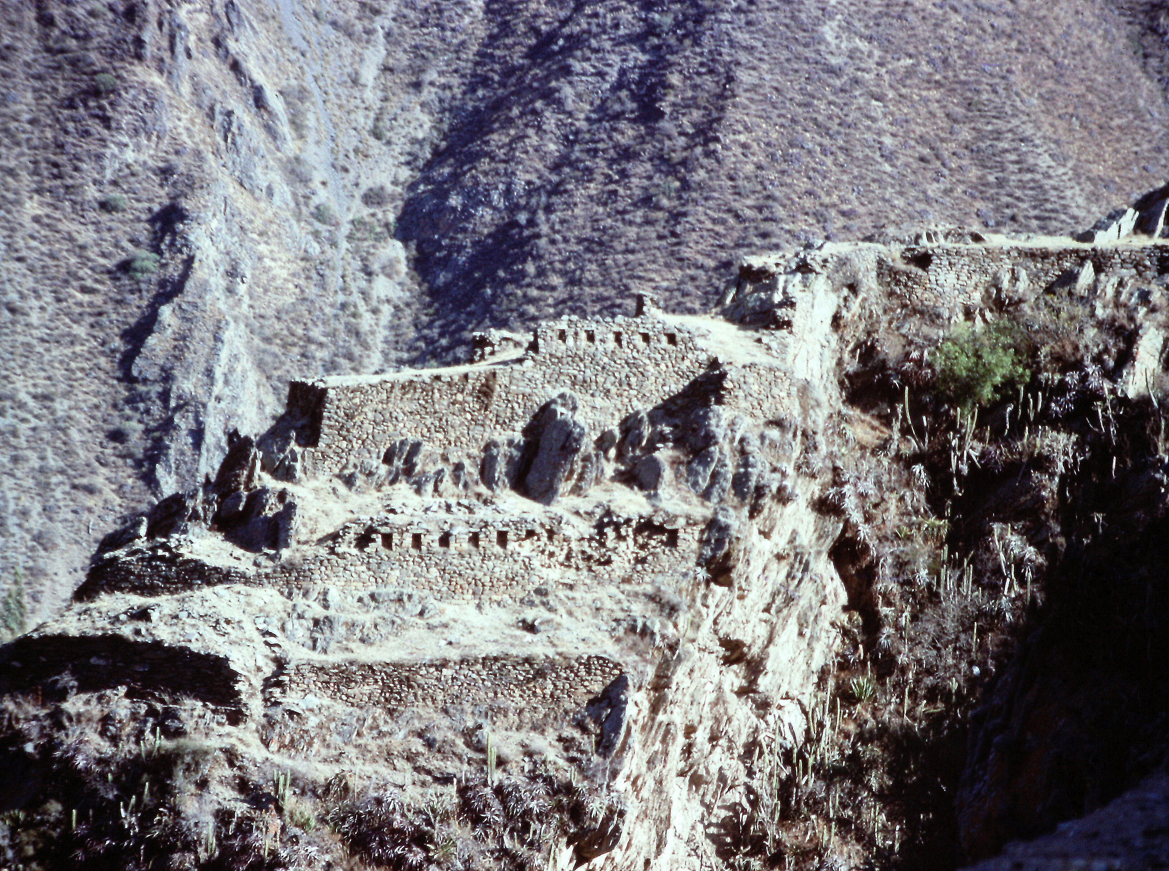
Inca ruins near Pisac, Peru.
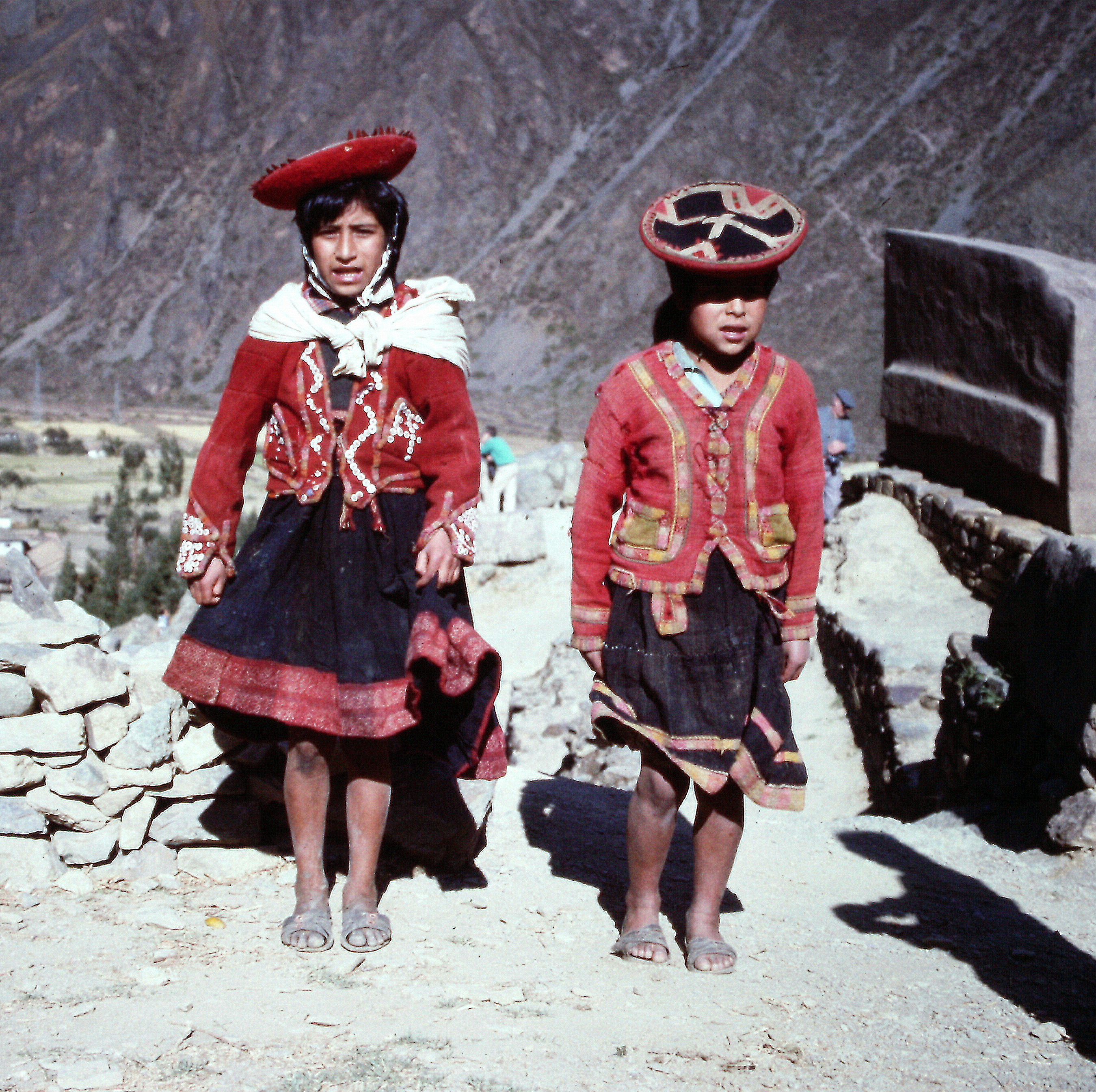
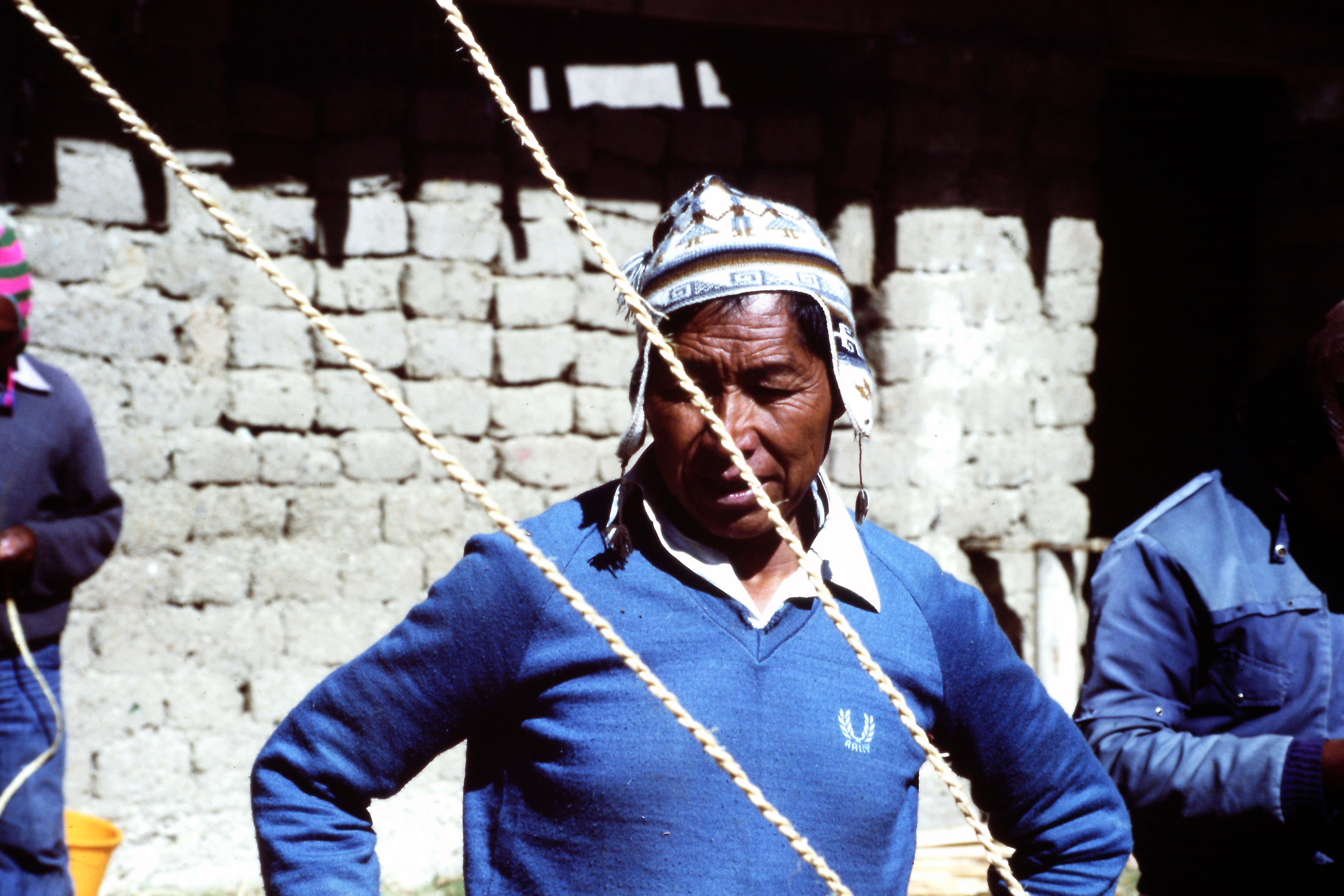
The Inca culture survives in the souls of inhabitants of the Andes.
July 4. Travel to Machu Picchu. We took the tourist train to Machu Picchu and were given a guided tour of the ruins. We spent the night in a hotel.
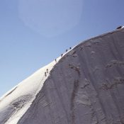
July 5. Climbed Huayna Picchu (8,852 feet) via the trail. Several of us got up early and hiked to the top of Huayna Picchu on a steep, exposed trail before returning to Cuzco.
Huayna Picchu rises to the north of Machu Picchu.
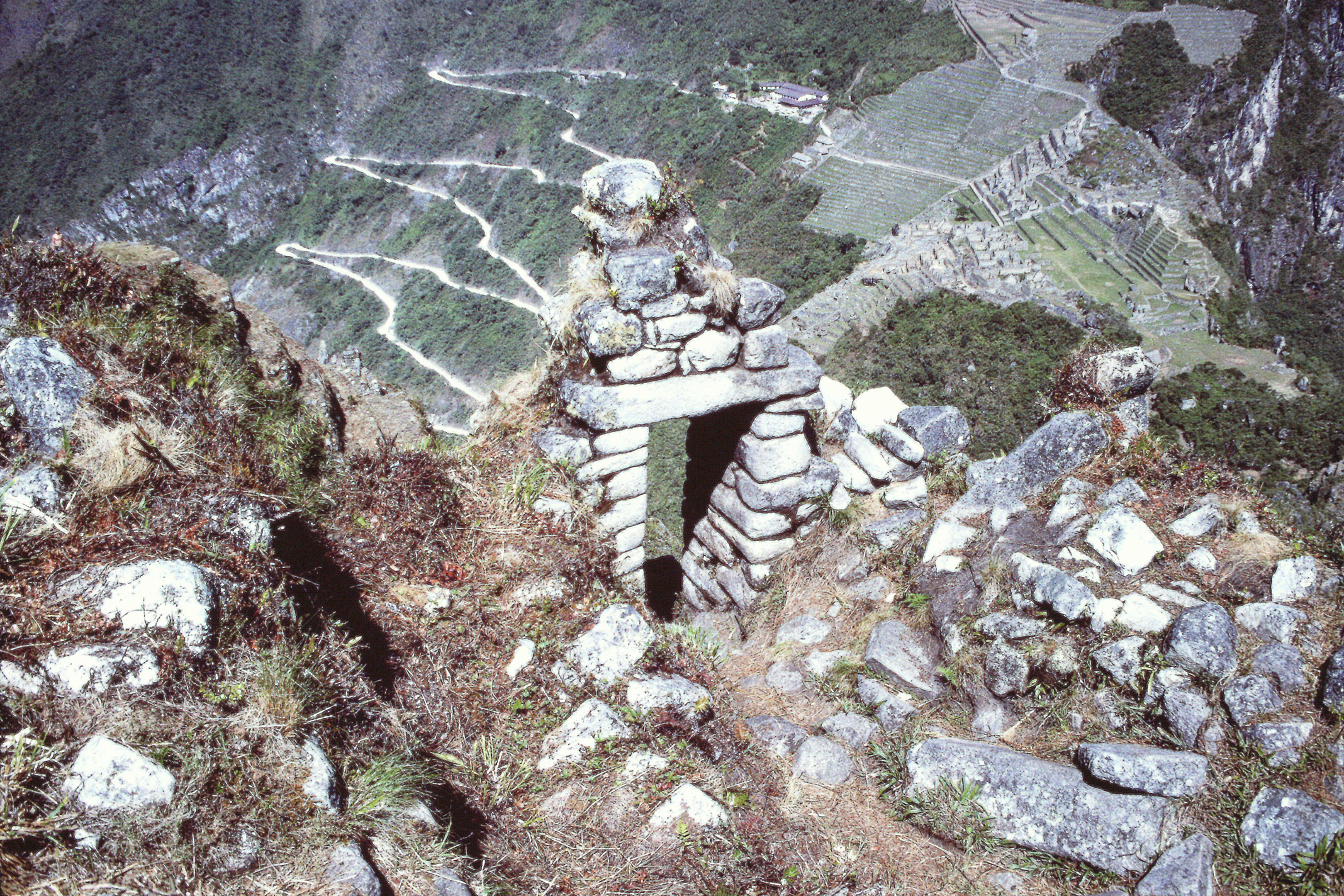
The ruins of a gate on the trail to the summit of Huayna Picchu. It is a steep trail up an even steeper peak.
July 6. Travel to La Paz, Bolivia. This would have been an uneventful day except I when we met our guide Jeff (another Australian), he had not heard anything about my equipment issue and was somewhat skeptical that I could be outfitted. However, as the day came to an end, between Jeff’s excess gear, a bit of equipment left by prior clients and generous donations by other team members, I was sort of equipped. The most striking piece of equipment was a sleeping bag worn so thin that you could see through it.
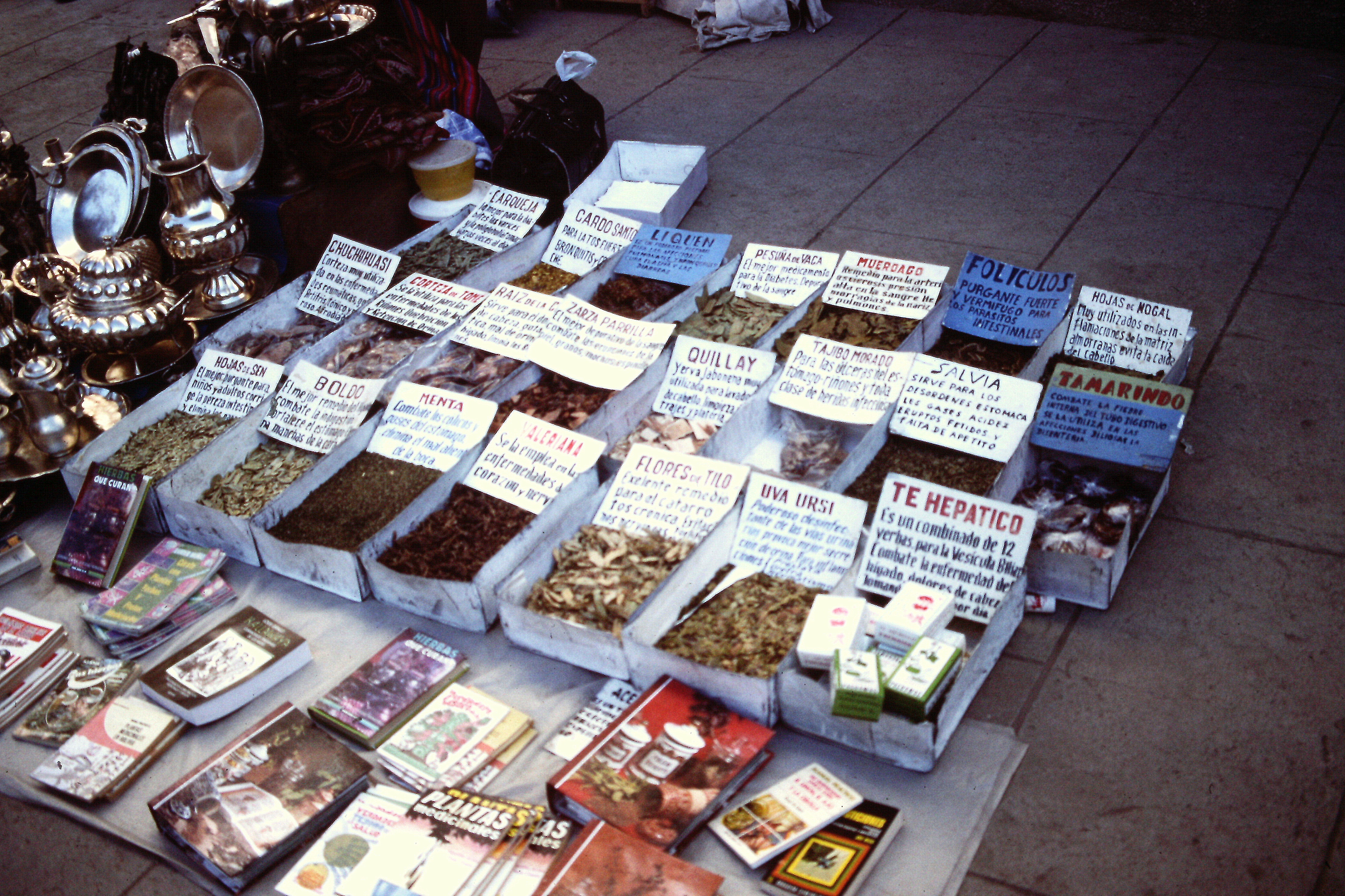
La Paz is a large and ever-growing city with a distinct mix of Spanish and Native culture. Herbs and spices for sale in a market. Yes, Mate de Coco is available.
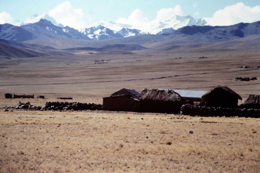
July 7. Travel to Lake Titicaca. We traveled by bus to Lake Titicaca (12,500 feet). We took a boat ride out to Surique Island and the home of Paulino Esteban, the man who built Thor II and Reed boats for Thor Heyerdahl. In addition to Jeff, we had 3 guides for the trip. One was an American who was (to be kind) a “waste of space” and 2 Bolivians, Mario and Fernando. Mario was a competent and complete climber and Fernando ran a tight camp and kept us on schedule. After our boat trip, we were driven to Mario’s home on the Alto Plano at Communidad Alto Pena where we camped.
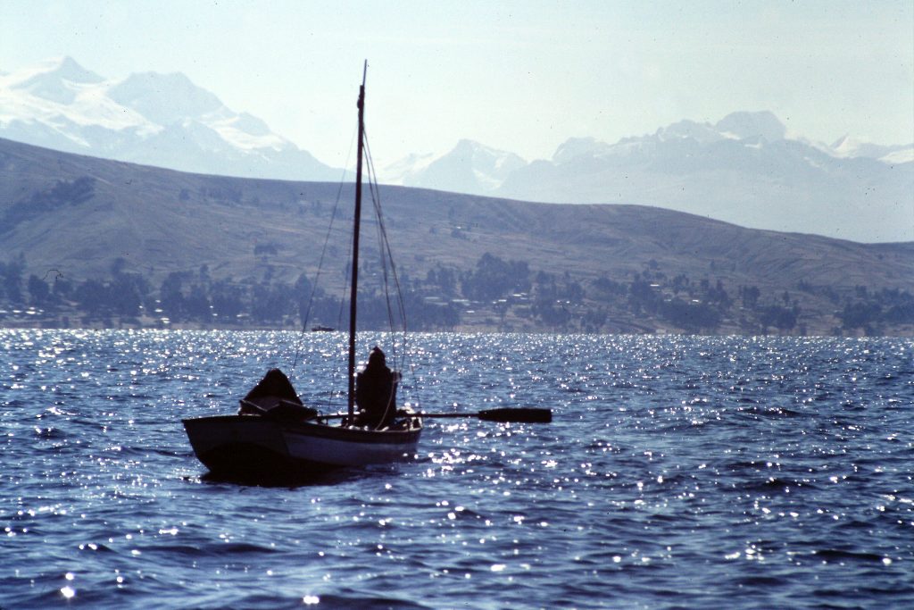
Fishermen on Lake Titicaca.
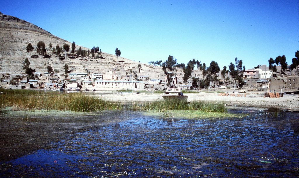
Approaching Surique Island.
Paulino Esteban, a reed boat builder of international fame.
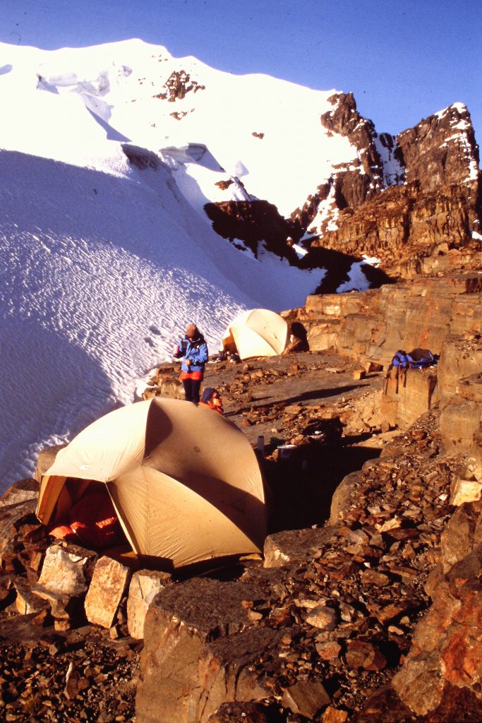
July 8. Hike from Communidad Alto Penas to Agencia Mina Palcoca. This hike was 12 miles long with a lot of elevation gain. We ended up at a base camp in a high valley before our first climbing objective, Cerro Ckekapa.
The home of Mario, one of our 4 guides on the Alti Plano west of Lake Titicaca.
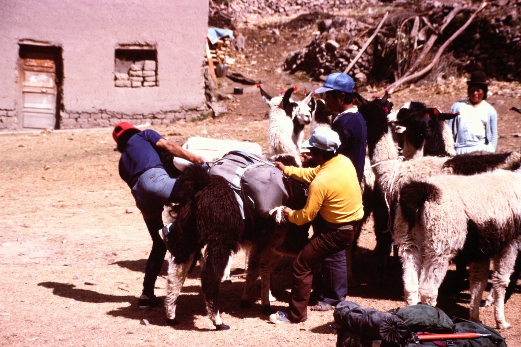
Loading up the llamas with our gear.
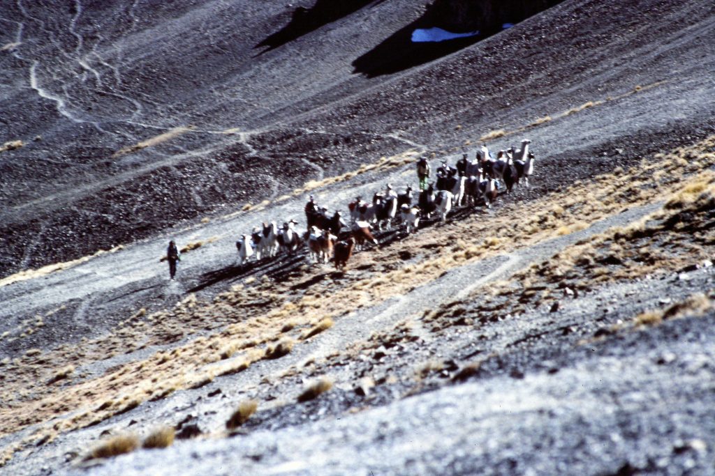
We had a lot of llamas to carry our gear but some of the ones in this photo were just along for the walk.
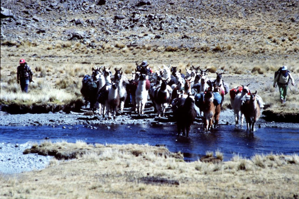
All of our hiking and climbing was above 12,000 feet. I am glad that I did not have to carry the equipment.
July 9. Ice Climbing School (4.5 miles). Jeff took us to the nearest ice and we had a brief ice climbing school so that he could assess the climbing abilities in the group. There were 10 clients and they had a wide range of skills but everyone was in good shape and skillful enough to be on the trip.
July 10. I was sick today and stayed in camp.
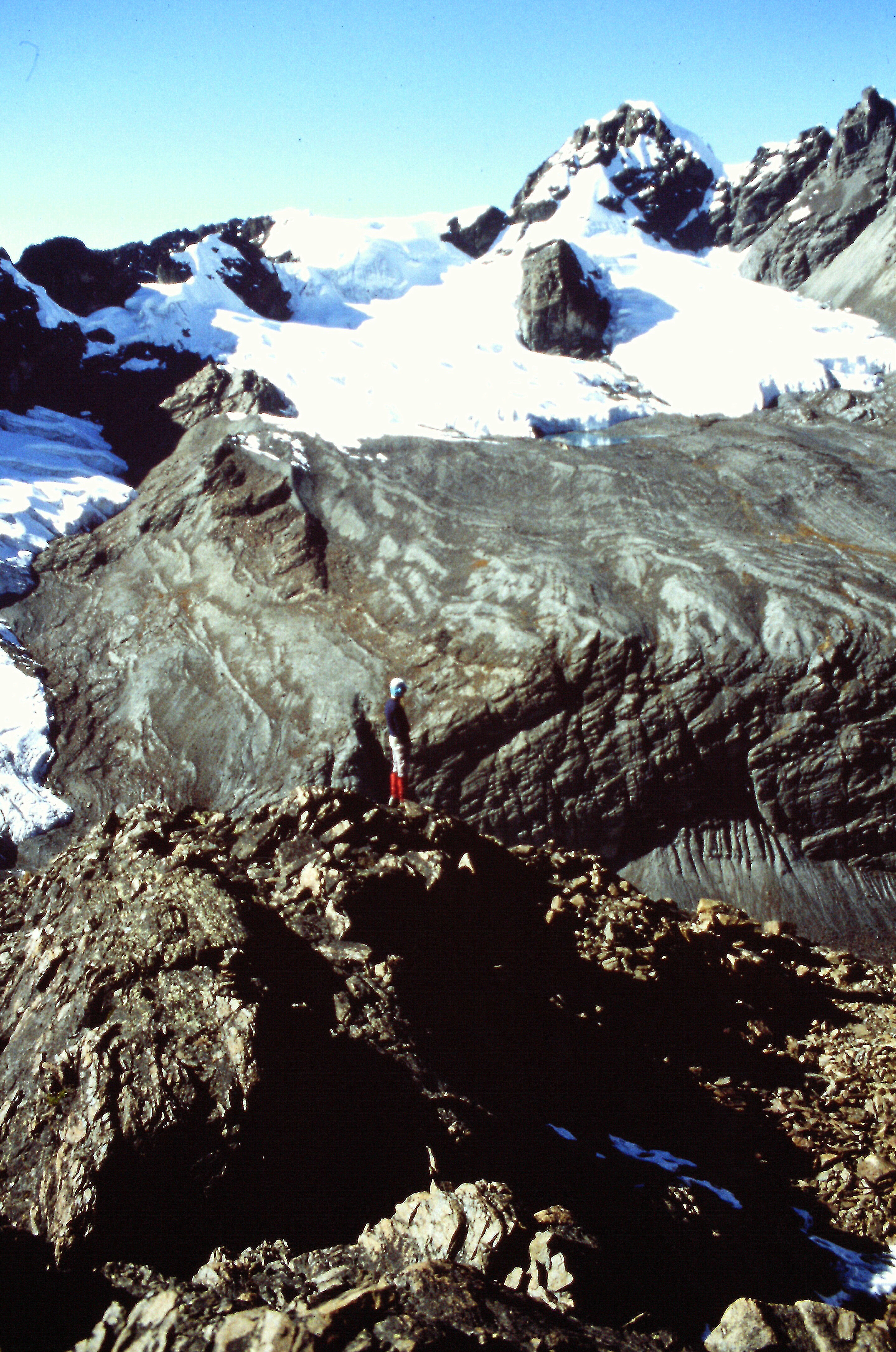
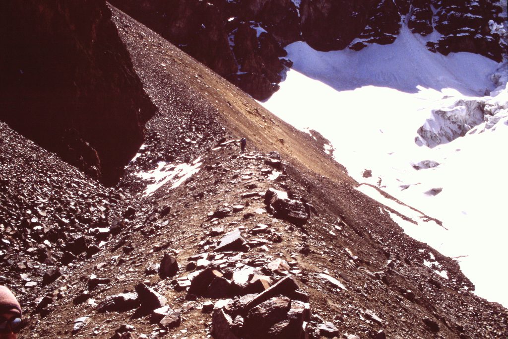
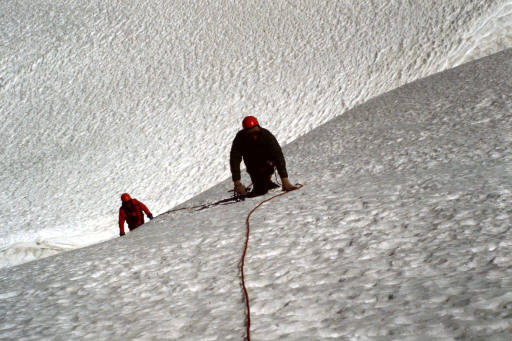
July 11. Cerro Chepaka (17,913 feet). Cerro Chepaka was our first real climb. The peaks in this part of Bolivia greatly resemble Idaho’s Lost River Range geologically. But they are much higher in elevation. The first part of this climb was up the valley to a headwall. At the base of the headwall, we turned north and climb up talus to a cliff band. We gained the ridge above the cliffs and followed it to snowline where we put on our crampons and roped up. The snow portion of the climb was straightforward with no obstacles. It was getting late when we reached the summit because one of the rope teams was slow. We returned down to snowline and unroped. Jeff put the other guide (“waste of space”) and Mario in charge so he could return to camp and start dinner.
There was no technical ground between us and camp so there should not have been any trouble. The group started down following “waste of space” but only Dana and I could keep up with him. Soon the group was spread out all over the mountain and it was dusk. Below the cliff band, I could hear people talking above us. They had all missed the exit couloir. I told the guide and, to his credit, he started back up the mountain. Dana and I returned to camp and told Jeff. He immediately left. Fernando fed us and we went to bed. We heard the rest of the climbers drag in after midnight. The next morning we learned that one of the climbers (a surgeon) had broken his wrist in a fall. I believe that our climb covered 5.0 miles round trip.
Our lead guide Jeff climbing on Cerro Chekapa.
All of our climbing was a mix of broken rock at first and snow and ice higher up.
Nearing the top of Cerro Chekapa.
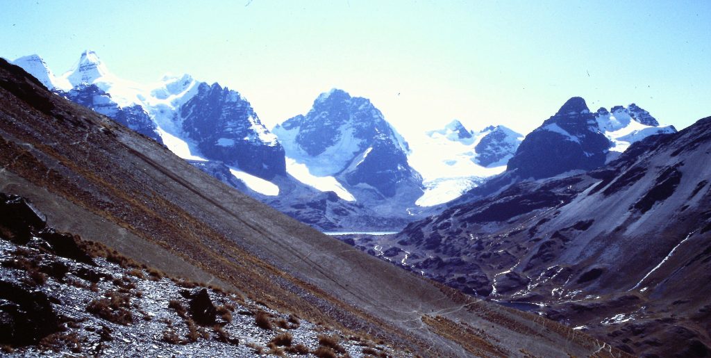
July 12. Mino Palcoco to Laguna Jurikkata. We hiked over 2 passes. One pass was at 16,000 feet. We covered 5 miles at high elevation. The scenery was inspiring.
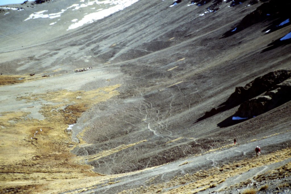
Crossing between valleys involved covering a lot of wide-open terrain similar to Idaho’s Lost River Valleys but at much higher elevations.
July 13. Laguna Jurikkata to Laguna Chiar Kkota (15,190 feet). Another day of hiking but no climbing.
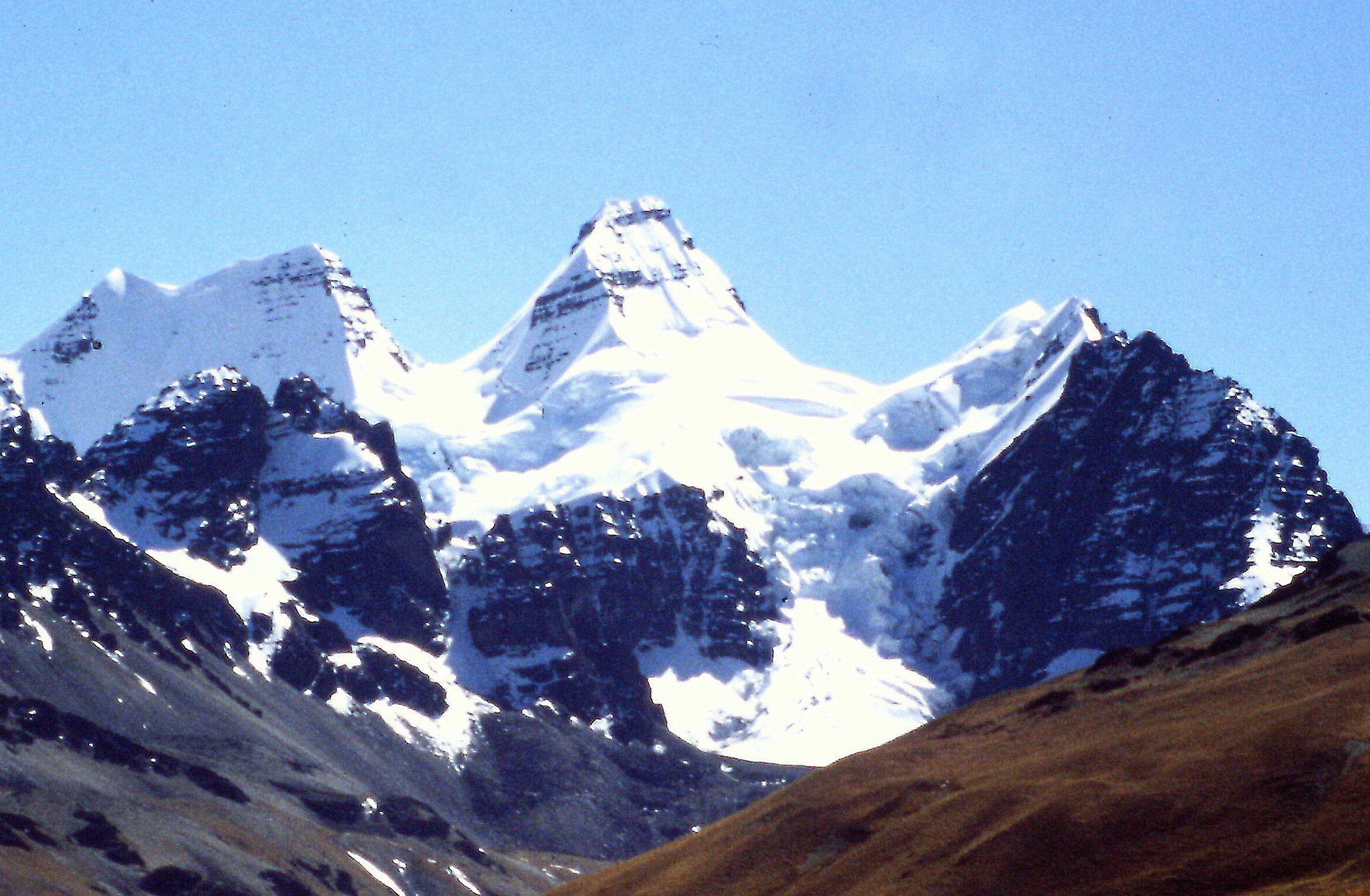
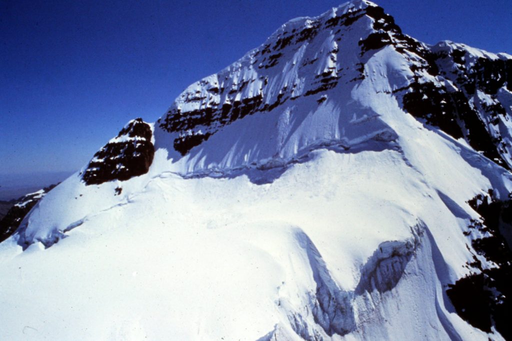
July 14. Pequeno Alpamayo (17,488 feet). This peak gets its name from its resemblance to the more famous Alpamayo in Peru. The resemblance is uncanny. The first part of the climb was around a cirque on rocks and then we dropped to a saddle and made the steep snow climb to the summit. We had perfect conditions for cramponing up the slope. 6 miles.
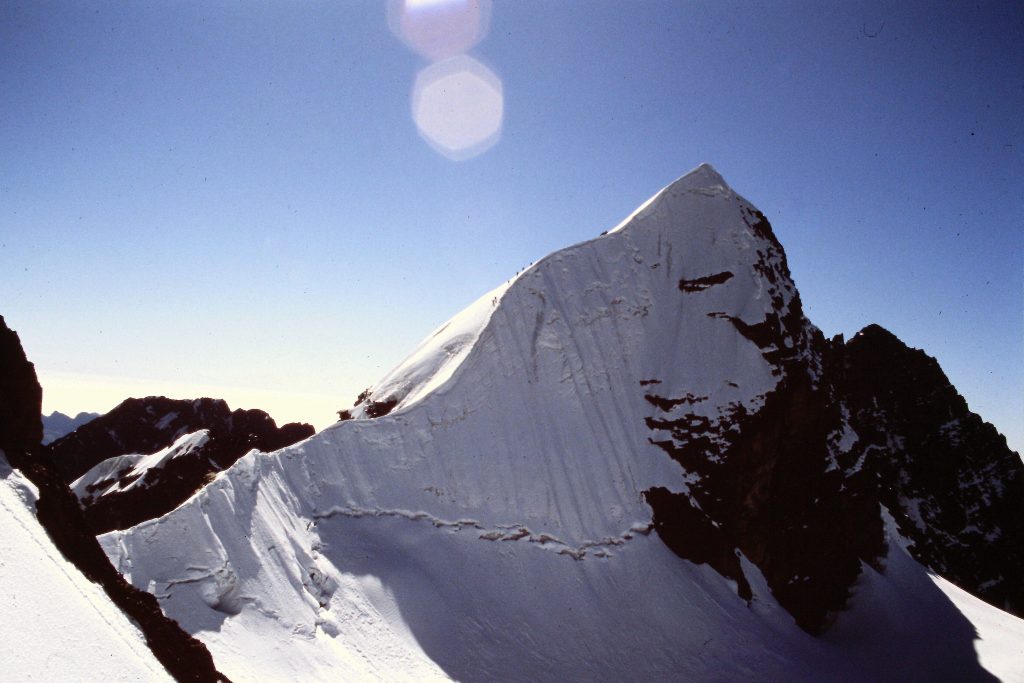
Pequeno Alpamayo
Pequeno Alpamayo is a popular summit. On our summit day, this Dutch team was about an hour ahead of us.
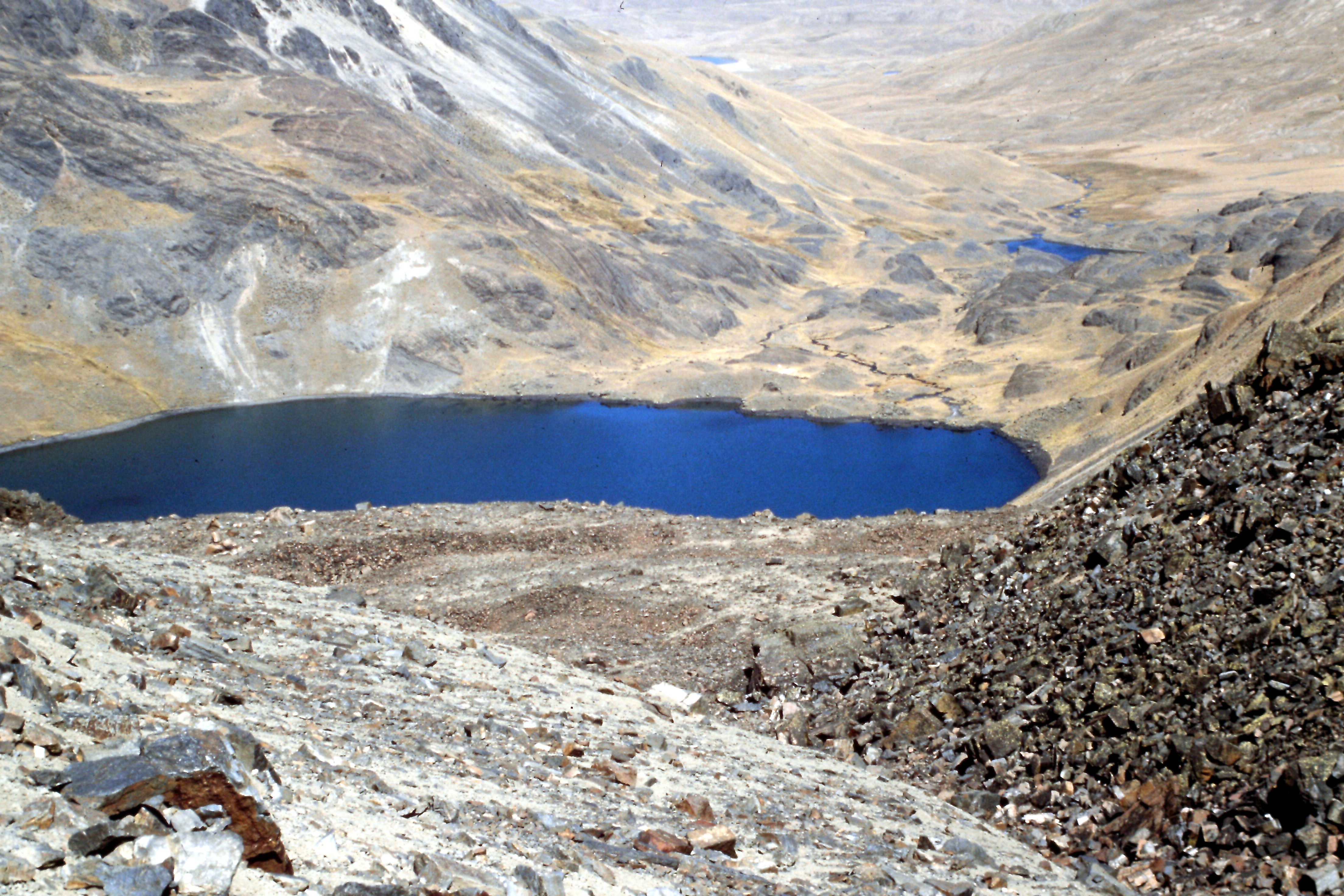
Lake Kkhota in the distance. We set up camp at the lake for our attempt on Condoriri.
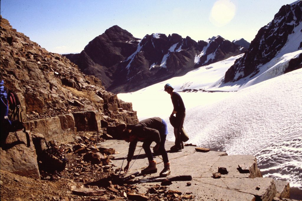
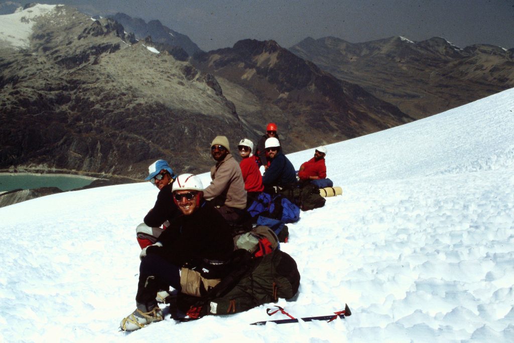
July 15. Climbed from base camp to 17,000 feet below Cerro Condoriri. As impressive as Pequeno Alpamayo was, it was nothing compared to Cerro Condoriri which had loomed over us since our arrival at Laguna Chiar Kkhota. The peak has 3 summits. The center summit looks like a condor’s body and head. The other 2 peaks look like the Condor’s wings. They are named Ala Norte and Ala Sur. It was a peak that I had to try. We were down to 9 climbers, as the surgeon and “waste of space” had departed. Jeff asked who wanted to climb Condoriri and only Dana, myself and Kevin spoke up. After lunch, the 4 of us left and made the steep climb up to 17,000 feet where we set up a spectacularly-located camp. 3 miles.
The head of the valley above Lake Jurikkata is full of impressive peaks.
Condoriri. Our 17,000-foot camp was located at the top of the center cliff. It doesn’t get any better than this. Ala Norte (left), Condoriri (center) and Al Sur (right).
Climbing up to our 17,000-foot high camp.
Cleaning off a rock shelf for the tents.
Settling in for the night.
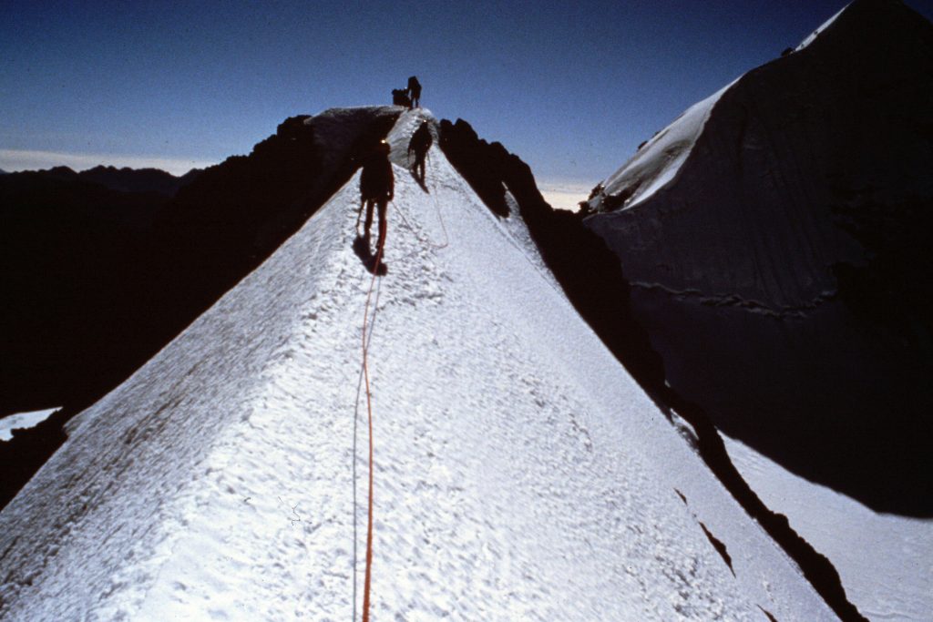
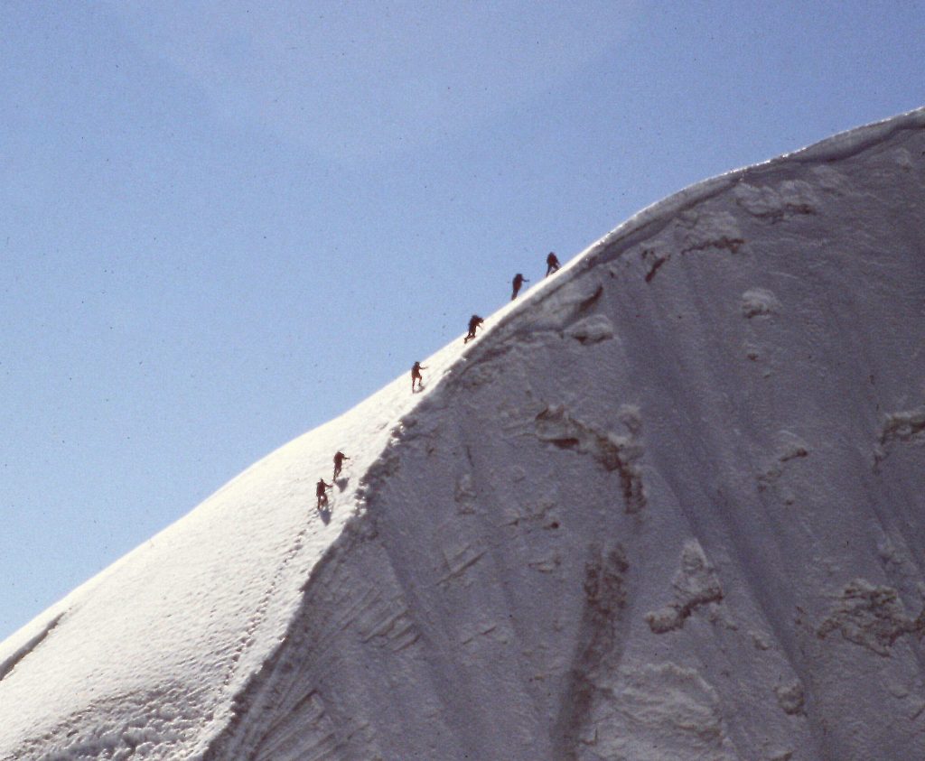
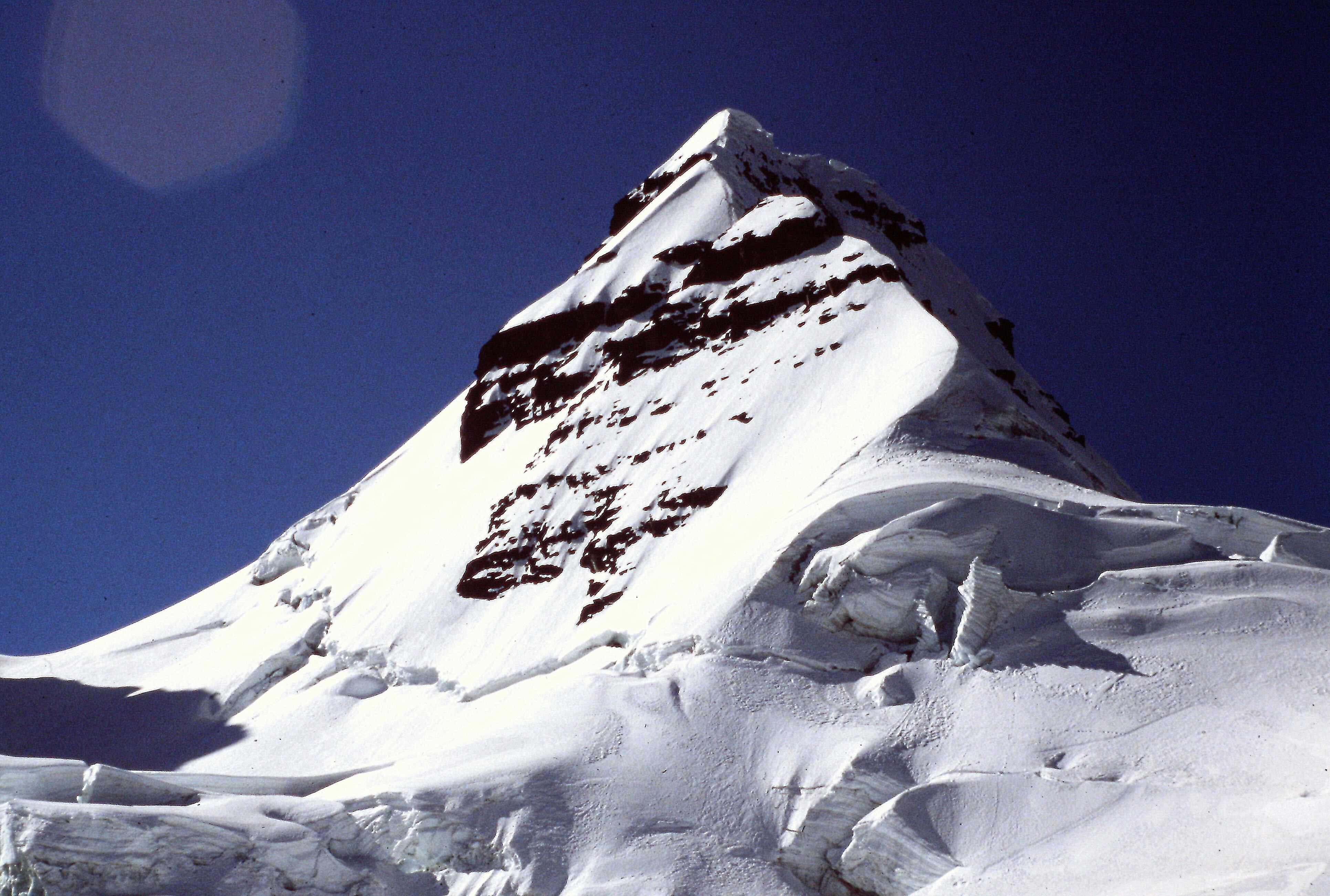
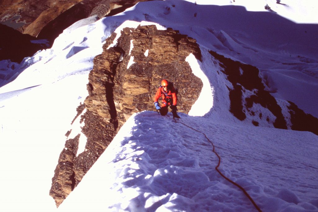
July 16. Cerro Condoriri (18,689 feet) and Ala Sur (13,935 feet). Everything above our camp was snow and ice. Jeff had climbed Condoriri before and he took us from camp across a small glacier. From the glacier, we climbed a short headwall to gain the peak’s knife-edged summit ridge. We then ascended the ridge which is the steepest, most-exposed snow and ice climb that I have ever done. Returned to camp.
Ala Norte up close. After Jeff broke through the snow bridge on Ala Sur, we decided to skip this beautiful peak.
We climbed the ridge that cuts from mid right to top center.
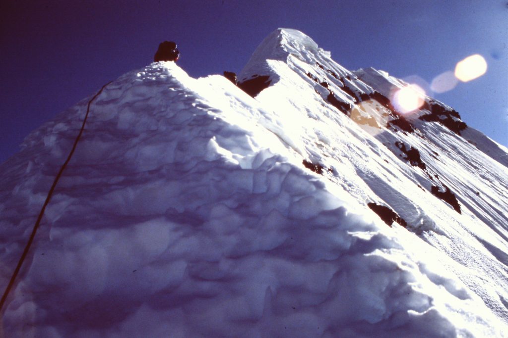
It is not a wide ridge.
Jeff leading.
Jeff and myself near the top.
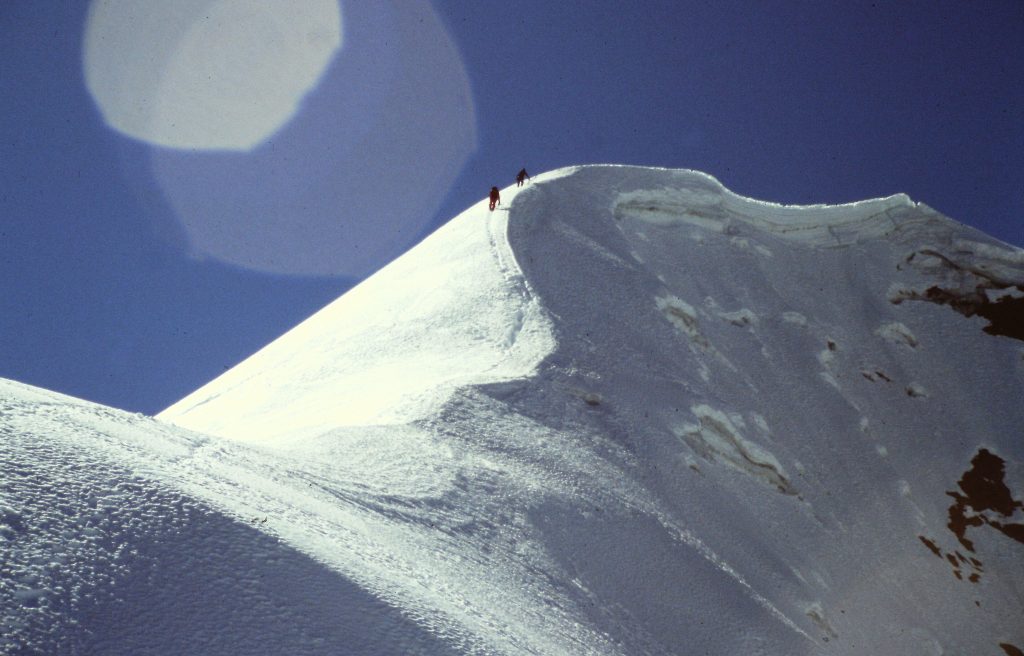
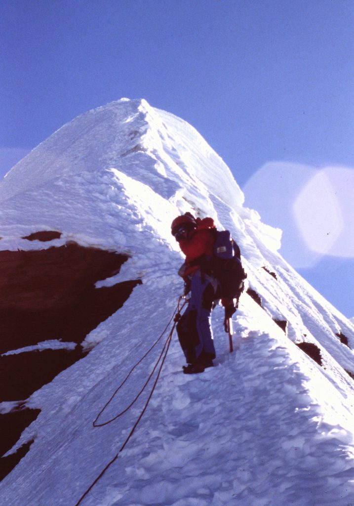
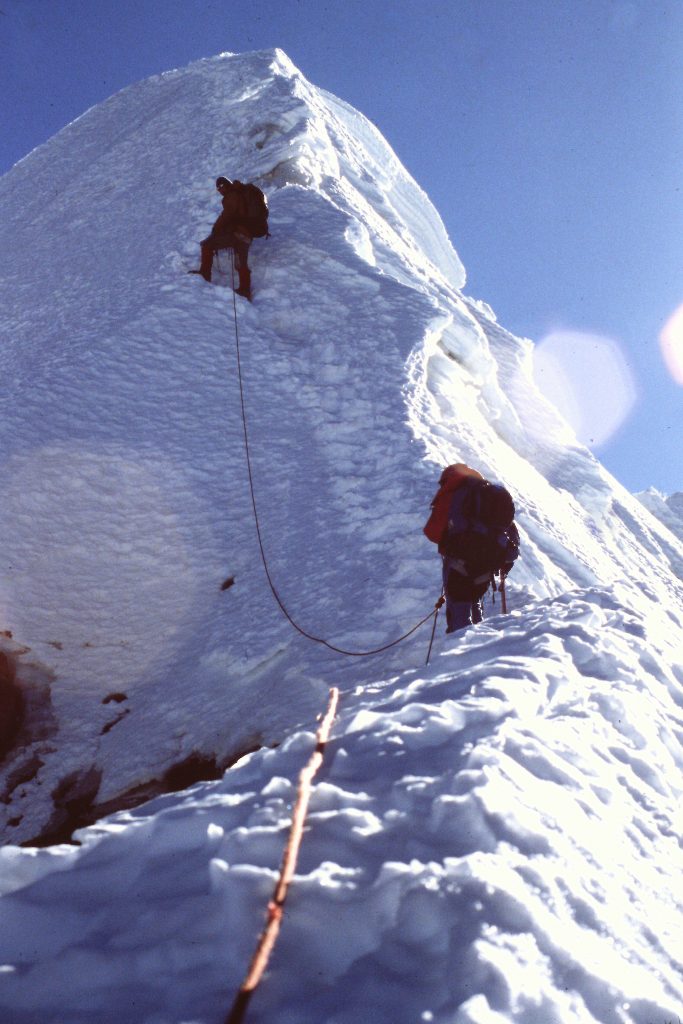
Jeff said that none of his previous clients had wanted to try climbing either of the wings. All 3 of us were game as we observed it from Condoriri’s summit. We retraced our steps down the mountain and crossed the glacier to Ala Sur. Jeff determined the best route was straight up the face. When we got to the bergschrund, I put Jeff on belay and he crossed it on a snow bridge. Standing on the bridge, he started to place an ice screw on the wall above him when the bridge gave way. He disappeared but my belay held him. The 3 of us hauled him out no worse for wear. Jeff then led us off to the right where the bergschrund was not as wide and the slope above was not quite as steep. He used his tools to get purchase, stepped across and climbed up the slope until he could set pickets. He then belayed us up. Above the belay spot, the slope was steep but the snow was perfect for cramponing and we made the summit.
Jeff standing on the snow bridge moments before it collapsed.
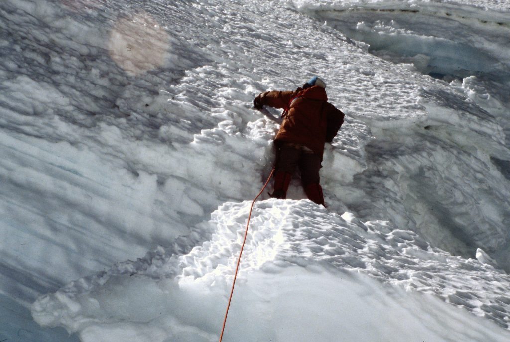
Climbing above the bergschrund.
July 17. Returned to La Paz. This was an uneventful day. Broke camp and hiked out the road to return to La Paz.
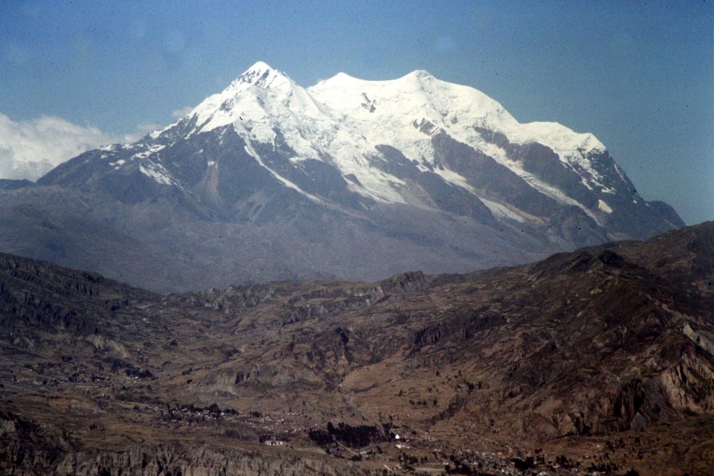
July 18. Drove to to a pass south of Huayna Potosi and camped. Huayna Potosi is one of the better-known Bolivian peaks. A number of challenging routes have been put up on its various faces. Our goal was to climb it by a relatively easy route. We camped at the pass for the evening.
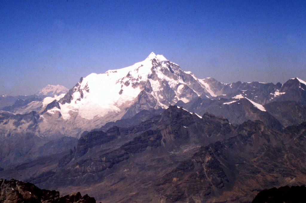
Huayna Potosi as viewed from Cerro Condoriri.
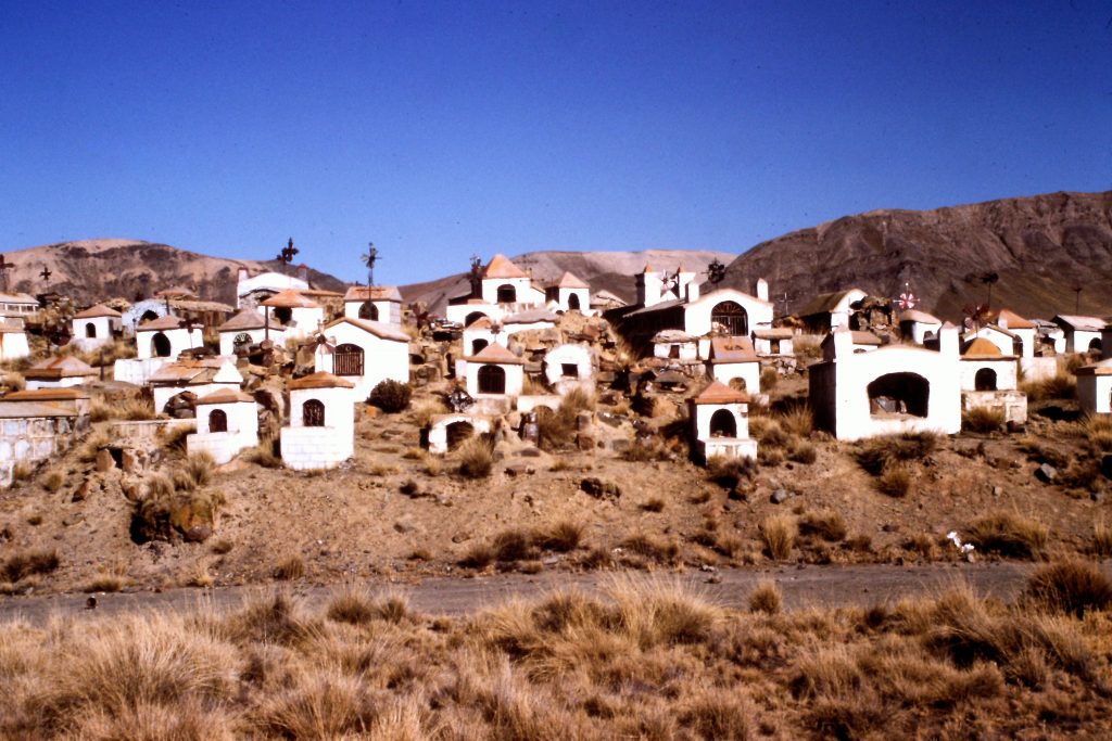
A cemetery on the way to Huayna Potosi. We were told that these graves were of miners killed during a strike.
July 19. Climbed up to Argentine Camp (18,000 feet). My missing gear had not been a problem up until this point. Before this night, I was not camping on ice at 18,000 feet with a thin pad and a sleeping bag that I could see through. Our food had been excellent throughout the trip but on this night we had only instant mashed potatoes with cheese and hot chocolate.
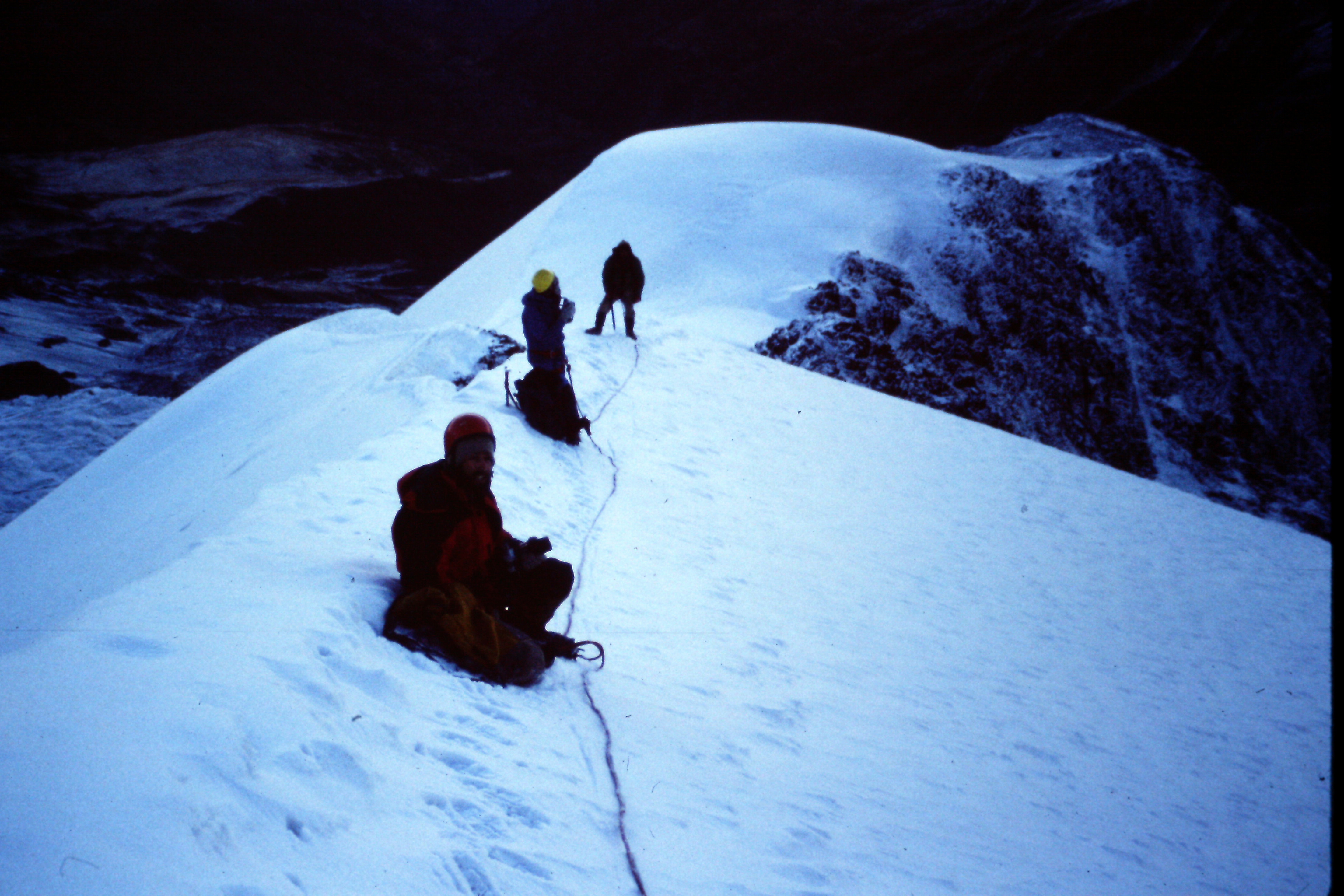
July 20. Huayna Potosi (19,994 feet). We climbed the peak via the East Face, descended back to the road and drove to La Paz. 8 miles round trip. It was one cold night on a glacier. We were up early the next morning. I should say the other climbers were up. I never really slept due to the cold. The hot chocolate got me going. The entire group, which had been slow to move most mornings, was ready to go in record time.The route to the summit was steep but not difficult and we were on top by 8:00AM. We retreated in good order off the mountain and drove back to La Paz.
I welcomed the early morning start as it gave me a chance to warm up.
A happy climbing team resting up for the long descent.
July 21. Rest day in La Paz. We managed to meet a witch who told us about Pachamama, a goddess revered by the indigenous inhabitants of the Andes. We bought a statue of Pachamama and were given a blessing by the witch.
July 22. Illimani (21,109 feet). Illimani was an add-on to the trip. Out of our group of 10, only Dana and I and one other climber signed on. Illimani is a big mountain with several summits. The climb would take 4 days round trip. On July 22nd, we were picked up at our hotel and driven to a village on the lower slopes of the peak. We then hiked to 13,593 feet where we set up camp. We were accompanied by Jeff, Mario and Fernando. Fernando’s family acted as porters.
Illimani is the highest summit that I have ever climbed.
July 23. Move up to high camp (17,500 feet). We climbed up Illimani’s South Rib to 17,500 feet and camped. Our second day on this big mountain, we hiked on trails to our high camp at 17,500 feet. I borrowed equipment from a departing climber and, for the first time, I was properly equipped.
Break time at 20,000-plus feet.
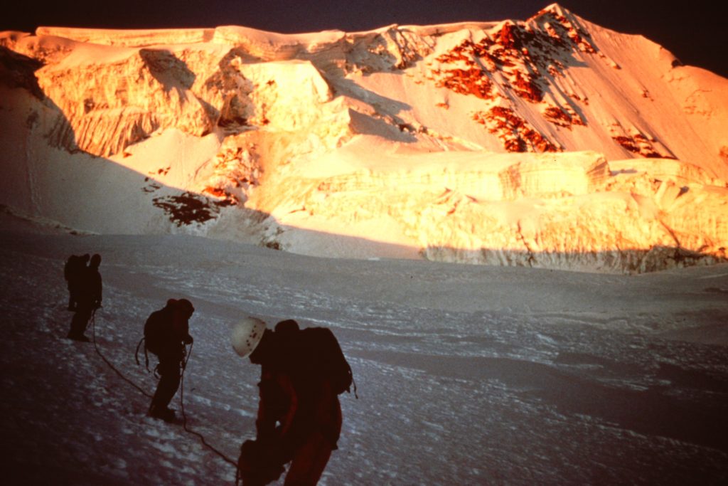
July 24. Summit Day on Illimani. We climbed from our camp to the summit in strong winds. It was good that the guides knew the mountain well because we had little visibility for the first half of the climb. We then were treated to a view for the last 2,000 feet. Between the wind and the cold, Jeff, Mario, Dana and I were only willing to spend 5 minutes on the summit. We descended back to our camp where we were treated to a nice meal prepared by Fernando. I should mention that our porters stayed in camp throughout the frigid day without tents.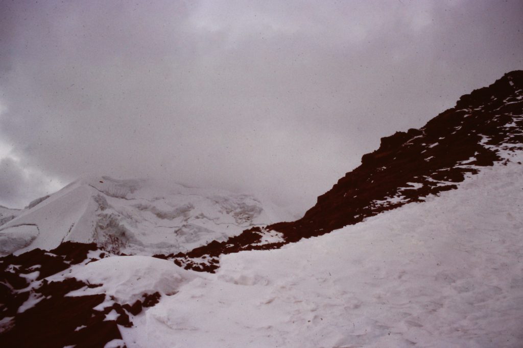
July 25. We awoke to fresh snow the next morning. Needless to say, everyone was ready to go so we ate and were out of camp quickly. All in all, we covered 19 miles round trip and gained over 10,000 feet of elevation.
Postscript. Dana and I spent a couple of days in La Paz and then flew to Miami where we visited Jay again. Still no sign of my equipment. When we returned to Boise, I picked up our mail and found a letter from the Miami International Airport. They had my bag and wanted to know what to do with it. The letter was sent before I had left Miami for Peru. United had never checked with the airport’s lost and found.
The end
Next: The First Ascent of Cabin Creek Peak